

Condor Summit and Vincent Tumamait Trail
View PhotosCondor Summit and Vincent Tumamait Trail
Difficulty Rating:
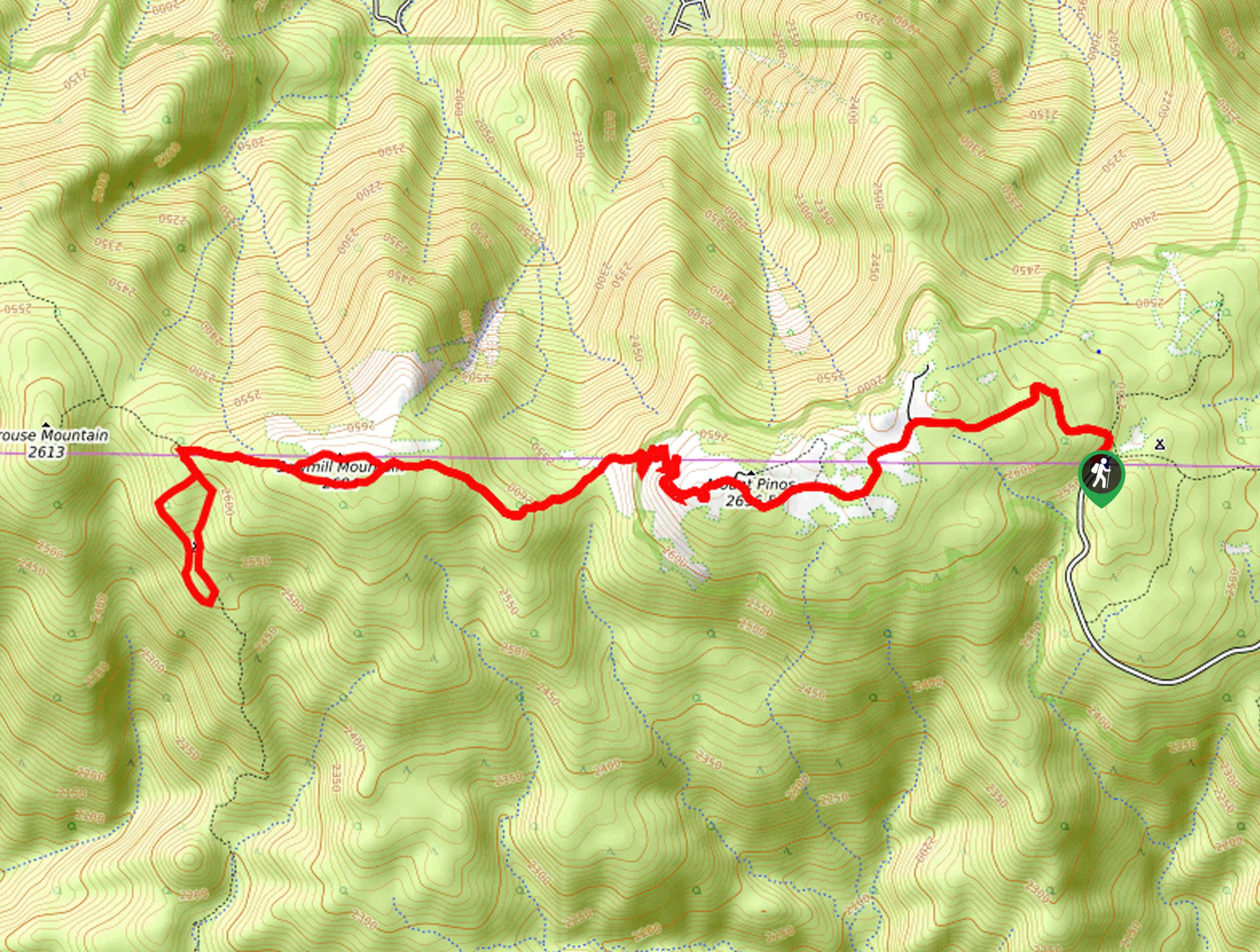
The Condor Summit and Vincent Tumamait Trail is an awesome adventure through the San Emigdio Mountains that offers breathtaking views of the mountainous landscape and the area’s diversity of flora and fauna. Though challenging, the vistas prove well worth the effort.
Getting there
The Condor Summit and Vincent Tumamait Trail departs from the Condor Summit Trailhead off Mount Pinos Road.
About
| Backcountry Campground | Sheep Camp |
| When to do | Year-round |
| Pets allowed | Yes - On Leash |
| Family friendly | Older Children only |
| Route Signage | Average |
| Crowd Levels | Moderate |
| Route Type | Out and back |
Condor Summit and Vincent Tumamait Trail
Elevation Graph
Weather
Condor Summit and Vincent Tumamait Trail Description
The Condor Summit and Vincent Tumamait Trail is a demanding adventure in the Los Padres National Forest that boasts unrivaled views of the Transverse Mountains. Requiring stamina and navigational skills, this route is no walk in the park! Be sure to download the trail GPS prior to departure; we also encourage you to pack plenty of water to stay hydrated along the way. Note much of the terrain is exposed, so SPF and sun protection are a must!
Setting out from the trailhead, the Condor Summit and Vincent Tumamait Trail follows the Condor Summit Trail, climbing through the woodlands and communities of high brush. Be mindful of the slippery terrain as you climb! The path will eventually redirect you westwardly, up to the summit of Mount Pinos, which offers jaw-dropping vistas of the mountainous wilderness. From here, continue west, merging onto the Vincent Tumamait Trail, which plunges down into the saddle and up to Sawmill Mountain. At this junction, keep right to the summit, then down to the next intersection.
Here, veer left onto the North Fork Trail to Sheep Camp. At this point, turn around and take the leftmost trail before turning right back onto Vincent Tumamait Trail. Follow this route east, reconnecting with the Condor Summit Trail, which will guide you back to the trailhead.
Similar hikes to the Condor Summit and Vincent Tumamait Trail hike

Last Chance Trail
The Last Chance Trail is an amazing adventure through the Santa Paula Canyon amongst the Topatopa Mountains. Indulge in the…

Grass Mountain Trail
The Grass Mountain Trail is an amazing adventure in the Los Padres National Forest that boasts commanding vistas of the…

Brazil Ranch Trail
The Brazil Ranch Trail is an amazing adventure in the Los Padres National Forest that is sure to impress. Walk…


Comments