

Cerro Alto Loop Trail
View PhotosCerro Alto Loop Trail
Difficulty Rating:
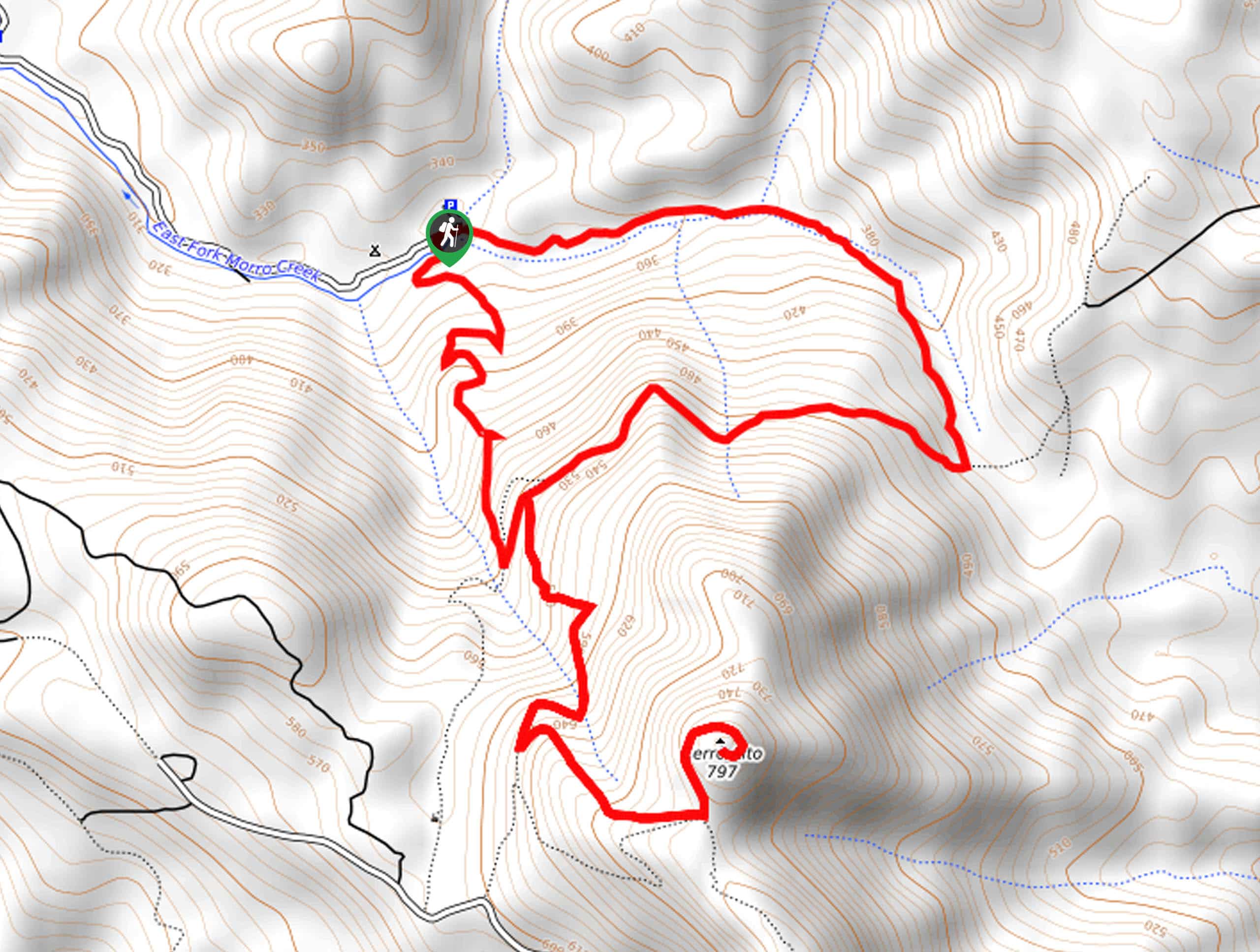
The Cerro Alto Loop Trail is an awesome adventure that beckons the exploration of hikers, bikers, and horseback riders alike. Wander through the lush coastal woodlands and high brush meadows that boast incredible views of the encompassing mountains and the shimmering bay.
Getting there
The Cerro Alto Loop Trail is accessed via the Bridge Trailhead Cerro Alto Road.
About
| Backcountry Campground | |
| When to do | Year-round |
| Pets allowed | Yes - On Leash |
| Family friendly | Older Children only |
| Route Signage | Average |
| Crowd Levels | High |
| Route Type | Lollipop |
Cerro Alto Loop Trail
Elevation Graph
Weather
Cerro Alto Loop Trail Description
The Cerro Alto Loop Trail is a well-revered route through the mountains of Los Padre that reveals unrivaled views. No matter how you choose to venture this trail, you will not be disappointed. The exposed terrain near Cerro Alto’s summit offers incredible views and extreme conditions, so check the forecast and dress accordingly. Be sure to pack plenty of water, and though not necessary, we encourage you to download the trail GPS. Note there is a $10USD parking fee required at the trailhead.
Setting out from the trailhead, those tackling the Cerro Alto Loop Trail will wander south along the Bridge Trail. This route demands the navigation of several switchbacks to a junction. Turn left here onto the AT&T Trail before diverting right onto the Cerro Alto Upper Trail. This exposed route will deliver you to the summit of Cerro Alto Mountain. Revel in the beauty of the encompassing mountainous landscape and distant views of the bay. After admiring the dramatic scenery, retrace your footing back down to the AT&T Trail intersection. Here, veer right onto the AT&T Trail, heading east.
Hike this route through the lush woodlands to the next intersection. Here, turn left, and you will be diverted onto the Canyon Trail. Follow this path along the East Fork Morro Creek all the way back to the trailhead, marking the end of your adventure.
Similar hikes to the Cerro Alto Loop Trail hike

Last Chance Trail
The Last Chance Trail is an amazing adventure through the Santa Paula Canyon amongst the Topatopa Mountains. Indulge in the…

Grass Mountain Trail
The Grass Mountain Trail is an amazing adventure in the Los Padres National Forest that boasts commanding vistas of the…

Brazil Ranch Trail
The Brazil Ranch Trail is an amazing adventure in the Los Padres National Forest that is sure to impress. Walk…


Comments