The Coniston Coppermines
View Photos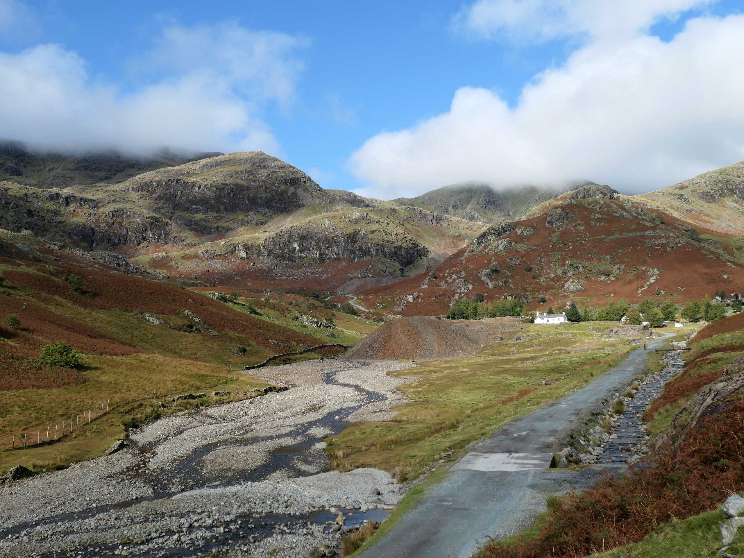
The Coniston Coppermines
Difficulty Rating:
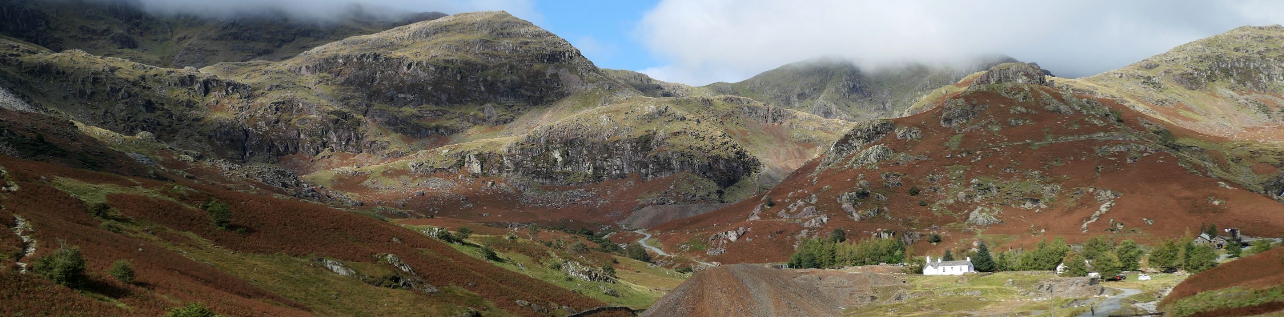
Walking the Coniston Coppermines Trail is a fun Lake District experience that will take you uphill through some rugged terrain to reach the shores of Levers Waters. While out on the trail you will experience some breathtaking scenery, as you walk below the majestic formation known as the Old Man of Coniston and look back across the blue expanse of Coniston Water below. This trail will also appeal to walkers with historical interests, as the trail passes through an area that has been mined since the 1600s.
Getting there
To reach the trailhead for the Coniston Coppermines from Skelwith Bridge, drive southwest on the A593 for 5.1mi and turn right. Continue on for 413ft to arrive at the starting point of the walk. Parking can be found nearby in the village.

About
| When to do | Year-round |
| Backcountry Campsites | No |
| Pets allowed | Yes - On Leash |
| Family friendly | Older Children only |
| Route Signage | Average |
| Crowd Levels | Moderate |
| Route Type | Circuit |
The Coniston Coppermines
Elevation Graph
Weather
The Coniston Coppermines Description
The Coniston Coppermines Trail is a fantastic walking route that will take you along some moderately challenging Lake District terrain to experience some truly spectacular scenery. The route climbs uphill at the foot of several rugged peaks in an area that has been used for mining operations dating back to the 1600s. The combination of breathtaking scenery, rugged terrain, and historical interests makes this route suitable for a wide variety of walkers.
Setting out from the edge of Coniston, the trail leads to the northwest to traverse the lower slopes of Yew Pike. Here, you will make your way across the hillside and enjoy the views of the mining operations below, with the Old Man of Coniston and Brim Fell towering above to the west. Eventually, you will pass by several small waterfalls and arrive at the calm shores of Levers Water, briefly walking along its edge before turning to the south. Here, you will have some amazing views overlooking the valley below, including Coniston Water off in the distance beyond the village. This portion of the walk will see you descend the rugged terrain around The Bell and cross the open fields towards the road. Turn to the north and follow the trail that runs parallel to the road to return to the village where you began your adventure.
Similar hikes to the The Coniston Coppermines hike

Osprey Viewpoint & Bassenthwaite Lake Walk
The Osprey Viewpoint & Bassenthwaite Lake Walk is a scenic Lake District adventure that will expose you to some beautiful…

Hawkshead, Wray Castle, and Windermere Walk
The Hawkshead, Wray Castle, and Windermere Walk is a fantastic journey that will lead you through some picturesque locations that…

Pike of Blisco and Crinkle Crags Walk
The Pike of Blisco and Crinkle Crags Trail is a challenging adventure that will see you climb several rugged peaks…
Comments