Tarn Hows Circular Walk
View Photos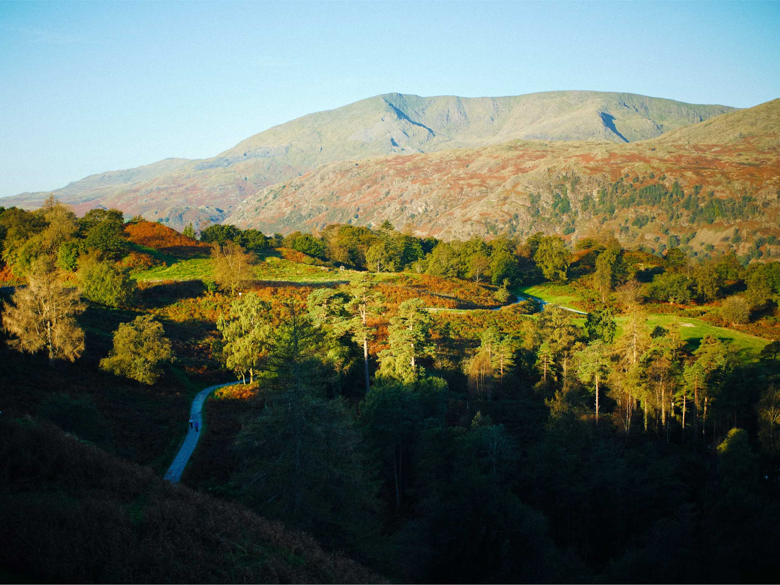
Tarn Hows Circular Walk
Difficulty Rating:
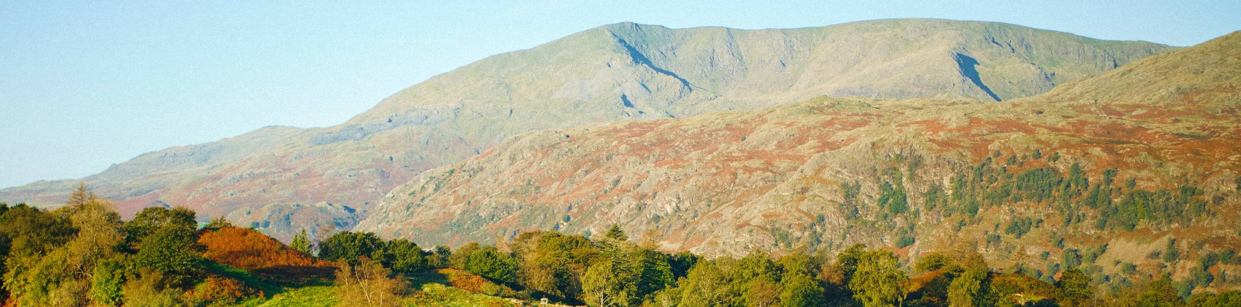
The Tarn Hows Circular is a scenic walking route in the Lake District that will take you through beautiful stretches of woodland terrain surrounding a picturesque tarn. While out on the trail, you will feel a sense of relaxation as you walk through the serene forests before climbing uphill to a viewpoint with spectacular views over the area. This walk is perfectly suited for a quiet waterside walk with scenery that the entire family will enjoy.
Getting there
To reach the trailhead for the Tarn Hows Circular from Hawkshead, drive northwest on Main Street for 230ft and continue straight onto B5285 for another 0.3mi. Make a left to continue on for 0.8mi before turning right. After 0.1mi, make another right and you will arrive at the trailhead in 0.2mi.

About
| When to do | March-November |
| Backcountry Campsites | No |
| Pets allowed | Yes - On Leash |
| Family friendly | Yes |
| Route Signage | Average |
| Crowd Levels | Moderate |
| Route Type | Circuit |
Tarn Hows Circular Walk
Elevation Graph
Weather
Tarn Hows Circular Walk Description
Walking the Tarn Hows Circular is a fairly short and fun adventure in the Lake District that doesn’t have many negative attributes, save for the often muddy trail conditions that can be found in the area. If you are looking to complete this walk, make sure to wear proper walking boots that are preferably waterproof. Additionally, the area sees a fair amount of visitors, so you may want to arrive early to secure parking.
Even with the soggy conditions along the trail, this is an amazingly scenic walk that the entire family is sure to love. The trail climbs gently uphill through wonderfully atmospheric stretches of woodland terrain and passes by several charming stone cottages before arriving at a viewpoint overlooking the calm waters of the tarn. From here, you will make your way around the edge of the water to experience some more amazing views and woodland plantations, before arriving back at the trailhead. This is a nice and quiet Lake District Walk that is perfectly suited for a leisurely weekend stroll.
Setting out from the trailhead, follow the lane north for 0.1mi to pass by the Lakeland Hideaways buildings and pick up the trail. Over the next 0.3mi, you will pass through a series of three gates that will bring you to a fork in the path. Head right and cross over the stile, passing by the picturesque Rose Castle Cottage before arriving at the Tarn Hows Viewpoint.
Enjoy the scenic views overlooking the peaceful tarn and surrounding woodland scenery before heading northeast on the trail to pass through the Rose Castle Plantation. After walking 0.4mi from the viewpoint, head left at the fork near the edge of the wood and continue around the water to the north to cross over a stream that feeds the tarn.
After crossing the bridge, head left at the junction and pass through a gate, keeping left along the edge of the tarn for 0.7mi to pass through the tranquil setting of Tom Heights Intake Plantation and arrive at another bridge crossing over Tom Gill. Make your way across and pass through the gate to take the first path on the left.
From here, continue along the southern edge of the water for 0.2mi, where you will pass through a series of four junctions. Keep straight at the first, head right at the second, straight on the third, and left at the fourth to continue southeast onm the return leg of the walk back to the trailhead.
After passing by the National Trust Disabled Car Park, cross over the road and pick up the trail to the left to continue south for 0.4mi. Continue straight through the next two junctions, where you will eventually meet up with the road. Head right here and keep left at the following intersection to arrive back at the trailhead in 0.2mi, having completed the Tarn Hows Circular.
Trail Highlights
Tarn Hows
Located in the iconic Lake District, Tarn Hows is a picturesque area 2.0mi northeast of Coniston that offers scenic views overlooking a tarn. The area is a popular tourist destination, with peak visitor numbers reaching over 500,000 people per year during the 1970s.
Frequently Asked Questions
How long is the walk around Tarn Hows?
The circular walk around the edge of Tarn Hows is 2.3mi. It should be noted that cycling is not permitted.
Is Tarn Hows man-made?
Although Tarn Hows is an idyllic destination set in the Cumbria countryside, it is actually a man-made construct. The modern-day tarn was created by combining three separate tarns in the 19th Century.
Insider Hints
Wear decent walking shoes that are preferably waterproof, as this trail can be very wet.
Pack a picnic for a scenic lunch at the elevated viewpoint.
Similar hikes to the Tarn Hows Circular Walk hike

Osprey Viewpoint & Bassenthwaite Lake Walk
The Osprey Viewpoint & Bassenthwaite Lake Walk is a scenic Lake District adventure that will expose you to some beautiful…

Hawkshead, Wray Castle, and Windermere Walk
The Hawkshead, Wray Castle, and Windermere Walk is a fantastic journey that will lead you through some picturesque locations that…

Pike of Blisco and Crinkle Crags Walk
The Pike of Blisco and Crinkle Crags Trail is a challenging adventure that will see you climb several rugged peaks…
Comments