High Street Roman Road Walk
View Photos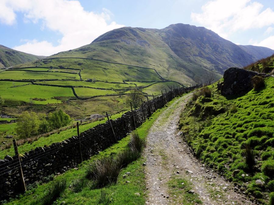
High Street Roman Road Walk
Difficulty Rating:
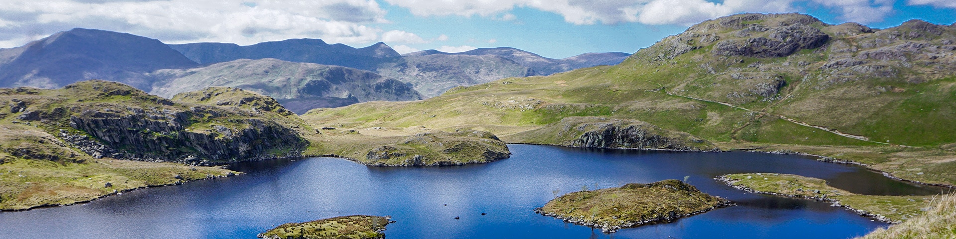
The High Street Roman Road Walk is a fine trail that takestrail you through an untouched valley then up to the summit of Thornthwaite Crag. From there, explore the wonderful views on a great walk along an ancient Roman Road to the stunning Angle Tarn.
Getting there
The High Street Roman Road Walk starts and ends in Hartsop, a village a short way from Patterdale and Glenridding. From Patterdale, head south on the A592 before turning left at the sign to Hartsop. Drive the narrow road to the end of the village, where there is free parking.

About
| When to do | When Dry, no fog |
| Backcountry Campsites | None |
| Toilets | None |
| Family friendly | No |
| Route Signage | None |
| Crowd Levels | Moderate |
| Route Type | Circuit |
High Street Roman Road Walk
Elevation Graph
Weather
High Street Roman Road Trail Description
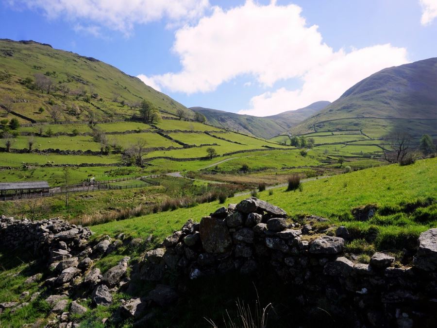
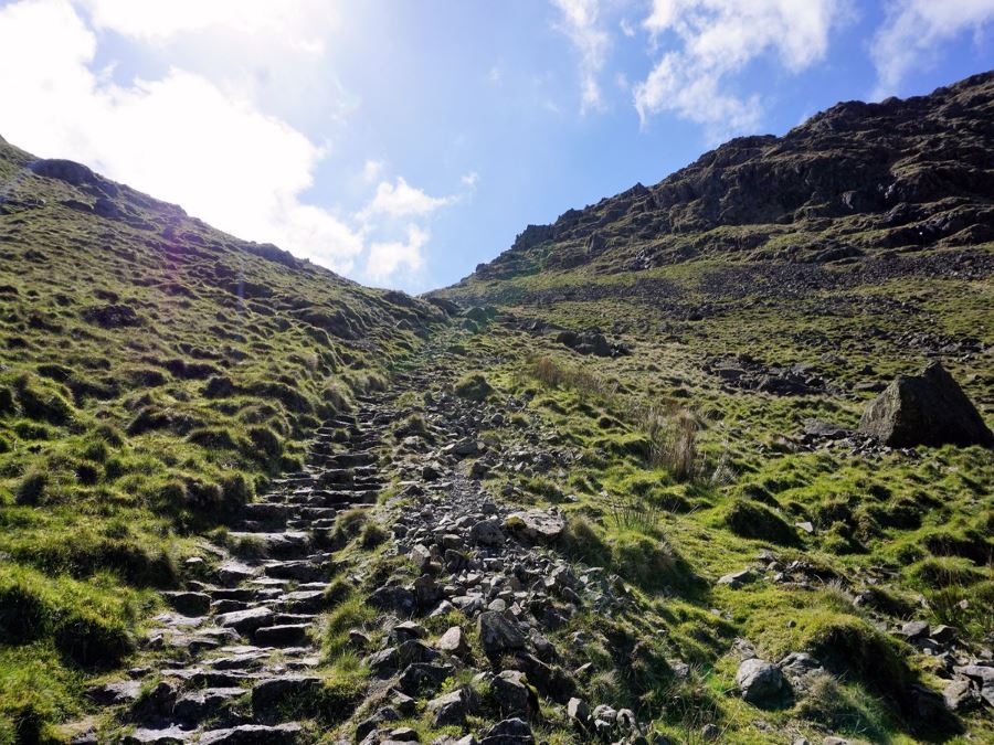
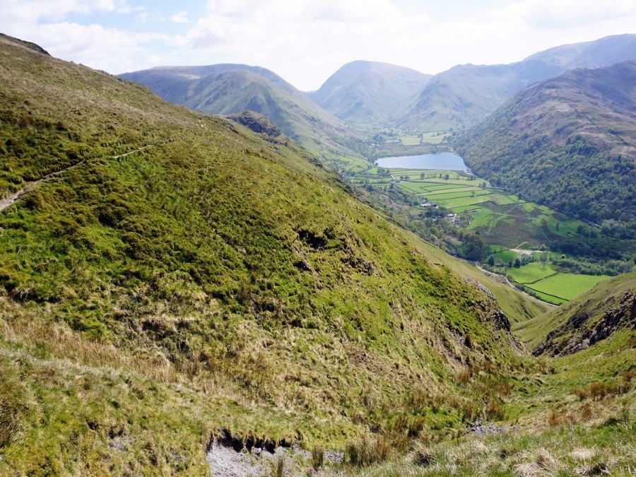
From the end of the parking lot at Hartsop village, walk out and immediately cross the bridge over Pasture Beck (stream). Head straight along the path; however, when it branches, take the left-hand side and continue along a well-defined path above the stream. Here, the path will slowly curve to the right as it heads up the valley.
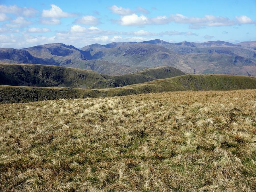
Eventually, you can see up the valley and you will notice there is no exit. Your path will take you to the saddle right in the centre of the valley. The upper end of the Pasture Beck Valley is a real highlight of the walk, as it has a wild, untamed quality. Continue along the clear path, as it begins to steepen on your approach to the saddle.
Upon reaching the saddle, enjoy the views down the next valley and towards Windermere. This is a fine place for a break, but the climbing isn’t over. At the saddle, you will head over a stonewall and immediately turn left tostart climbing up to the top of Thornthwaite Crag. The path is fairly clear though you may need your hands to steady yourself on the way up in places.
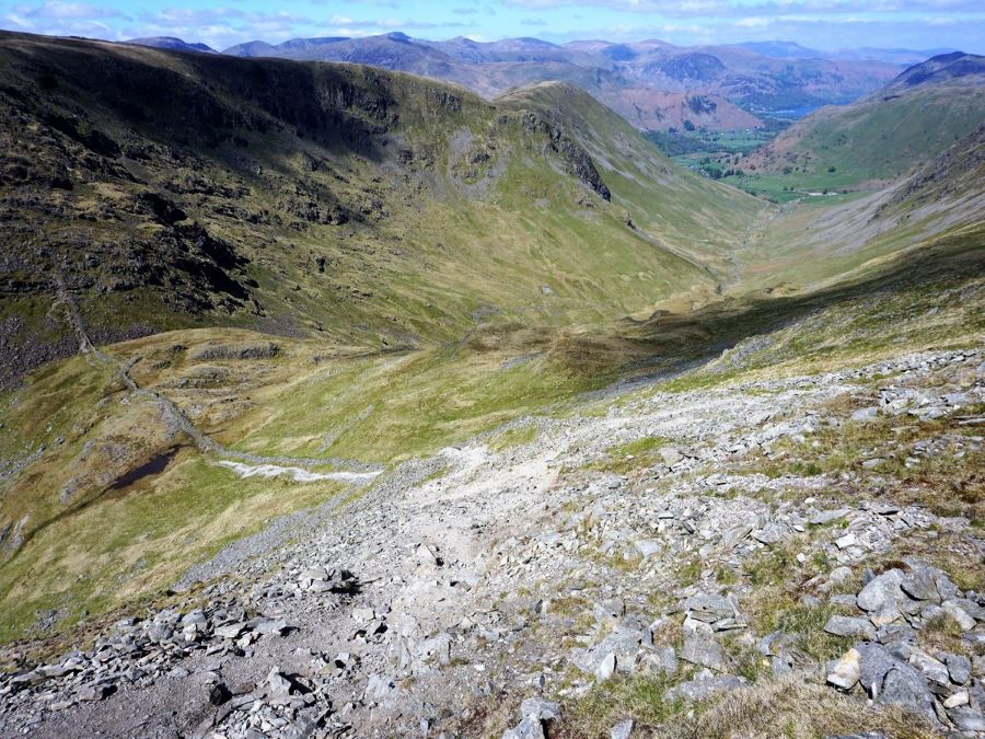
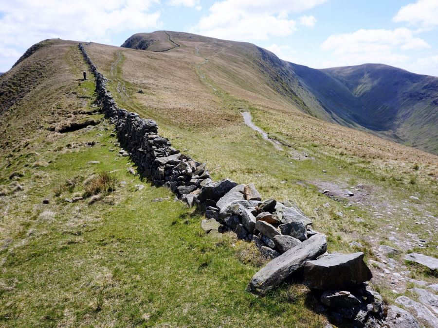
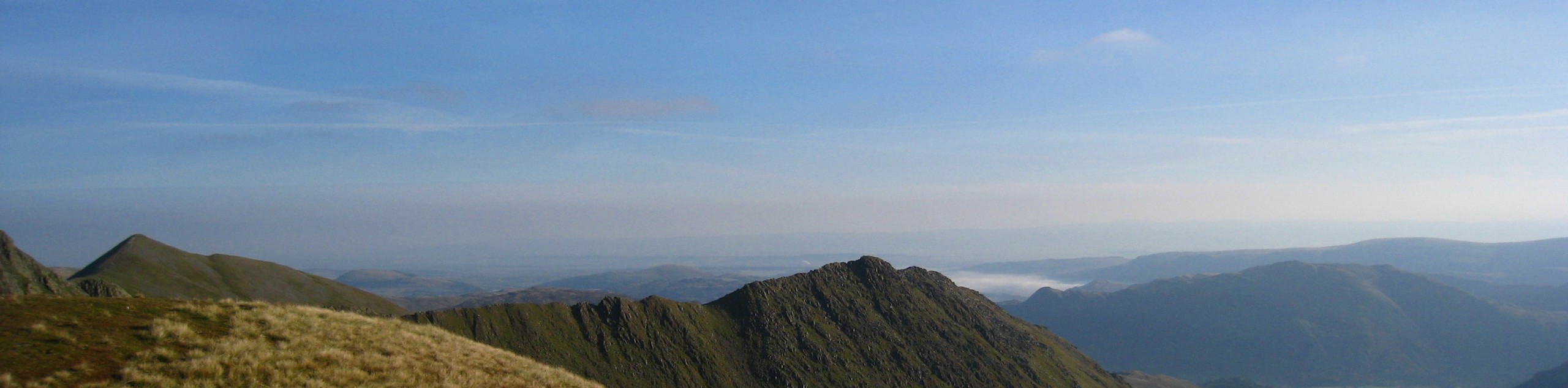
At 2.9mi you reach the peak of Thornthwaite Crag, where there is a chimney shaped cairn. The views here are great, and you can see the trail heading off across the relatively flat terrain to the left. Take this trail, and when it splits go left – don’t go over the wall. For this section keep the stonewall on your right, as you are now on the ancient Roman High Street. The Romans built this gentle path as the valleys of that time were heavily forested and marshy (as well as prone to ambushes). Later, locals used these gentle slopes in the 18th and 19th centuries for summer fairs, held in July.
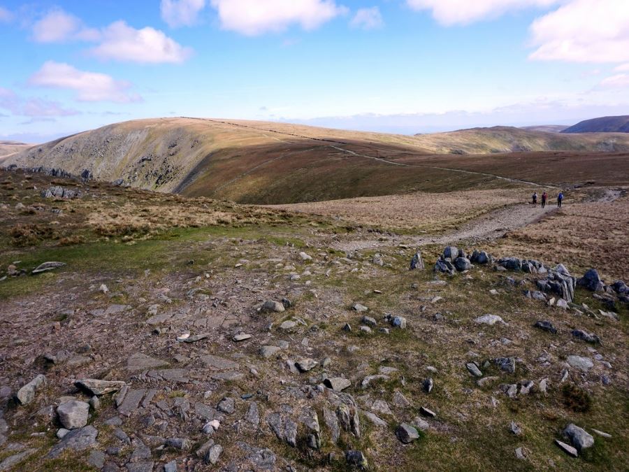
Follow the well-worn path as it gently rises and then falls away. The trail will have occasional paths heading off to your right, however you want to continue contouring to your left. You will see glimpses of Hayeswater down to your left, and a prominent feature known as the Knott directly ahead.
At 4.7mi the path splits just before a feature known as The Knott. You can head to the left and go over the Knott; however, we prefer contouring to the right as the path is easier. After the Knott, ignore the path heading right and continue left. Immediately, you will see a path heading off to the left down towards Hayeswater – ignore this path and keep straight, unless you want to go back to Hartsop and skip Angle Tarn.
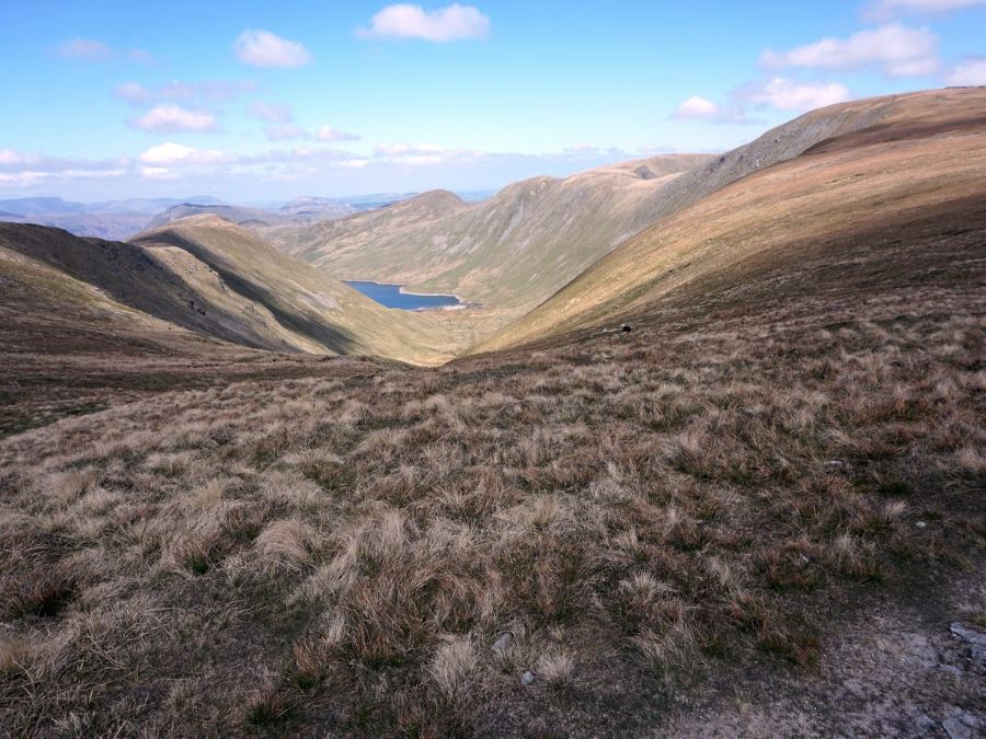
Continuing straight ahead, not down to Hayeswater, you will pass another route leading off to your right. Here, you will come across a rocky feature known as Satura Crags – a great place to stop for a snack.
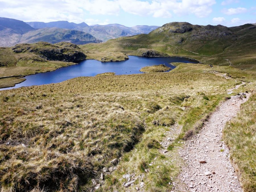
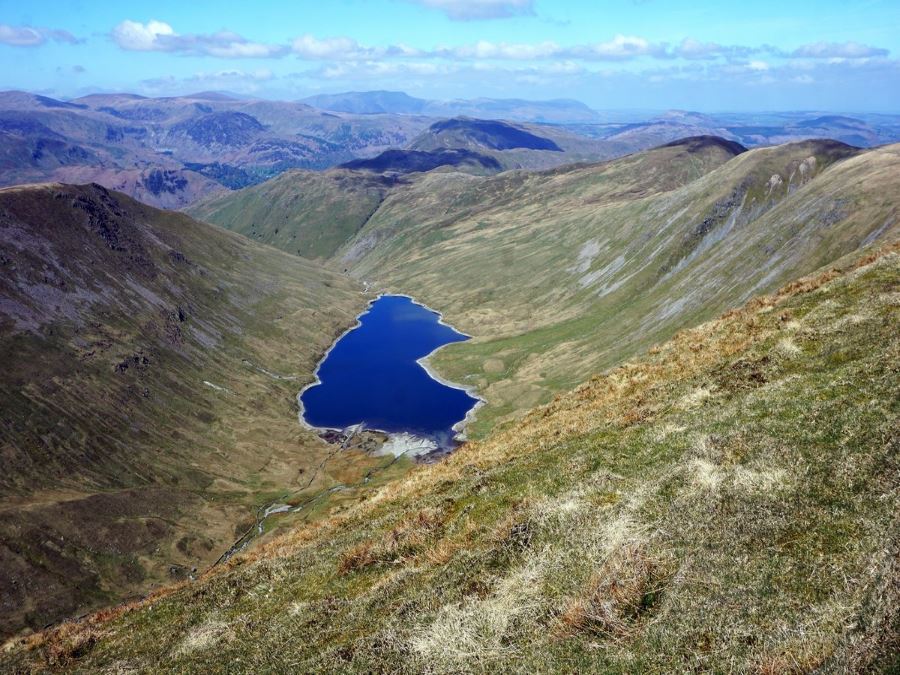
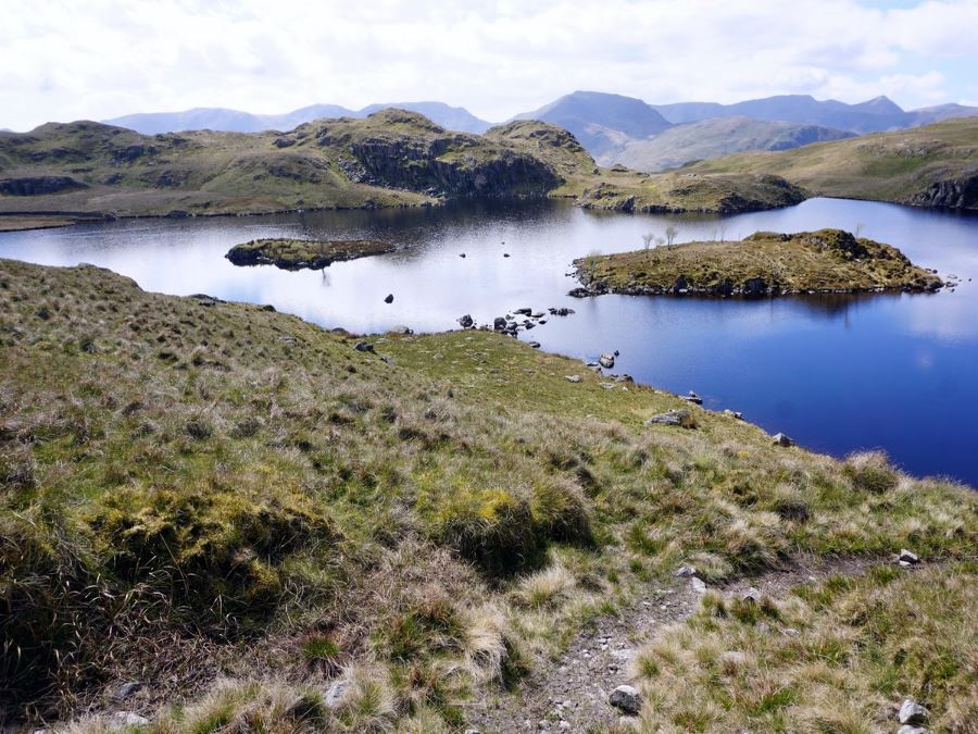
After cresting a hill you will see the stunning Angle Tarn (tarn being a term for a small mountain lake). This is one of the prettiest tarns we’ve seen in the Lake District, and ranks up with stunning tarns we’ve hiked to in the Rockies and Alps. Pass by Angle Tarn on the right hand side and then follow the path that continues behind it.
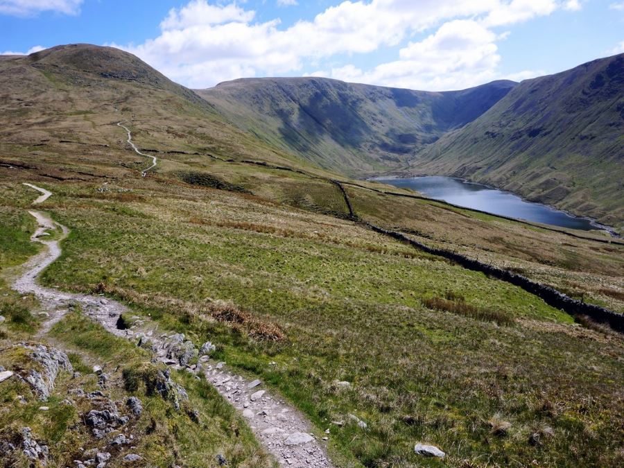
You will stay downhill on the obvious path until you reach a saddle between Stony Rigg and Place Fell. Here, you can see the white path snaking up Place Fell.
From the saddle, the path splits in two. Go left to get back to your car, while the right hand path leads down to Patterdale.
The route down can be slippery with the hard track and lots of small stones. Take care – poles come in handy. As this route descends you go in and out of the trees.
Almost back in Hartsop you will come out of the trees and run into a fork in the road with bridges in both directions. While the lower route looks like the continuation of the trail, take the upper route and go over Angletarn Beck on a unique bridge. The route continues on the edge of the forest, with occasional forays into the trees.
You’ll see some homes as you go over occasionally paved portions of the path. Coming to a junction, go right and head downhill back to your car.
Looking for more great walks in the Lake District? Check out the Helvellyn Walk, Scafell Pike Walk, Fairfield Horseshoe or the Old Man of Coniston.
Insider Hints
You can do this walk from Patterdale, as Patterdale is on the Penrith – Windermere Bus service. If you walk from Patterdale, it can be very nice if you get a ride to the starting point in Hartsop.
There are many different paths up here, and having a GPS device really does help

Similar hikes to the High Street Roman Road Walk hike
Nethermost Pike via East Ridge Walk
Walking to Nethermost Pike via East Ridge is a tough climb up several rugged fells that will expose you to…

Hawkshead, Wray Castle, and Windermere Walk
The Hawkshead, Wray Castle, and Windermere Walk is a fantastic journey that will lead you through some picturesque locations that…

Pike of Blisco and Crinkle Crags Walk
The Pike of Blisco and Crinkle Crags Trail is a challenging adventure that will see you climb several rugged peaks…
Maxine A. 4 years ago
My favorite feature was the Satura Crags, for some unknown reason I find it unique!
Brit_Hiker 4 years ago
Great hike! Pretty long, took us about 6 hours give or take. Fabulous views.
Hunter156 4 years ago
It was foggy when I came here, so I wasn't able to fully enjoy the view. I want to try this hike again on a good day!
Squarepants11 4 years ago
I enjoyed this hike a lot. One of the best long hikes I ever had so far.
Theo 4 years ago
I'm grateful that I finally get the chance to go here. My friends suggested this hike to me long ago, but the first time I went here, It was so foggy, so I had to wait. Worth it on a sunny day!
MuhammadA. 4 years ago
The weather was simply perfect when we visit. Not so sunny and not so cloudy. Amazing!
AlphM. 4 years ago
The paths were really rocky. People with knee problems might experience a few difficulties during the hike, but the views are absolutely outstanding!
Joannachan 4 years ago
This place is heavenly! The views are totally brilliant!
Ray M 4 years ago
Extraordinary views! You should see it yourself!
Ramses CC 4 years ago
Worth every stop. It was challenging, there are few steep paths and some are rocky.