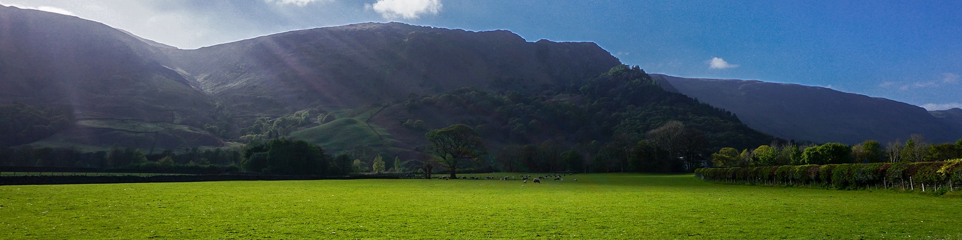
Langstrath Valley hike
View Photos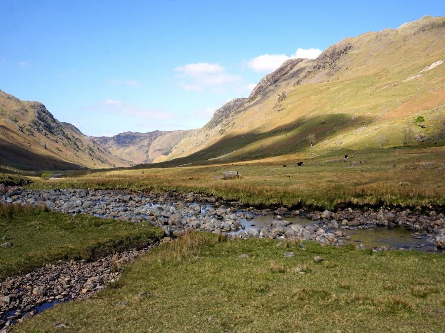
Langstrath Valley hike
Difficulty Rating:
The walk to the hidden Langstrath Valley is a favourite low-level walk in the Lake District. Get stunning views without the strenuous uphill the Lake District is famous for.
Getting there
The walk starts at Rosthwaite Village, as that’s where the most abundant parking is. This walk can be improved if you can find parking and start in Stonethwaite (though there is limited parking). Get to Rosthwaite by car by going south on B5289. Follow the signs to park at the parking lot by the Village Hall in Rosthwaite.

About
| When to do | When Dry, no fog |
| Backcountry Campsites | In Stonethwaite |
| Toilets | At car park |
| Family friendly | Yes |
| Route Signage | None |
| Crowd Levels | Moderate |
| Route Type | Out and back |
Langstrath Valley
Elevation Graph
Weather
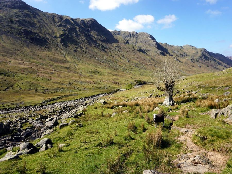
Route Description for Langstrath Valley
From the National Trust Parking lot in Rosthwaite, return to the B5289 and turn right (south). Walk along a path at the side of road for roughly 10 minutes, and turn left when you see a road on your left, signed to Stonethwaite.
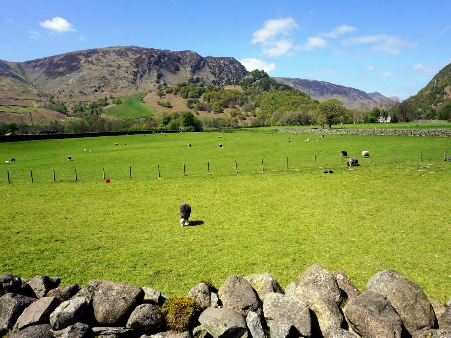
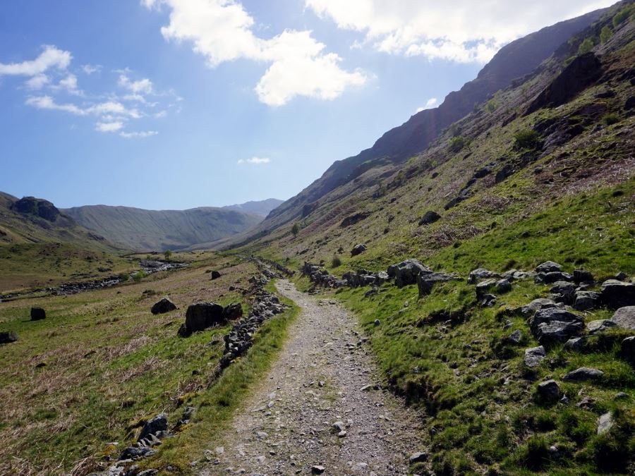
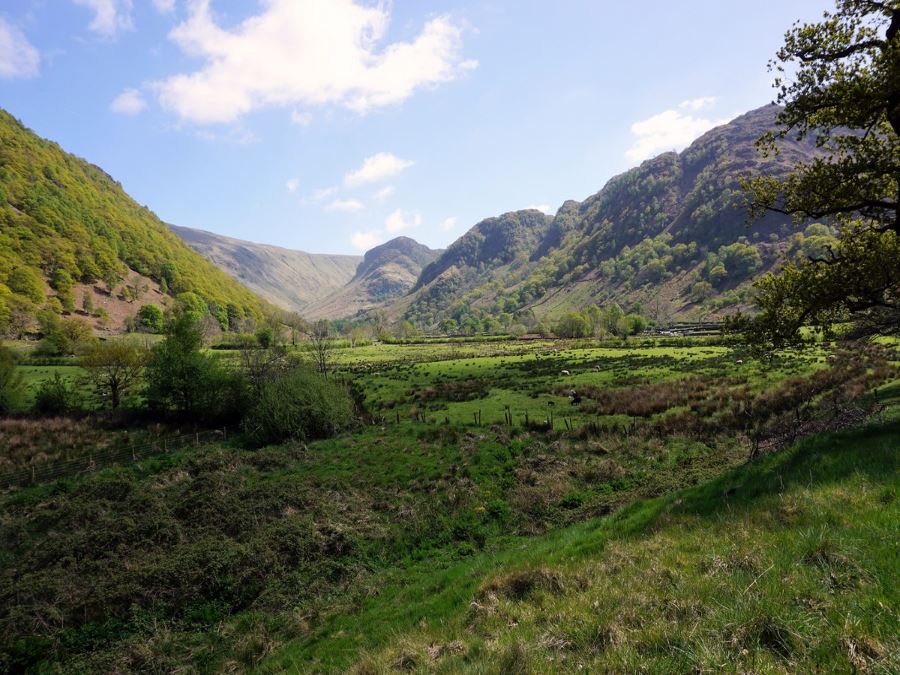
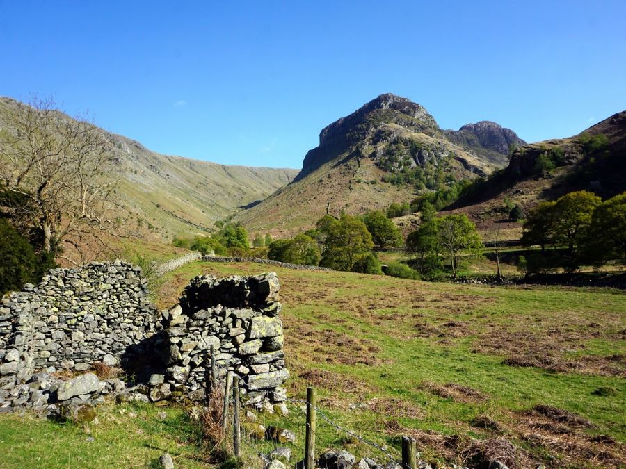
Take this road until you reach the town of Stonethwaite. Continue past the cute little village, passing the Langstrath Hotel and follow the route leading beyond. You can either take the main route, a rocky road that slowly disintegrates or else make your way along the river, taking public footpaths and passing many gates.
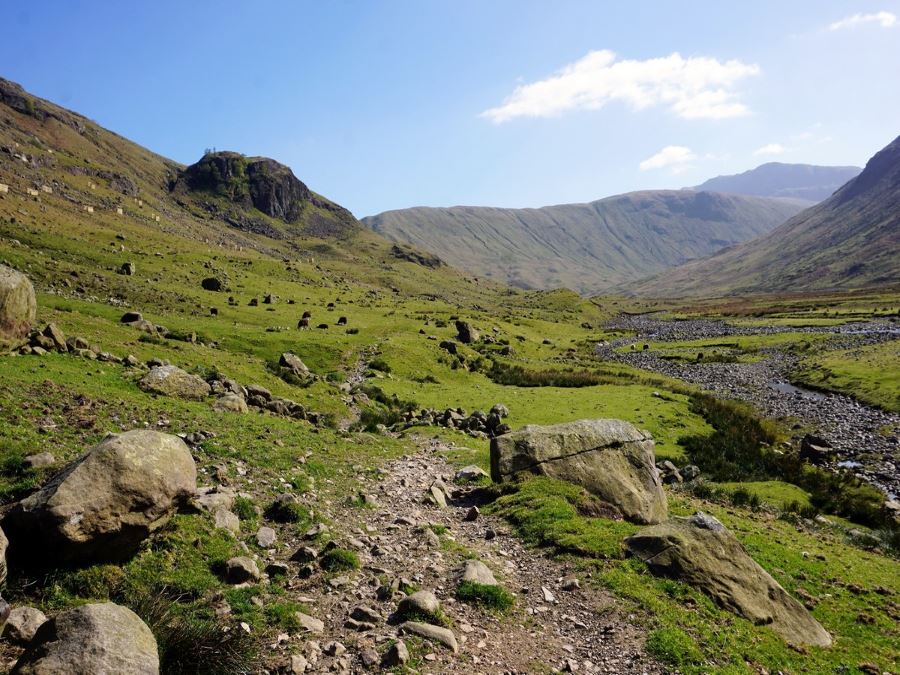
For the rest of the walk, a good rule of thumb is to keep the stream on your left. At the start you will be walking along a Stonethwaite Beck (a little stream) and continuing straight ahead. You will continue past a campsite, and from here on in the walk becomes a true pleasure. As you advance, look out for a path that veers off to the right, heading up the Langstrath Valley.
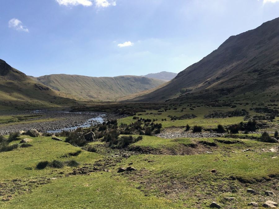
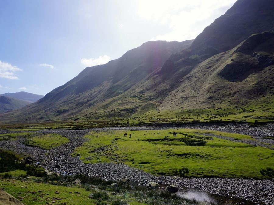
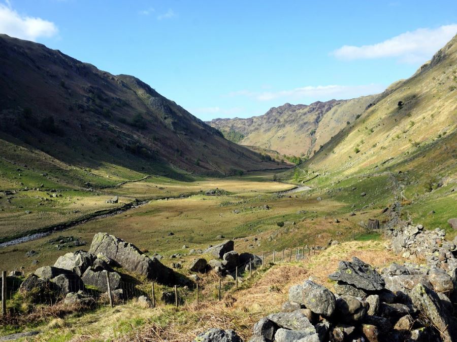
After about 2.2mi the path will come to another stream, Longstrath Beck, coming down from your right. Follow the path as it curves to the right, heading uphill as it meanders up the stunning, hidden Langstrath valley. The walk up and then back down this valley is the highlight of the walk, so savour this route.
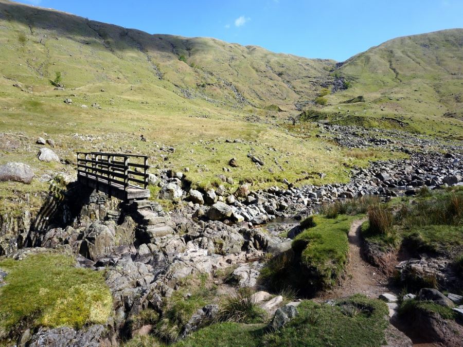
After roughly 4.0mi, you come to a bridge crossing Longstrath Beck. Cross this bridge, and you can return immediately along the path going left, heading back down the valley. You will also notice a path leading up to your right, crossing over a bridge and then heading uphill in the direction of Mansey Pike. This is an excellent walk if you have the energy. We recommend to at least walk up to this second bridge, as it allows the views of the valley to unfold before you, making the trip truly memorable.
From the second/upper bridge, turn back down the valley and walk back along Longstrath Beck, keeping the stream on your left. This path strays farther from the river as it heads back down the valley. Upon reaching the end of the valley, you will encounter another bridge over Greenup Gill (which leads into Stonethwaite Beck). Cross over the bridge and turn left, returning with the river on your left.
As you head downhill you will see Stonethwaite on your left. Continue on down the path, eventually turning into a track as you get close to your starting village of Rosthwaite. When you come to a bridge, turn left, crossing the bridge and walking down Howe Lane to the B5289. Here, you turn left again before making a quick right back to the narrow street leading to the car park.
Looking for more great walks in the Lake District? Check out the Helvellyn Walk, Scafell Pike Walk, Fairfield Horseshoe or the Old Man of Coniston.
Insider Hints
Shorten this walk and focus only on the wonderful Langstrath Valley by parking in Stonethwaite by the red call box. There is limited parking here, however it makes the walk shorter without missing any of the great scenery.
There is camping after the village of Stonethwaite in a National Trust Campground, however caravans are not allowed.
This walk has lots of stones to walk over, and poles are useful for stability.
You can get to Rosthwaite on the #78 Bus from Keswick to Seatoller.

Similar hikes to the Langstrath Valley hike

Osprey Viewpoint & Bassenthwaite Lake Walk
The Osprey Viewpoint & Bassenthwaite Lake Walk is a scenic Lake District adventure that will expose you to some beautiful…

Hawkshead, Wray Castle, and Windermere Walk
The Hawkshead, Wray Castle, and Windermere Walk is a fantastic journey that will lead you through some picturesque locations that…
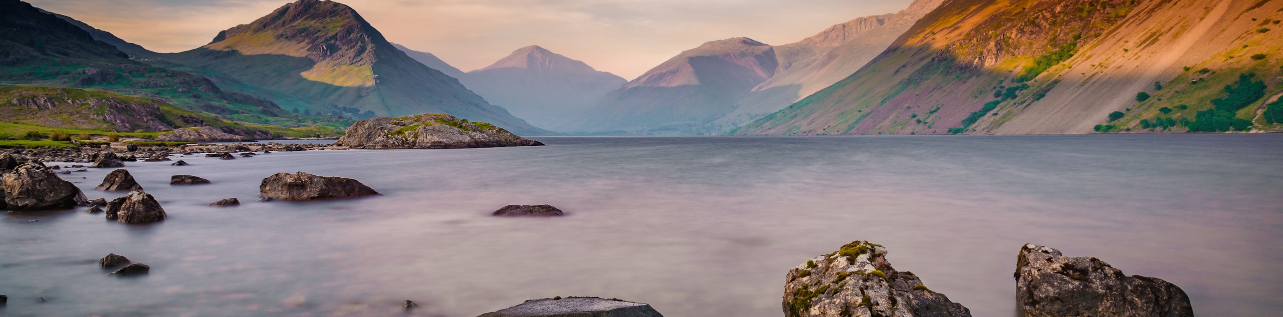
Nether Wasdale and Wastwater Walk
The Nether Wasdale and Wastwater Walk is a fairly relaxing stroll through a variety of Lake District terrain that will…
Elenastankova 4 years ago
I really love the view. I can't help falling in love with Lake District's hike.
unicorn_lady 4 years ago
I brought my friend with me here and it was her first time to hike so I never thought that she would appreciate the joys of hiking and discovering the stunning scenery waiting at the top. Hiking is good for the well-being and I am happy that I was able to share this experience with someone close to me.
climbing_ally21 4 years ago
This was a relaxing trail that gives a remarkable view of the district lake.
Fran Cine 4 years ago
We spent just one night here, the location is idyllic, breathtaking scenery, fantastic walks.
angelathompson2020 4 years ago
Took the long route beautiful day
alexabostwick 4 years ago
This was a beautiful walk, following the stream. Not too difficult although some paths are rocky and after heavy rainfall it can be very wet and you’re walking through streams.
Max O. 4 years ago
I had some difficulty finishing the hike because I did not get enough rest the day before I did this.
Charlotte Sea 4 years ago
It's not very steep and the routes were easy to follow. Great experience!
dancraig 4 years ago
Beautiful walks with babbling streams, ponds and vistas.
ShirleySyk 4 years ago
This hike was beautiful and absolutely great weather