Honister Round
View Photos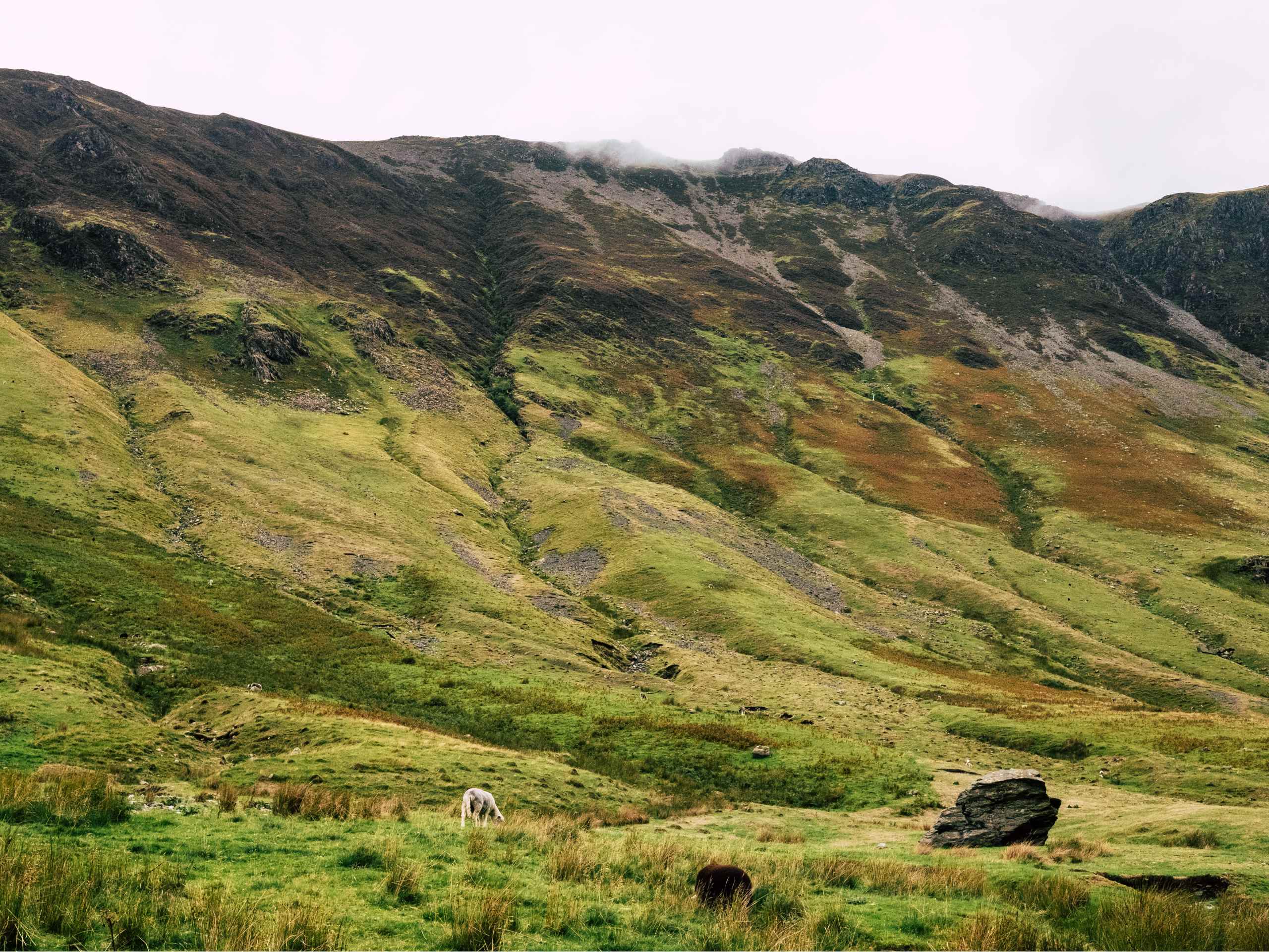
Honister Round
Difficulty Rating:
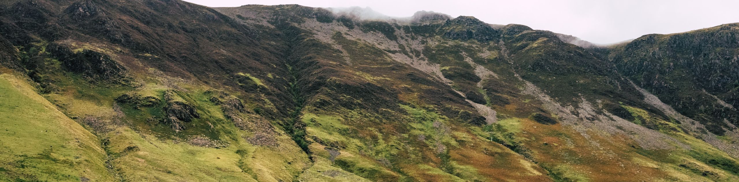
The Honister Round is an exciting trail in the Lake District that will take you uphill along both sides of Honister Pass to explore the amazing summit viewpoints from atop the fells. While out on the trail, you will climb along the rugged terrain that flanks the pass and summit iconic peaks like Fleetwith Pike and Dale Head for some spectacular views of the surrounding mountains and Buttermere to the northwest. This route has some fairly steep and exposed sections of trail, but the views are certainly worth the effort.
Getting there
To get to the car park for the Honister Round from Keswick, make your way to the southeast along Borrowdale Road/B5289 for 8.4mi and turn left to enter the car park.

About
| When to do | March-October |
| Backcountry Campsites | Dalegarth Guest House Campsite |
| Pets allowed | No |
| Family friendly | No |
| Route Signage | Average |
| Crowd Levels | Moderate |
| Route Type | Circuit |
Honister Round
Elevation Graph
Weather
Honister Round Description
Walking the Honister Round is a challenging Lake District adventure that will see you gain and lose a fair amount of elevation as you summit several rugged peaks that flank the pass. Proper walking footwear is strongly recommended, as the terrain along this route is steep, rocky, and often uneven. There are also a number of intersecting trails throughout this route that could make navigation difficult, so be sure to bring a decent trail map or GPS to help keep you on track.
Although it is a difficult climb across a number of peaks, the views along each of these elevated positions offer a spectacular perspective of the surrounding Lake District terrain. While out on the trail you will climb uphill to the summit of Fleetwith Pike before descending into the valley along the serene shores of Buttermere. From here, you will climb up the steep hillside on the opposite side of the pass, traversing the terrain along the summits of Robinson, Hindscarth, and Dale Head, before descending back down into the pass below. This walking route is sure to be a tough workout, but the views will be more than worthwhile.
Setting out from the car park in Honister Pass, head west along the track to make your way past the Sky Hi Cafe, bearing left at the fork and continuing on for 400ft. From here, turn left again and follow the trail for 0.5mi as it climbs uphill to arrive at a junction. Turn right and keep left at the fork, continuing north until you meet up with the mining road. Cross over to the other side and traverse the open terrain to the north for 70ft before turning left along a footpath. After 262ft, turn right at the junction to begin making your way up the steep hillside.
This section of the walk up to the summit of Black Star features a lot of intersecting pathways, so make sure to keep an eye on the GPS or chart a course for the top of the hill in order to stay on the correct route to the summit. Continue walking up the hillside for 0.4mi, making sure to avoid any areas related to mining operations that are closed to the public as a safety precaution. Eventually, you will arrive at the summit of Black Star, where you will have a great view overlooking Honister Pass.
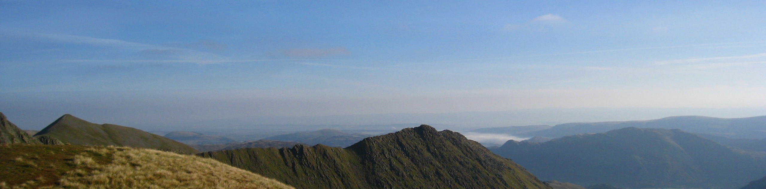
After taking in the views, continue making your way west along the rugged mountaintop terrain for 0.5mi, where you will arrive at the summit of Fleetwith Pike. From this elevated position at 648m, you will enjoy some more amazing views overlooking the rugged terrain of the pass, with the added bonus of sweeping views to the northwest that overlook the waters of Buttermere.
From here, head northwest along the trail and carefully descend the rugged terrain of Fleetwith Pike for the next 1.0mi, eventually arriving at the edge of the road along the valley floor. Turn left along the road and follow it for the next 0.8mi, skirting around the edge of the charming waters of Buttermere, before picking up a trail on the right just before the Dalegarth Guest House Campsite. This is a great place for an overnight stay in the area if you are thinking of turning this into a multi-day adventure.
Turn right along the path and enter into the forest, following it up the steep hillside along Hassnesshow Beck for the next 1.1mi. After arriving at a junction, turn left and make your way up to the summit of Robinson for some more scenic views overlooking Buttermere and the surrounding fells. After taking in the views, retrace your steps down from the summit and keep left for the next 1.3mi, once again climbing uphill along the rugged terrain to reach a vantage point atop Hindscarth.
From this hilltop perch, follow the trail to the south and keep left, traversing the elevated terrain for 0.9mi to arrive at the summit of Dale Head. From this rugged lookout, you will enjoy the final views of the day across Honister Pass, with Fleetwith Pike standing directly opposite to the south west. After taking in these last scenic views, make your way south to descend the hillside on the final 1.2mi stretch of trail that will bring you back to the car park where you began your walk along the Honister Round.
Insider Hints
Pop into the Sky Hi Cafe near the trailhead for some pre/post-walk refreshments.
Proper walking boots are recommended, as terrain along this route is fairly rugged.
Be sure to bring plenty of water, as there is a fair amount of elevation gain along this route.
If you are looking to spend the night along the trail, try booking a spot at the Dalegarth Guest House Campsite on the shores of Buttermere.
Toilet facilities can be found at the trailhead.
Similar hikes to the Honister Round hike
Nethermost Pike via East Ridge Walk
Walking to Nethermost Pike via East Ridge is a tough climb up several rugged fells that will expose you to…

Hawkshead, Wray Castle, and Windermere Walk
The Hawkshead, Wray Castle, and Windermere Walk is a fantastic journey that will lead you through some picturesque locations that…

Pike of Blisco and Crinkle Crags Walk
The Pike of Blisco and Crinkle Crags Trail is a challenging adventure that will see you climb several rugged peaks…
Comments