Harter Fell Walk
View Photos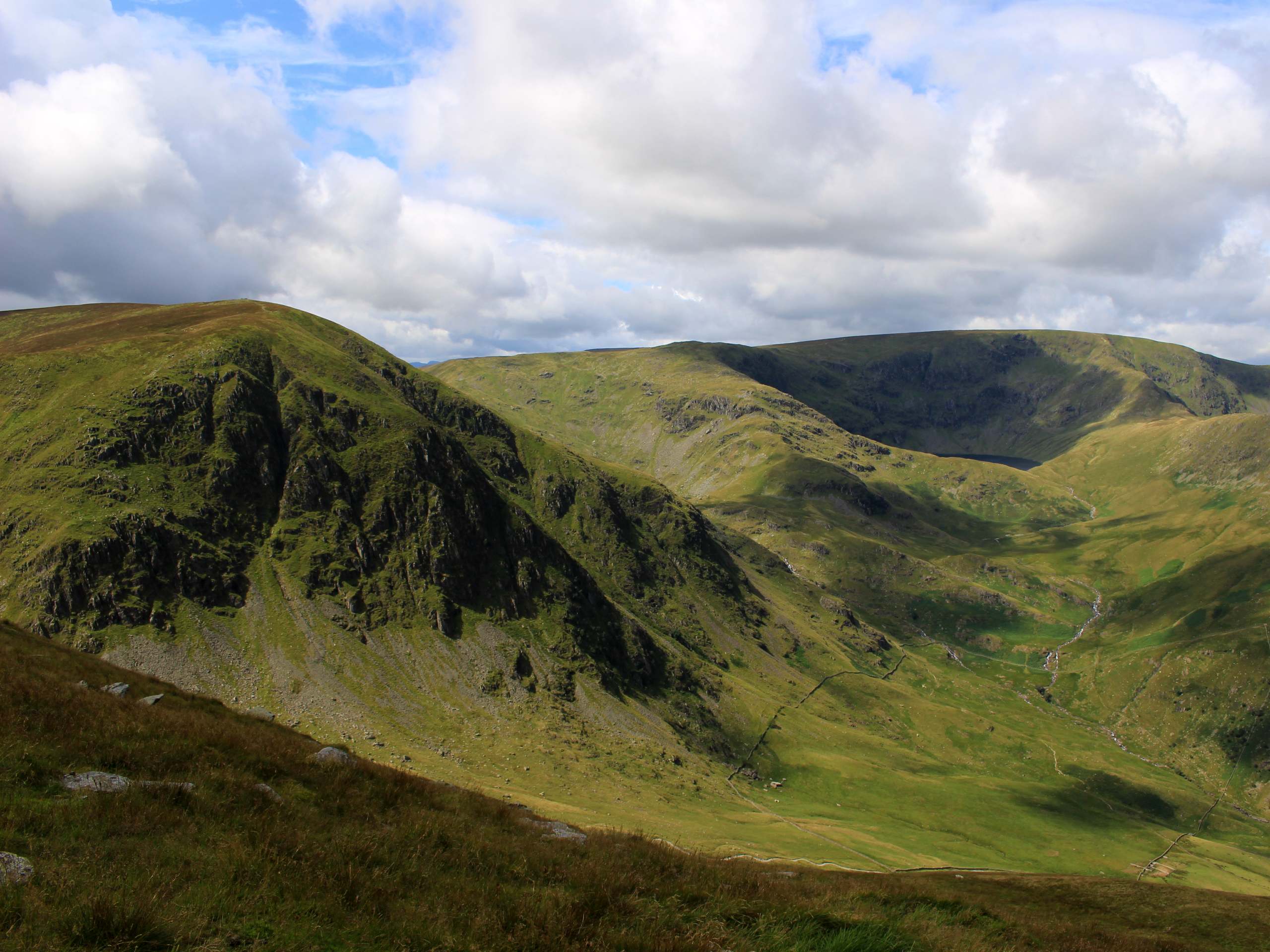
Harter Fell Walk
Difficulty Rating:
The Harter Fell Walk is a spectacular route in the Lake District that takes you up to the craggy summit of the fell for some amazingly scenic views. This trail is slightly less used than some of the other routes leading up to the summit, but the views are no less scenic. If anything, you might be able to enjoy a bit of solitude while you enjoy the views across the rolling hills and rugged peaks of the English countryside.
Getting there
To reach the car park for the Harter Fell Walk from Skelwith Bridge, drive southwest on the A593 for 1mi and turn right, following it for 0.4mi. Turn left here onto Side Gates, continuing on for 1.9mi. Keep left and continue onto Wrynose Pass, following it for 5.7mi and turning right to enter the car park.

About
| When to do | Year-Round |
| Backcountry Campsites | No |
| Pets allowed | Yes - On Leash |
| Family friendly | Older Children only |
| Route Signage | Average |
| Crowd Levels | Moderate |
| Route Type | Circuit |
Harter Fell Walk
Elevation Graph
Weather
Harter Fell Walk Description
The Harter Fell walk is a great outdoor experience that will take you through a variety of terrain, including boggy sections of trail, overgrown paths, and a rocky ascent to the summit viewpoint. Make sure to wear a good pair of walking boots for this adventure. Additionally, parts of this route are overgrown and tough to navigate. Remember to keep a close eye on your GPS in these areas.
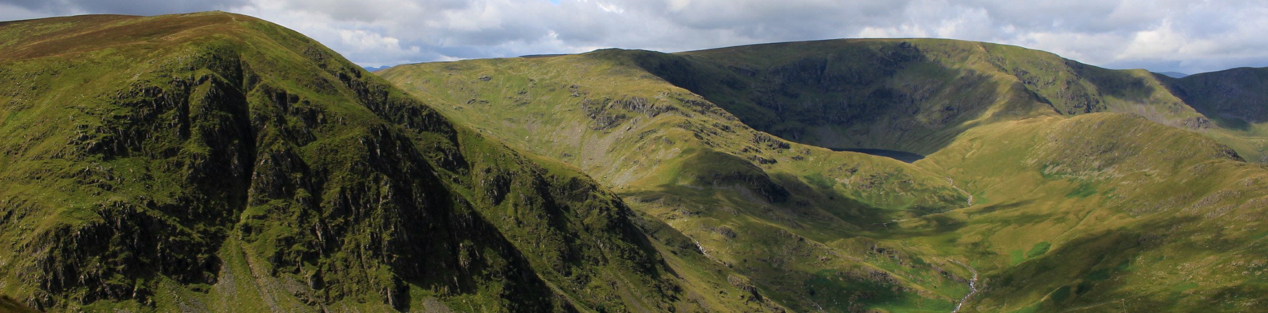
While the route may be a bit rugged and take you off the beaten path, it also offers some fantastic views overlooking the surrounding Lake District terrain. While out on the trail, you will climb uphill through several scenic forests and traverse some unmarked terrain before climbing up to the rocky summit for amazing views overlooking the surrounding fells. This route is less busy than others in the area, making it a great option for some peace and quiet along the trail.
Setting out from the car park, turn right along the road and make your way over Birks Bridge to cross the flowing waters of the River Duddon. After crossing the bridge, continue along the road for 420ft and turn right, keeping right along the track for the next 1.0mi to cross over several streams as you pass through Dunnerdale Forest and begin the climb up the hillside. Make sure to keep an eye on your GPS on this portion of the walk, as the path is fairly overgrown and can be challenging to navigate.
In order to cut down on the overall distance of your walk, follow the GPS as it turns away from the path and takes you northwest on a more direct route up the hillside. This is a bit of a rugged climb, but it will save you from traversing the hillside and backtracking to climb uphill. Follow this off-trail route for 0.3mi, where you will meet up with a trail atop the hill.
Turn left along the trail and follow it to the southwest, as you begin the steep and rugged climb up to the summit of Harter Fell. Certain parts of this ascent will be rocky and will require some light scrambling, but it is more than manageable for walkers of most skill levels. After arriving at the summit viewpoint, you will have a great sightline over the surrounding Lake District terrain, including the Hard Knott and Border End fells to the north, Green Crag to the southwest, and Seathwaite Tarn to the east below several rugged peaks.
After taking in the views, follow the trail to the southwest to descend the hillside for 0.5mi to arrive at a junction. Turn left here and pass through the gate to enter the densely wooded expanse of Hardknott Forest. Continue to the east for 1.4mi, keeping left until you arrive at a junction. Turn left here and make the next right, continuing straight along the trail as it leads you downhill through a series of three gates over the next 0.4mi.
Turn right at the junction and follow the path east to pass through a gate and cross a bridge over the River Duddon. From here, turn left onto the road and follow it north for 0.1mi to arrive at the car park where you began the Harter Fell Walk.
Insider Hints
Parking at the car park is free.
Wear proper walking boots, as some sections of the trail are boggy and the approach to the summit will require some light scrambling.
Keep an eye on your GPS, as some parts of the route are overgrown and can be tough to follow.
Similar hikes to the Harter Fell Walk hike

Osprey Viewpoint & Bassenthwaite Lake Walk
The Osprey Viewpoint & Bassenthwaite Lake Walk is a scenic Lake District adventure that will expose you to some beautiful…

Hawkshead, Wray Castle, and Windermere Walk
The Hawkshead, Wray Castle, and Windermere Walk is a fantastic journey that will lead you through some picturesque locations that…

Pike of Blisco and Crinkle Crags Walk
The Pike of Blisco and Crinkle Crags Trail is a challenging adventure that will see you climb several rugged peaks…
Comments