
Bowfell & Scafell Pike Walk
View Photos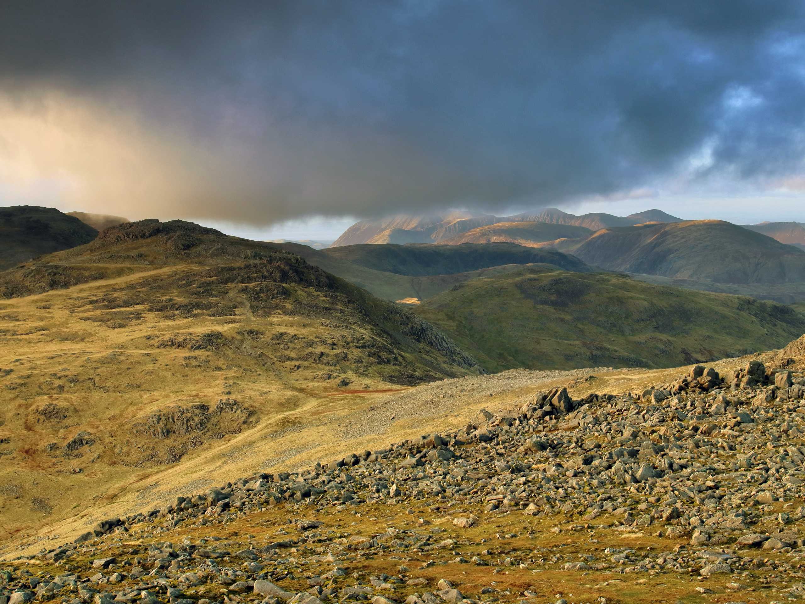
Bowfell & Scafell Pike Walk
Difficulty Rating:
The Bowfell & Scafell Pike Walk is a scenic adventure in the Lake District that will take you from the floor of the Great Langdale Valley to the summit of Scafell Pike off in the distance to the west. While out on the trail, you will make your way along the valley floor before traversing some rugged terrain along the summits of several peaks that include Bowfell, Esk Pike, and Scafell Pike to name a few. This is a bit of a challenging walk, but if you are up for a long distance journey with scenic views of the mountains, then look no further.
Getting there
To reach the car park for the Bowell & Scafell Pike Walk from Skelwith Bridge, make your way west for 4.2mi on the B5343 and take the next two left turns to arrive at the roadside car park.

About
| When to do | March-October |
| Backcountry Campsites | Great Langdale Campsite |
| Pets allowed | Yes - On Leash |
| Family friendly | No |
| Route Signage | Average |
| Crowd Levels | Moderate |
| Route Type | Lollipop |
Bowfell & Scafell Pike Walk
Elevation Graph
Weather
Bowfell & Scafell Pike Walk Description
The Bowell & Scafell Pike Walk is a lengthy journey across some rugged terrain that could prove to be challenging for less experienced walkers. Make sure that you wear proper walking footwear to traverse the sometimes boggy and often rocky terrain, as well as bring any extra gear and supplies that you may need. Portions of this walk are also fairly exposed to the elements, so keep an eye on weather conditions, especially on the upper portions of the trail.
Although this route is a bit tough in places and features a fair amount of elevation gain, it also offers a number of scenic viewpoints from which you can gaze out across the breathtaking landscape of the Lake District. If you are able to handle the rugged and undulating terrain, you will summit a number of peaks that include Bowfell, Esk Pike, and Scafell Pike. The trail also offers the chance to take several quick detours to the summits of Great End, Ill Crag, Broad Crag, Allen Crags, and Rossett Pike. It may be a long walk, but the journey is just as amazing as the stunning views.
Setting out from the car park, make your way southwest along the road for 0.7mi and continue straight through the gate. From here, follow the lane for another 0.7mi, making your way through the grounds of Stool End Farm to arrive at a junction with a trail known as “The Band.” Turn right here to begin making your way up to the summit of Bowfell.
After 1.5mi of climbing uphill along the rugged sloped terrain, keep left at the junction to eventually arrive at a junction at the edge of Buscoe Sike. Keep right along the trail, following it up the steep and rugged hillside for another 0.5mi to arrive at the summit of Bowfell. From this rocky perch, take some time to enjoy the views of the surrounding peaks with the Great Langdale Valley below, before continuing toward the northwest.
Keep straight along the trail for the next 1.4mi, traversing the undulating landscape of Esk Pike before arriving at a junction in the trail at Esk Hause. Take the second path on the left and follow it in a westward direction, keeping left for 0.8mi as you work around the peaks of Great End and Ill Crag. From here, keep straight for another 0.4mi to arrive at a t-intersection next to Broad Crag Col.
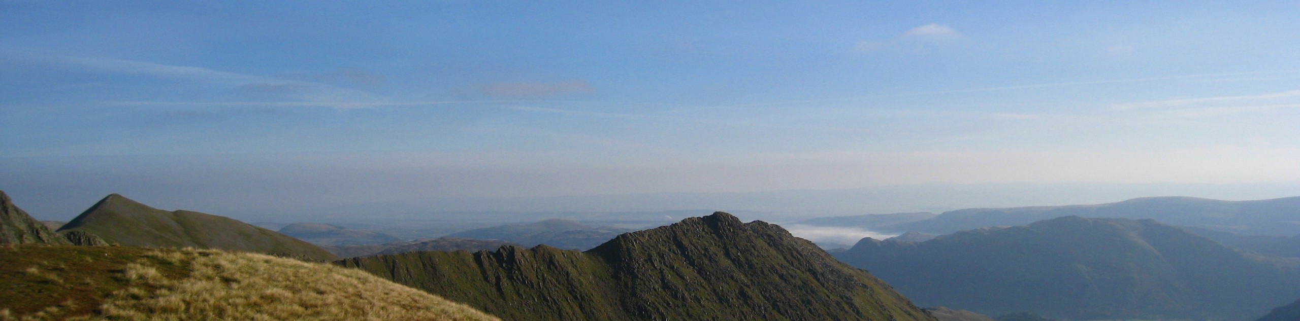
Head left here and make the short but steep climb up to the summit of Scafell Pike. Enjoy the amazing views that sweep across the Lake District and include Great Gable to the north and Wast Water to the west. After taking in the mountainous views, retrace your steps along the trail for 1.4mi to arrive back at the junction at Esk Hause.
From here, pass straight through and continue on across the open terrain for 1.0mi, keeping right to descend the hillside under the shadow of Allen Crags before arriving at the edge of Angler Tarn. Enjoy the peaceful views across the water before setting back out on the return leg of the journey to the southeast.
Keeping right along the trail for the next 1.6mi, cross over Angle Tarn Gill and make your way uphill near Rossett Pike before descending the hillside alongside Rossett Gill to the valley floor below. Continue southeast for 1.8mi and enjoy the beautiful views of the Langdale Pikes on your left before you arrive at the location of the Old Dungeon Ghyll Hotel. Keep right here and follow the trail across Great Langdale Beck to the edge of the road. Head left here and follow the road northeast for 0.7mi to arrive back at the car park where you began the Bowell & Scafell Pike Walk.
Insider Hints
This route features a variety of terrain that includes wet/boggy and rocky/rugged sections. Wear sturdy walking boots with good ankle support.
As there may be livestock roaming along the route, make sure to keep any dogs on a leash to avoid interactions
This walk is a bit on the long side, so bring plenty of water/snacks.
If you are looking for a great place for some post-walk drinks, try Sticklebarn close to the car park.
Similar hikes to the Bowfell & Scafell Pike Walk hike
Nethermost Pike via East Ridge Walk
Walking to Nethermost Pike via East Ridge is a tough climb up several rugged fells that will expose you to…

Hawkshead, Wray Castle, and Windermere Walk
The Hawkshead, Wray Castle, and Windermere Walk is a fantastic journey that will lead you through some picturesque locations that…

Pike of Blisco and Crinkle Crags Walk
The Pike of Blisco and Crinkle Crags Trail is a challenging adventure that will see you climb several rugged peaks…
Comments