The Valley of The Seven Lakes Hike
View Photos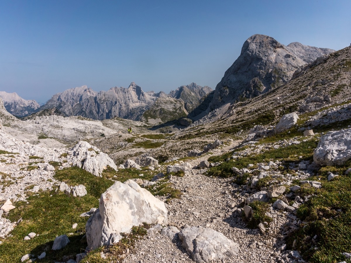
The Valley of The Seven Lakes Hike
Difficulty Rating:
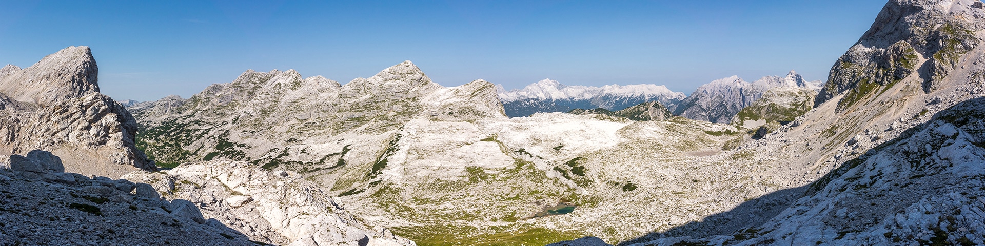
Walking in the Valley of the Seven Lakes is probably the most popular area in the Julian Alps. This is the crème de la crème. This hike offers you everything: picturesque pastures, hilly landscapes, sharp rock ridges, distant panoramic views, shiny lakes, and mountain huts. But, it comes at a price: a full day of hiking! This is a big day out, but very rewarding.
Getting there
From the 633, driving towards Bohinj lake, enter Stara Fužina. Turn left when the main road crosses the bridge. Follow the road until you reach a parking area, then drive up for ~3.7mi. Turn right on the gravel road to Planina Blato/Planina pri jezeru. Drive 0.6mi and park.

About
| When to do | Spring to fall |
| Backcountry Campsites | Yes, in Ukanc at the Bohinj lake area, in Bohinjska Bistrica |
| Toilets | Yes, Planina pri jezeru hut, Zasavska hut at Prehodavci, Triglav lakes hut |
| Family friendly | No |
| Route Signage | Average |
| Crowd Levels | Moderate |
| Route Type | Lollipop |
The Valley of The Seven Lakes Hike
Elevation Graph
Weather
Route Description for The Valley of The Seven Lakes Hike
Go back from the parking lot on the road you drove in on and look for the broad, steep cart track going up on your right (at the Triglav National Park wooden map board). Follow the cart track up and, in around ten minutes, keep to the left (the path to the right goes to Planina v Lazu). A few steps up the path and you’ll connect with the path from Vogar pasture.
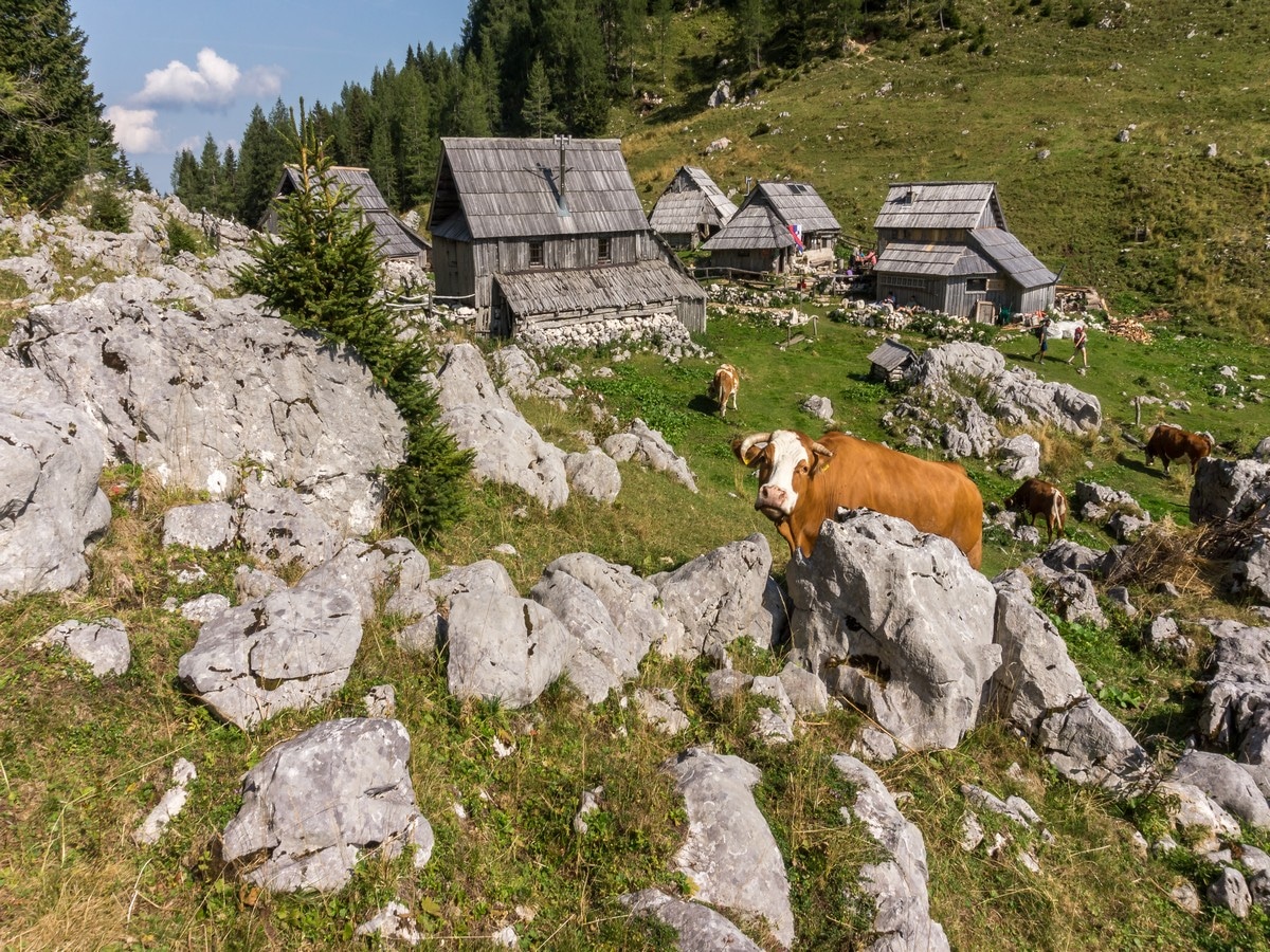
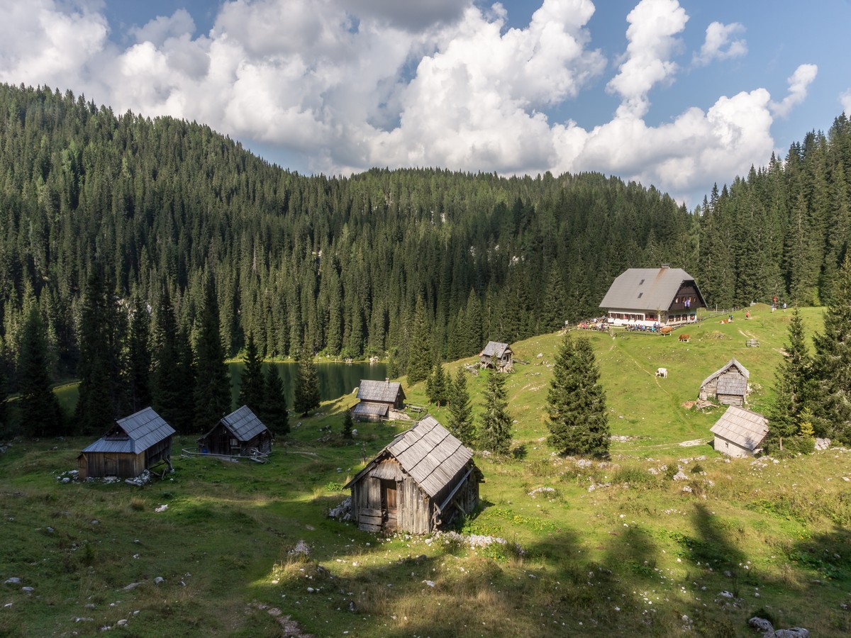
Eventually the rocky cart-track will take you to the Planina pri Jezeru hut. Take note of the beautiful lake behind the hut. From the hut, walk down a little bit to the west to reach a signed junction. Go straight ahead on the wide path in the direction of Planina Dedno polje (The path to the left goes to Planina Viševnik and Pršivec). The path climbs up through a scarce spruce forest.
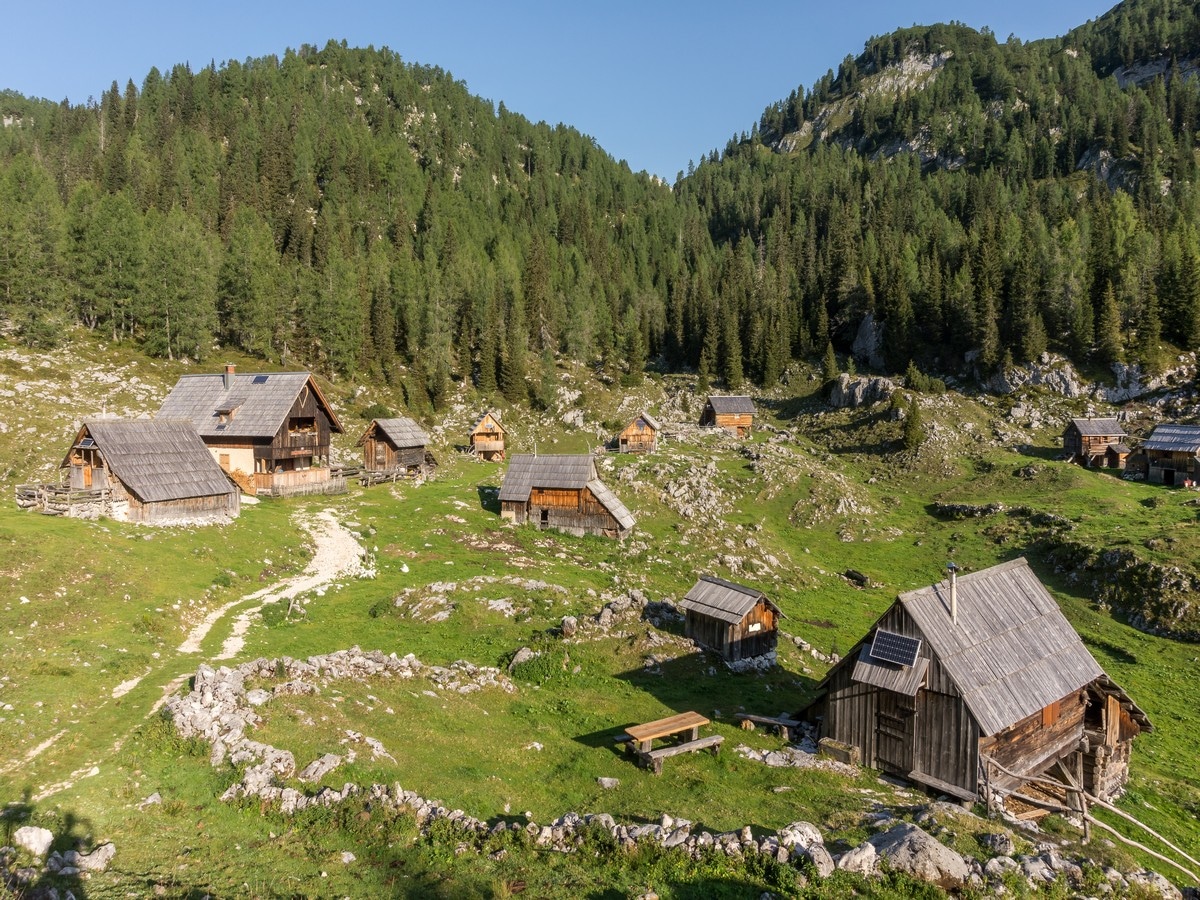
In about 40 minutes you will get to the Dedno polje pasture. At the water trough drop down to the right in the direction of Preval Hribarice, Prehodavci and Dolič. Walk between the old shepherd´s houses to the other side of the pasture.
At the less noticeable crossroad proceed straight up the trail (the right path goes to Planina v Lazu). The path climbs up through the larch and spruce forest. In about 30 minutes from Dedno polje, the trail will level out, and a nice view of the surrounding peaks opens up. Further ahead, the path gains elevation quickly, climbing up the slopes of Slatna and Prvi Vogel.
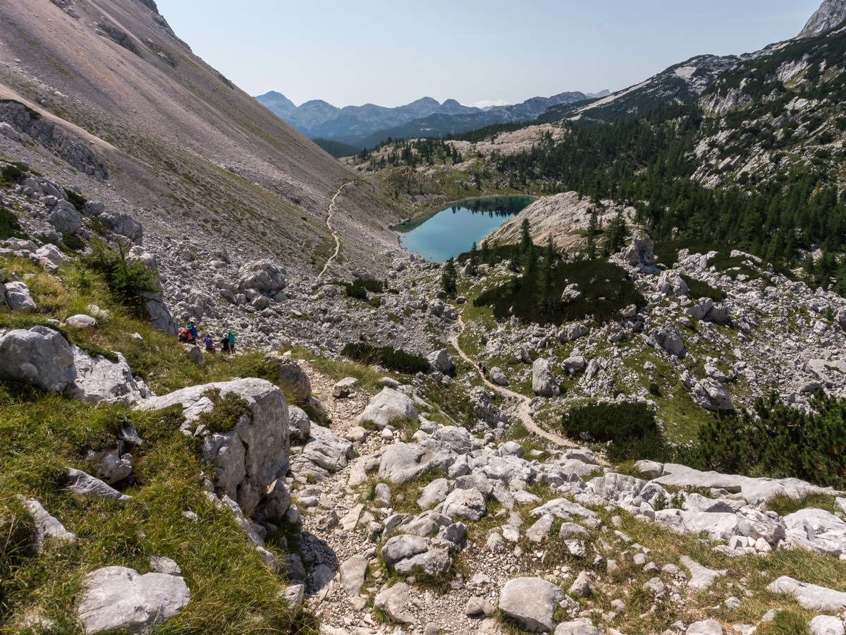
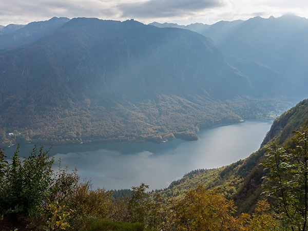
Leaving the tree line and turning slightly to the right we find ourselves in the Za Kopico valley. Be sure to look back and enjoy the stunning view across the valley to the lower Bohinj mountains.
Follow the path to the saddle Vrata, where the view opens up to the north. You should spot the high peaks of Prisank, Razor and Škrlatica on the horizon. Continue north and descend. Soon you will spot the Zasavska hut at Prehodavci on the north edge of the valley. Then, the path curves to the right and starts to climb back up again towards the walls of Vršaki.
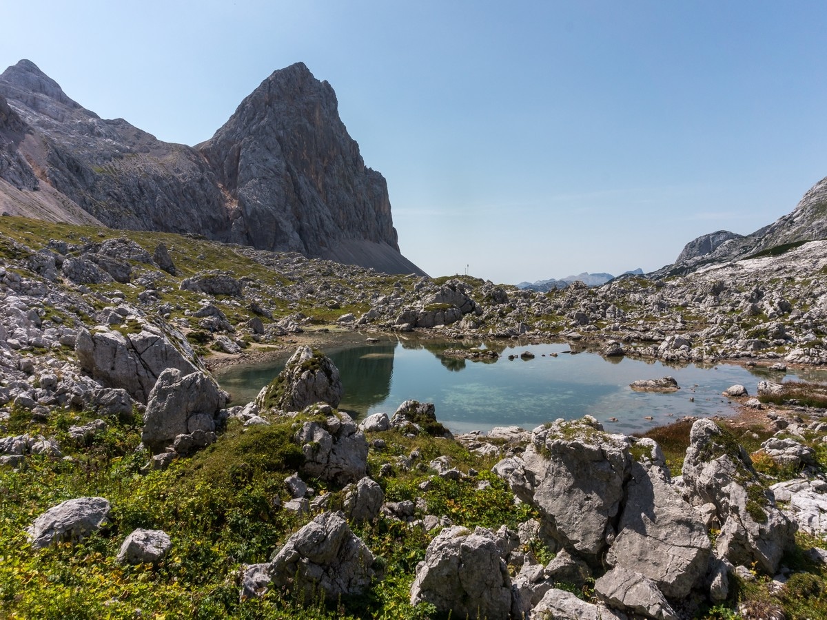
About fifteen minutes later, you will get to the intersection where the path from Hribarice joins from the right. Turn left at the large stone and follow it down. Continue to the right and pass the Rjavo jezero lake.
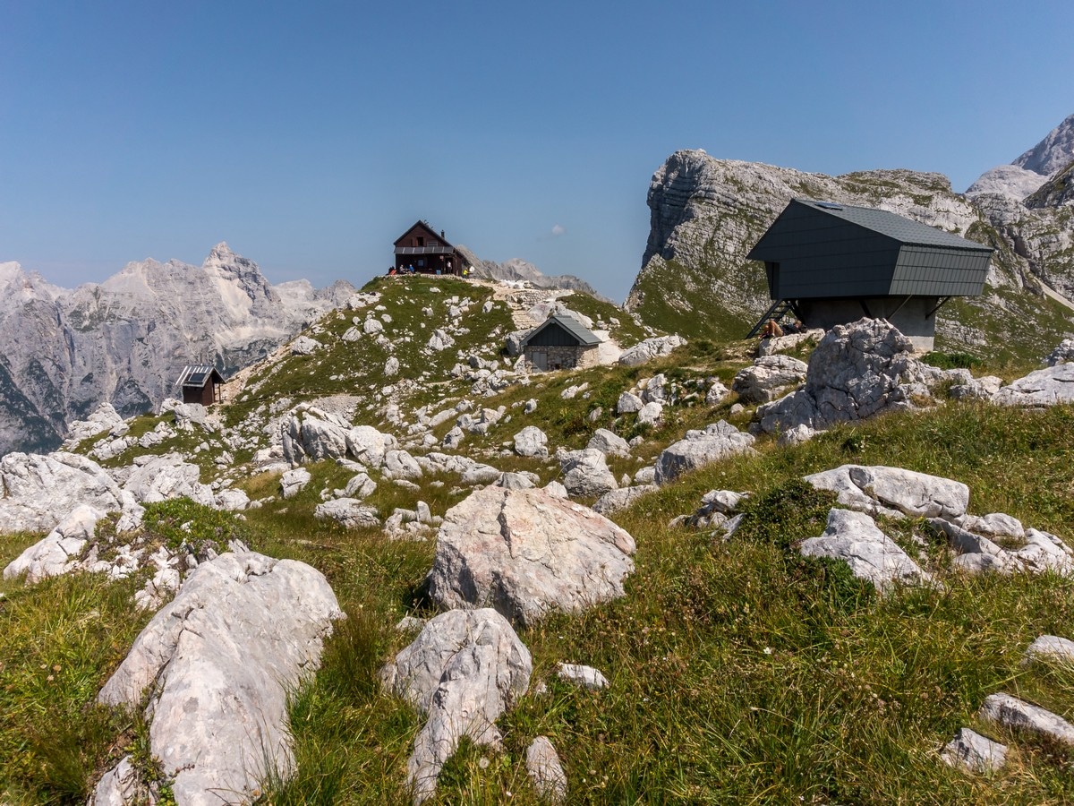
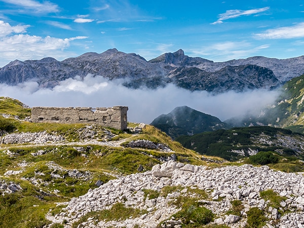
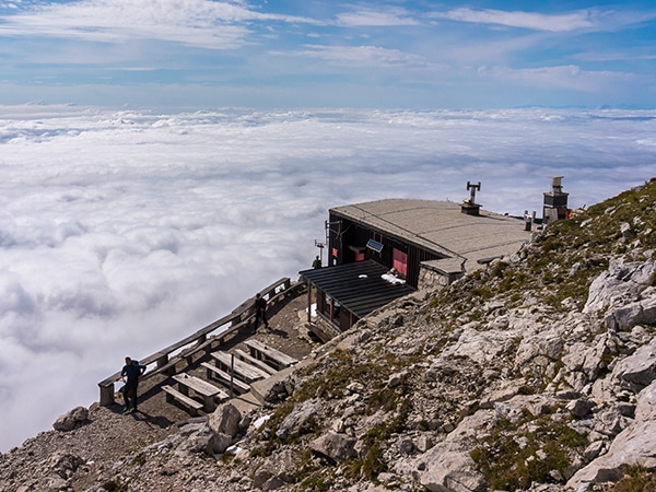
After a short climb you will get to the Zasavska hut at Prehodavci. This is a great place to have a break. The hut offers you some local food and tea. Make sure to savour the breathtaking views to the western Julian Alps peaks.
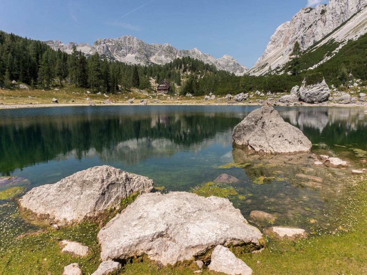
Walk back down from the hut to the crossroads and point yourself south – in the direction of Koča pri Triglavskih jezerih. Pass the winter bivouac on the gravel foot path, cross a short plain and descend to the Green lake. With the Green lake on your right, continue on the trail down the valley of the seven lakes.
As the trail starts to descend more rapidly, you will spot the largest of the seven lakes, Jezero v Ledvicah (Kidney lake). Continue on the path to the south. You will reach the hut at the Triglav lakes. You can buy some food and drinks here too!
From the hut continue to the south with the Dvojno jezero (Double lake) on your right (you can also do a circuit of the lakes if you want). Soon the path starts to climb up through the forest. A few minutes later, you will dip down and find yourself at a crossroad. Take the path to the left in the direction of Planina Ovčarija (the path to the right goes to Hotel Zlatorog). The trail descends through the trees before opening up onto some grassy slopes. As we cross the slopes, the path starts to climb up again. Eventually, it flattens out at a beautiful viewpoint. Look to the west and admire the views of the vast Komna plateau.
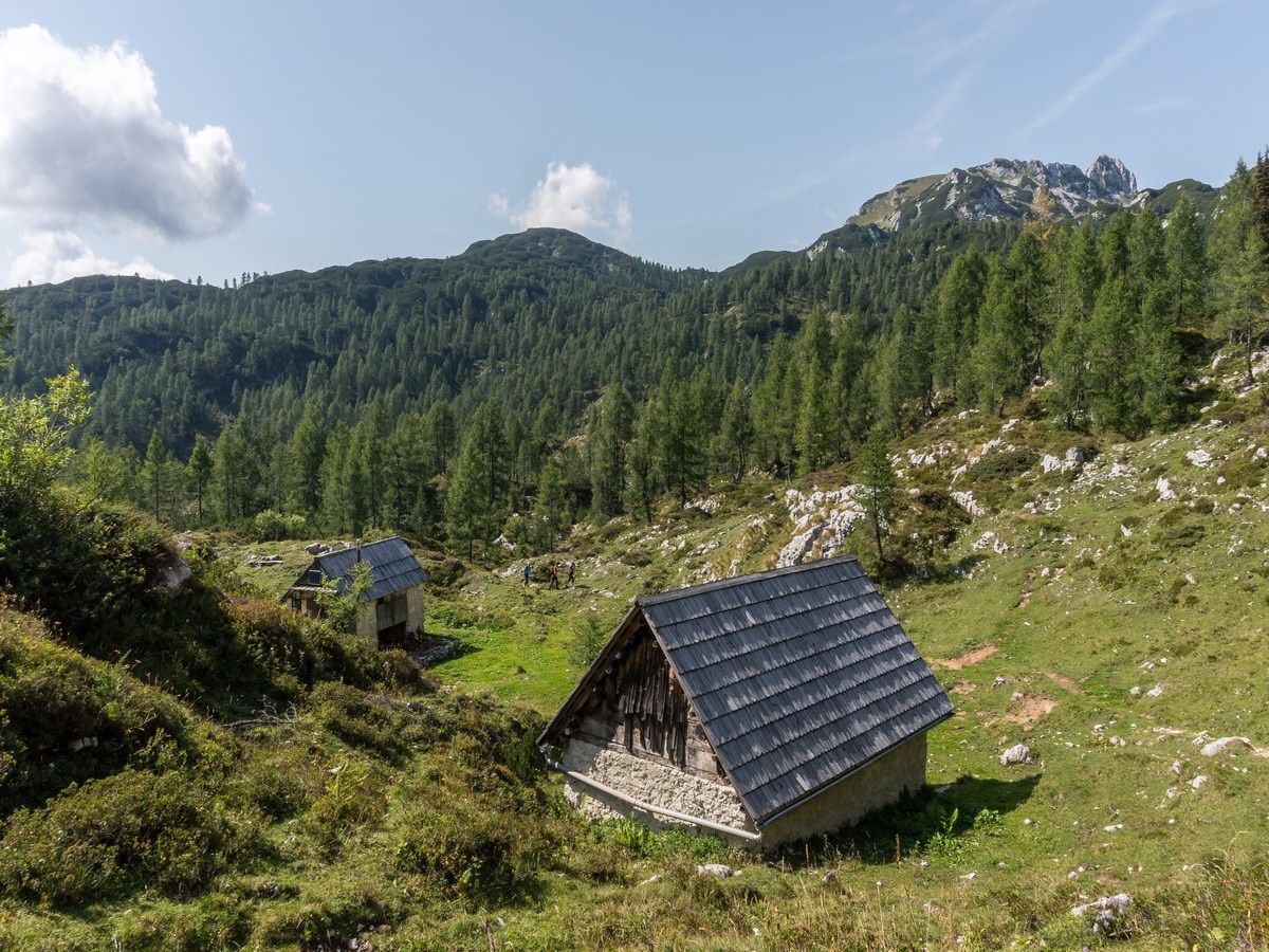
Continue on the pleasant path and you will arrive at the Ovčarija pasture. Find the red signs and continue straight in the direction of Planina Viševnik, Pršivec and Planina pri Jezeru. There is another intersection just 164ft ahead where you’ll turn right: heading to the Planina Viševnik and Pršivec. This is a smaller and not much used trail. In a few minutes you will pass a few old shepherd´s cottages, and the path will start to climb until you will reach a saddle.
Follow the path east and, after a short descent, you will find yourself in a small forest valley. As the path starts to climb again there will be a less noticeable crossroad where you should keep right (left is an unmarked path going to Dedno polje).
In approximately ten minutes you will rapidly descend, going southeast. Watch your step on the roots and rocks. Coming from the forest you will get to the Viševnik pasture. In the middle of a small shepherd´s village look for the Bregar refuge (there should be a waving Slovenian flag attached to it). Sit down for a moment and have a refreshing drink.
Leaving the pasture continue northeast in direction of Planina Blato and Planina pri Jezeru. Take the right path at the intersection just 164ft from the refuge. You’ll walk through the woods for less than 30 minutes. Eventually, you will get back to the Planina pri Jezeru hut. From here return the same way to the parking space near Planina Blato.
Consider a Hiking Holiday in the Julian Alps
One of the best ways to experience this breathtaking mountain region is by booking a pre-planned adventure tour in the Julian Alps. Find the stunning self-guided Julian Alps Walking Tour and other amazing guided and self-guided tours on 10Adventures Tours.
Insider Hints
You will have to pay a fee to access the mountain road (10€).
When at Prehodavci, turn to the northeast. Just between the two nearest peaks, you can spot the top of Mount Triglav. Using binoculars or camera’s zoom you should be able to see the Aljaž tower on top!
It is essential to start this long hike early in the morning. If you have the time, this is a wonderful walk and you can extend it to two days by sleeping overnight at one of the huts. In the season, book a bed in advance.
Tired and hungry from all day hiking, you should stop in Stara Fužina village and check what the local inns offer for dinner.
Staying in Bohinj area you should check the Mostnica gorge near Stara Fužina village. Park your car on the gravel parking at the end of the village, where the mountain road to Blato pasture begins. There is a foot path to the north. You will reach the gorge in a few minutes.

Similar hikes to the The Valley of The Seven Lakes Hike hike
Bohinj Pastures Route
The Bohinj Pastures Route is a long but pleasant walk that will take you to six traditional cheese production farms…
Komna and Lanževica
The hike to Komna and Lanževica is a wonderful day out. As you hike around the area surrounding the Komna…
The battlefield of Mount Krn
The hike to Mount Krn (7362ft) is filled with memories and artifacts of WWI battles, but this hike…
Jeremy Sandle 4 years ago
Out-of-this-world scenery! It was very secluded too. So you'll feel that you're on an entirely different universe!
Szonnja 4 years ago
We were prepared for a difficult hike, that turned out absolutely doable. Our border collies accompanied us and we loved it all. The views are stunning and the trails are beautiful! We accidentally made a shot cut at the end still my watch showed 28km with 1500m elevation. Definitely worth the effort!
veelora 4 years ago
This was an absolutely stunning hike! There were some passages that were a bit tricky (we had a relatively steep snow field to cross after the path) and on the way down when your legs are tired you need to walk extra careful. But watch out, I think the 25km was measured on the mal because my Garmin watch was at a bit over 30km with 1500m uphill! We finished it with a lunch break and several small breaks in 10:30 Absolutely worth it though! The food in the huts on the way was super tasty!
Audrey Osullivan 4 years ago
Wonderful views and beautiful lakes
Maciej W. 4 years ago
Nice peaceful hike around the lake through the woods
boomer 5 years ago
Go here, and you'll never get disappointed! Beautiful landscapes and rock ridges all around.
Giedrius 5 years ago
Hello, is there any gear needed to complete this hike? No ropes etc.?
Ebony Claire 5 years ago
Really engaging hike! Beautiful views we'll make sure to go back!
Lisa B 5 years ago
This hike is unbelievable - the Valley of the Seven Lakes is absolutely stunning. It was long, but there was so much to see.
Macyj 5 years ago
This was, perhaps, the hardest hike I have done in Slovenia. Maybe in Europe. amazing scenery