Parker Ridge Trail hike
View Photos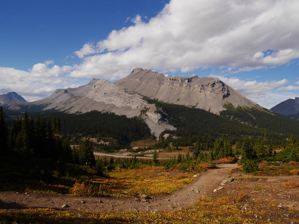
Parker Ridge Trail hike
Difficulty Rating:
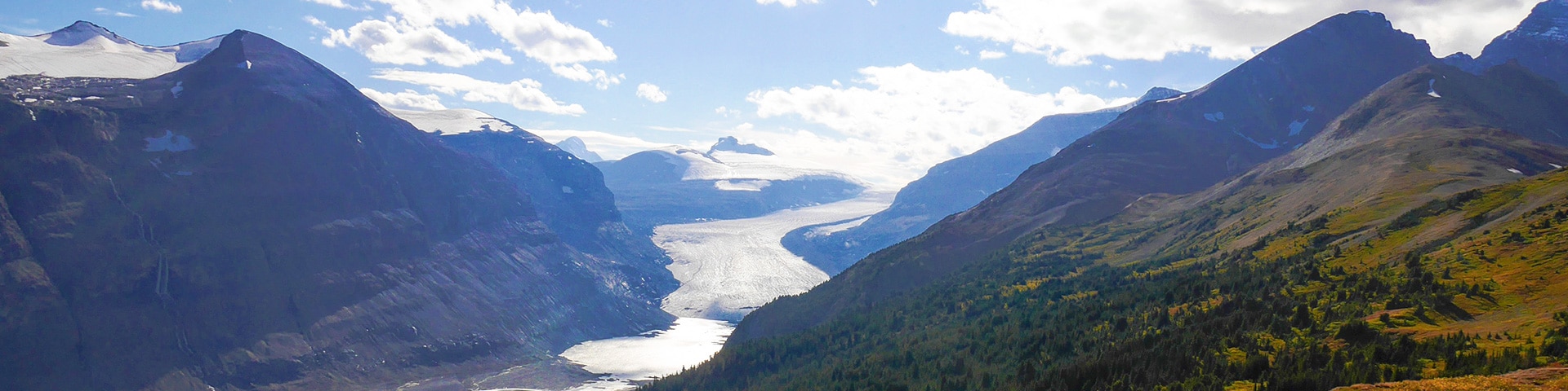
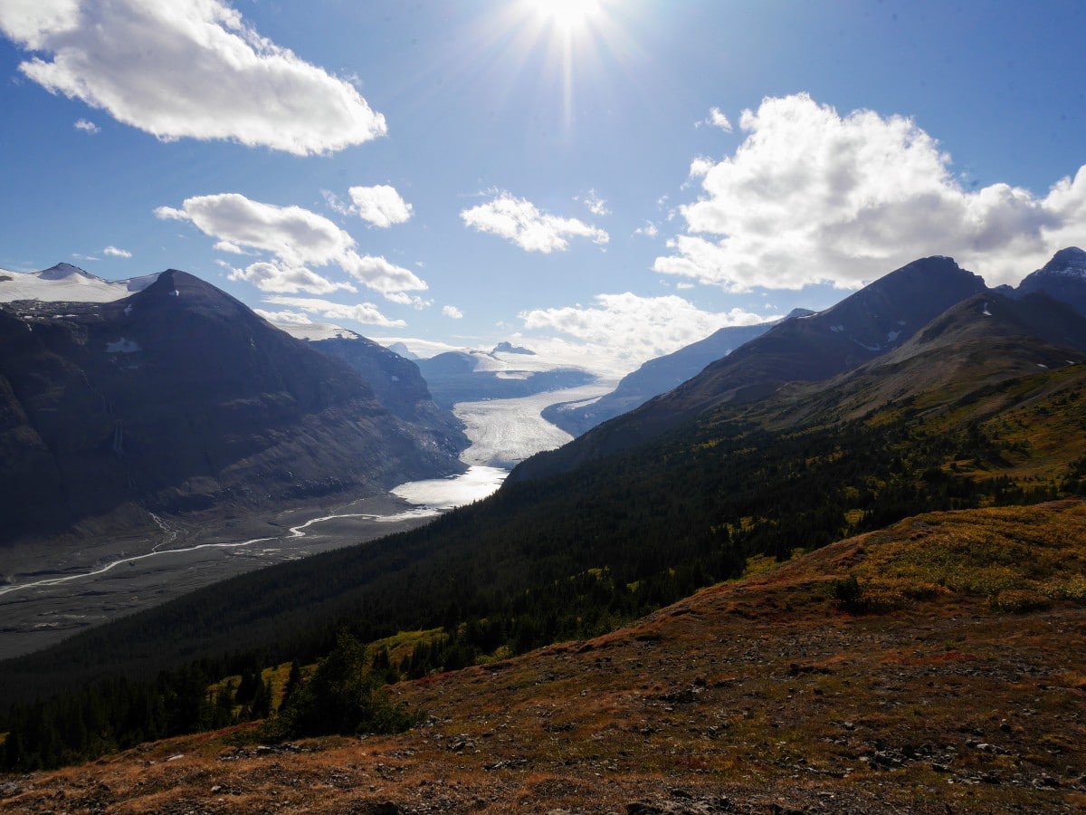
Hiking up Parker Ridge unlocks some amazing views of the Saskatchewan Glacier, the largest of the Columbia Icefield’s six valley outlet glaciers. This hike is a great stop when driving the Icefield Parkway between Lake Louise and Jasper.
Getting there
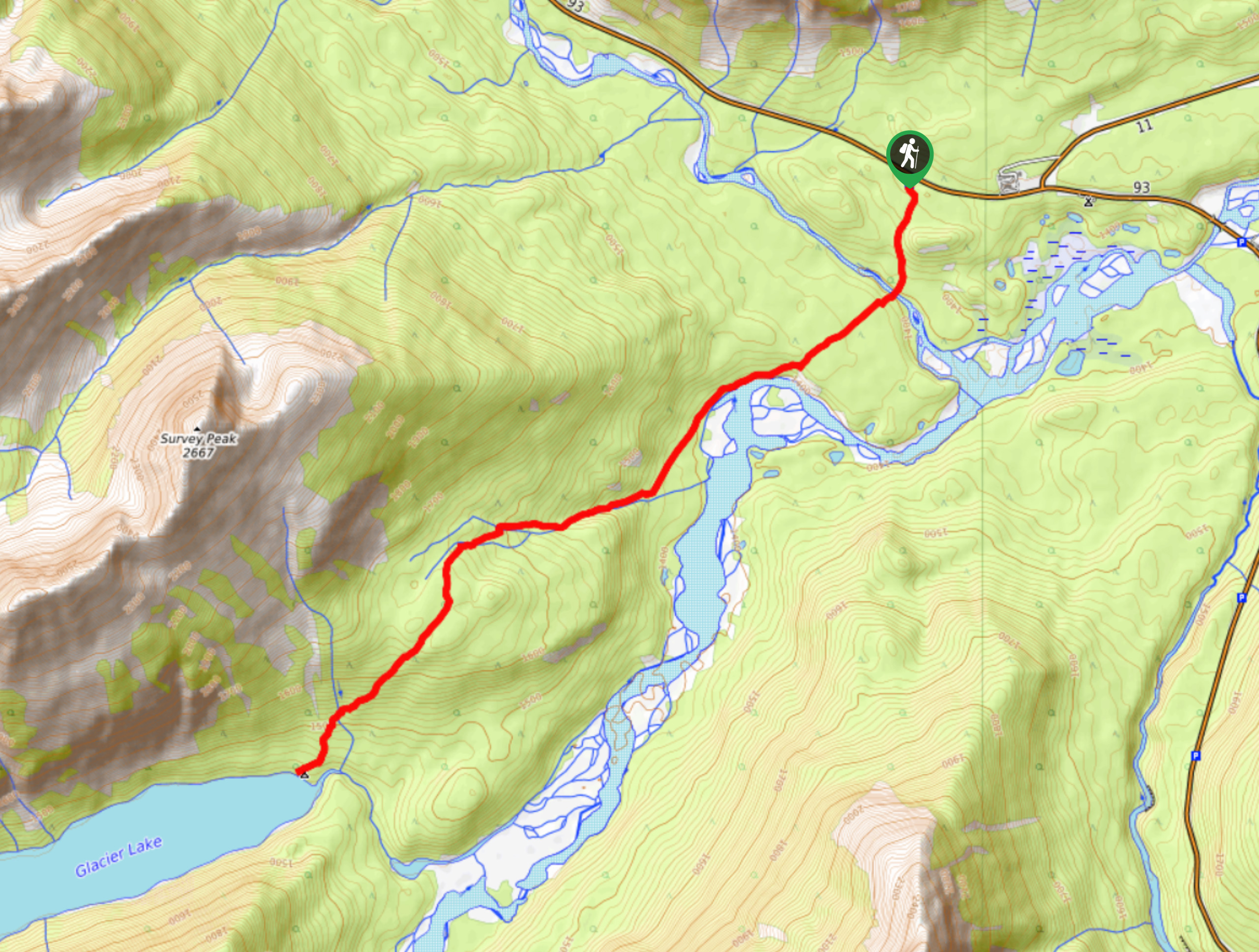
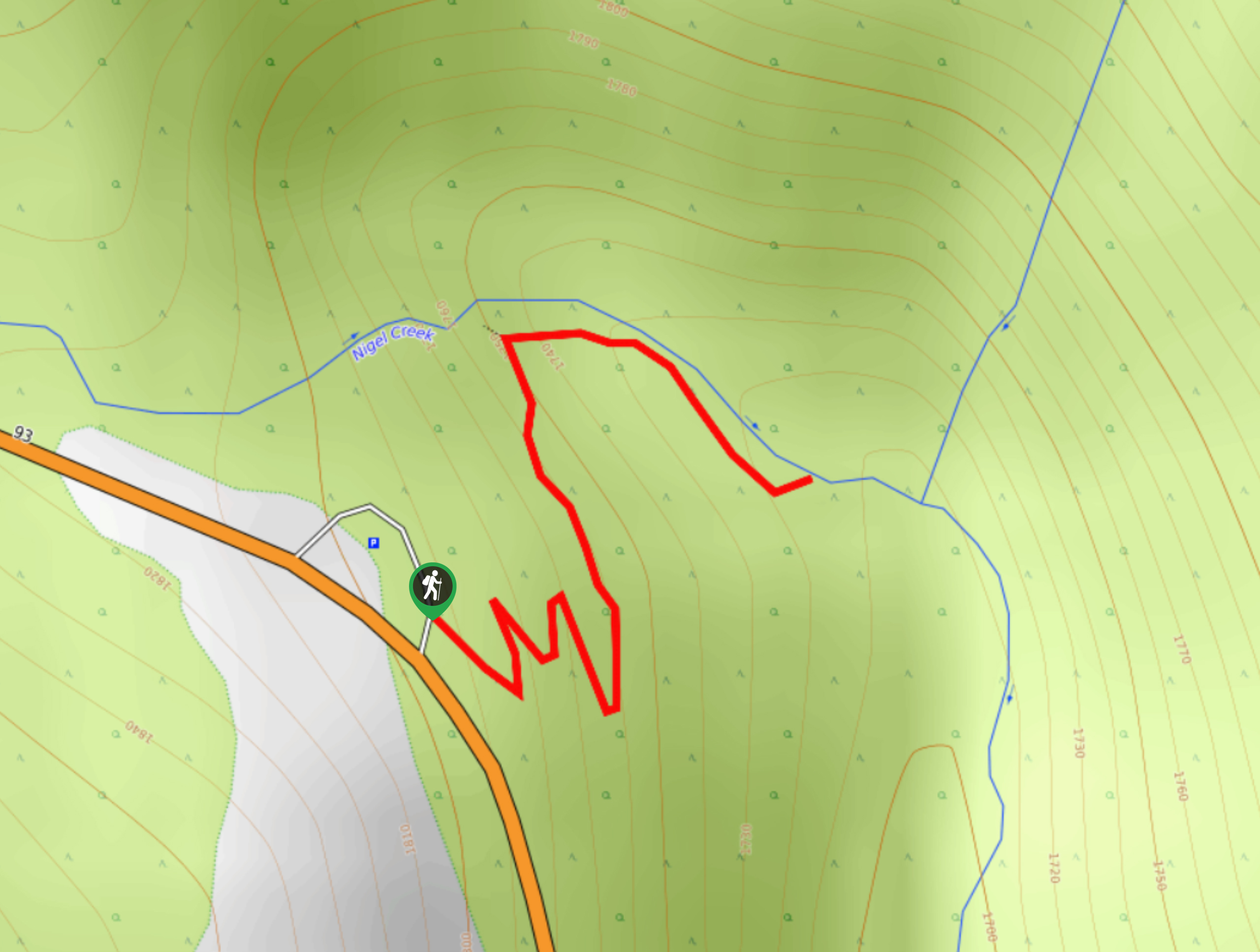
From Lake Louise, take Trans-Canada Hwy west. Exit onto Icefields Parkway (93N). Drive 72.7mi north. Park in the lot on the west side of the hwy, with signs for Parker Ridge. Coming from the north, the trailhead is 5.0mi south of the Columbia Icefield Discovery Centre.

About
| When to do | July to September |
| Backcountry Campsites | No |
| Toilets | Yes, at trailhead |
| Family friendly | Yes |
| Route Signage | Poor |
| Crowd Levels | High |
| Route Type | Out and back |
Parker Ridge Trail
Elevation Graph
Weather
Route Description for Parker Ridge Trail
At just under 6562ft above sea level, the trailhead for Parker Ridge itself is scenic enough to justify a visit. An interpretive board greets you as you start, describing the unique qualities of the alpine environment you’re about to visit.
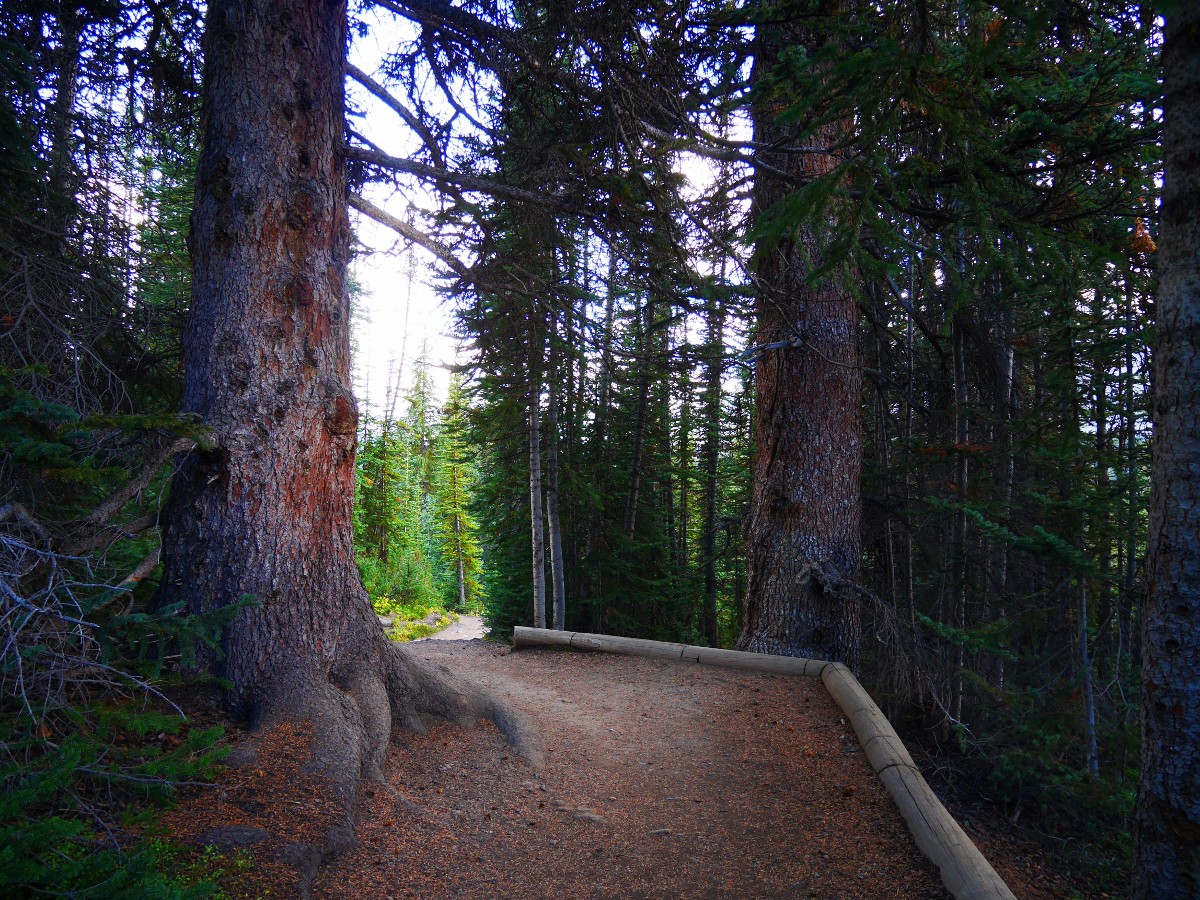
The hiking trail initially crosses a small meadow – a frost hollow. Cold air from nearby Hilda Glacier collects here, creating a microenvironment with a short growing season, which is the reason for the lack of trees. A few steps uphill take you into a small but ancient subalpine forest. Two enormous Engelmann Spruce flank the pathway, gatekeepers to the alpine. These trees are likely to be at least 400-years-old.
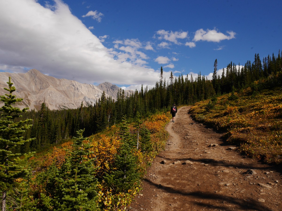
The trail continues gently uphill, emerging into another open meadow created by avalanche. The 20ft–26ft of snow that falls annually on Parker Ridge takes a long time to melt. In July and August these meadows bloom with tall wildflowers, protected from the elements and fed by the abundant moisture from snowmelt. In fall, the meadows are a sea of gold and red, interspersed with islands of dense, stunted kruppelholz trees (another product of the short growing season in the alpine).
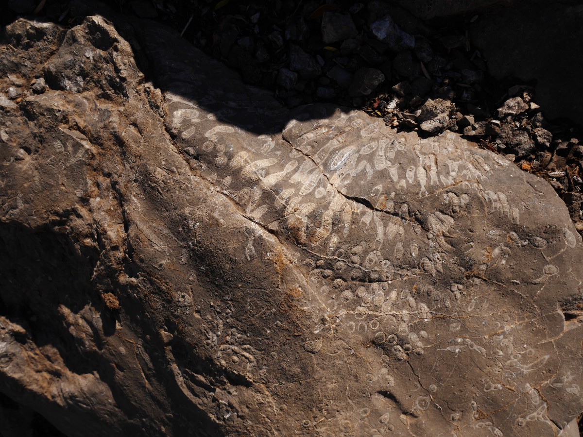
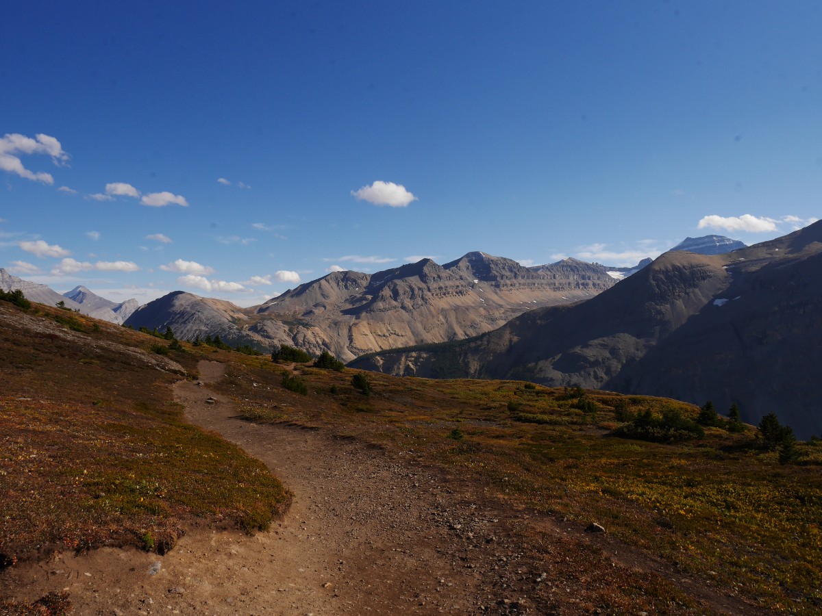
The trail continues to switchback up the ridge until all trees are left behind. Looking northwards, the summits of Mt Athabasca (11453ft) and its outlier – Hilda Peak (10039ft) – dominate the view. The sharp, pointed peaks have been whittled away by glaciers since the last ice age, creating the horns. Across the highway is the 3.1mi long ridge of Nigel Peak. To the north is Wilcox Pass and south is Nigel Pass (two of the other excellent hikes in the area). Don’t spend all your time gazing at the surrounding peaks; the middle section of the trail is full of fossilized coral, and even the occasional gastropod (snail). In fact, the whole ridge is an ancient reef, dating back to 380 million years ago.
After passing a large talus slope (watch carefully for pika’s darting in and out of the rocks), an icy blast of air welcomes you to the crest of Parker Ridge.
The trail splits in two opposite directions along the ridge top. While the right-hand trail takes you higher, the official Parker Ridge trail branches off to the left, taking you south along the ridge to the viewpoints for the Saskatchewan Glacier.
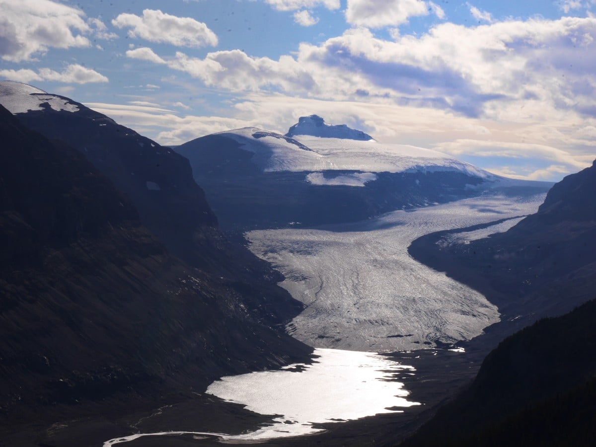
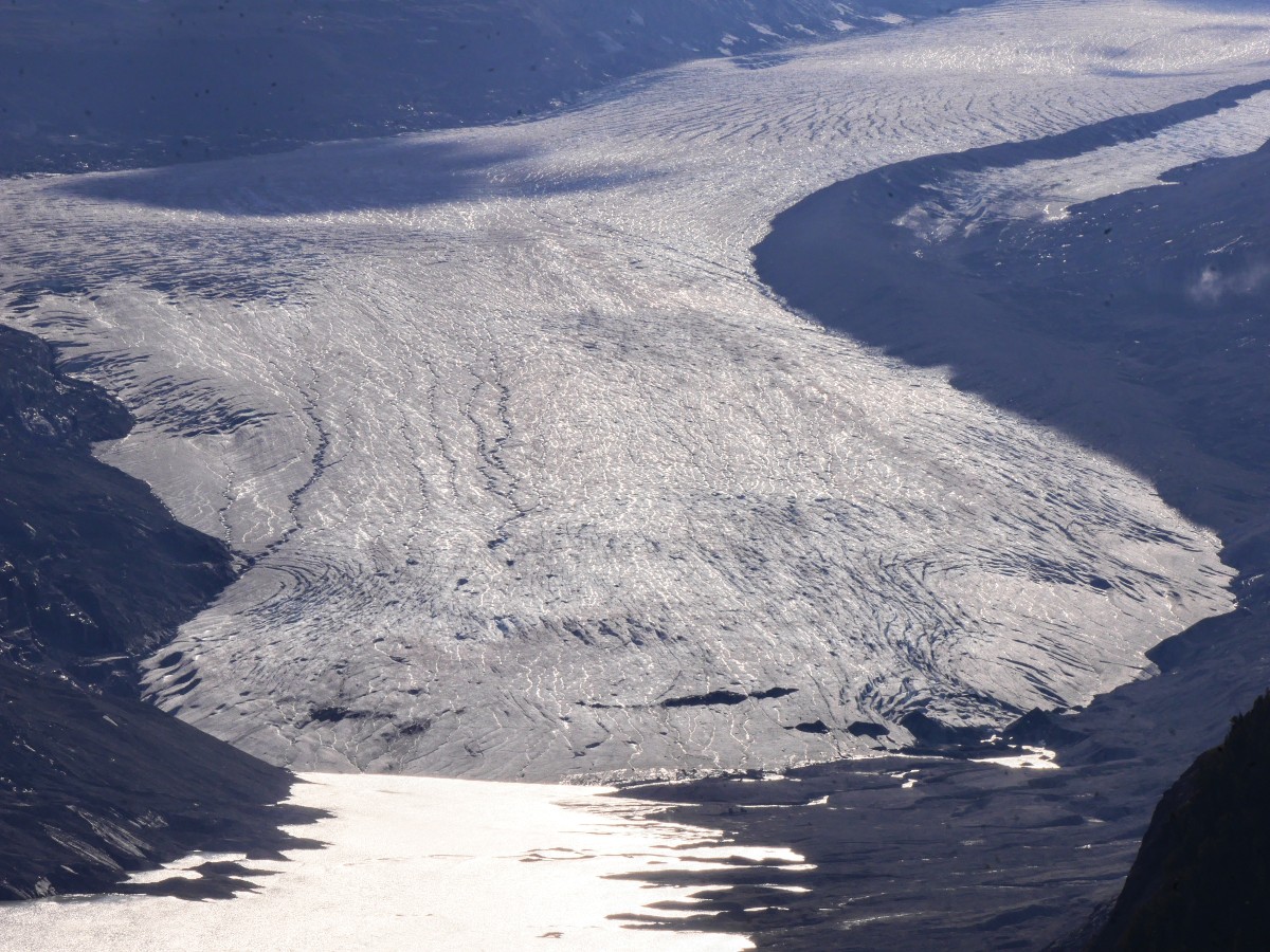
From the ridge crest, the trail continues for another kilometre, ending abruptly at a seemingly randomly chosen point on the ridge. Past the first few viewpoints, there’s very little point to continuing to the true end of the trail. You’ll catch your first glimpse of the glacier after about 656ft, but the best view is another 984ft further. The Saskatchewan Glacier is the longest of the Columbia Icefields six-valley outlet glaciers at almost 4.3mi. Less than 100 years ago it occupied the entire valley below, now filled only with rubble and braided streams. This is the source of the North Saskatchewan River, which flows for 799.7mi across the prairies, merging with the South Saskatchewan River and travelling another 341.8mi before emptying into Lake Winnipeg, forming one of Canada’s major river systems. You may notice a dark stripe on the right side of the glacier. That stripe is a medial moraine, which is a strip of gravel and debris formed where two tributary glaciers merge.
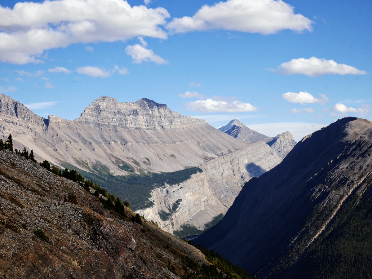
Some of the highest peaks in Alberta can be viewed from Parker Ridge. The shoulder of Mt Saskatchewan (10965ft) forms the other side of the valley, its peak just visible above rounded summits. Directly to the left of the head of the glacier is Castleguard Mountain (10115ft) home to one of the third deepest cave systems in North America. Beyond is Mt Bryce, (11506ft) visible on a clear day. Watch for golden eagles and hawks hunting in the meadows of the ridge, and bighorn sheep and mountain goats on the cliffs below.
The return trip from Parker Ridge takes the same trail back to the parking lot. Due to its heavy use, and sensitive alpine environment, short cuts created between the switchbacks are badly eroding the slope. Costly rehabilitation projects have been undertaken here in the 1980’s and in 2014, with seedlings being nurtured in greenhouses before being transplanted back to revegetate the area. Please respect these areas and stay on the main trail.
Insider Hints
The huge amount of snow that falls on Parker Ridge each winter means the trail is usually not accessible until early-mid July. Plan your hike for later in the summer.
Parker Ridge sits almost exactly at the midpoint of the Icefields Parkway. Services along this road are few and far between. Pack your water, snacks and lunch before you depart, rather than paying the exorbitant prices at Saskatchewan River Crossing or the Columbia Icefields Discovery Centre.
Plan your trip for the morning. Photographs of the Saskatchewan Glacier with the sun in the west, behind it, don’t turn out well due to the reflected light.

Similar hikes to the Parker Ridge Trail hike
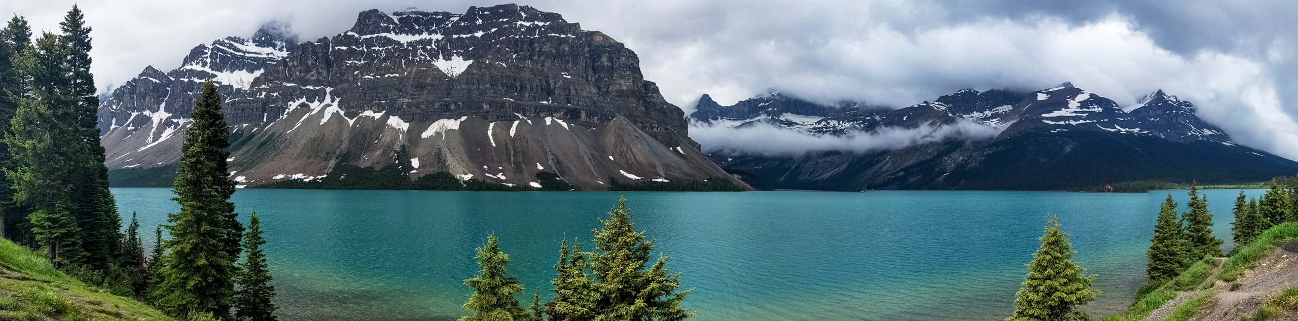
Glacier Lake
The relatively flat Glacier Lake trail is commonly used by backpackers; however, it makes for an excellent day hike. Whether…
Waterfowl Lake Trail
This quick and easy route takes families to Upper Waterfowl Lake from the Waterfowl Lakes Campground. Lower Waterfowl Lake is…
Panther Falls
The Panther Falls Hike is often missed by those travelling the Icefields Parkway. Tucked away between more popular landmarks, Panther…
DesireeD. 5 years ago
I was surprised when I saw the whole ridge of the ancient reef and other prehistoric remains in the middle section of this hike. It's a pretty educational hike.
RobCruz 5 years ago
The views od the Saskatchewan Glacier was remarkable. We had so much fun.
PeterHopkins 5 years ago
Saskatchewan Glacier views are remarkable!
MartiniC 5 years ago
I had an incredible summer adventure here a few years back. It was unforgettable.
Lambert Y. 5 years ago
You'll hear birdcalls and crickets as you pass through the woodlands. It was very calming.
Hiking-eh 5 years ago
This hike offers up great views of the other side of the Columbia Icefields. Well worth it!!
kelsih_99 5 years ago
really solid time to view ratio. it's short and steep and quick with perfect views of the Saskatchewan glacier
Jeffrey Reagan 5 years ago
It is a breathtaking paradise! It was a really AWESOME experience!
LukeMc 5 years ago
Phenomenal hike! I knew this was going to be a great hike when I saw some bighorn sheep and mountain goats climbing the Rockies.
Kairi Subarashi 6 years ago
The Parker Ridge itself is scenic enough to justify a visit. The journey to the top was very peaceful and tranquil. So happy it's not busy during my visit.