Cirque & Chephren Lakes hike
View Photos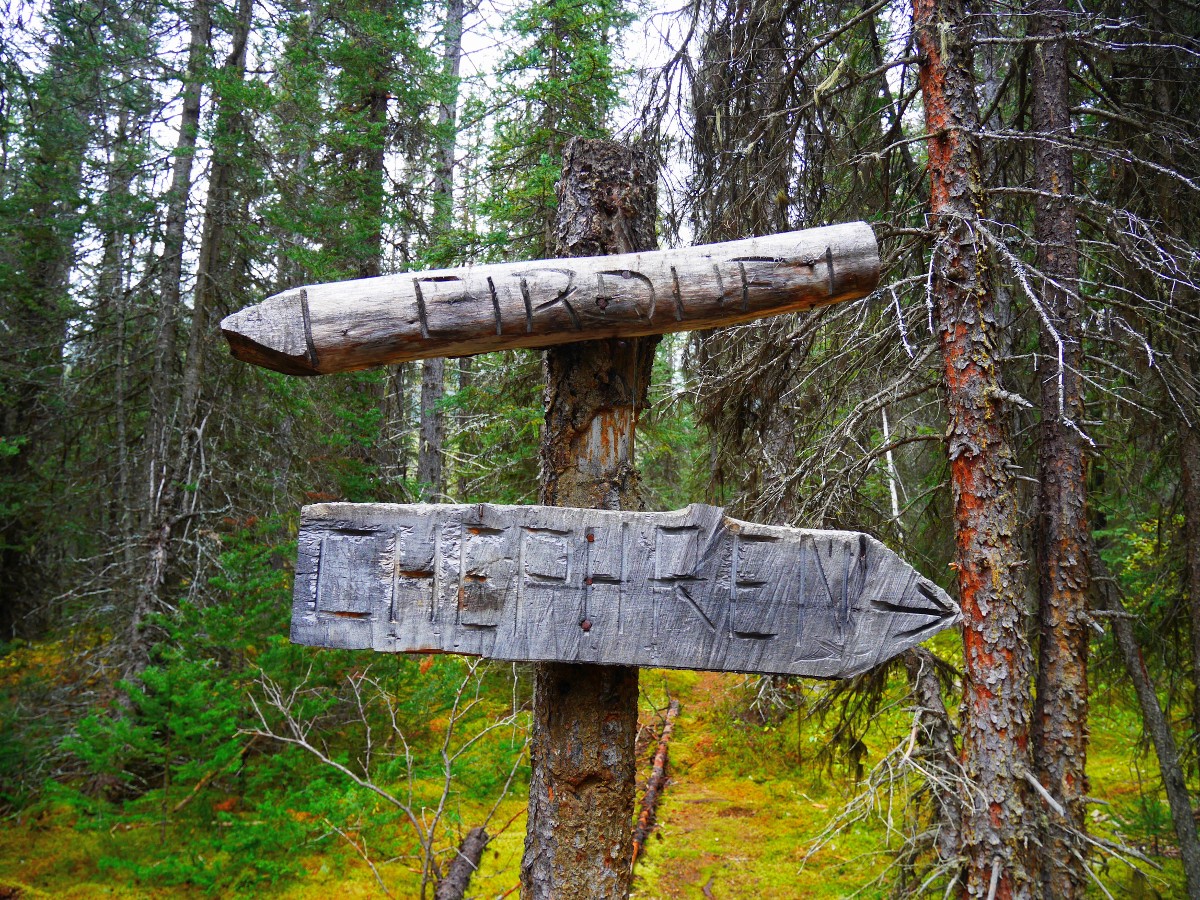
Cirque & Chephren Lakes hike
Difficulty Rating:
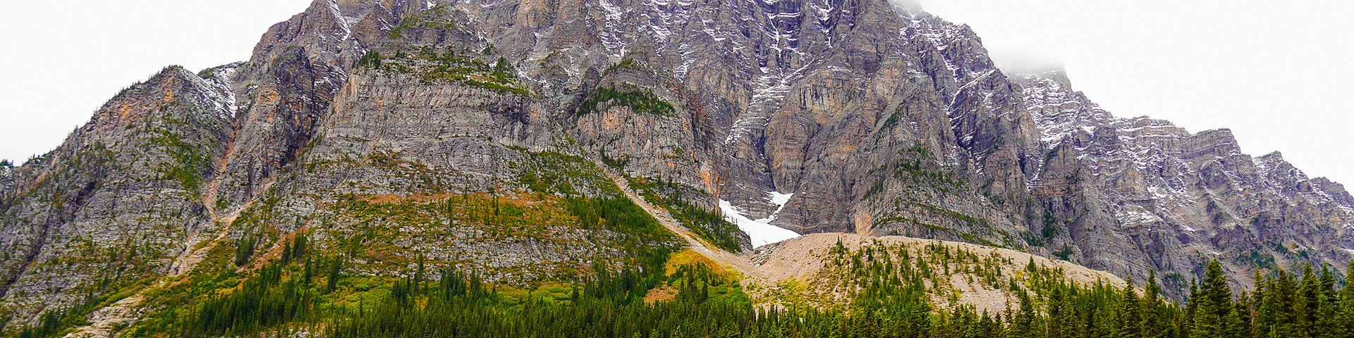
Hiking around Cirque & Chephren Lakes is an easy hike that goes to two classic, and seldom visited, Canadian Rockies Lakes on the Icefields Parkway. These lakes are situated at the base of the rugged mountains making up the continental divide.
Getting there
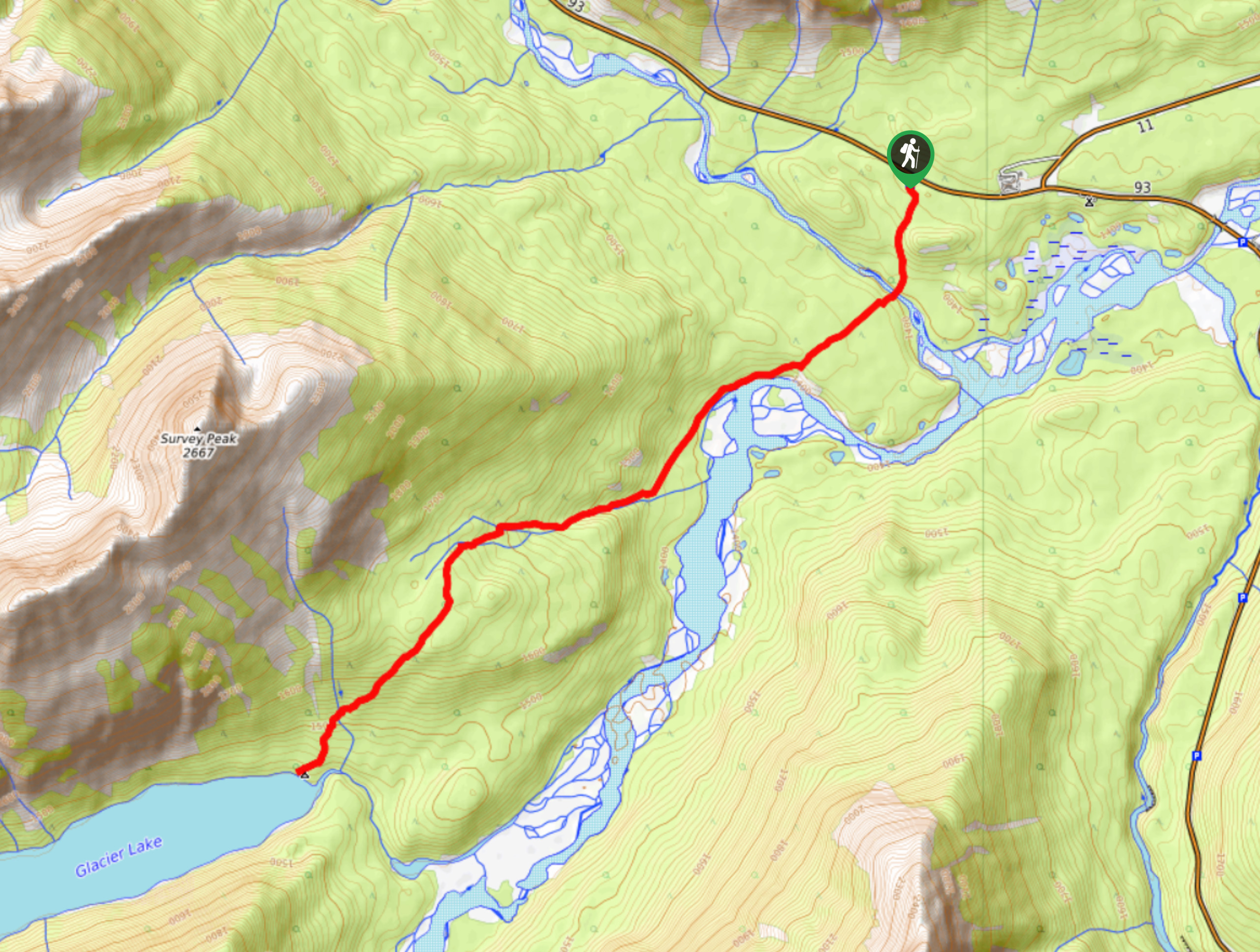
From Lake Louise, go west on the Trans-Can Hwy. Turn north onto the Icefields Parkway (93N). Go 35.4mi north. Turn left into the driveway for Waterfowl Lakes Campground. Don’t drive into the campground. Follow the road parallel to the hwy for 1640ft. Park near the closed service road.

About
| When to do | June to October |
| Backcountry Campsites | No |
| Toilets | Yes, 500m from trailhead |
| Family friendly | Yes |
| Route Signage | Average |
| Crowd Levels | Low |
| Route Type | Out and back |
Cirque & Chephren Lakes
Elevation Graph
Weather
Route Description for Cirque & Chephren Lakes
We’ve combined the hike to Cirque Lake and Chephren Lake into one big day. Alternatively, you can do one or the other. If we had to choose to hike only one of the hikes, hiking to Cirque Lake would win out.
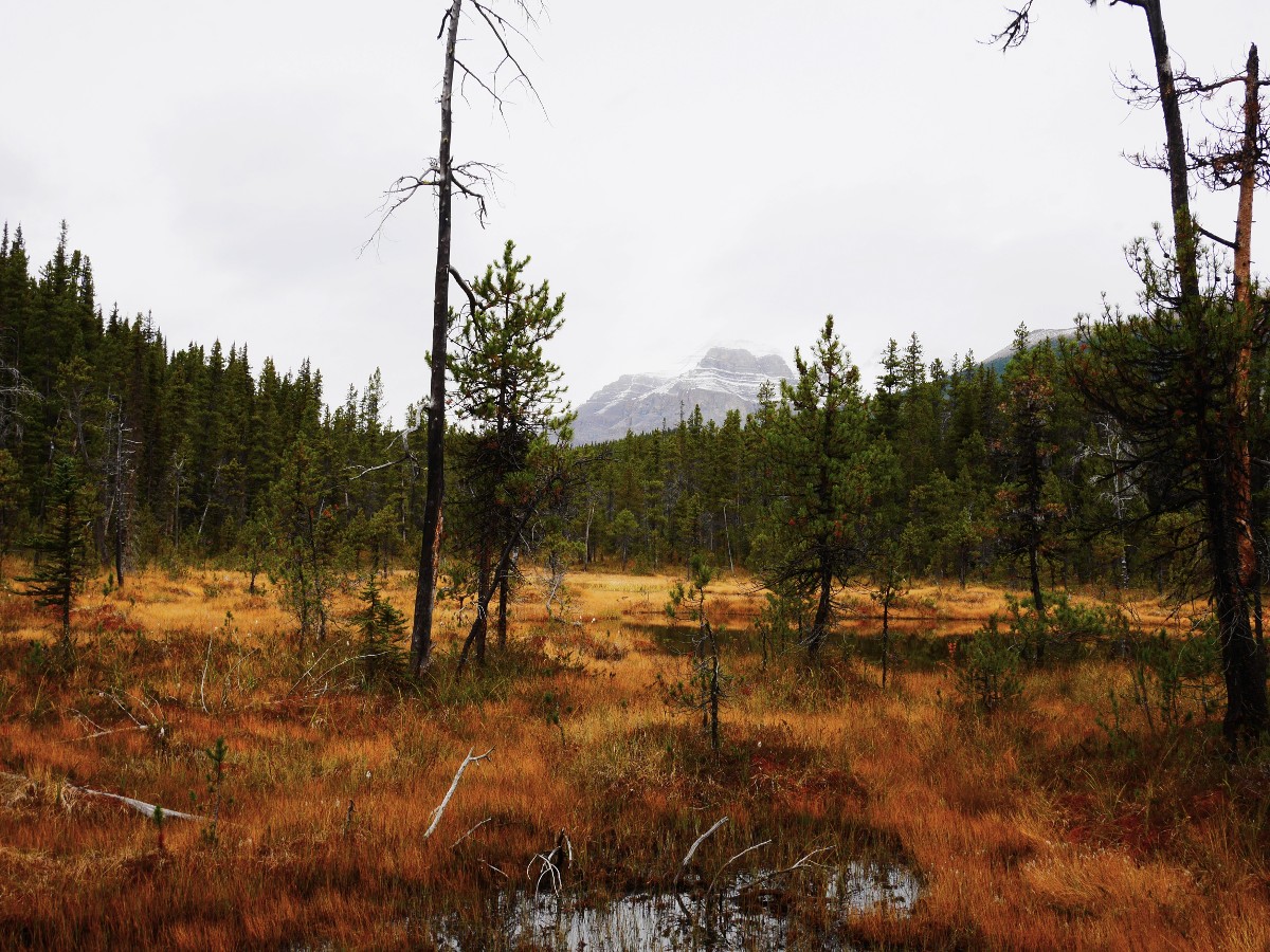
From the parking lot, the hike to Cirque and Chephren Lakes begins as a smooth gravel path that borders the edge of the Waterfowl Lakes Campground. This section of the trail, and the campground, sits on an alluvial fan – a triangle shaped deposit of gravel and debris from an ancient creek – that divides the Upper & Lower Waterfowl Lakes.
After 0.2mi you’ll reach another information kiosk adjacent to a bridge over the Mistaya River: the “official” start to the trail. Mistaya means “great bear” or “grizzly bear” in Cree. Take this as a hint, make sure you have Bear Spray and are travelling in a group. Cross the bridge and follow the trail uphill for 0.8mi.
The forest here is open spruce, the large amount of deadfall indicating a long period since the area burned – approximately 160 years. As the trail flattens out, you’ll reach the Cirque-Chephren junction, marked with both an official Parks sign and a hand carved wooden sign. From here you have a choice: if you decide to hike to Cirque Lake only, the trip will total 5.7mi with approximately 492ft further elevation gain. If you decide to hike to Chephren Lake you will lose about 98ft of elevation, and the trip will total 4.8mi. We like to do both lakes, making this a full-day trip.
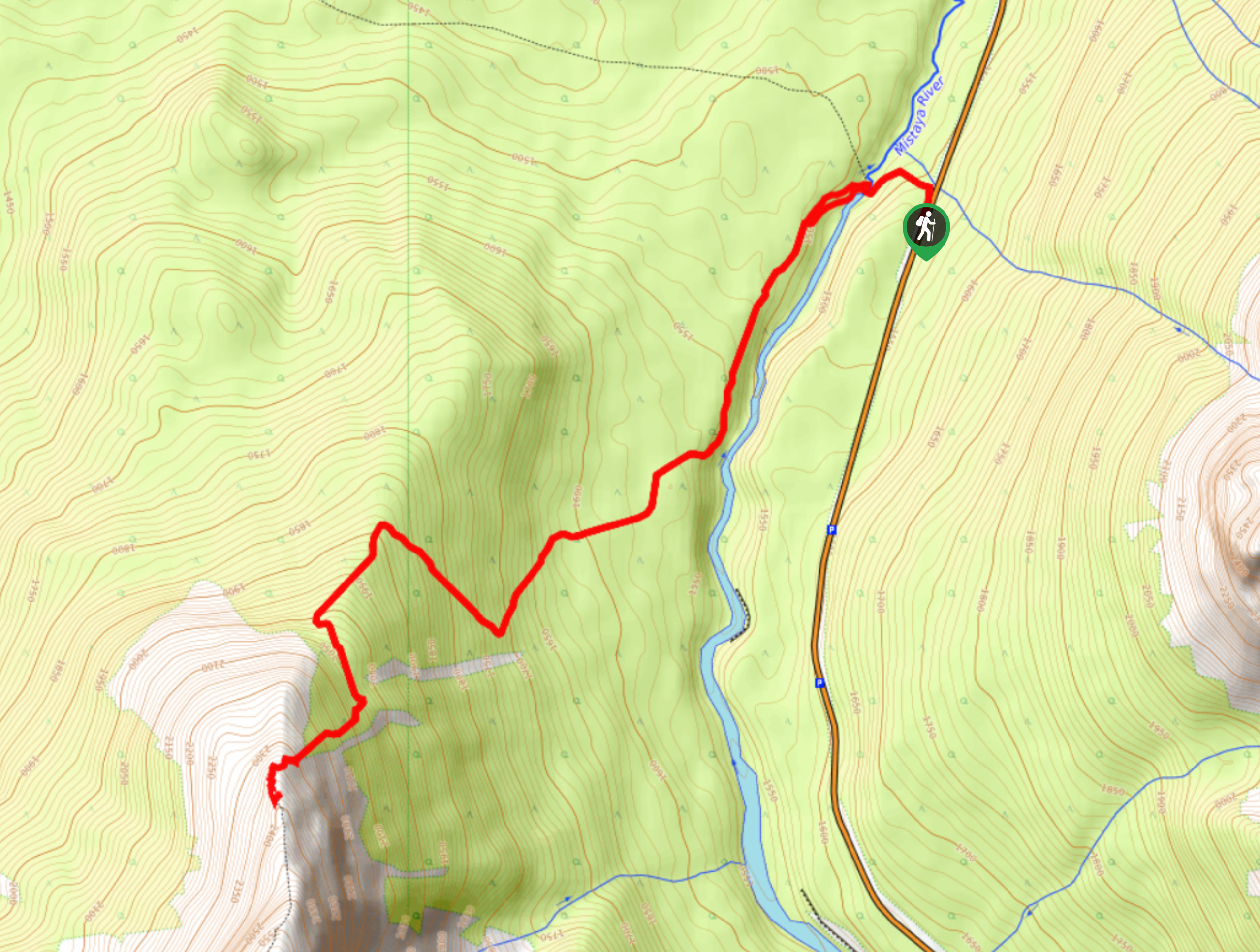
To hike to Cirque Lake, turn left at the junction. The forest here is a haven for red squirrels. At the base of many of the trees are piles of pine scales discarded from cones as the squirrels harvest the seeds. Red squirrels make their homes in middens – piles of discarded pine needles, scales, and cones that they burrow into. The trail angles gently downhill for approximately a kilometre, then turns a corner, skirting around a wet meadow. Old boardwalks are in place, but the trail still contains many wet, muddy puddles. In the distance Mt Wilson (10696ft) looms above the forest.
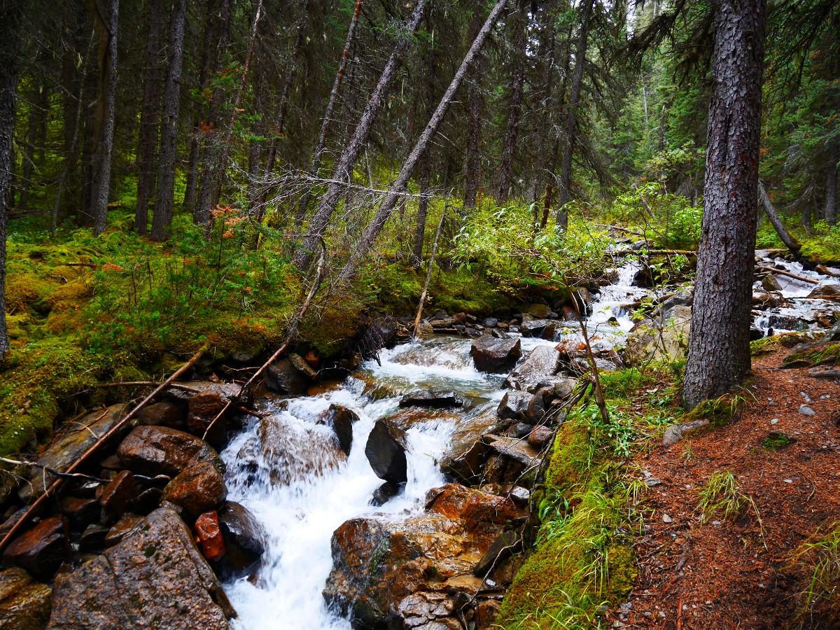
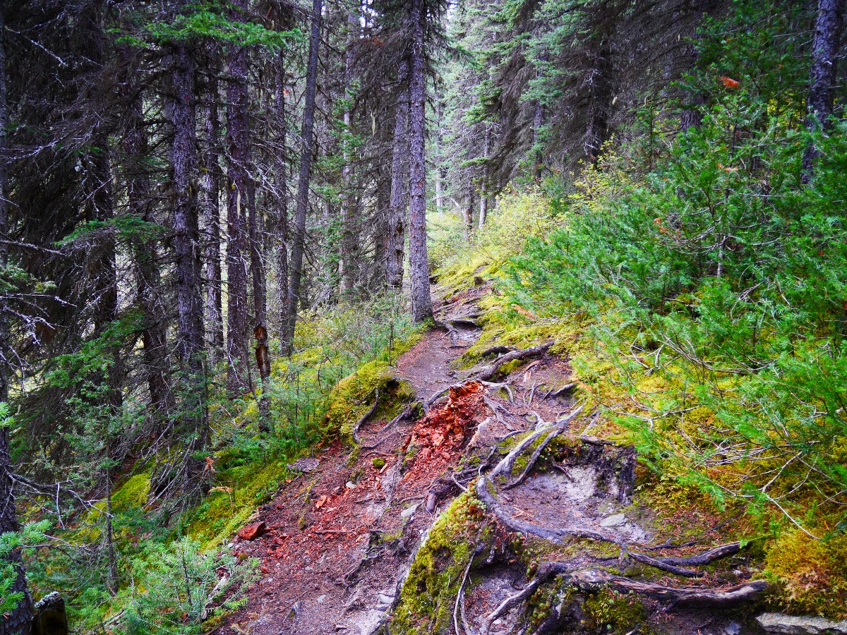
The trail becomes rough as it swings uphill and to the right, coming alongside the outlet stream of Cirque Lake. Most of the elevation gain for this portion of the hike is done in two steep but short sections climbing up an old forested moraine.
The trail is rough, eroded, and covered with loose dirt and rotting wood. Eventually it levels out and you hike parallel to the stream. This flat, damp section of forest is a haven for bears, moose and smaller creatures (on our last hike we saw a spruce grouse just off the trail, and a black bear track on the trail), as well as moisture loving wildflowers such as orchids and yellow columbine.
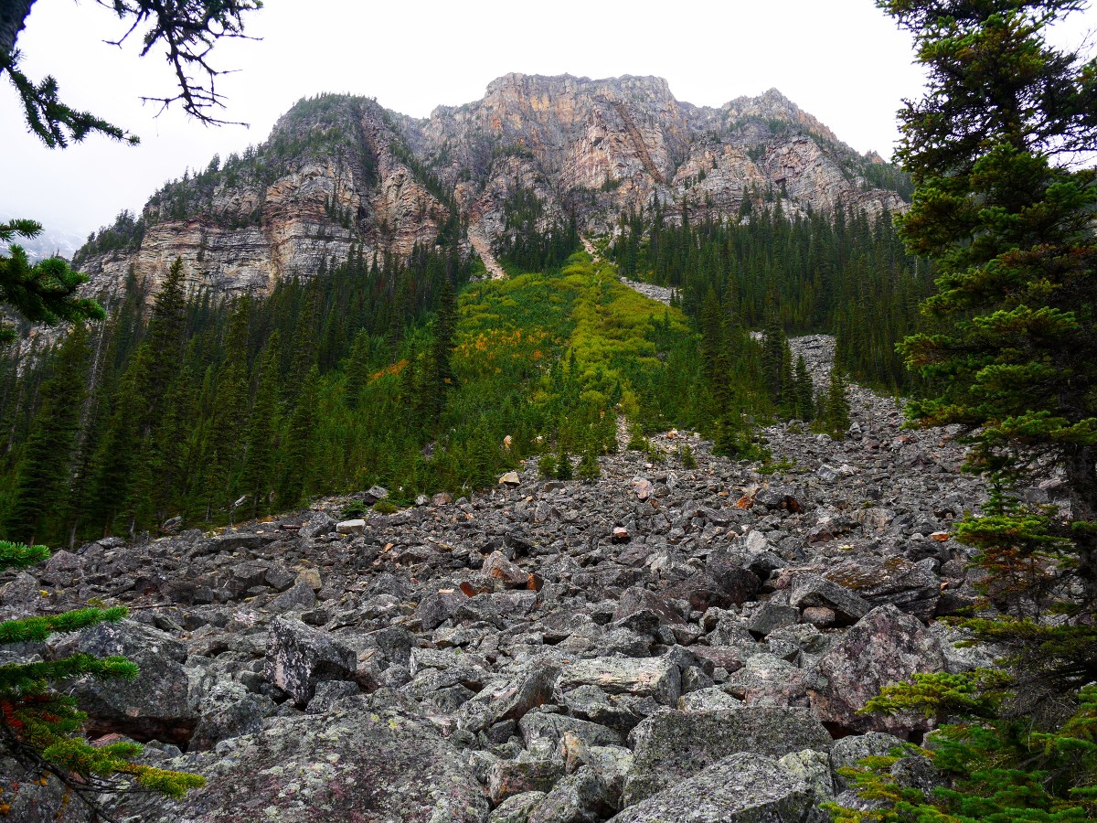
The canopy starts to open up ahead and you’ll get your first glimpse of the headwall at the end of Cirque Lake, however you still have to hike approximately 0.6mi until you reach Cirque Lake. Hop across the rocks on two shale creek beds and continue until you reach the lakeshore.
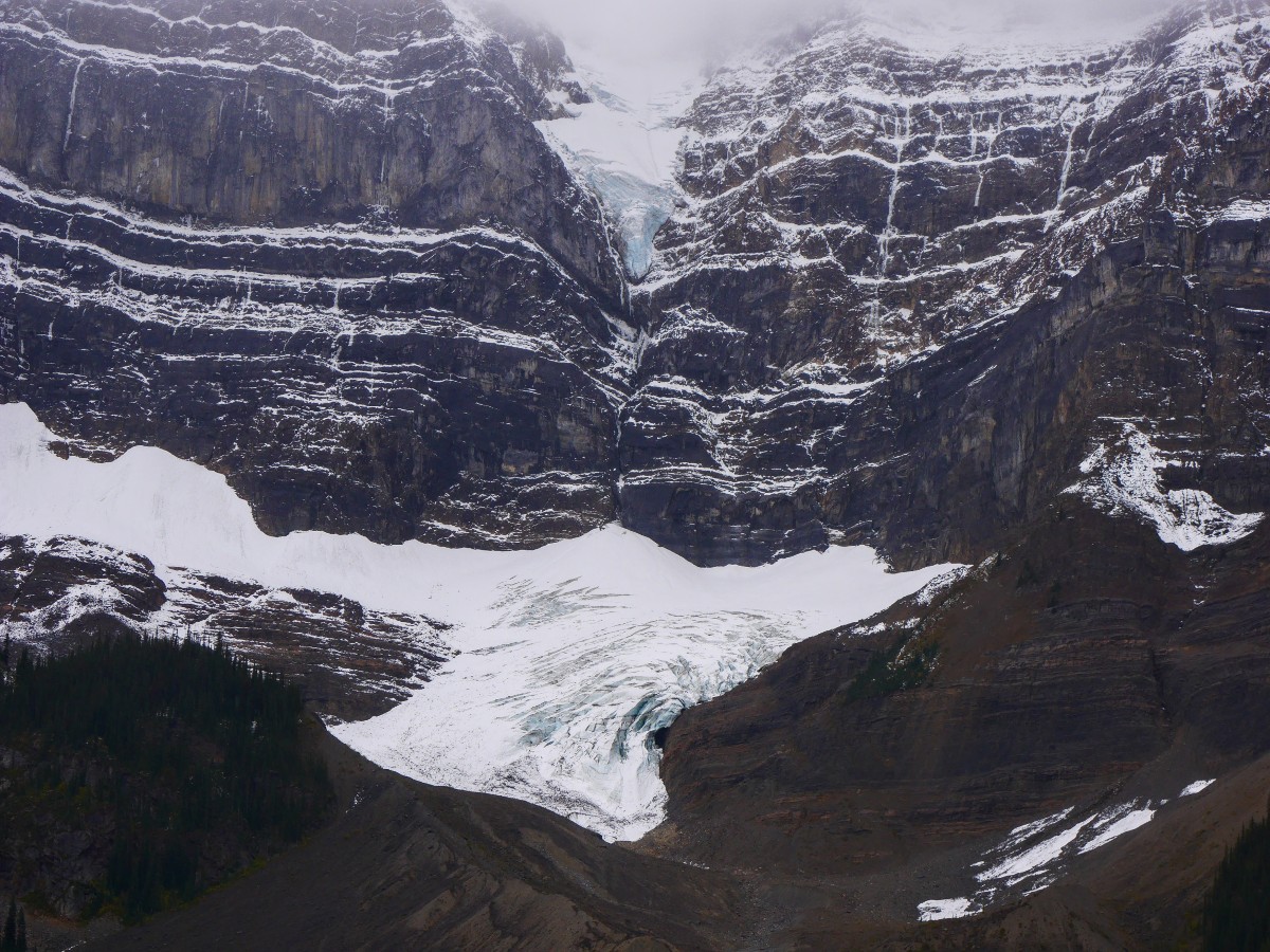
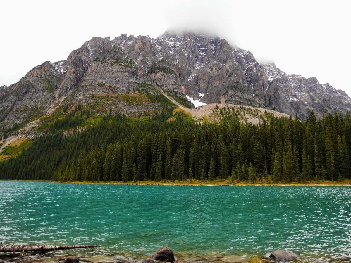
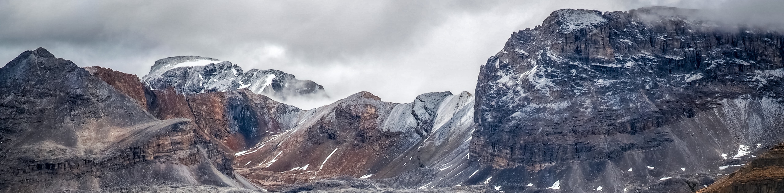
The trail ends on a boulder field that extends out into Cirque Lake, sitting below an avalanche slope on the shoulder of Mt Synge (9751ft). The rocks make perfect places to sit and observe the two glaciers at the back of the lake. First, there’s a small hanging glacier sandwiched between Aries Peak (9882ft) and Stairway Peak (9843ft). There’s also a larger valley glacier at the base of the cliffs. The ridge linking this chain of peaks makes up the continental divide, dividing the watersheds of Canada. This ridgeline is more than a kilometre higher than the lake.
If you wonder on how Cirque Lake got its name, a cirque is a bowl-like amphitheatre formed by glacial erosion – exactly what you’re looking at here. As you return to the junction, look up for views of Mt Noyes (10118ft) and its striking rock towers across the valley.
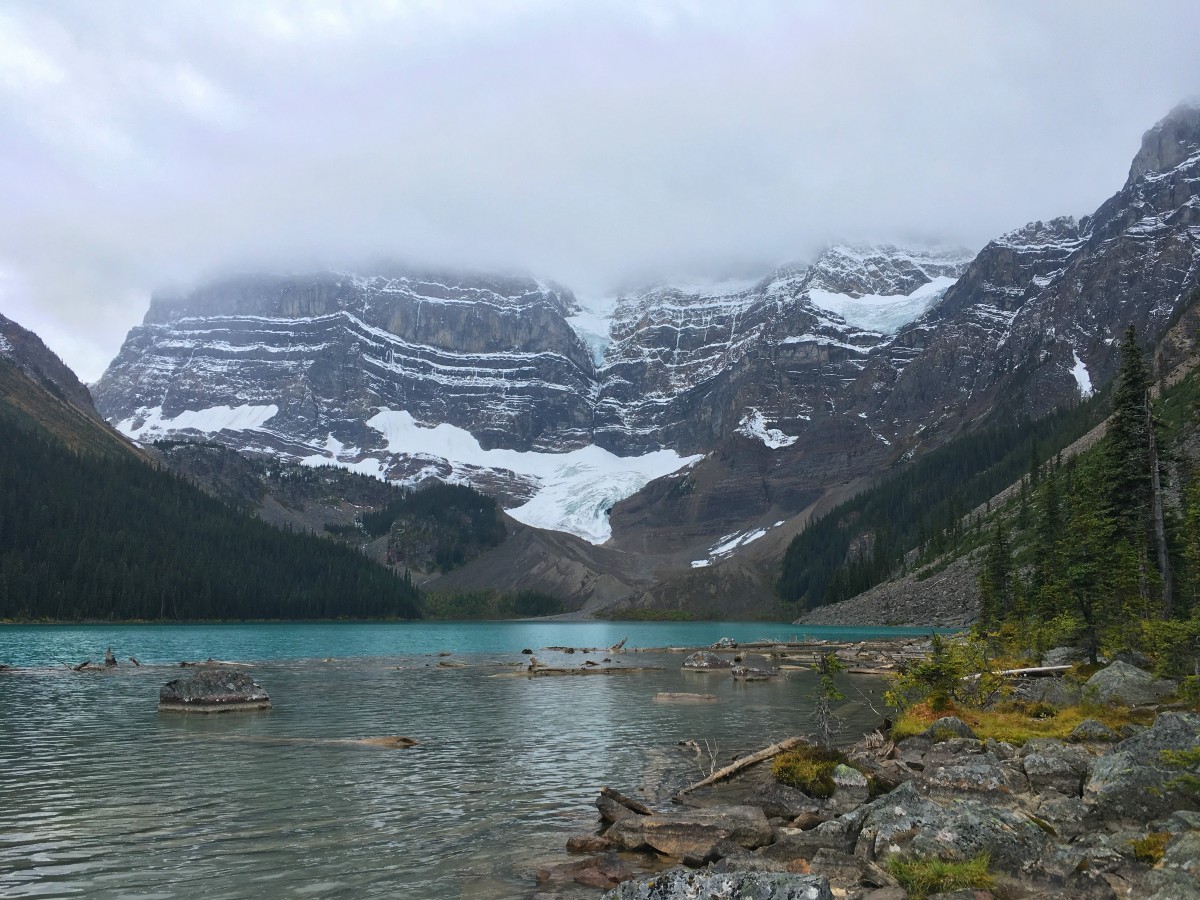
As mentioned earlier, to hike to Chephren Lake, turn right at the junction. The trail is consistently rough and muddy, but remains relatively flat for the majority of the 1.4mi to the lake. Much of the hike is alongside a series of large, wet meadows – a good place to catch sight of wildlife if you approach quietly. If not, the meadows offer fine views of Mt Chephren (10741ft) and Howse Peak (10810ft), which form the backdrop of Chephren Lake.
Legendary guide & outfitter Jimmy Simpson cut this trail in 1923, so pack trips could avoid fording the Mistaya River further down valley on their way to the mountains of the Columbia Icefield. At 1.2mi from the junction, the trail swings west, leaving the old route and beginning a steep decent down to Chephren Lake.
Larger than Lake Louise, Chephren Lake is named for the prominent peak above it, Mt Chephren. Originally named the Black Pyramid (to contrast with the glacier capped White Pyramid behind it, visible from Saskatchewan River Crossing), the mountain was renamed in 1918 to prevent confusion with another Pyramid Mountain in Jasper National Park. Chephren (pronounced kefran) was an ancient Egyptian pharaoh and builder of the second largest pyramid of Giza.
Unofficial trails follow the shoreline of Chephren Lake. These trails are mainly used by mountaineers heading up to the White Pyramid or Mt Chephren. The condition of these trails is the same as the trail coming in – not very fun. Better to sit at the lakeshore and watch for avalanches or rockfall from the imposing peaks above.
When you wish to return, hike out on the same trail you came in on. This trail takes you back to the junction, then turn left to return over the Mistaya River to the parking lot.
Insider Hints
Precipitation is high, and drainage is poor in this area. If there has been rain, expect the trail to be a mud pit and bring waterproof shoes and gaiters.
Upper Waterfowl Lake is a 0.9mi return side trip from the Mistaya River Bridge - usually only visited by people staying at the campground.

Similar hikes to the Cirque & Chephren Lakes hike
Glacier Lake
The relatively flat Glacier Lake trail is commonly used by backpackers; however, it makes for an excellent day hike. Whether…
Sarbach Lookout
Hiking to Sarbach Lookout is a great way to cleanse your palate after walking through the crowds at Mistaya Canyon.…
Katherine Lake
Hiking to Katherine Lake will take you beyond the famed Helen Lake through fields of wildflowers beneath gigantic peaks. It…
PeterHopkins 5 years ago
The trail was bit muddy, make sure to bring gaiters and wear waterproof shoes.
MartiniC 5 years ago
Easy hike that comes with amazing views of lakes and mountains.
MUCHADVENTURE 5 years ago
We had the whole place to ourselves. the note about the ground being wet was totally true, but we had a great time regardless of some wet feetsies. LEarn from my mistakes, bring extra socks!
Rosemery Ash 5 years ago
The enormous rugged mountains were really impressive in person.
Hiking-eh 5 years ago
Beautiful, Incredible, breathtaking. A must do!
Leonard J. 5 years ago
Better check the weather before going here. It's also safer.
FellWalker 5 years ago
Easy hike but it will still offer you outstanding views throughout the hike.
Kairi Subarashi 5 years ago
Some trails were wet and slippery with all the muddy puddles. On the other hand, the flat and damp section of the forest was a haven for bears, moose, and smaller creatures. We had a close bear encounter. It's so much safer to hike in groups.
Larry D. 6 years ago
Enjoyed the rugged terrain! Glad the weather was perfect.
romeoM 6 years ago
Give it a shot. You won't be disappointed I promise.