
Port Moody Shoreline Trail
View Photos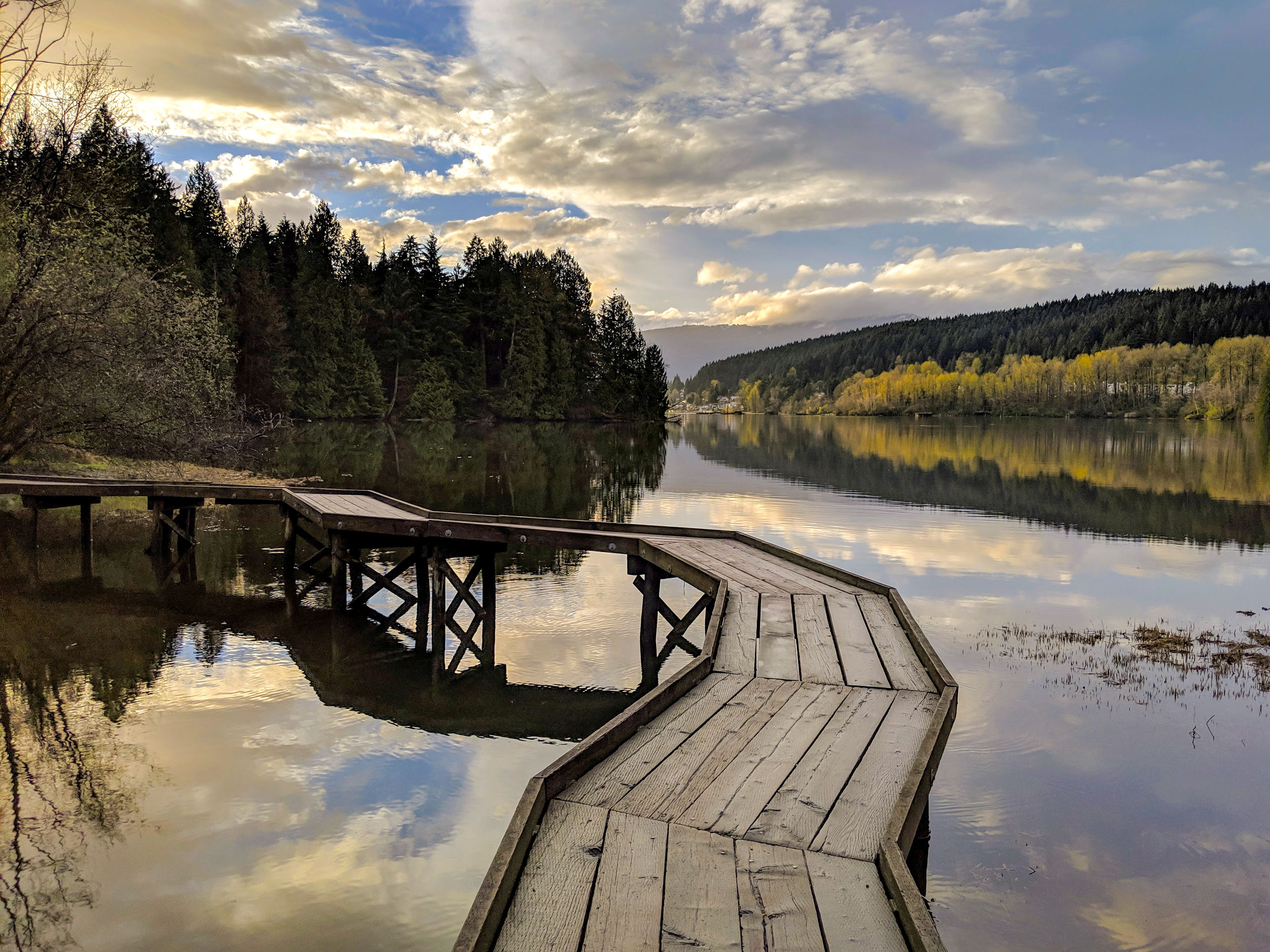
Port Moody Shoreline Trail
Difficulty Rating:
The Port Moody Shoreline Trail is a 3.6mi out-and-back route that follows along the beautiful waters of the inlet and travels over a mixture of well-maintained pathways and boardwalks. In nice weather, hikers will have stunning views out over the water and of nearby Burnaby Mountain. Stretching between Rocky Point Park to the south and Old Orchard Park to the north, this trail is an easy-to-navigate route that hikers of all capabilities are sure to enjoy.
Getting there
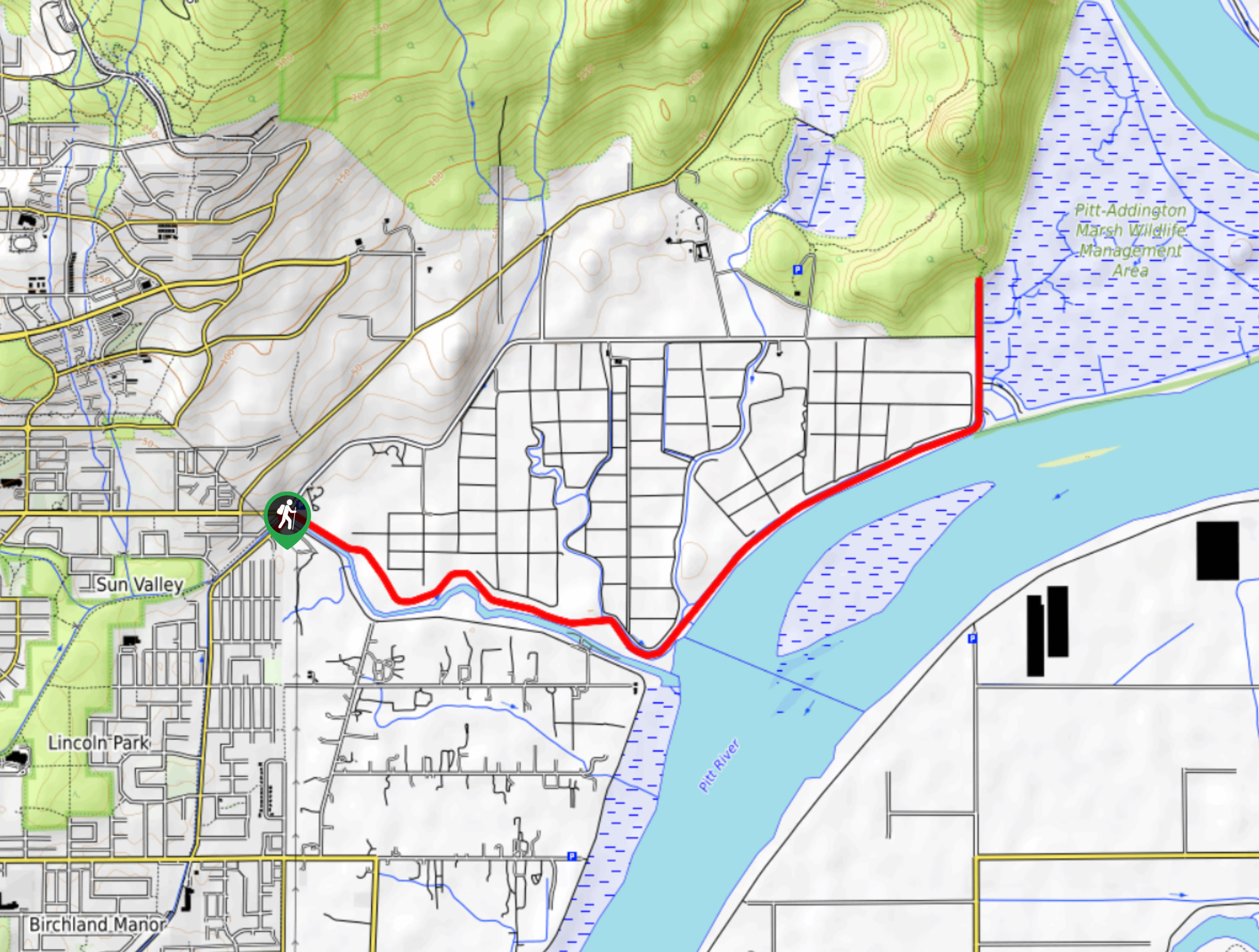
To get to the parking area for the Port Moody Shoreline Trail from Coquitlam, drive west along Barnet Highway/BC-7A and turn right onto Ioco Road. After 1312ft, make a left turn onto Murray Street, continuing on for 1.0mi to reach the parking area on your right.

About
| When to do | Year-Round |
| Backcountry Campsites | No |
| Pets allowed | Yes - On Leash |
| Family friendly | Yes |
| Route Signage | Average |
| Crowd Levels | Moderate |
| Route Type | Out and back |
Port Moody Shoreline Trail
Elevation Graph
Weather
Port Moody Shoreline Trail Description
The Port Moody Shoreline Trail is a popular route along the eastern shore of the Burrard Inlet that passes through several parks and beach areas. As such, the trail can be quite busy with hikers, runners, bikers and beachgoers, making an early arrival to this trail a necessity. The route itself is a combination of non-technical dirt, paved, and boardwalk paths with almost no change in elevation. This means that you can leave the hiking boots and extra gear at home for this easy hike near Port Moody.
This trail is a popular one due to its easy terrain, access to amenities, nearby wildlife, and beautiful views. As the route skirts along the eastern shores of the Burrard Inlet, hikers on the trail will have beautiful views out over the water toward nearby Burnaby Mountain from almost any point along the trail.
Setting out from the parking area, make your way toward the water to pick up the Shoreline Trail and follow it east into the tree cover. From here, the trail will wind along the water’s edge until the tree cover breaks, giving you amazing views of the Burrard Inlet. Continue along the forested trail as it works its way along the northern shore of the inlet, eventually arriving at the beach within Old Orchard Park. After spending some time along the beach admiring the views of Burnaby Mountain across the water to the south, set back out along the same route to return to the carpark having completed the Port Moody Shoreline Trail.
Similar hikes to the Port Moody Shoreline Trail hike

Trans Canada and Pandora Trail Loop
The Trans Canada and Pandora Trail Loop is a combination of several trails within the Burnaby Mountain Conservation Area that…
DeBoville Slough to Addington Lookout
The hike along DeBoville Slough to Addington Marsh is an easy 6.0mi out-and-back trail along a paved path…
Katzie Marsh Loop
The Katzie Marsh Loop is a beautiful 4.1mi hike through the wetlands of the Pitt-Addington Marsh Wildlife Management…
Comments