Hayward Lake Trail
View Photos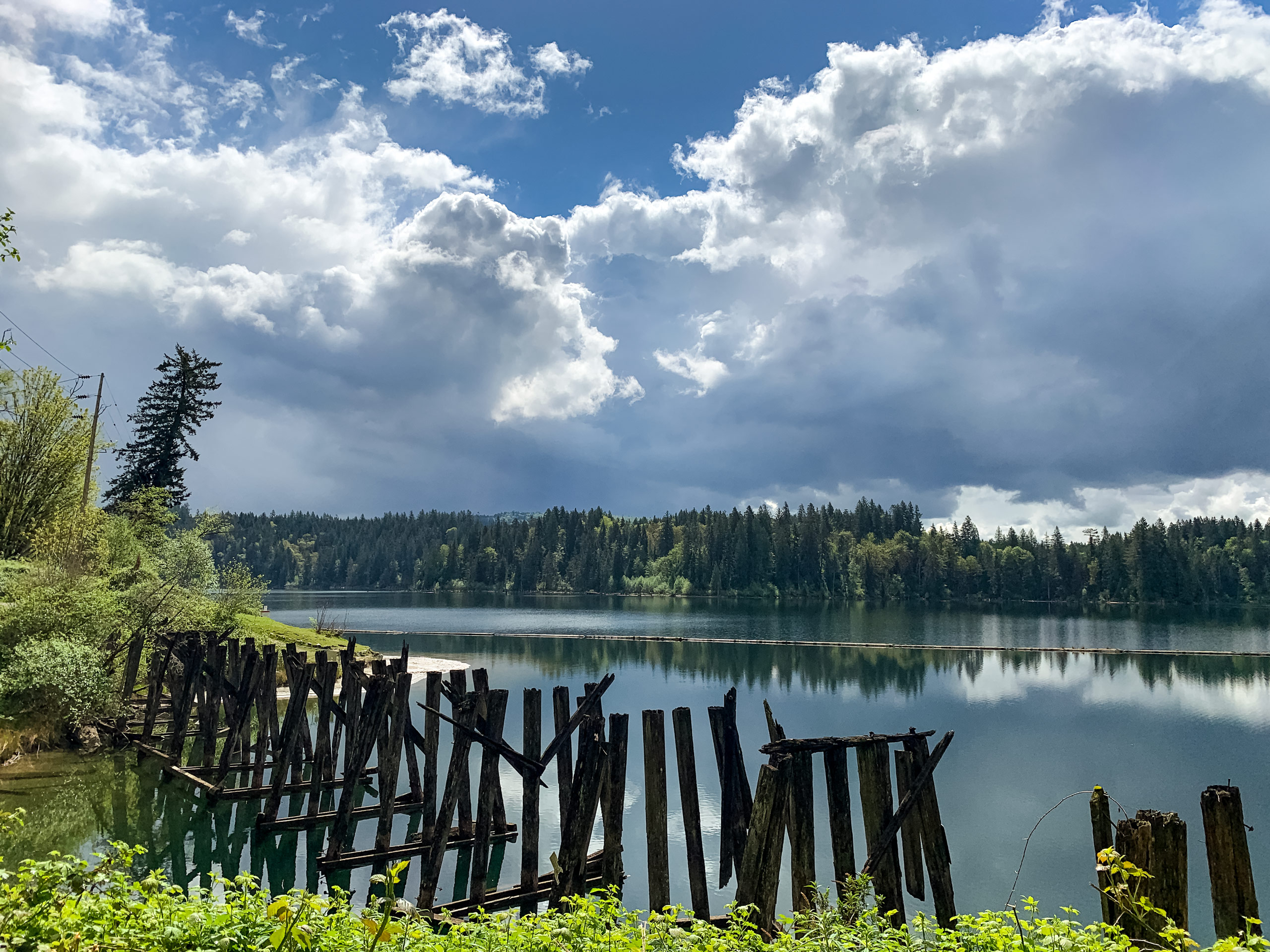
Hayward Lake Trail
Difficulty Rating:
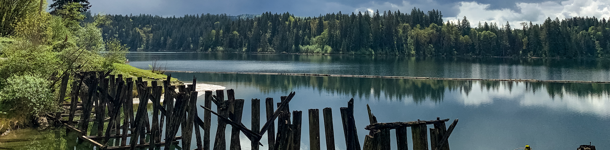
The Hayward Lake Trail is a 10.9mi route near Mission, BC, that loops around Hayward Lake and crosses over two dams - Ruskin Dam in the south and Stave Falls Dam in the north. Travel around the beautiful lakeside scenery on your way to the picturesque Steelhead Falls before ending up at one of the lake’s beautiful beaches. This is a great day hike that offers access to a lot of other fun outdoor activities.
Getting there
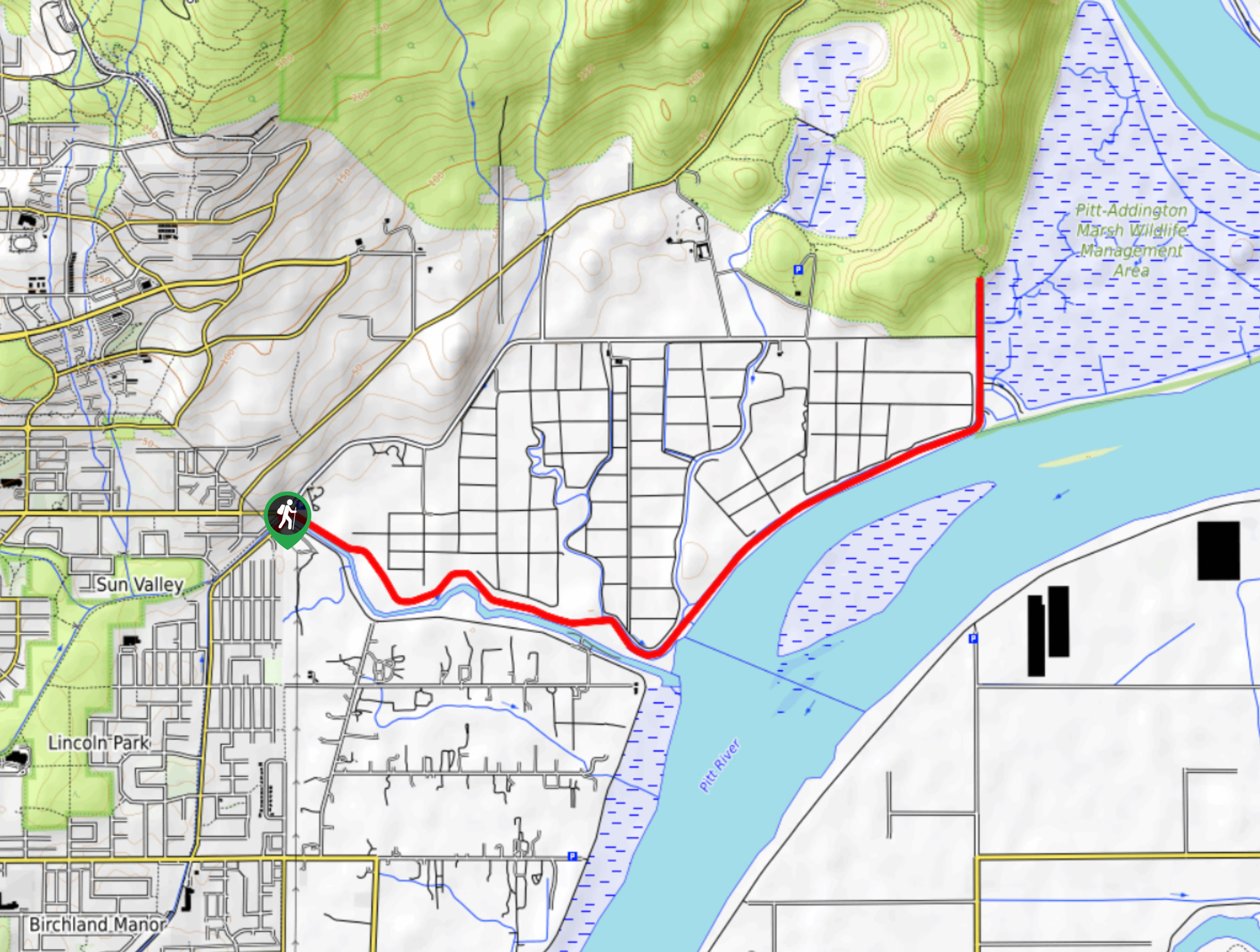
To get to the parking area for the Hayward Lake Trail from Maple Ridge, drive east on Dewdney Trunk Road for 10.7mikm, and make a right turn just before the Stave Falls Powerhouse Visitor Centre. You will reach the parking area in 2297ft.

About
| When to do | Year-Round |
| Backcountry Campsites | No |
| Pets allowed | Yes - On Leash |
| Family friendly | Older Children only |
| Route Signage | Average |
| Crowd Levels | Moderate |
| Route Type | Circuit |
Hayward Lake Trail
Elevation Graph
Weather
Hayward Lake Trail Description
Completing the Hayward Lake Trail can be a bit of a tricky affair due to closures that frequently restrict access to certain sections of the loop. The most notable of these is the closure of the floating bridge across the Hairsine Inlet at the lake’s southern end, that has been closed for years due to a need for repairs. The only safe option available to hikers that wish to complete the entire trail loop is to reach the floating bridge and then turn back along the same trail. This greatly extends the length of the hike, so many hikers have taken it upon themselves to either swim across the waters of the Hairsine Inlet or skirt around its heavily wooded shoreline. Both of these off-trail options present obvious risks that should be well understood by anyone hoping to attempt them.
Bridge closures aside, this trail is a wonderful route along a beautiful lake that offers several scenic vantage points, as well as the chance to experience the beauty of Steelhead Falls on the eastern side of the lake. The Hayward Lake Trail also contains two dam crossings – one over the Ruskin Dam to the south and one over the Stave Falls Dam to the north – that add an engineering element to the route in addition to the various natural elements. Whether you are looking to simply utilize the hiking trails or make use of the beaches and other recreational areas, a day out in the sun at Hayward Lake should be considered a day well spent.
Starting out from the parking area, follow the trail south as you make your way past the beach and through the narrow stretch of land between the beaver pond and Hayward Lake. Continue south along the edge of the lake to pass by the Hayward Lake Dog Beach and off-leash area. Keep on the trail for 2.5mi, as it passes over two small bridges and dips in and out of the forest along the shoreline.
Towards the southern end of the lake, you will pass by a small beach area with a nice view of the lake as it stretches out toward Ruskin Dam. Make your way to the dam, taking the route through the parking lot and up to Wilson Street, which will take you over Ruskin Dam at Hayward Lake’s southwest corner.
After crossing the dam, go left into the trees to pick the trail back up as it works toward the floating expanse of the Hairsine Inlet Bridge. This bridge has been closed for several years due to a need for repairs. As such, hikers will need to choose one of several options to complete the loop around Hayward Lake. The first is to turn back around and retrace their steps around the lake to cross at Stave Falls Dam to the north, making their way around the eastern edge edge of the lake. For those who are a tad bit more adventurous, common methods of completing the loop include swimming across the inlet or doing a short off-trail hike around the water’s edge to reach the other side. Whatever method you end up choosing, pick the trail back up on the other side of the bridge to continue along the eastern shore of the lake.
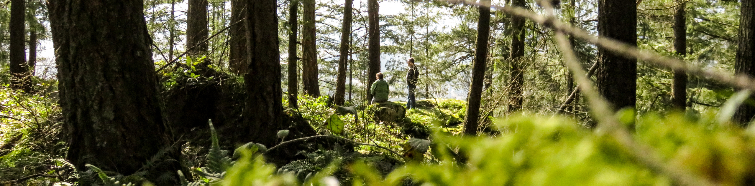
Continue on the trail for 0.7mi to reach a junction in the trail to the left for the Canoe Landing Site. This is a brief detour that offers beautiful views of the lake from the east side. Continuing on the main trail, head north through the dense tree cover as the trail continues to weave alongside the water’s edge. This stretch of the route is heavily forested and won’t have many scenic views, so take the time to admire the beauty of the surrounding forest.
After travelling for 3.1mi through the thick tree cover, you will reach a junction on the left for Steelhead Falls. Taking this brief detour will bring you to a scenic and serene vantage point, from which you can gaze upon the waters of the picturesque Steelhead Falls as they cascade over the moss-covered rocks.
When you’ve finished appreciating the beauty of the falls, head back to the main trail and continue north towards Stave Falls Dam. Travelling 1km further along the trail will bring you to another lookout, this time with a sweeping picture across Hayward Valley and the lake. Continue on the trail as it follows closely alongside the road before turning south and crossing over Stave Falls Dam with its rushing water below. After crossing the dam, turn left onto Power Station Access Road to descend alongside Stave River. You will soon arrive at your starting point, the parking area next to the beautiful waters of Hayward Lake.
Hiking Route Highlights
Steelhead Falls
Located just off the Reservoir Trail, Steelhead Falls is a scenic waterfall with rushing water that cascades down the moss-covered rocks on its way to Hayward Lake. This picturesque location is a perfect destination for a family day hike.
Stave Falls Dam
Completed in 1912, the Stave Falls Dam is a dual-dam power complex used to generate hydroelectric power. The powerhouse located at the dam was once the largest hydroelectric power source in BC and is considered a National Historic Site of Canada.
Frequently Asked Questions
Can you swim in Hayward Lake?
Hayward Lake is open to the public for swimming and offers two beaches along its western shore.
What activities can be done around Hayward Lake?
The area around Hayward Lake offers recreational space for a variety of activities including swimming, boating, hiking, biking, and fishing.
Similar hikes to the Hayward Lake Trail hike
Trans Canada and Pandora Trail Loop
The Trans Canada and Pandora Trail Loop is a combination of several trails within the Burnaby Mountain Conservation Area that…
Quarry Trail
The Quarry Trail is a scenic hike through the beautiful wetlands of Minnekhada Regional Park that takes hikers to several…
DeBoville Slough to Addington Lookout
The hike along DeBoville Slough to Addington Marsh is an easy 6.0mi out-and-back trail along a paved path…
Comments