Golden Ears Canyon Loop
View Photos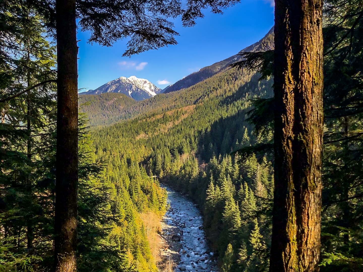
Golden Ears Canyon Loop
Difficulty Rating:
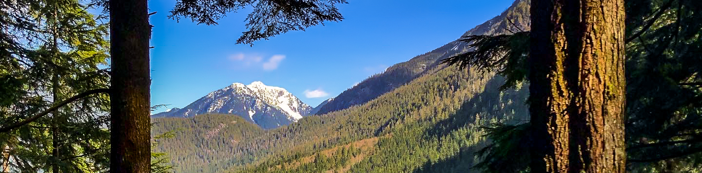
The Golden Ears Canyon Loop is a 6.5mi route through the beautiful West Coast forests of Golden Ears Provincial Park. The trail follows closely alongside the banks of Gold Creek and utilizes the East and West Canyon trails to form a convenient loop through the area. Also located along this route is a scenic viewpoint overlooking the majestic Upper Falls of Gold Creek.
Getting there
To reach the parking area for the Golden Ears Canyon Loop from Mapleridge, make your way east along Dewdney Trunk Road and turn left onto 232 Street. Continue on 232 Street for 3.7mi, where you will enter Golden Ears Provincial Park. Continue to drive on Golden Ears Parkway for 8.2mi and you will approach the Gold Creek parking lot on the left.

About
| When to do | March-October |
| Backcountry Campsites | North Beach, Golden Ears, Gold Creek |
| Pets allowed | Yes - On Leash |
| Family friendly | Older Children only |
| Route Signage | Average |
| Crowd Levels | High |
| Route Type | Circuit |
Golden Ears Canyon Loop
Elevation Graph
Weather
Golden Ears Canyon Loop Description
The Golden Ears Canyon Loop travels alongside Gold Creek fairly closely, making it susceptible to wet/muddy trails and washouts. Make sure to wear proper hiking footwear for this trek to ensure that your feet stay dry for its 6.5mi duration. Additionally, this trail is quite rocky in places, so take extra care when traversing these sections and remember to pack hiking poles to help save your knees from excess impact along the trail.
A largely forested trail, this route also contains some excellent highlights and viewpoints from which you can experience the amazing wooded landscape. Hiking down to the vantage point at the Upper Falls will enable you to catch a glimpse of the rushing waters of Gold Creek crashing over the rocks below, and the Gold Creek Lookout on the western bank of the creek gives an awesome view of the woodland valley with a picturesque mountain backdrop. For a moderate amount of effort, this hike offers some pretty amazing sights that you are not likely to forget any time soon.
Embarking on the trail from the Gold Creek parking lot, follow it east until you reach a junction with the East Canyon Trail. Follow this north for 1.6mi to find the trail leading down to the Upper Falls on your right. Take this path to make your way down to the vantage point overlooking the majestic Upper Falls of Gold Creek. After taking in the sights, backtrack to the main trail and continue north along it for 2297ft, where you will meet up with the East West Canyon Connector Trail that crosses over the creek.
Taking this route to the left, cross over Gold Creek and continue on until you reach a junction near Alder Creek. Go left, following the trail until you get to the Gold Creek Lookout that overlooks the scenic valley. Continue south along the West Canyon Trail, crossing over a creek and taking Menzies Trail to the left. This will meet up with the Golden Ears Parkway, which you will need to follow over Gold Creek to return to the parking area.
Similar hikes to the Golden Ears Canyon Loop hike
Trans Canada and Pandora Trail Loop
The Trans Canada and Pandora Trail Loop is a combination of several trails within the Burnaby Mountain Conservation Area that…
Quarry Trail
The Quarry Trail is a scenic hike through the beautiful wetlands of Minnekhada Regional Park that takes hikers to several…
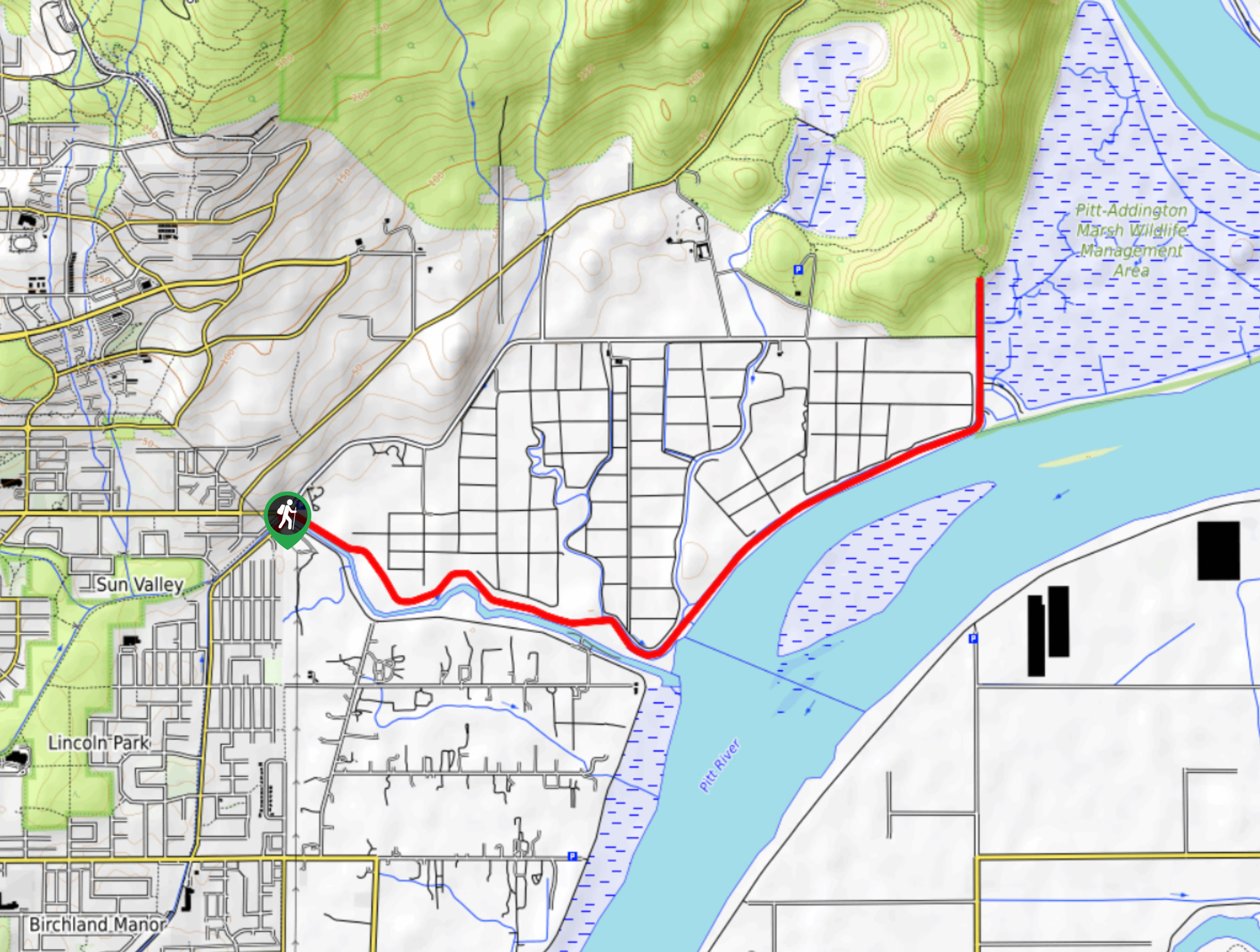
DeBoville Slough to Addington Lookout
The hike along DeBoville Slough to Addington Marsh is an easy 6.0mi out-and-back trail along a paved path…
Comments