Eagle Ridge Trail
View Photos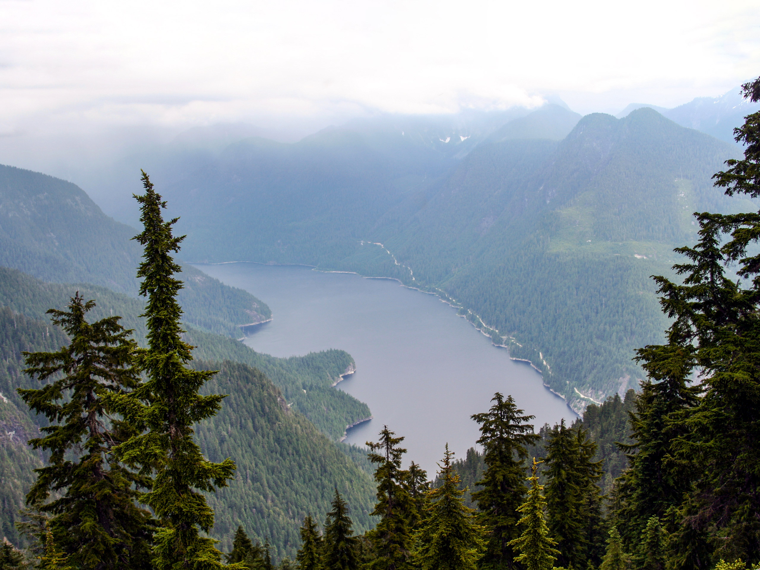
Eagle Ridge Trail
Difficulty Rating:
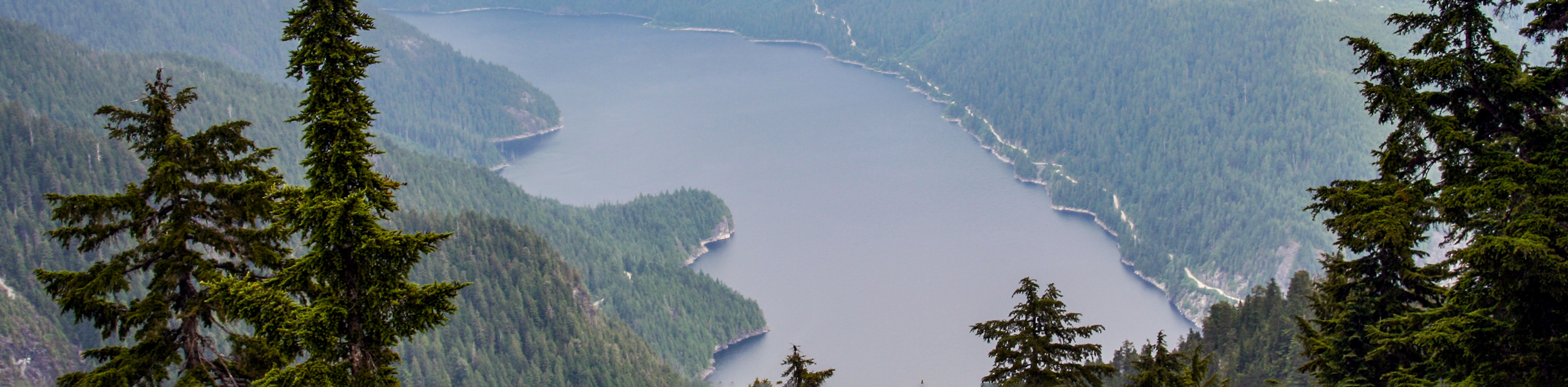
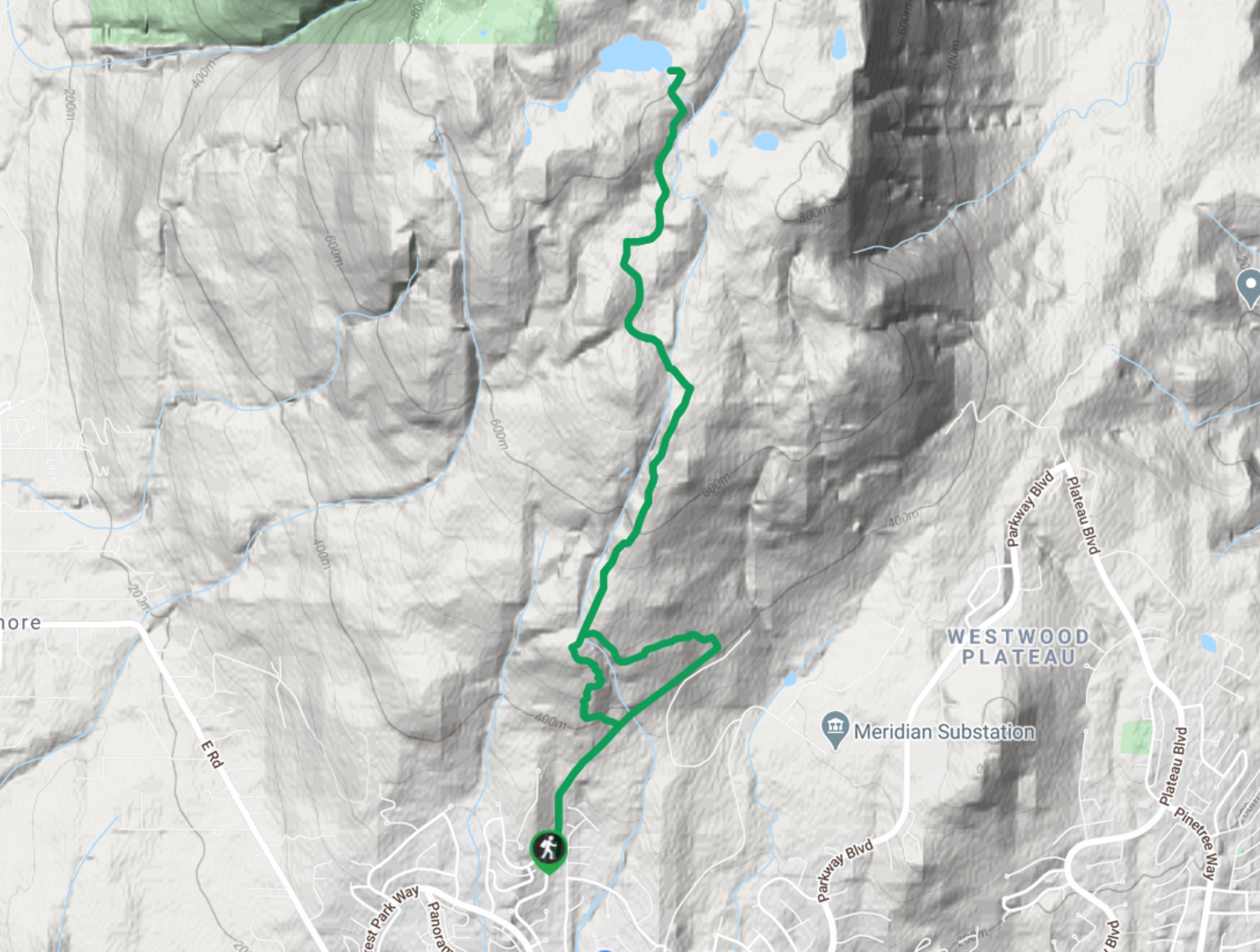
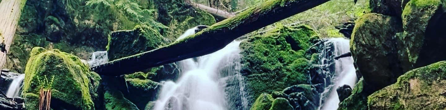
The Eagle Ridge Trail is a fantastic hiking route that sets out from Buntzen Lake and heads into the backcountry of Indian Arm Provincial Park. This 10.0mi loop trail travels along the slopes of Eagle Mountain and passes by several amazing vantage points, including The Pulpit, West Point, Spahats Rigg, Little Valhalla, and Barton Point. This hike is a great opportunity to get an eagle’s eye view of the surrounding area.
Getting there
To reach the parking area for the Eagle Ridge Trail from Coquitlam, drive west on Barnet Highway/BC-7A and take the exit toward Lansdowne Dr. Follow it for 1.2mi and make a left turn onto Honeysuckle Ln. Make a right turn after 2461ftonto Noons Creek Dr and a left onto David Ave. Keep on David Ave for 0.7mi and turn right onto Forest Park Way. At Aspenwood Dr, make a left turn and follow it for 1.6mi. Make a right turn onto Sunnyside Rd and keep on it for 1.7mi to arrive at the parking area on your left.

About
| When to do | June-October |
| Backcountry Campsites | No |
| Pets allowed | Yes - On Leash |
| Family friendly | No |
| Route Signage | Poor |
| Crowd Levels | Moderate |
| Route Type | Circuit |
Eagle Ridge Trail
Elevation Graph
Weather
Eagle Ridge Trail Description
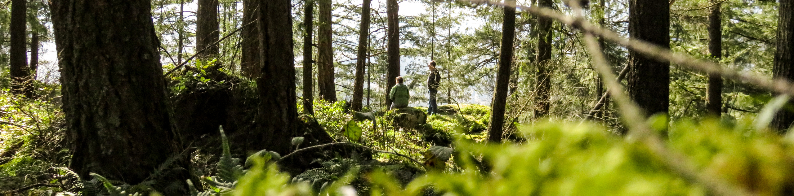
The Eagle Ridge Trail is a difficult hiking route that works its way into the backcountry of Indian Arm Provincial Park and up the slopes of Eagle Mountain. Due to the elevation of the hike, certain times of the year will see the route packed in with snow, making trail conditions difficult to traverse. Make sure to pack proper gear for the conditions, including crampons, microspikes, or snowshoes if need be.
This trail offers an amazing opportunity to experience sweeping views from Eagle Mountain that stretch west along the North Shore and south across the Metro Vancouver Area. Along the route, you will find great variation in terrain as the trail cuts through a largely wooded area, crossing over mountain streams as it climbs uphill to the many vantage points and small lakes that can be found along the slopes of the mountain.
Similar hikes to the Eagle Ridge Trail hike
Quarry Trail
The Quarry Trail is a scenic hike through the beautiful wetlands of Minnekhada Regional Park that takes hikers to several…
Lungbuster Trail to Cypress Lake
The Lungbuster Trail is a challenging 5.1mi out-and-back hiking route near Coquitlam, BC, that follows along an extremely…
Cypress Lake Trail
The Cypress Lake Trail is a 5.7mi out-and-back that passes through the dense forests near Coquitlam and ends…
Comments