

DeBoville Slough to Addington Lookout
View PhotosDeBoville Slough to Addington Lookout
Difficulty Rating:
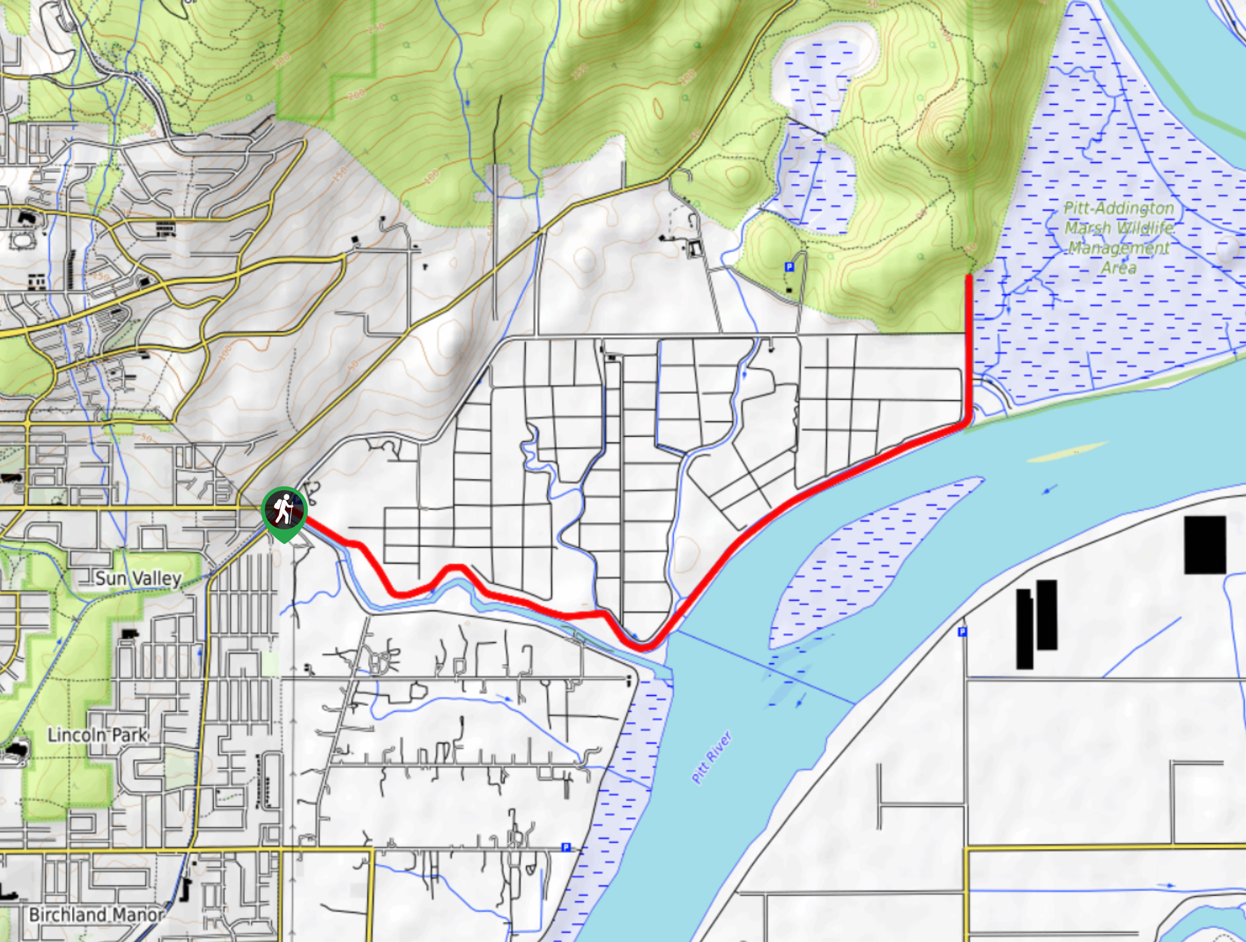
The hike along DeBoville Slough to Addington Marsh is an easy 6.0mi out-and-back trail along a paved path that offers the opportunity to see a wide variety of wildlife. The trail skirts alongside berry farms and marshlands, with beautiful views of the Pitt River and nearby mountains. Keep an eye out for animals (including the occasional bear) that like to feed on berries from the nearby farm.
Getting there
To reach the parking area for the DeBoville Slough Trail from Coquitlam, drive north on Pinetree Way N and make a right turn onto David Avenue. After 1.7mi, make a right turn onto Coast Meridian Road and a left on Victoria Drive. After 1.0mi, the road will veer to the right and the parking area will be on your left.
About
| When to do | Year-Round |
| Backcountry Campsites | No |
| Pets allowed | Yes - On Leash |
| Family friendly | Yes |
| Route Signage | Average |
| Crowd Levels | Moderate |
| Route Type | Out and back |
DeBoville Slough to Addington Lookout
Elevation Graph
Weather
DeBoville Slough to Addington Lookout Description
Hiking along the DeBoville Slough to Addington Point is a great outdoor experience that the entire family will love. The main concerns (if you can even call them that) along this trail are the wildlife species that call the marshlands home. You will likely come across numerous species of birds, smaller mammals, and even some bears, so be mindful of their habitat and admire them from a safe distance.
As mentioned, this is a great family trail along a paved path that is perfect for getting everyone outdoors. The beautiful wetlands are the perfect backdrop for a day hike at any point of the year, and the view of Pitt River and the mountainous backdrop make everything that much more serene. Hiking along the trail, you will arrive at Addington Lookout, the perfect vantage point for bird watchers and nature lovers to gaze out over the marshy landscape.
Similar hikes to the DeBoville Slough to Addington Lookout hike

Trans Canada and Pandora Trail Loop
The Trans Canada and Pandora Trail Loop is a combination of several trails within the Burnaby Mountain Conservation Area that…

Quarry Trail
The Quarry Trail is a scenic hike through the beautiful wetlands of Minnekhada Regional Park that takes hikers to several…

Lungbuster Trail to Cypress Lake
The Lungbuster Trail is a challenging 5.1mi out-and-back hiking route near Coquitlam, BC, that follows along an extremely…


Comments