Coquitlam Lake View Trail
View Photos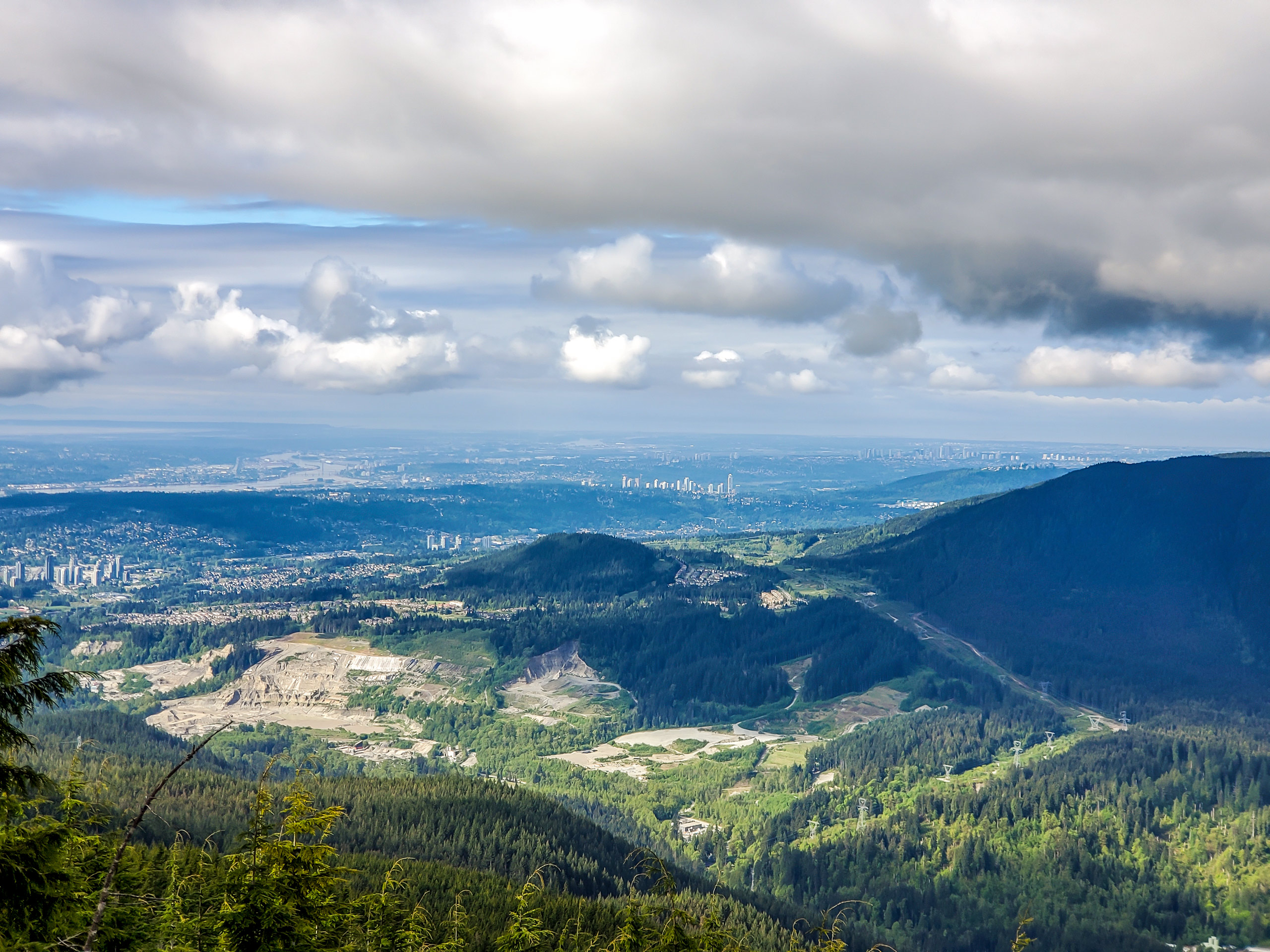
Coquitlam Lake View Trail
Difficulty Rating:
The Coquitlam Lake View Trail is a 6.1mi out-and-back route that passes through Pinecone Burke Provincial Park on the way to a viewpoint overlooking Coquitlam Lake. This trail is largely forested, meaning there won’t be any views until you reach the top, but once you make it to the viewpoint, the sights will not let you down. Take in sweeping views of the picturesque Coquitlam Lake as it sits nestled in a wooded valley below a mountainous backdrop. This trail is a real hidden gem amongst Coquitlam area hiking routes.
Getting there
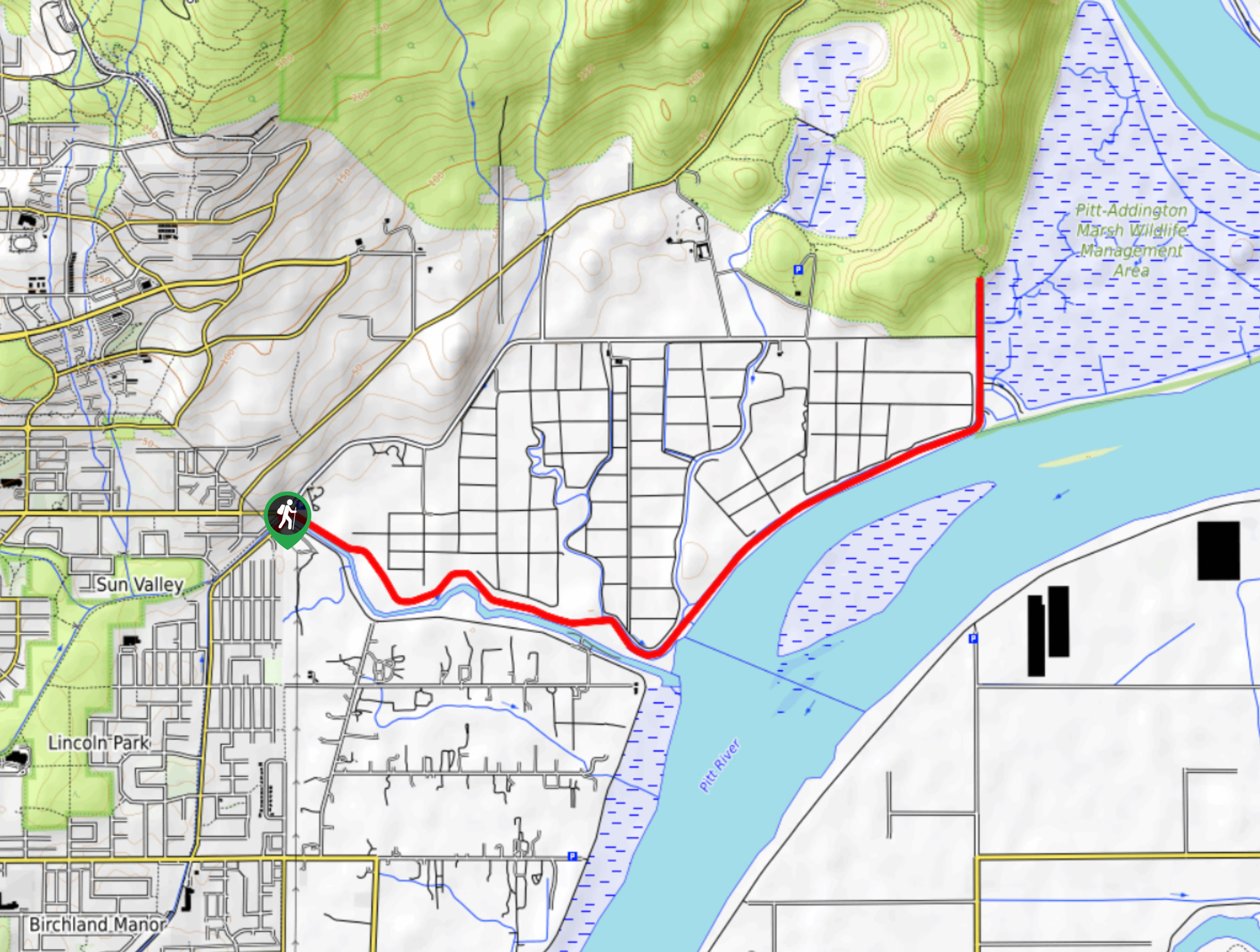
To get to the parking area for the Coquitlam Lake View Trail from Coquitlam, head north on Pipeline Road and turn right onto David Avenue. Turn left after 1.2mi onto Coast Meridian Road. Continue to drive north for another 0.8mi, making a right turn onto Harper Road. Follow Harper Road for 1.2mi, and the trailhead will be on your right side.

About
| When to do | April-October |
| Backcountry Campsites | No |
| Pets allowed | Yes - On Leash |
| Family friendly | Older Children only |
| Route Signage | Average |
| Crowd Levels | Moderate |
| Route Type | Out and back |
Coquitlam Lake View Trail
Elevation Graph
Weather
Coquitlam Lake View Trail Description
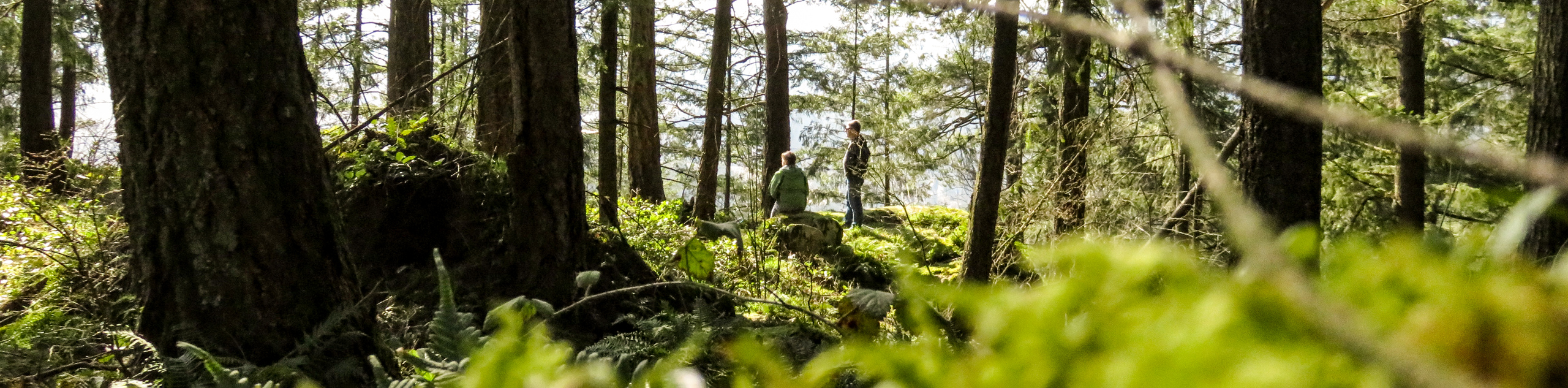
The Coquitlam Lake View Trail passes through the heavily forested lower portion of Pinecone Burke Provincial Park and utilizes its dense network of trails. Hikers should bring a good trail map or GPS when navigating this trail, as there are numerous side paths – especially along the initial stretch of the hike – that stray away from the main course. This network of trails is also a popular place for mountain bikers, so be mindful of your surroundings and share the space with other people along the trail. Additionally, the upper portions of the trail can be covered with snow and ice, making microspikes a friendly piece of kit to bring along on early/late season hikes.
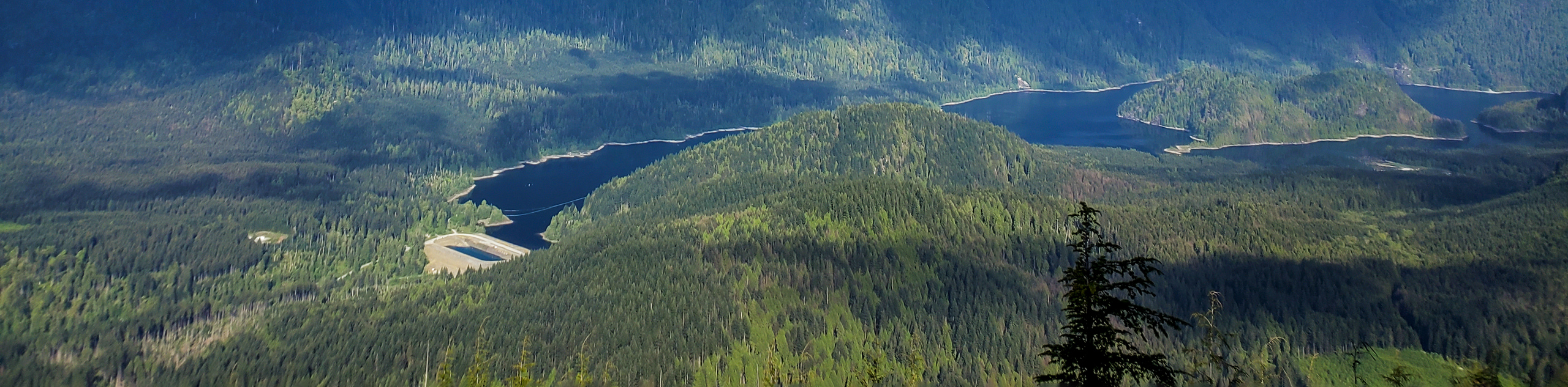
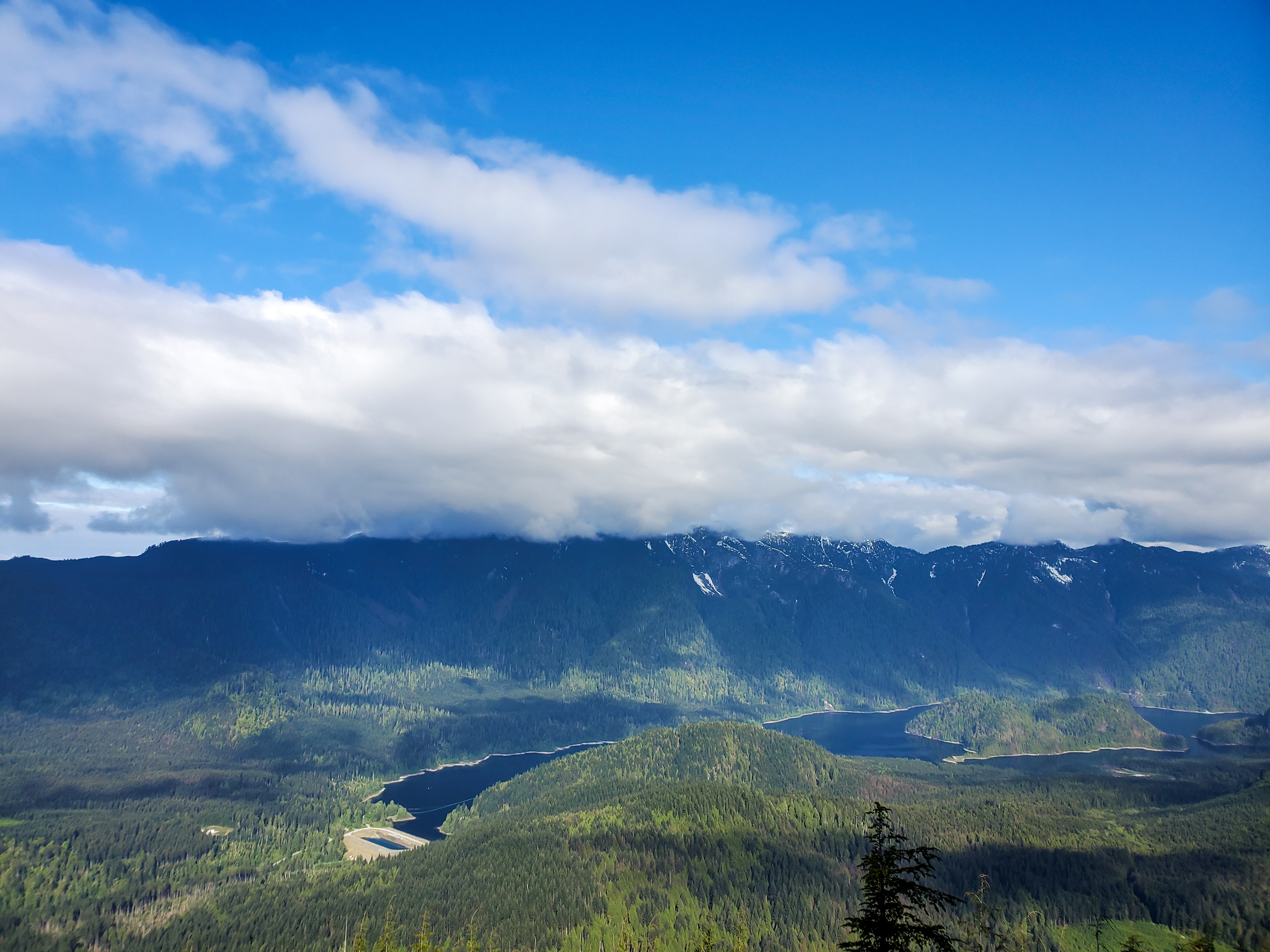
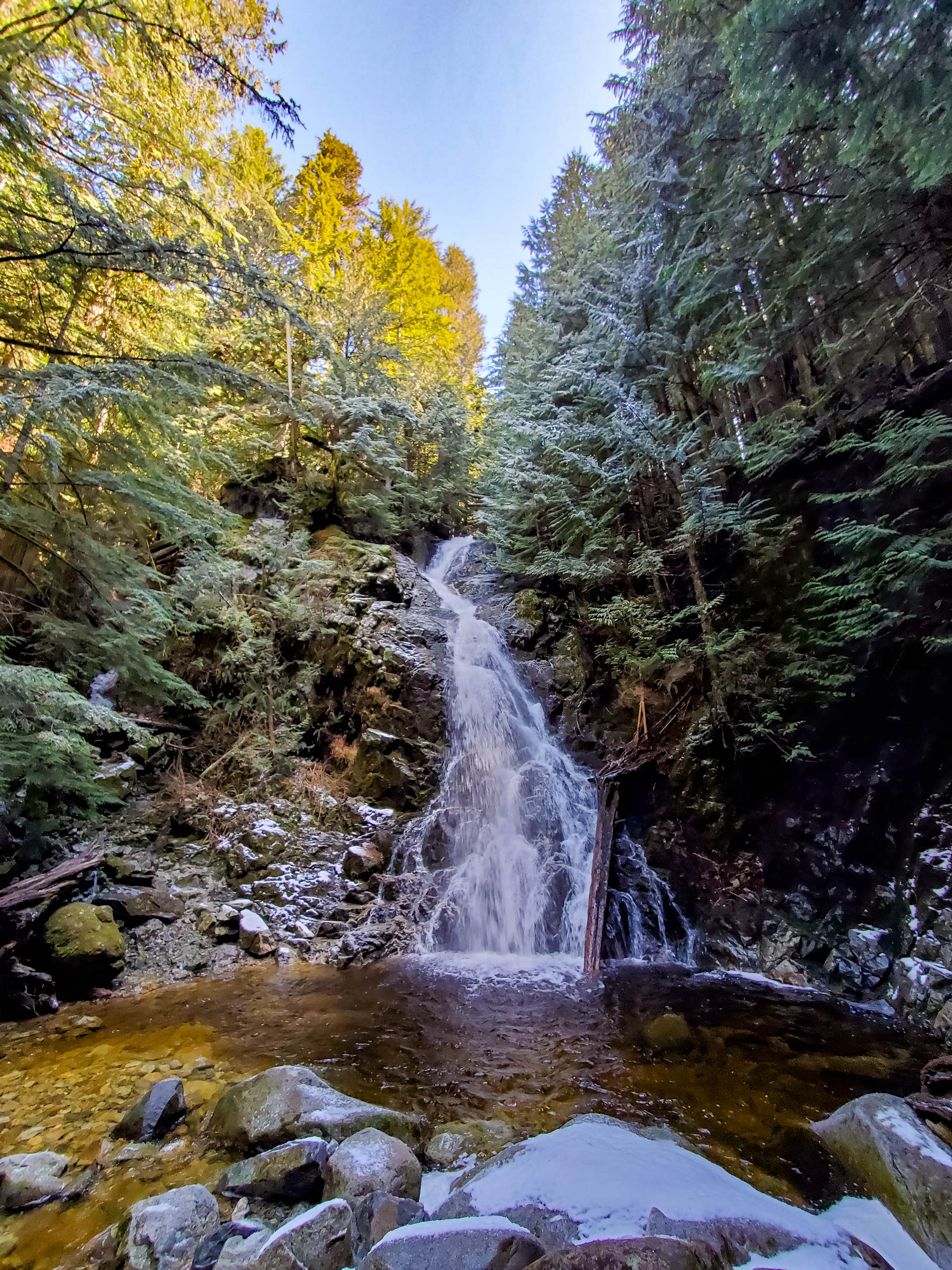
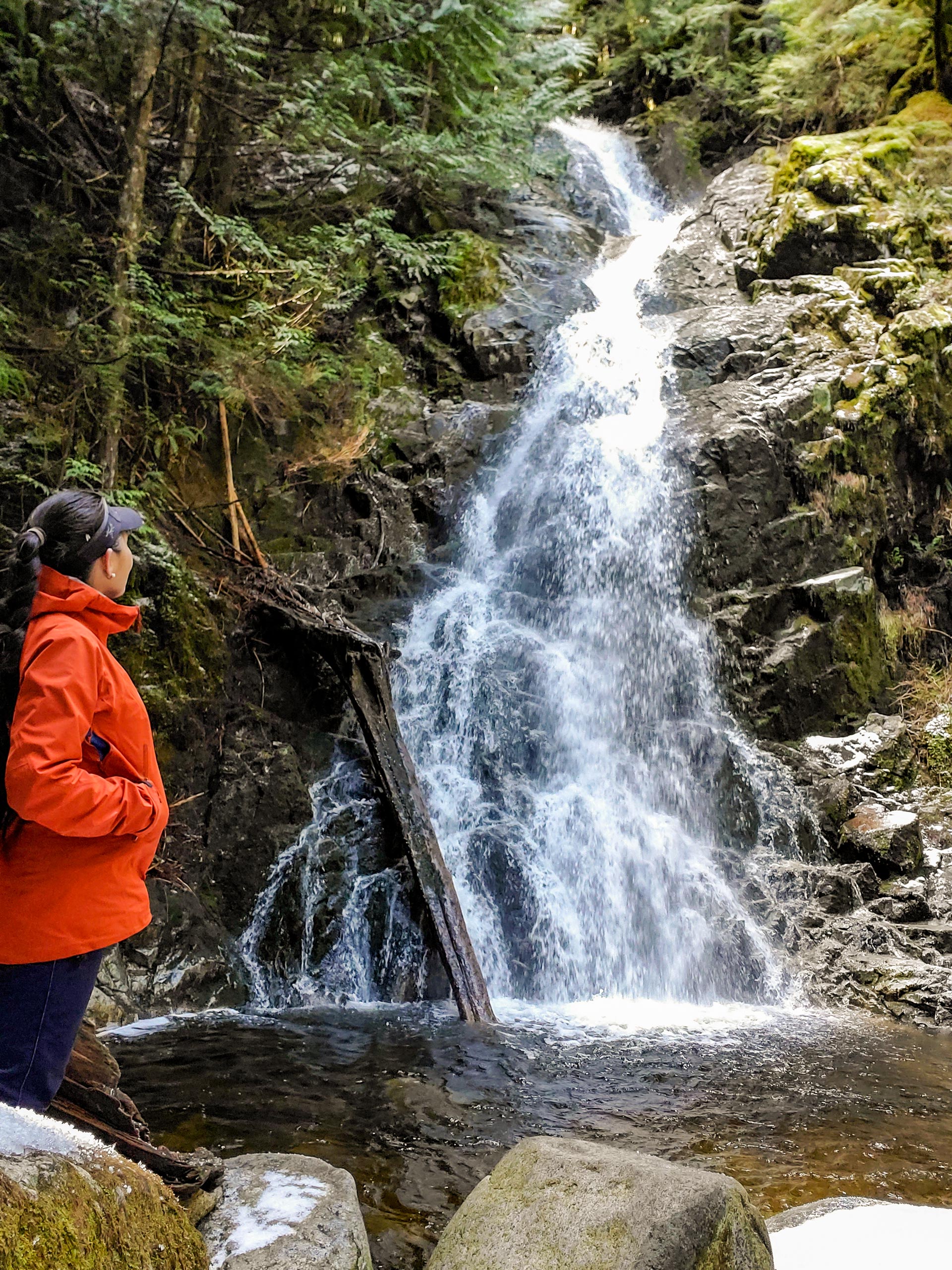
Although this route passes through a heavily forested stretch of land, there are numerous creek crossings and small waterfalls along the trail to keep you entertained as you pass through the wooded landscape. After making their way through the beautiful West Coast forest, hikers will be rewarded with truly stunning views at the end of the trail. From here, you will be able to look out to the west over the waters of Coquitlam Lake that sits in front of a mountain ridge that houses Eagle Mountain, Tangled Summit, and Mount Beautiful.
Setting out from the parking area, follow the Garbage Trail as it heads northeast into the dense tree cover. Reaching a four-way junction with the Woodland Walk Trail, hike straight through and keep left at the junction immediately after to continue on the Garbage Trail. Follow this for another 1804ft , where you will enter into a powerline clearing in the forest. Follow the trail directly across the clearing to re-enter the forest on the opposite side.
Now travelling along the Coquitlam Lake View Trail, continue straight for 1km to reach a fork in the path. Follow this to the left to continue along the trail as it skirts alongside a creek before breaking north. Another 0.7mi of hiking through the dense cover of the forest will bring you to a junction with the Sawblade Trail to your left that leads down to Sawblade Falls. Ignore this – or save it for the return trip – and keep straight along the trail to continue on to the viewpoint.
From here, you will need to make your way across the creek bed toward another fork 492ft down the trail. Go right at the fork and follow the trail straight to continue your uphill climb for 2133ft, where you will reach another junction. Take the trail to the left to begin the final ascent toward the viewpoint overlooking Coquitlam Lake.
As you climb up the hill, you will come out at the viewpoint over the lake, but pressing on for a few extra minutes will bring you to an even better vantage point with more stunning views. After reaching this further lookout, you will be greeted with awesome views over the peaceful waters of Coquitlam Lake, nestled in the valley below the mountains. After taking in the sights and breaking for a quick snack, head back down along the same route to return to the parking area, having completed the Coquitlam Lake View Trail.
Hiking Route Highlights
Coquitlam Lake
This body of water along the Coquitlam watershed serves as one of the three main sources of drinking water for the Metro Vancouver area. The lake is also a part of the BC Hydro system, with a pipeline that diverts some of its water down to nearby Buntzen Lake to aid in hydroelectric power generation.
Insider Hints
Bring a trail map or GPS for the initial portion of the trail, as the route is part of a dense network of hiking trails.
Wear proper hiking footwear - preferably water-resistant - as sections of the trail are rocky and require hiking along a creek bed.
Microspikes are also helpful in snowy trail conditions.
Bring hiking poles to help traverse technical sections of the trail and to lessen the impact on your knees during the descent
As with most BC hiking trails, bring bear spray to avoid any close encounters.
Arrive early for this hike, as the trail can become very busy around midday.
Similar hikes to the Coquitlam Lake View Trail hike

Trans Canada and Pandora Trail Loop
The Trans Canada and Pandora Trail Loop is a combination of several trails within the Burnaby Mountain Conservation Area that…
Quarry Trail
The Quarry Trail is a scenic hike through the beautiful wetlands of Minnekhada Regional Park that takes hikers to several…
DeBoville Slough to Addington Lookout
The hike along DeBoville Slough to Addington Marsh is an easy 6.0mi out-and-back trail along a paved path…
Comments