Alouette Lake Trail
View Photos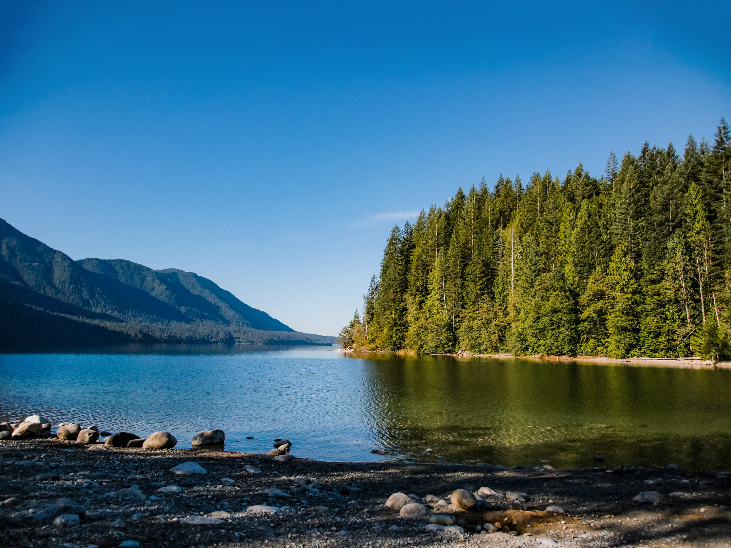
Alouette Lake Trail
Difficulty Rating:
The Alouette Lake Trail is a fun 9.5mi out-and-back trail that takes you along a forested path through Golden Ears Provincial Park. This hiking route doesn’t offer much in terms of great views until you get to the South Beach at Alouette Lake, but it does pass through some beautifully forested areas with spectacular flora and fauna. Make sure to pack a swimsuit to enjoy the refreshing waters of the lake.
Getting there
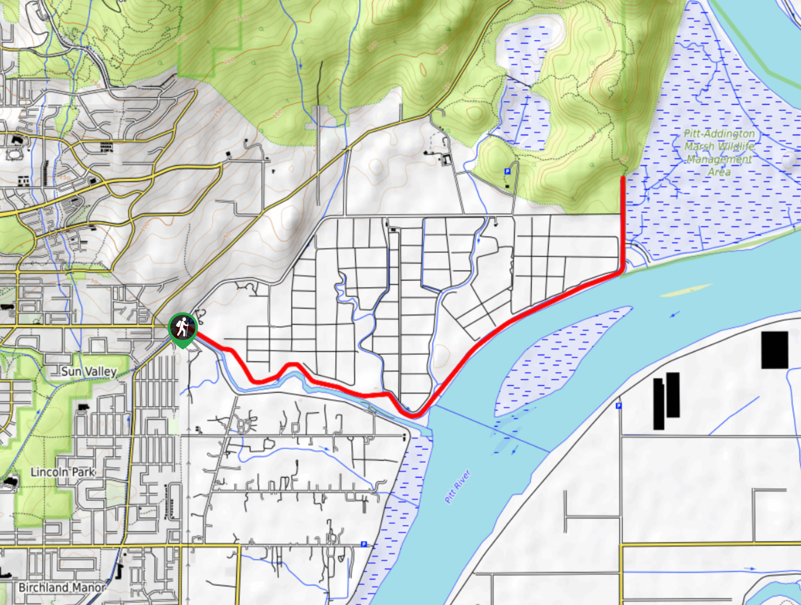
To reach the parking lot for the Alouette Lake Trail from Coquitlam, drive southeast on Lougheed Highway/BC-7 E and use the left lanes to exit onto Golden Ears Way. Continue on as the road changes into 128 Avenue and again into Abernethy Way. Turn left onto 224 Street and right onto 132 Avenue. After 1.0mi, take the 1st exit at the roundabout onto 232 Street. At the next roundabout, take the second exit, travelling for 1640ft before turning right onto Fern Crescent. After 0.9mi, turn left onto 128 Avenue and left again to get back onto Fern Crescent. Continue on for 0.9mi, and the parking area will be on the left.

About
| When to do | March-October |
| Backcountry Campsites | Alouette Group Campground |
| Pets allowed | Yes - On Leash |
| Family friendly | Older Children only |
| Route Signage | Average |
| Crowd Levels | Moderate |
| Route Type | Out and back |
Alouette Lake Trail
Elevation Graph
Weather
Alouette Lake Trail Description
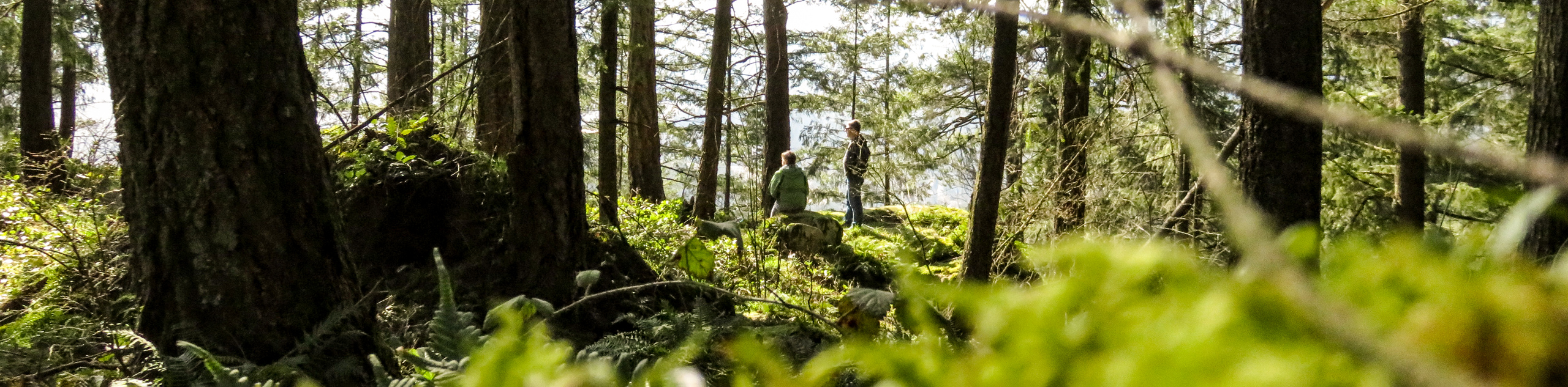
The Alouette Lake Trail heads through the beautiful forests of Golden Ears Provincial Park and is easy to follow, largely because the majority of the trail meanders alongside the road. This close proximity to the road means that this is a very safe hiking route with a high improbability of getting lost; however, it does mean that there will be a bit of road noise, especially on a busy summer day. Besides that minor issue, the only thing to keep in mind is the popularity of Alouette Lake as a summer beach destination. If you are looking to grab a spot at the beach or go for a midday swim, it might be best to leave a bit earlier in the day to beat the crowds to the lake.
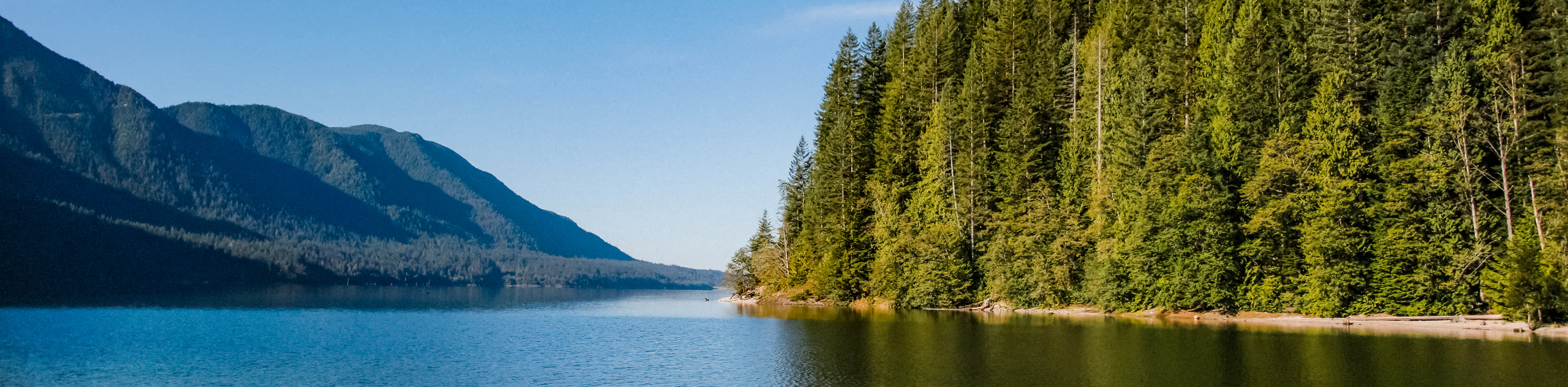
This route is a nice and easy, non-technical out-and-back trail that takes hikers on a 9.5mi journey through the forest, ending up at the beautifully picturesque Alouette Lake. While the trail itself might not have the most attractive views, it does offer a variety of plant and animal life to tide you over until you reach the scenic shores of Alouette Lake. Once you get to the South Beach, you will be greeted with amazing views of the lakeside shoreline and the many peaks that can be found within the park. From here, you can spend the day at the beach, rent a canoe to get out on the pristine water, or simply head back on the return journey along the Alouette Lake Trail.
Setting out on the trailhead at the north end of the parking area, make your way through the forest until you reach a junction with the Alouette Lake Trail. Follow the path to the right as it begins to travel closely alongside the road, arriving at a creek crossing in 2133ft. Cross over the creek and follow the trail to meet up with the road, making your way to the other side to pick the trail back up. After 2461ft, the tree cover will begin to dissipate, and you will find yourself walking through a powerline clearing. Continue through the clearing as the trail makes its way back into the forest on the other side.
From here, the trail will continue to wind its way through the dense forest for 1.5mi where you will reach a junction in the trail. Follow this to the right to continue on the Alouette Lake trail for another 2.0mi, while taking in the beauty of the West Coast forest as you make the final approach to Alouette Lake. Continue straight through the junction and walk along the parking area to reach South Beach on your right.
As you pass through the receding tree cover, you will begin to see beautiful views that stretch out over the waters of the lake, painted with a stunning mountainous backdrop in behind. With the Alouette Hydroelectric Dam immediately to your right, you will see views of Evans Peak, Mount Nutt, and Mount Gatey to your left and Mount Crickner straight out over the water.
Having taken in the beautiful views of the lake, set up on the beach to enjoy a fun day in the sun or head over to the boat rental on South Beach to get out onto the water and explore the area. After finishing up your day at the lake, turn back and make your way along the same trail through the forest to return to the parking area, having completed the Alouette Trail.
Hiking Route Highlights
Alouette Lake
This often-photographed lake is located within Golden Ears Provincial Park and is a popular area for watersports such as canoeing, windsurfing, and water skiing. The area surrounding the lake has several campgrounds, beaches, and an extensive trail system.
Frequently Asked Questions
How warm is Alouette Lake?
Early season water temperatures can be quite cold, but the lake does warm up over the summer, reaching temperatures around 22℃ in August.
When does Alouette Lake open?
Opening hours for Golden Ears Provincial Park change seasonally. From October to April the gates are open from 8am-5:30pm; from May to September they are open 7am-11pm.
Insider Hints
The area around the beach is extremely busy in the summer. If your goal is to spend the day by the water after your hike, make sure you set out early to beat the crowds.
As with many BC trails, bears frequent this area. Make sure to come prepared with bear spray
There is a canoe rental shop at South Beach if you want to get out and enjoy the water.
If you want to spend some time near the water but away from the crowds at the beach, try hiking a bit further around the southern tip of the lake to find a secluded spot.
Similar hikes to the Alouette Lake Trail hike

Trans Canada and Pandora Trail Loop
The Trans Canada and Pandora Trail Loop is a combination of several trails within the Burnaby Mountain Conservation Area that…
Quarry Trail
The Quarry Trail is a scenic hike through the beautiful wetlands of Minnekhada Regional Park that takes hikers to several…
DeBoville Slough to Addington Lookout
The hike along DeBoville Slough to Addington Marsh is an easy 6.0mi out-and-back trail along a paved path…
Comments