
Admiralty Point Trail
View Photos
Admiralty Point Trail
Difficulty Rating:
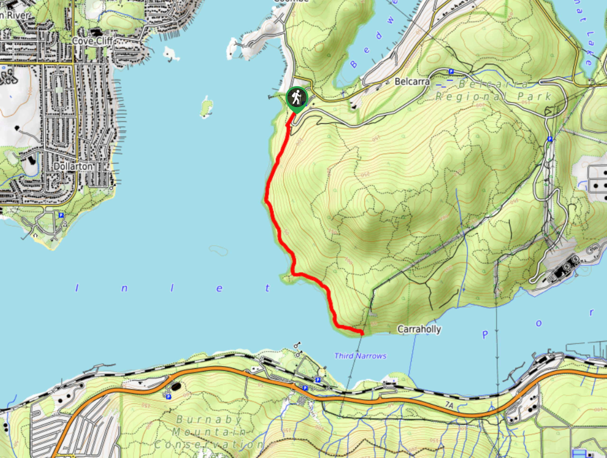
The Admiralty Point Trail is a short 3.3mi out-and-back hike that hugs the coast of the Burrard Inlet and offers beautiful views out over the water. Make your way along the trail to the various vantage points that allow you to see across the water to Burnaby Mountain and east toward Port Moody. Due to the easy nature of the trail, this is a great hike that the entire family can take part in.
Getting there
To get to the Admiralty Point trailhead from Coquitlam, head west on the Barnet Highway/BC-7A and take the exit for Ioco Road. Turn right, staying on Ioco Road for 2461ft, before turning left to continue on the same street. After the turn, keep on Ioco Road for 2.5mi and make a right turn onto 1st Avenue. Follow this for 2297ft, veering to the left to continue on Bedwell Bay Road for 1.1mi. Turn left onto Tum Tumay Whueton Drive, and in 2.5mi the parking area will be on your left.

About
| When to do | Year-Round |
| Backcountry Campsites | No |
| Pets allowed | Yes - On Leash |
| Family friendly | Yes |
| Route Signage | Average |
| Crowd Levels | High |
| Route Type | Out and back |
Admiralty Point Trail
Elevation Graph
Weather
Admiralty Point Trail Description
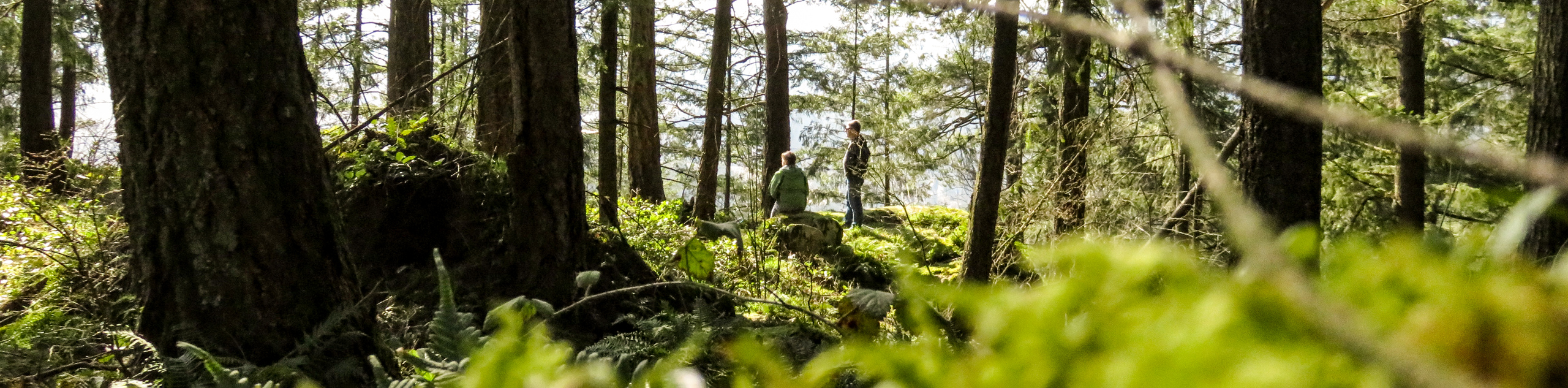
The Admiralty Point Trail can be busy during peak hours and on weekends, so make sure to arrive early to ensure you get a parking space and beat the crowds out to the viewpoints along the trail. This is a fairly short and easy route, making it suitable for families, but be aware of trail conditions, as sections of the route are covered in tree roots and rocks. This can make the trail difficult to traverse in wet conditions, so make sure to wear proper hiking footwear to navigate these more technical sections.
As mentioned, the Admiralty Point Trail is a perfect half-day hike for families, as the route is easy to navigate and offers many scenic views of the Burrard Inlet. After seeing the sights from Cod Rock, Admiralty Point, and Burns Point, head back along the trail to explore the area around Belcarra Bay, have a nice picnic, or enjoy the watersports that the area has to offer. With all of the shoreline sights packed into this short route, it is sure to be one that the entire family will enjoy.
Setting off from the parking lot, make your way to the washrooms near the Belcarra Picnic Area to pick up the Admiralty Point Trail, as it leads south through the forest. After a few minutes on the trail, you will approach a gravel road. Cross the road and pick the trail back up on the other side, as it begins a short climb uphill. This will level out quickly, descending down the backside of the hill, where you will get a nice view of the water through the trees.
From here, the trail will continue to hug the coastline, offering views of the Burrard Inlet and likely some passing boats before eventually reaching a vantage point known as Cod Rock. Take a few moments to soak up the views from the rocky outcrop, where you will have a sweeping sightline of the surrounding area and possibly the odd seal swimming in the waters below.
Continue back on the main trail for one kilometre, passing by Maple Beach on your right to get to a junction in the trail. Follow this short trail to the right to reach the multiple viewpoints of Admiralty Point that look out over the water as it splashes on the rocks. Make your way back to the main trail, turning right to continue on toward the final point of the hike.
Make your way through the trees and along the coastline for another kilometre, where you will reach the lookout at Burns Point. This offers a different vantage point of the water, with a view that stretches east toward Port Moody and Burnaby Mountain across the waters of the inlet.
After getting your fill of the sights, head back down along the trail as you make your way toward the picnic/parking area. From here, you can spread out and enjoy a nice picnic in the sun or explore the area around Belcarra Bay before returning to your car having completed the Admiralty Point Trail.
Hiking Route Highlights
Burrard Inlet
This shallow-sided coastal fjord was formed during the last Ice Age and has a convenient depth that allowed early ships to traverse its waters. This led to the waterway becoming a central hub in the region, with the creation of harbours at English Bay, Vancouver, and Port Moody.
Burnaby Mountain
Overlooking the arms of the Burrard Inlet, Burnaby Mountain is a low, forested mountain that is home to the Simon Fraser University Campus, as well as a conservation area.
Insider Hints
The trail can become muddy in wet weather. Wear proper hiking footwear to avoid slipping on roots or rocks.
Arrive early to secure parking and beat the crowds.
Bring a swimsuit and spend some time at Maple Beach, or take on some watersports in the area around Belcarra Bay.
Similar hikes to the Admiralty Point Trail hike

Trans Canada and Pandora Trail Loop
The Trans Canada and Pandora Trail Loop is a combination of several trails within the Burnaby Mountain Conservation Area that…
Quarry Trail
The Quarry Trail is a scenic hike through the beautiful wetlands of Minnekhada Regional Park that takes hikers to several…
DeBoville Slough to Addington Lookout
The hike along DeBoville Slough to Addington Marsh is an easy 6.0mi out-and-back trail along a paved path…
Comments