Pulpit Rock Trail
View Photos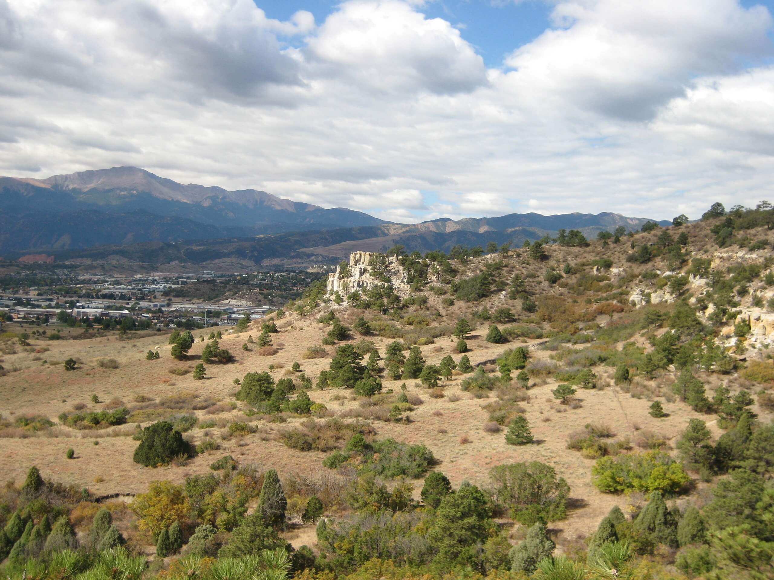
Pulpit Rock Trail
Difficulty Rating:
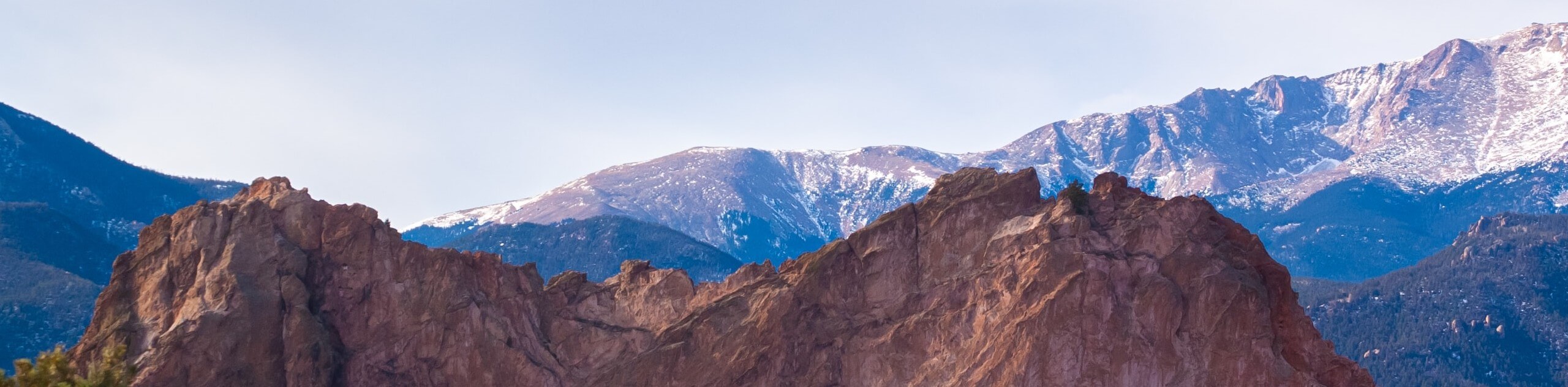
The Pulpit Rock Trail is an exciting adventure through the Austin Bluffs Open Space in Colorado Springs. One of the highest points in the city, the unique geological feature is in and of itself an epic view, but the vistas from the ridgeline are the cherry on top!
Getting there
The Pulpit Rock Trail departs from the Pulpit Rock Trailhead off North Nevada Avenue.

About
| Backcountry Campground | No |
| When to do | Year-round |
| Pets allowed | Yes - On Leash |
| Family friendly | Yes |
| Route Signage | Poor |
| Crowd Levels | High |
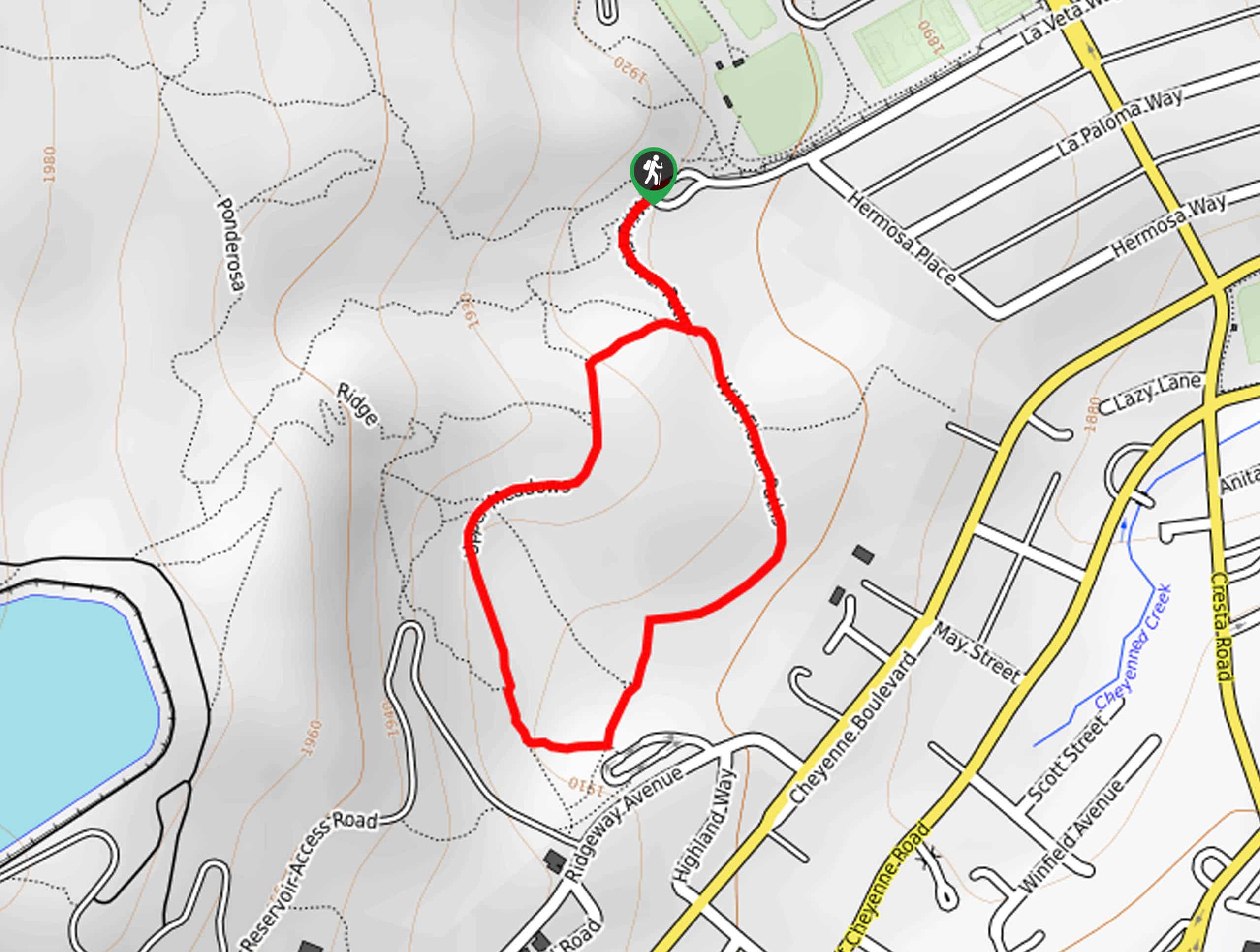
| Route Type | Lollipop |
Pulpit Rock Trail
Elevation Graph
Weather
Pulpit Rock Trail Description
Escape the hustle and bustle of the city as you venture the Pulpit Rock Trail. This amazing excursion presents the ideal opportunity to get some exercise as you wander through the Open Space and up the bluffs. Conveniently located near the city’s center, this is a popular weekend outing among locals and visitors alike, so you will likely have to share the path with fellow adventurers. Note that this area is not well signposted, so use the trail GPS to navigate the route easily. Accessible year-round, we suggest hiking this path in the spring, summer, and autumn as winter hikes present inherent dangers. However, if you are determined to get out in winter, we highly recommend microspikes to navigate the likely icy terrain safely.
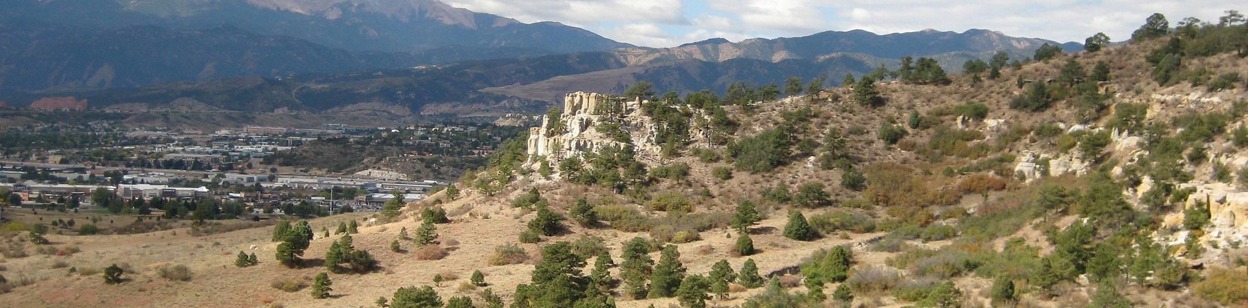
Delivering awe-inspiring vistas of the Rocky Mountains and the cityscape, the Pulpit Rock Hike is a must-do the next time you find yourself in Colorado Springs. Adventure the dirt path through luxuriant meadowlands, along creek beds, and mixed pine forestlands up to the ridgeline of the crags. Adventurous spirits will love exploring and scrambling up the pinnacles of Pulpit Rock for 360-degree panoramic views of the surrounding wilderness. Ideal for those seeking a fresh air escape, the Pulpit Rock Trail will surely impress as it exhibits the diversity and beauty of Colorado’s many topographies. Make sure to charge your camera—there are countless Instagram-able scenes along this trek.
Embark on your adventure along the Pulpit Rock Trail from the trailhead of North Nevada Avenue. From here, hike south along the Pulpit Rock Trail to an intersection. Adventurers can choose which direction they complete the circuit at the junction, but we prefer to trek clockwise. To head the same way we did, keep left, and you will be diverted onto the Pulpit Rock Loop Trail. Soon you will encounter another fork in the road, veer right and head south, hooking onto another branch of the Pulpit Rock Loop Trail. At this point, you will confront another junction, again track south, merging onto the Pulpit Rock Trail.
If you get off track, no worries, there are dozens of routes in this network of trails that lead to the Pulpit Rock. Continue along the marked path which will guide you west, nearing the impressive geological feature. At the next fork in the road, keep left and begin your ascent through sparse mixed pines and up to the ridge of Pulpit Rock. Hike up through the immense outcroppings to the overlook, which presents breathtaking views of the cityscape and the Front Range peaks that line the horizon. Revel in the views, then trek east along the ridgeline, navigating the spires and boulders that litter the trail.
As you continue your climb along the Pulpit Rock, you will pass several interesting formations, including some sculptures that resemble mushrooms; how fun! Following the same route, the path will begin to guide hikers down the eastern slope of the rock, back below the shade of the odd pine tree. Using the trail GPS, follow the Pulpit Rock Trail south before curving west, traveling along the base of the rock garden’s southern face. Now trekking through grasslands, you will pass several sports fields before reconnecting with the first intersection you encountered. At this point, you will want to keep left, retracing your footing back to the trailhead and parking lot.
Frequently Asked Questions
How long is the Pulpit Rock Trail?
The Pulpit Rock Trail is a 4.2mi circuit, but there are several paths within the Open Space; thus, the hike can be customized to your liking.
Are dogs permitted on the Pulpit Rock Trail?
Yes, dogs are permitted on the Pulpit Rock Trail if they remain on-leash.
Insider Hints
Head out in the early morning and on weekdays to mitigate the chances of a packed path and limited parking!
Be mindful of rattlesnakes in the summer months!
Wear a sunhat in the summer, the limited tree shade warrants extremely warm conditions!
For winter hikes, strap on a pair of microspikes to safely navigate the likely icy terrain along the ridgeline.
Head into Colorado Springs and grab a gold beverage at the Goat Patch Brewing Company after your trek.
Similar hikes to the Pulpit Rock Trail hike
Zook Loop
The Zook Loop is an awesome family-friendly nature walk that exhibits breathtaking panoramas of Cheyenne Mountain looming above. Explore the…
Wildflower Path and Upper Meadows Loop
The Wildflower Path and Upper Meadows Loop is a lovely nature walk through the Stratton Open Space. Immerse yourself in…
Ute and Niobrara Loop Trail
The Ute and Niobrara Loop Trail is an awesome adventure in the Garden of the Gods. Traveling along the outskirts…
Comments