Mount Cutler Trail
View Photos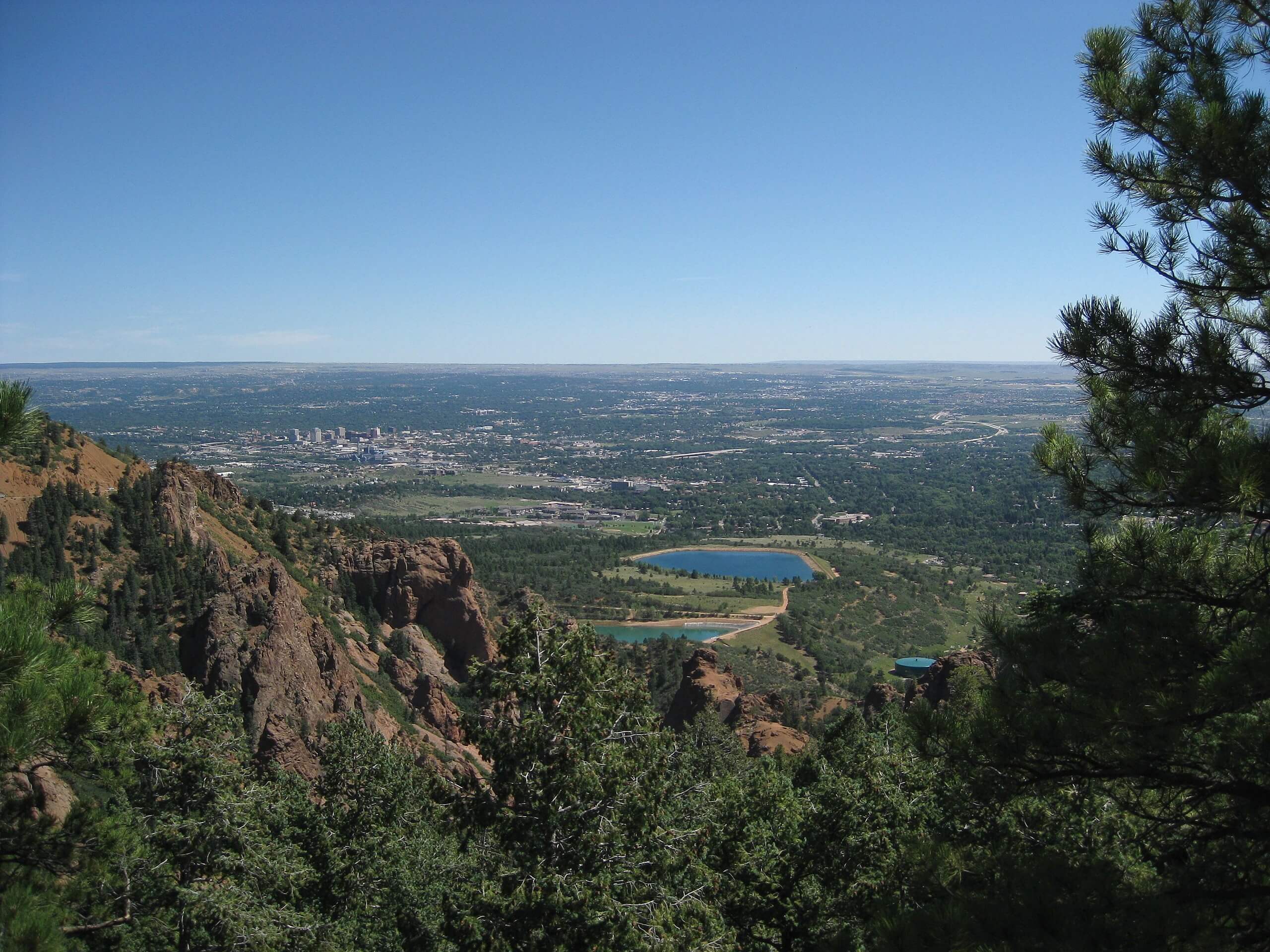
Mount Cutler Trail
Difficulty Rating:
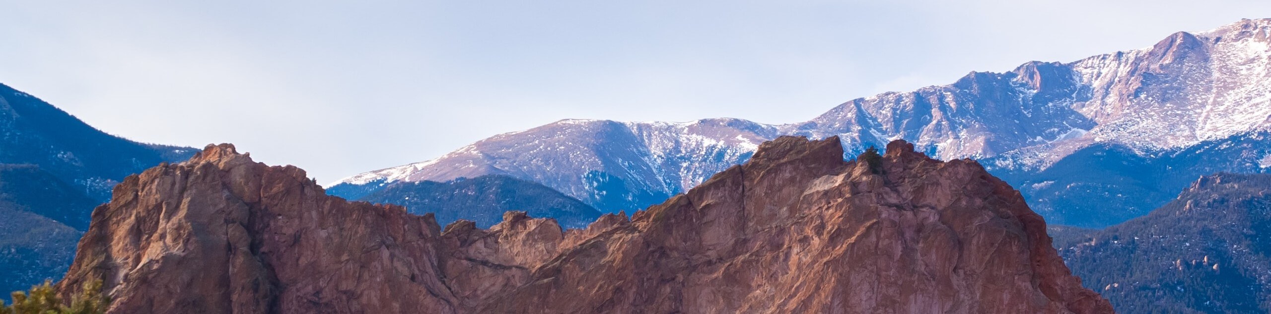
Ideal for families, low-landers, and those seeking a short but scenic adventure, the Mount Cutler Trail delivers. This easy-going nature walk to the 7231ft summit reveals some of the best vistas, including sights of the Front Range peaks, the foothills, Colorado Springs, and the Seven Falls. Chock-full of epic scenery, this family-friendly excursion is a must add to your adventure bucket list.
Getting there
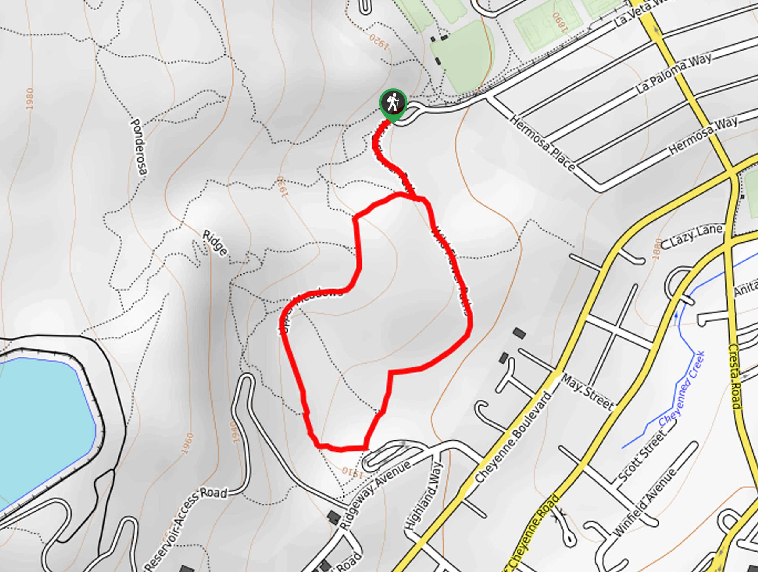
The Mount Cutler Trail is accessed via the trailhead off North Cheyenne Canyon Park Road.

About
| Backcountry Campground | No |
| When to do | Year-round |
| Pets allowed | Yes - On Leash |
| Family friendly | Yes |
| Route Signage | Good |
| Crowd Levels | High |
| Route Type | Out and back |
Mount Cutler Trail
Elevation Graph
Weather
Mount Cutler Trail Description
Boasting views usually reserved for technical summit ascents, the Mount Cutler Trail is an undeniably beautiful trek. A crowd favorite amongst visitors and locals alike, you can expect to share the path with like-minded adventurers. If you are seeking a walk in solitude, best consider another hike or an early morning excursion! Though family-friendly, this trek has sections, notably along the eastern and southern slopes near the summit, that are thin, rocky, and bounded by steep drop-offs. Mind your footing and keep children and dogs nearby. Lastly, if the small parking lot at the trailhead is full, you can park at either one of the Columbine Trailhead parking lots and walk to your starting point.
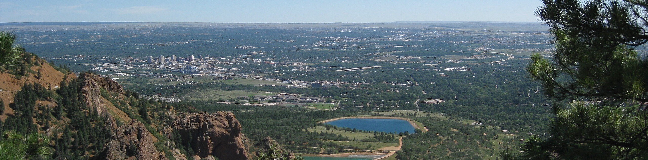
Manageable terrain, epic panoramas, and a good workout, the Mount Cutler Trail checks all the best boxes. Short, sweet, and steep, there is something to see every step of the way! As you travel up the rocky trail, the path will weave between stunning mixed pine forest and exposed terrain, which reveal diverse views of the Colorado landscape- from Front Range peaks, forested canyons, waterfalls, the Colorado Springs cityscape, and views of the plains. Packed with epic vistas, there is no question as to why this relaxing adventure is a crowd favorite.
Lace up your hiking shoes and begin your hike along the Mount Cutler Trail from the trailhead off of North Cheyenne Canyon Road. From here, head southeast along the Mount Cutler Trail, which will guide you below the tree shade of towering pines. This section of your hike will likely be busier as those planning to summit Mount Muscoco share the initial segment of the route. The path will eventually open as you trek, revealing views of Colorado Springs and the Gold Camp and South Suburban Reservoirs. Take the time to enjoy the vista of the cityscape, then continue hiking.
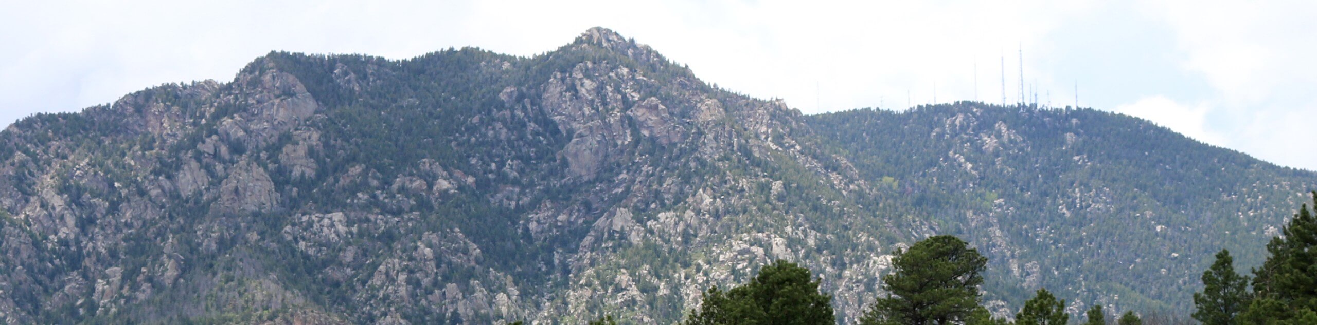
Soon after departing the eastern lookout, you will meet an intersection with the Mount Muscoco Trail. Keep left here, following the Mount Cutler Trail. Shortly after leaving the junction, the path will once again grant you stunning panoramas. You will be rewarded with views of the Seven Falls below and Cheyenne Mountain in the south from the western slope. Revel in the vistas the continue tracking the now increasingly rocky and vertiginous terrain to the summit of Mount Cutler.
As you revel in the panoramic sights from the peak, make sure to keep your distance from the cliffside and mind your footing on slippery rocks. After admiring the dramatic Colorado landscape, being your descent and retrace your footing along the route all the way back to the trailhead.
Frequently Asked Questions
Is there parking at the Mount Cutler Trailhead?
Yes, there is a small car park at the Mount Cutler Trailhead. This limited lot fills up fast, so best to arrive early!
How tall is Mount Cutler?
Mount Cutler is a 7231ft summit in North Cheyenne Cañon Park.
Insider Hints
After your hike take a trip to see the Helen Hunt Falls just up the road.
In the winter be sure to strap on some microspikes or snowshoes to navigate the slippery and snow-packed terrain.
Don’t forget your camera! This short walk is one of the most scenic—presenting countless photo opportunities.
Check out Jives Coffee Lounge after your trek and grab a coffee or sweet treat.
When hiking in the summer it is best to summit before noon to avoid getting caught in an afternoon thunderstorm.
Similar hikes to the Mount Cutler Trail hike
Zook Loop
The Zook Loop is an awesome family-friendly nature walk that exhibits breathtaking panoramas of Cheyenne Mountain looming above. Explore the…
Wildflower Path and Upper Meadows Loop
The Wildflower Path and Upper Meadows Loop is a lovely nature walk through the Stratton Open Space. Immerse yourself in…
Ute and Niobrara Loop Trail
The Ute and Niobrara Loop Trail is an awesome adventure in the Garden of the Gods. Traveling along the outskirts…
Comments