Austin Bluffs and Pulpit Ridge Trail
View Photos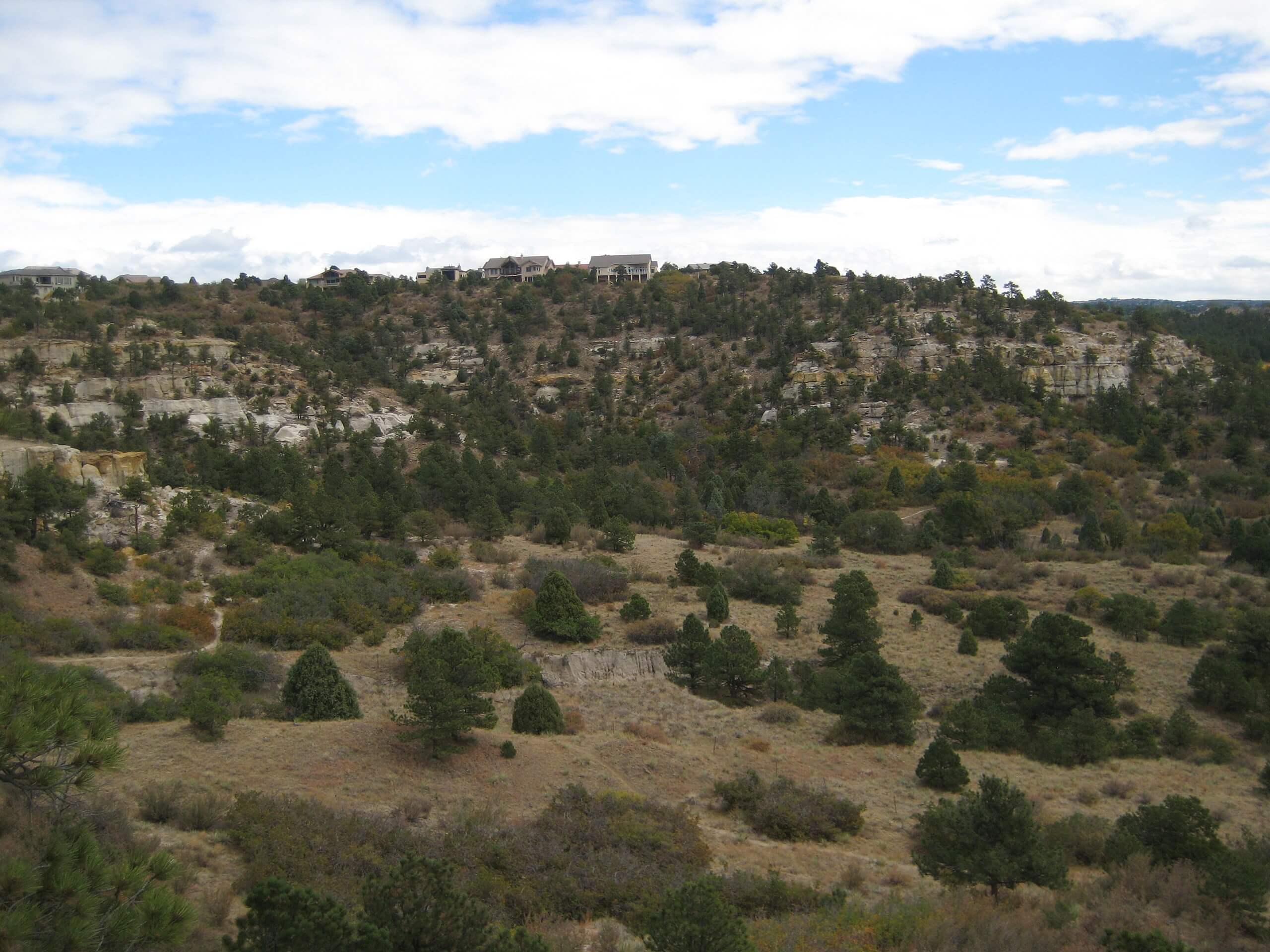
Austin Bluffs and Pulpit Ridge Trail
Difficulty Rating:
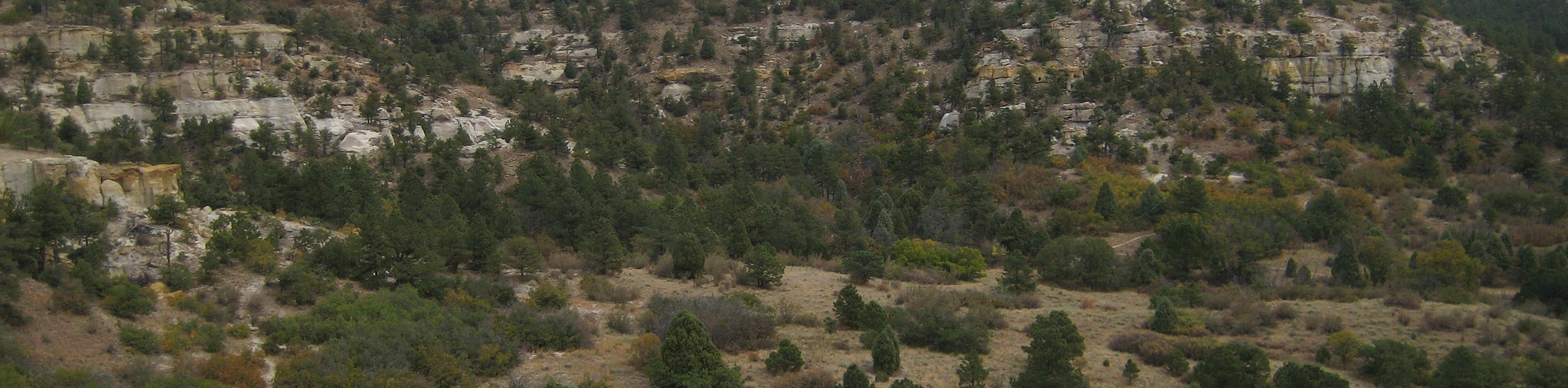
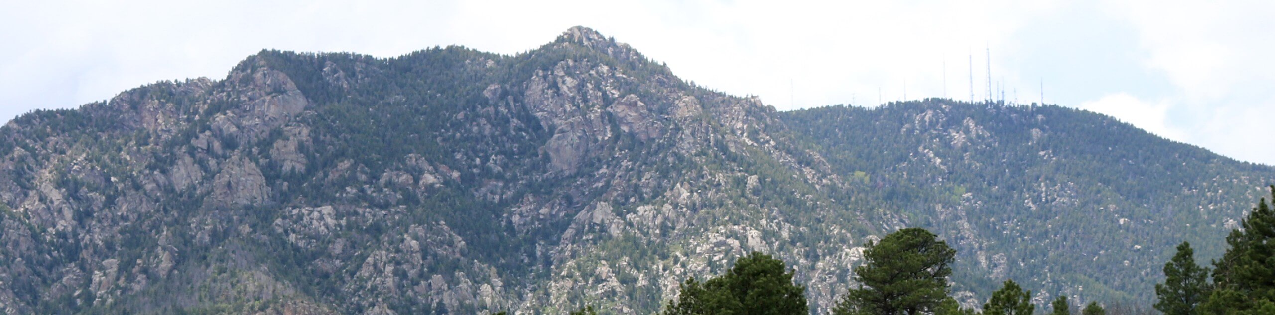
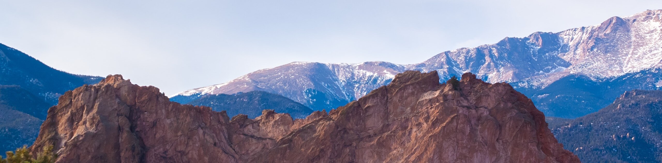
The Austin Bluffs and Pulpit Ridge Trail is a lovely adventure through the Austin Bluffs Open Space to the unique geological feature that is the Pulpit Rock. Traveling through meadowlands and mixed pine forests, the pièce de résistance is the craggy rock feature that protrudes from the landscape.
Getting there
The Austin Bluffs and Pulpit Ridge Trail is accessed via the trailhead off University Park Boulevard.

About
| Backcountry Campground | No |
| When to do | Year-round |
| Pets allowed | Yes - On Leash |
| Family friendly | Yes |
| Route Signage | Poor |
| Crowd Levels | Moderate |
| Route Type | Lollipop |
Austin Bluffs and Pulpit Ridge Trail
Elevation Graph
Weather
Austin Bluffs and Pulpit Ridge Trail Description
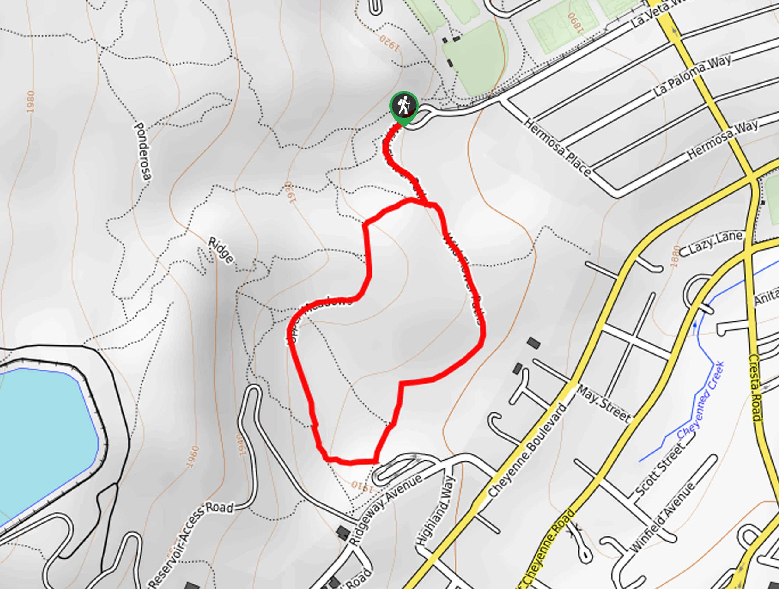
The Austin Bluffs and Pulpit Ridge Hike is a charming adventure in Colorado Springs that exhibits the beauty and diversity of Colorado’s topographies. Wander through luxuriant grasslands, mixed pine forests, and up the rocky outcropping, which reveals expansive vistas of the cityscape and the Front Range summits that line the horizon. Note that the trek up to Pulpit Rock’s ridgeline is steep and rocky, so mind your footing! Additionally, the trail is not well signposted and confusing, so use the trail GPS to easily navigate the route.
Begin your adventure along the Austin Bluffs and Pulpit Ridge Trail from the trailhead off University Park Boulevard. From here, head southwest along the Pulpit Rock Trail. Ignore intersection routes and continue along this path using the trail GPS; you will soon be guided northwest. The Pulpit Rock Trail will eventually reach the south side of the ridge. Climb up the southern slope through the rocky outcroppings up to the ridgeline.
Soon you will meet your turnaround point on the west side of the rock. From here, head east, along the northern side of the ridgeline. This route will weave through the landscape, ultimately leading you south, back to the initial intersection. Here, keep left and retrace your footing back to the trailhead.
Similar hikes to the Austin Bluffs and Pulpit Ridge Trail hike
Zook Loop
The Zook Loop is an awesome family-friendly nature walk that exhibits breathtaking panoramas of Cheyenne Mountain looming above. Explore the…
Wildflower Path and Upper Meadows Loop
The Wildflower Path and Upper Meadows Loop is a lovely nature walk through the Stratton Open Space. Immerse yourself in…
Ute and Niobrara Loop Trail
The Ute and Niobrara Loop Trail is an awesome adventure in the Garden of the Gods. Traveling along the outskirts…
Comments