
The Wildcat Trail
View Photos
The Wildcat Trail
Difficulty Rating:
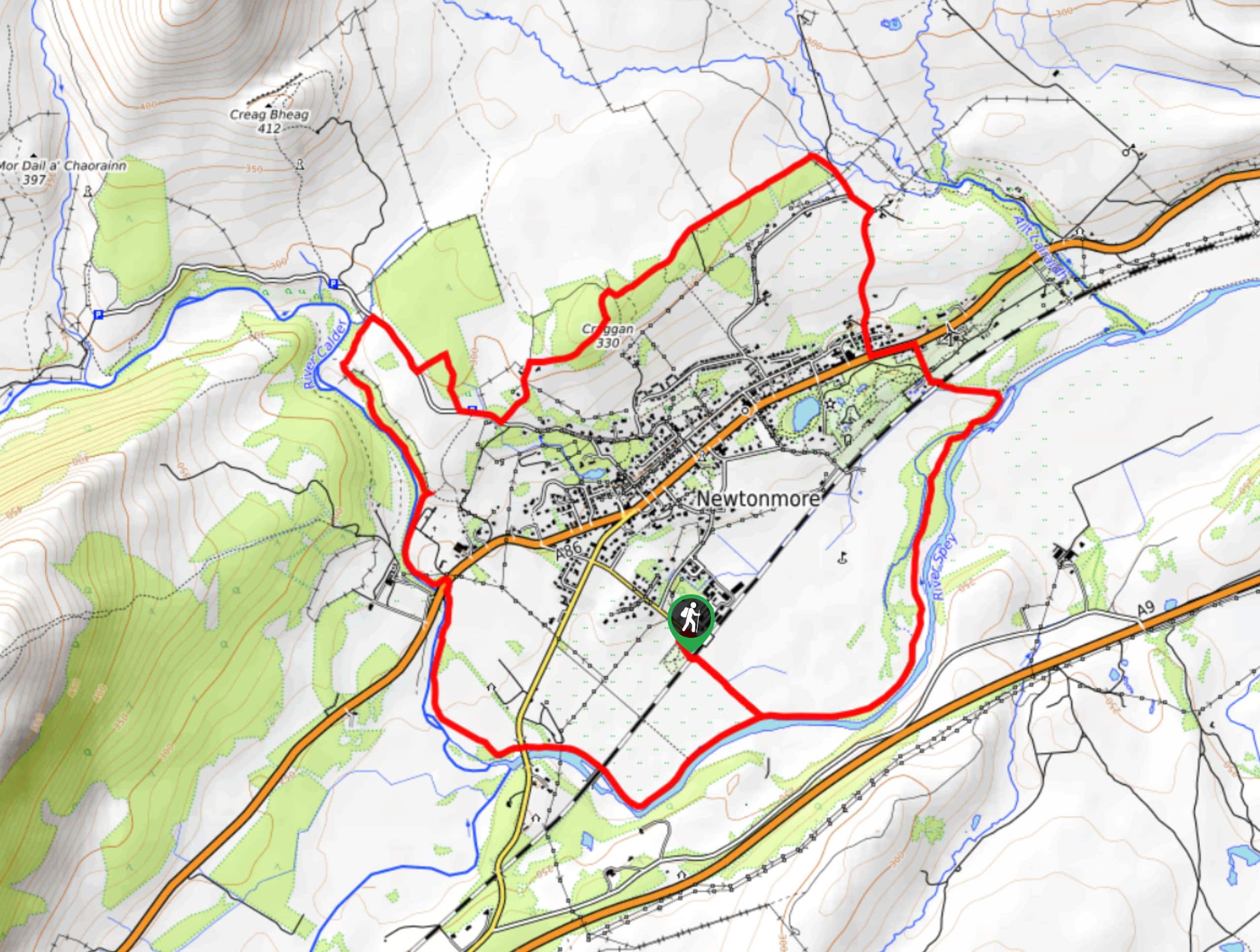
The Wildcat Trail is a fun family-friendly walking route in Cairngorms National Park that will lead you around the village of Newtonmore. While out on the trail, you will climb uphill to traverse the rugged hills to the north, before looping around the village along the winding banks of the River Spey. This is a fantastic activity to do if you are looking to take in the beauty of the highlands without much in the way of difficulty.
Getting there
The trailhead for the Wildcat Trail can be found at the car park on Glen Road.

About
| Backcountry Campground | No |
| When to do | Year-Round |
| Pets allowed | Yes - On Leash |
| Family friendly | Yes |
| Route Signage | Average |
| Crowd Levels | Moderate |
| Route Type | Lollipop |
The Wildcat Trail
Elevation Graph
Weather
The Wildcat Trail Description
If you are wanting to explore the beauty of Cairngorms National Park but don’t want to commit to a longer and more challenging adventure, the Wildcat Trail is a great compromise that offers some beautiful views and fun terrain, all without straying too far from town.
Setting out from the car park in the heart of Newtonmore, you will follow Glen road to the northwest to leave the village behind, before breaking off to the right to explore the forests surrounding Craggan. Heading to the east, you will traverse the hilly terrain until you reach the banks of Allt Lairaidh, at which point you will follow the water southeast until it meets the River Spey.
Here, you will meander along the winding banks of the river to the southwest, looping around Newtonmore and the picturesque countryside surrounding it until you arrive at a fork in the river where the River Spey and River Calder converge. Keep right along the Calder and follow it north, taking in the beauty of the riverside setting before arriving at the edge of Glenbanchor Road. Turning right here, you will follow the road to the southeast to arrive back at the car park where you began.
Similar hikes to the The Wildcat Trail hike

Loch an Eilein, Loch Gamhna, Old Logging Way Loop
The Loch an Eilein, Loch Gamhna, Old Logging Way Loop is a wonderful walking trail in Cairngorms National Park that…
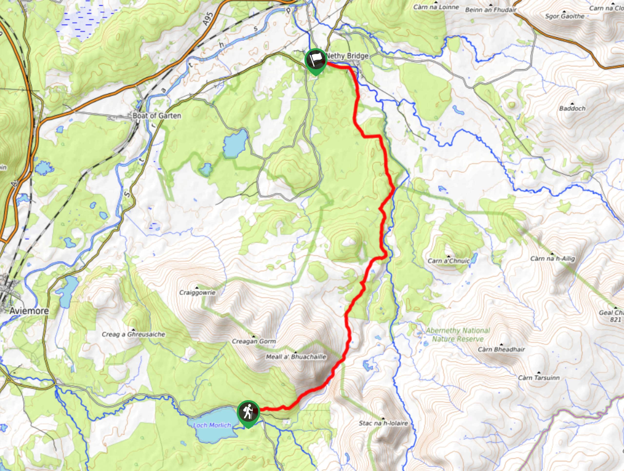
Loch Morlich to Nethy Bridge Walk
The Loch Morlich to Nethy Bridge Walk is a fun one-way trail in Cairngorms National Park that will lead you…
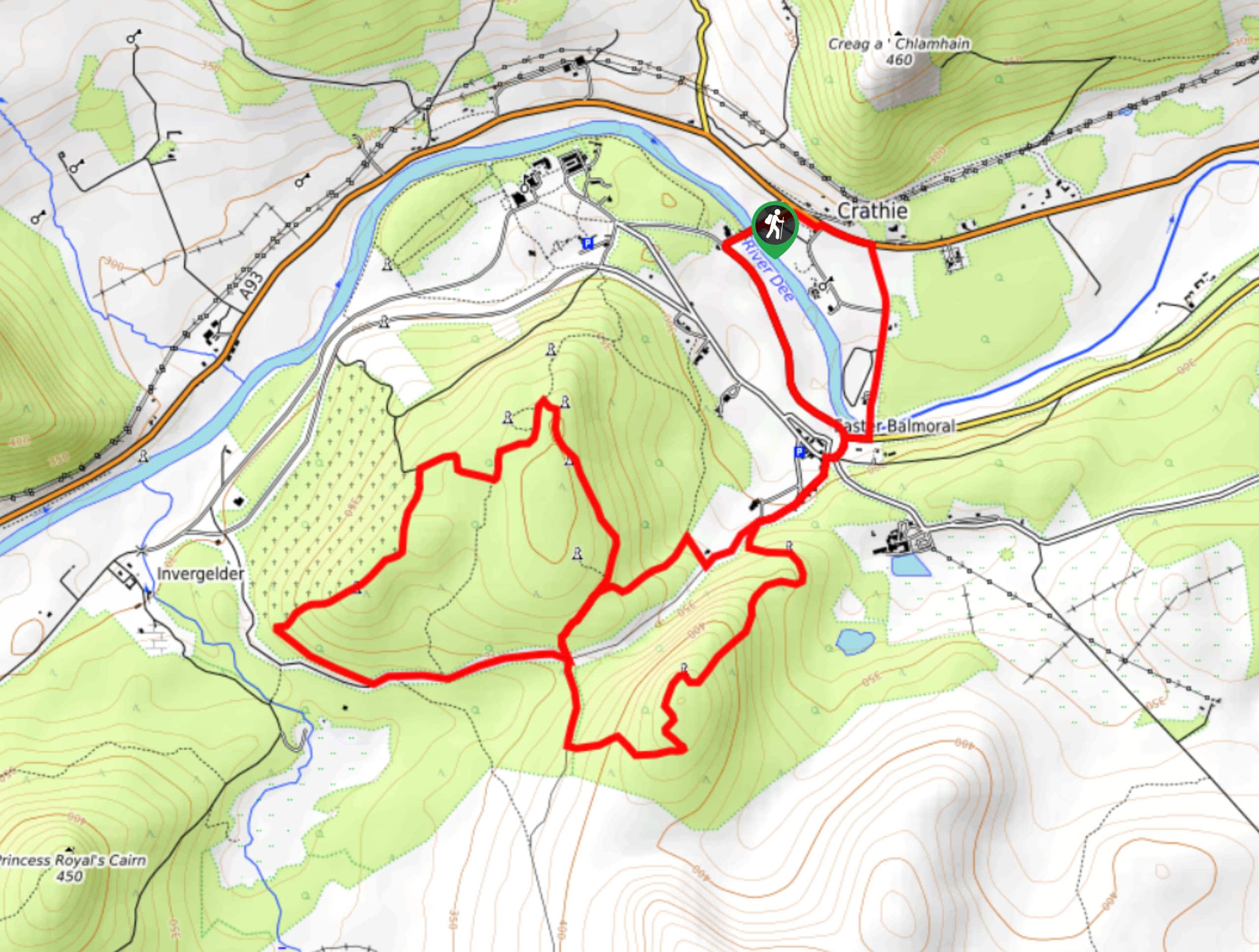
Crathie, Easter Balmoral and Cairns Circular Walk
The Crathie, Easter Balmoral, and Cairns Circular is a wonderful adventure in Cairngorms National Park that will see you explore…
Comments