
Dava Way: Dunphail to Forres
View Photos
Dava Way: Dunphail to Forres
Difficulty Rating:
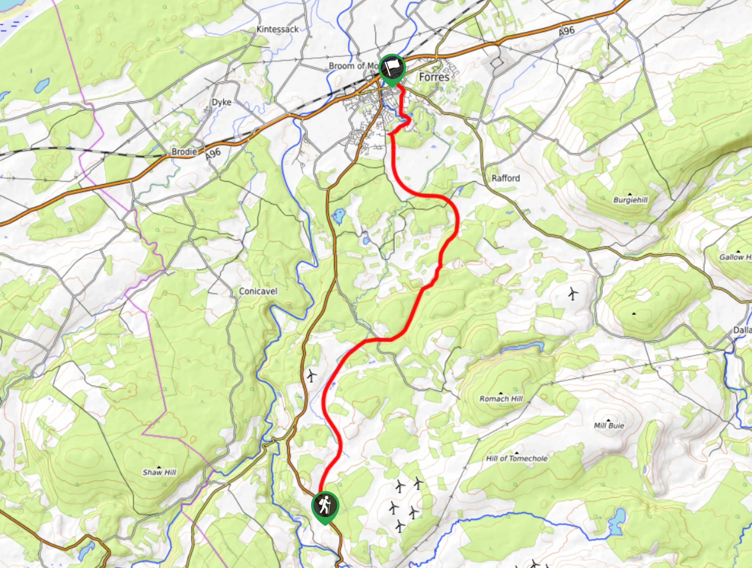
The Dava Way: Dunphail to Forres is a joyful 8.8mi through a scenic landscape made up of woods and expansive pastures. As the final section of the 23.6mi full Dava Way, this walk follows in the footsteps of the previous two sections, following an old railway line through peaceful and remote areas. Views from an extensive embankment along the route are spectacular and the walk wraps up in the attractive town of Forres, where you’ll have no trouble finding a refreshing pint and a bite to eat after finishing up.
Getting there
To get to the Dava Way: Dunphail to Forres from nearby Aviemore, follow Dalnabay and Dalfaber Dr to Grampian Rd/B9152 and continue 0.1mi. Follow A95 and A939 to A940 in Moray and continue 28.0mi to reach Edinkillie Community Hall where the walk begins.

About
| Backcountry Campground | No |
| When to do | Year-round access |
| Pets allowed | Yes |
| Family friendly | Yes |
| Route Signage | Good |
| Crowd Levels | Moderate |
| Route Type | One Way |
Dava Way: Dunphail to Forres
Elevation Graph
Weather
Dava to Dunphail Trail Description
The Dava Way: Dunphail to Forres is the final stage of the complete Dava Way and is a great walk for all skill levels due to its level paths and tracks and straightforward navigation along the old railway. Some muddy sections make waterproof shoes a good idea for this route and a signed diversion is something to keep an eye out for. An iron bridge crossing above the Altyre Burn may not appeal to those with a significant fear of heights.
Pleasant woods and peaceful pastures make for a great escape into the peaceful countryside and the Dallas Dhu Distillery dating to 1899 is the perfect place to top the walk-off in lovely Forres.
To begin the walk, depart the parking lot found beside the Edinkillie Community Hall and join the Dava Way at the back of the picnic area located here. Pick up the route by turning left to join the old railway line and continue beneath the stone arch bridge. You’ll likely find yourself in the company of several bovine friends as you pass through extensive grazing lands.
A low embankment continues to pave the way to Forres towards Cowgreens Wood which is reached after just under 3.0mi on this stretch. Continue to follow the markers as you’re led across a small road and then over the Altyre Burn via an iron bridge. Later on, pass beneath the arch of Scurrpool bridge before leaving the old railway line beyond you to make your way up the steps to your left, found just after the Squirrel Neuk bridge.
After following waymarkers to rejoin the railway, continue along another embankment where you’ll enjoy brilliant views across the sprawling countryside. Another bridge soon takes you over Rafford road before you join a path on the right that is signed.
You’ll soon spot the famous Dallas Dhu distillery, a top attraction in the area and a nod to traditional distilling. Continue to trace the railway line until you reach a ramp that leads up Mannachie Avenue, marking your arrival in the outskirts of Forres. Up ahead you’ll continue past the school and later join the main street into Forres where the final section of the Dava Way comes to an end.
Similar hikes to the Dava Way: Dunphail to Forres hike

Loch an Eilein, Loch Gamhna, Old Logging Way Loop
The Loch an Eilein, Loch Gamhna, Old Logging Way Loop is a wonderful walking trail in Cairngorms National Park that…
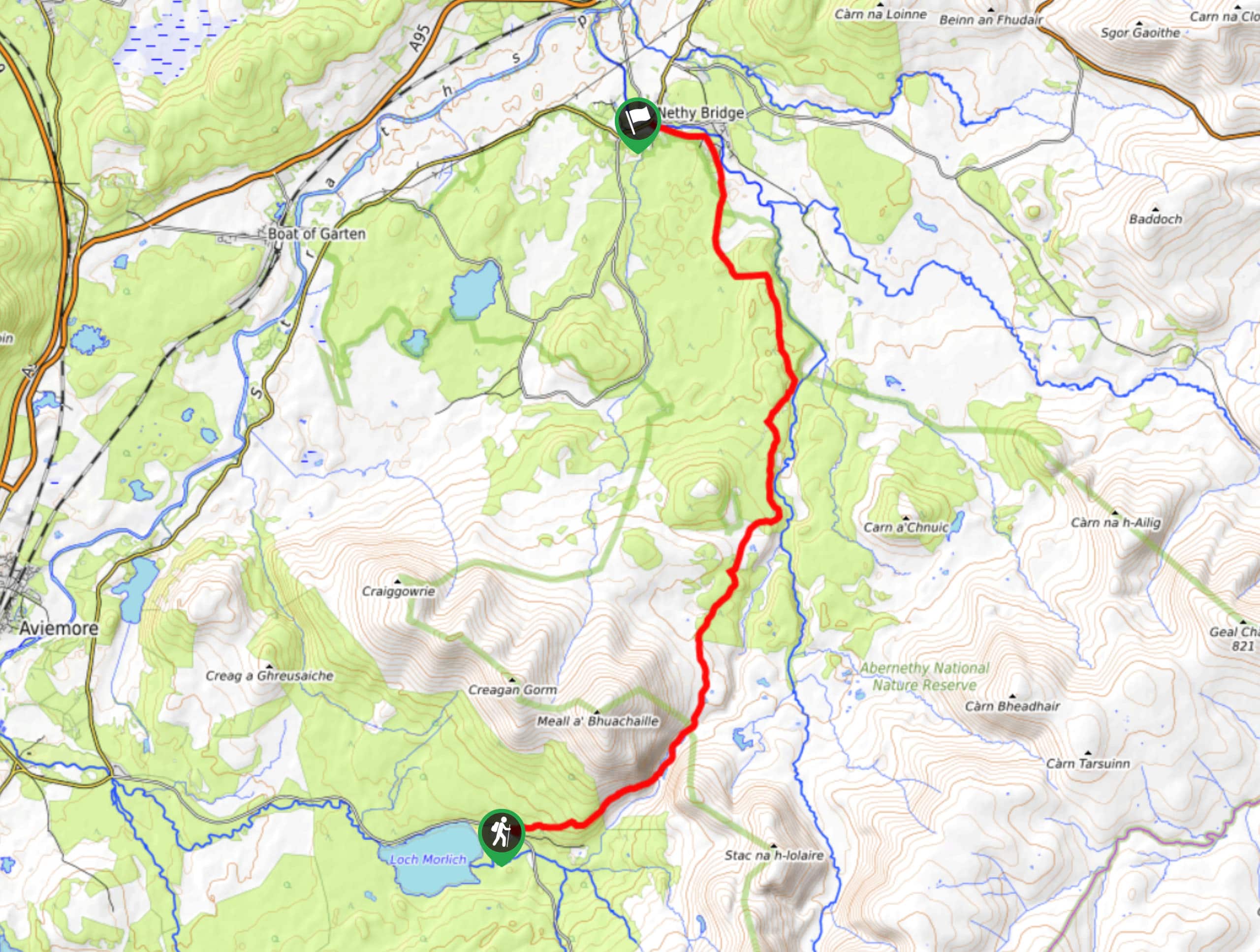
Loch Morlich to Nethy Bridge Walk
The Loch Morlich to Nethy Bridge Walk is a fun one-way trail in Cairngorms National Park that will lead you…
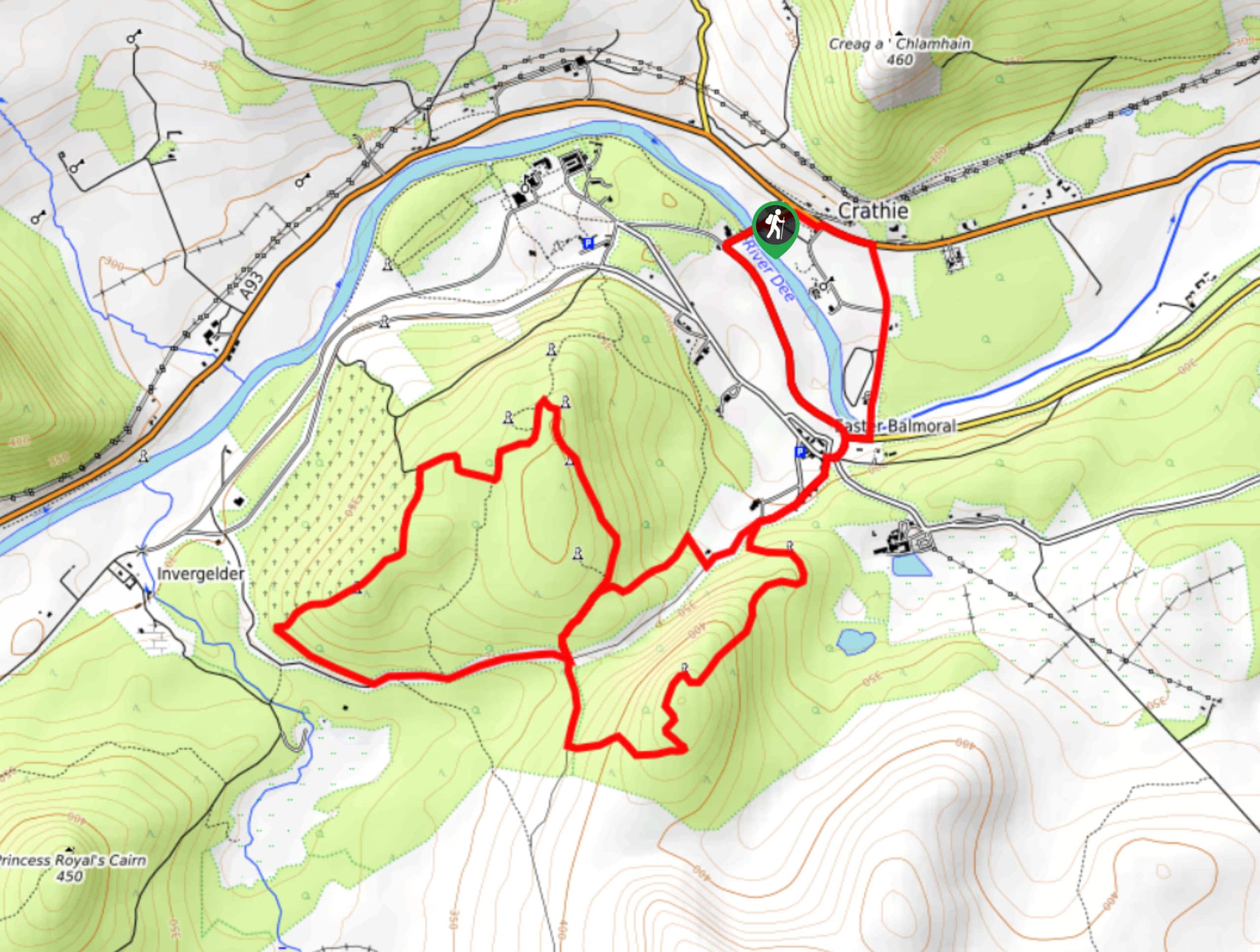
Crathie, Easter Balmoral and Cairns Circular Walk
The Crathie, Easter Balmoral, and Cairns Circular is a wonderful adventure in Cairngorms National Park that will see you explore…
Comments