Spray River Loop hike
View Photos
Spray River Loop hike
Difficulty Rating:
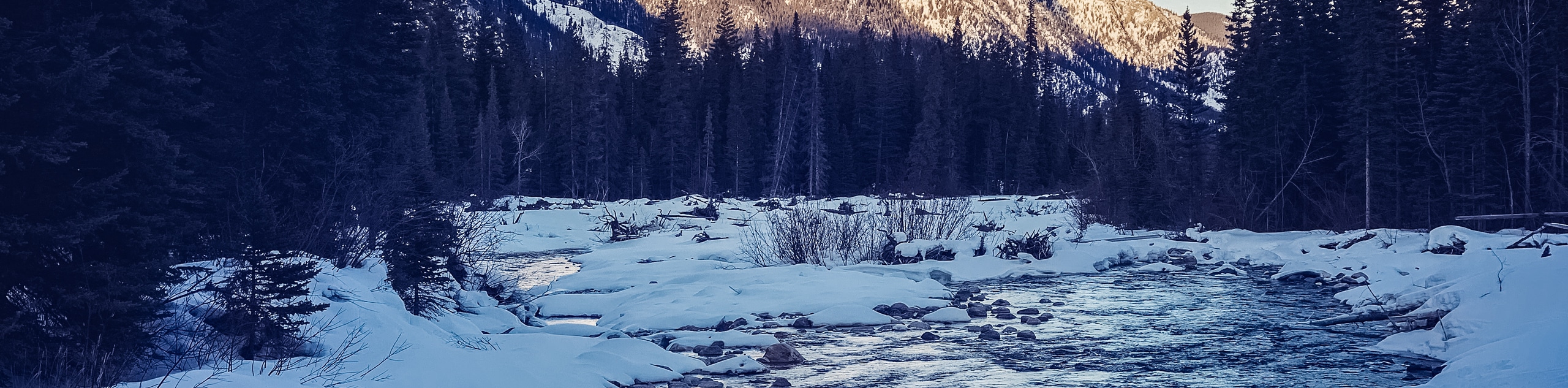
The Spray Loop is surprisingly scenic for a trail that remains in the valley bottom. You will cross the Spray River and be able to admire incredible mountain views intermittently throughout the loop. Escape the crowds on the Spray Loop as you aren’t likely to encounter many others.
Getting there
To get to the Spray River Loop parking lot, head south on Banff Avenue from the Town of Banff and cross the Bow River Bridge. Cross the bridge and turn left onto Glen Avenue. Continue straight through the lights and again through the second set of lights where Glen Ave will become Spray Avenue. You will arrive at the Fairmont Banff Springs Hotel, and the road will end in a traffic circle. Take the traffic circle and immediately turn right, passing under a pedestrian bridge. Continue for 328ft beyond the hotel parking, and you will come to a parking lot for Spray West trails. This is your trailhead.

About
| When to do | May-October |
| Backcountry Campsites | SP6 Parks Canada |
| Pets allowed | Yes - On Leash |
| Family friendly | Yes |
| Route Signage | Average |
| Crowd Levels | Moderate |
| Route Type | Circuit |
Spray River Loop
Elevation Graph
Weather
Spray Loop Trail Description
The Spray Loop is a multi-use trail that travels 7.6mi around the Spray River. There is an easily accessible backcountry campground on the east side that is perfect for families. This can be booked through Parks Canada’s reservation system.
The trail isn’t replete with jaw-dropping views like some of the high alpine hikes in the park, but it has some clearings with stunning views, and the crystal-clear blue waters of the Spray River remain in view for the duration of the hike.
Beginning at the Spray West parking lot, hike along the old fire road at a moderate grade for 3.5mi. Here, you will come to the Goat Creek junction where the Spray Loop crosses the river and heads back the opposite way. There is a covered bench area that is perfect for lunch or a break. You can sit by the riverbank as well and enjoy views of Mount Rundle high above.
Cross the bridge and return on the other side of the river. This side of the trail is narrower, so watch for cyclists. In a few hundred metres, you will come across the backcountry campground on your right. Continue along the trail until you reach a small junction 2.9mi from the bridge you crossed. You may choose to go right here, crossing a small bridge and meeting up with the beginning of the Spray Loop to return to the car. You may also continue straight, ending at the Banff Springs Golf Course. Add a bit of distance here by taking a left on the golf course road, crossing the bridge and walking up to the left, past the Waldhaus restaurant and up the stair set to the parking lot area where you began.
Similar hikes to the Spray River Loop hike
Rundle Riverside Trail
The straightforward Rundle Riverside trail is an easy to follow trail that connects Banff to Canmore. It is a great…
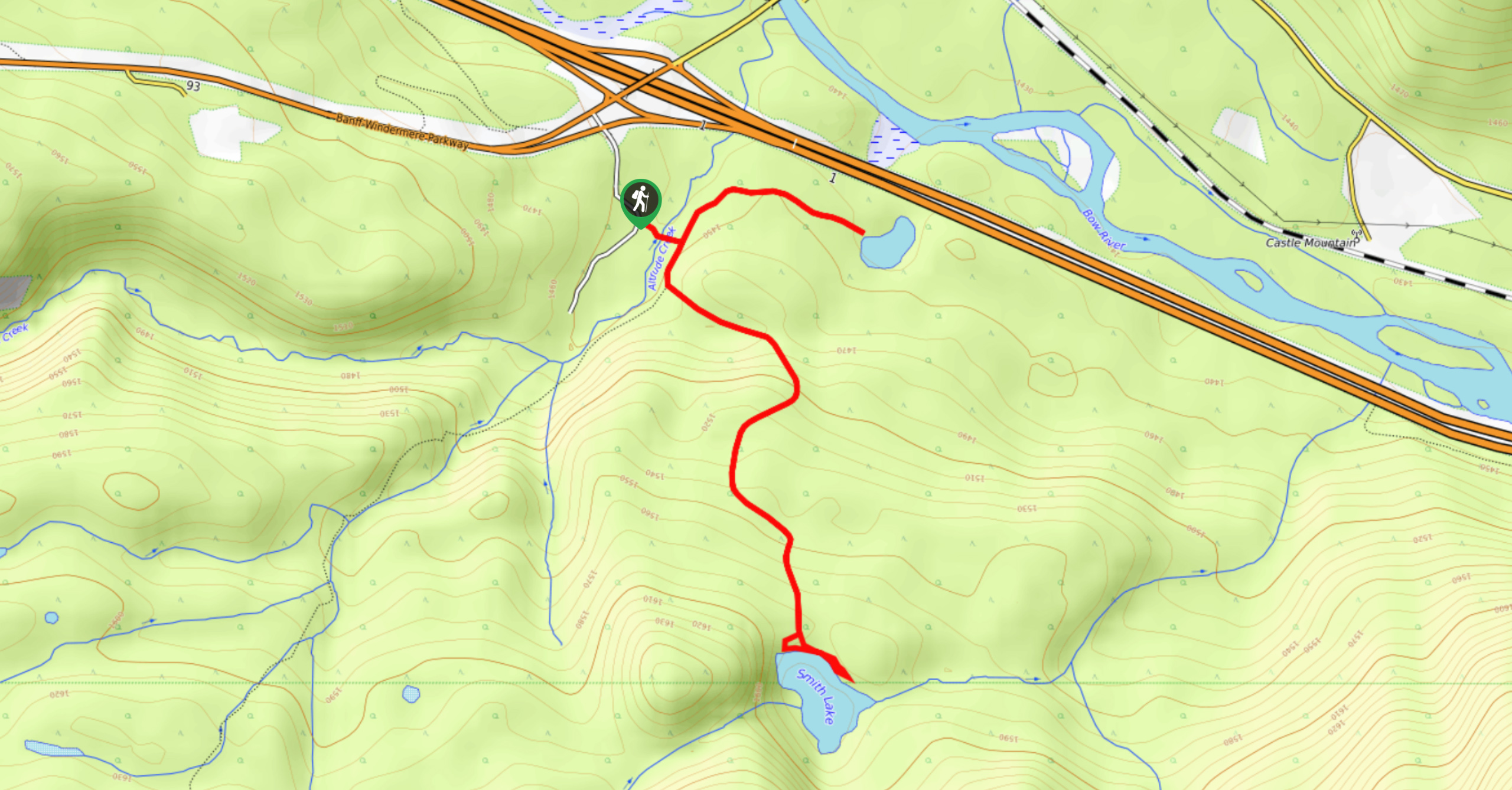
Smith Lake Trail
Smith Lake is an often-forgotten lake that is nestled in the forest at Castle Junction. It is a stunning green-blue…
Healy Creek Trail
Hiking along Healy Creek Trail is an enjoyable route wide enough for a stroller or chariot. This hike can be…
Comments