Monte Comune hike
View Photos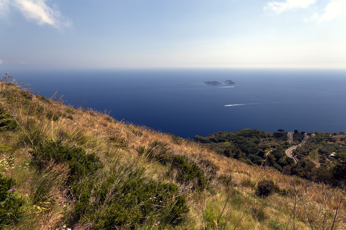
Monte Comune hike
Difficulty Rating:
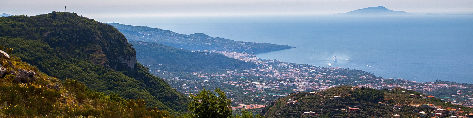
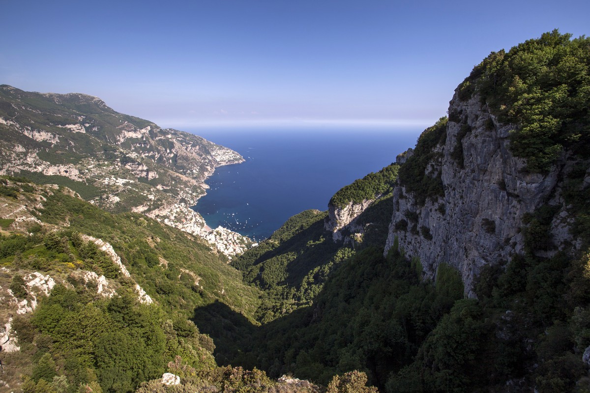
Being one of the longer hikes in the Sorrentine Peninsula, this trail provides wonderful and unique views, going from the Sorrento Coast to Positano. This walk is a fantastic way to spend a day.
Getting there
Coming from Sorrento, go to Piano di Sorrento via the SS163 highway, called "Amalfi Drive." Turn left onto Via San Pietro when you see the Hotel Royal Hills on your left. You’ll find parking around this area.

About
| When to do | March to November |
| Backcountry Campsites | No |
| Toilets | No |
| Family friendly | No |
| Route Signage | None |
| Crowd Levels | Low |
| Route Type | Out and back |
Monte Comune
Elevation Graph
Weather
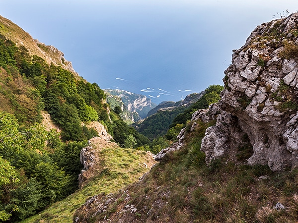
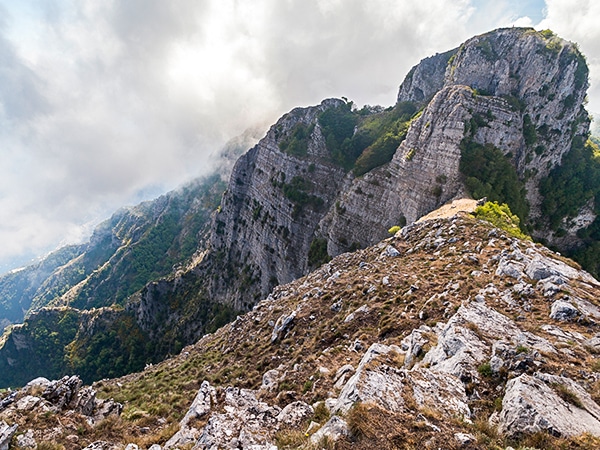
Route Description for Monte Comune
In the spring, the path on the Monte Comune hike is often difficult to see as there are lots of wildflowers and ferns that cover the path. By summer the heat usually burns some of them away and the path gets clearer yet part of the trail can stay covered by the foliage all year long.
Your hike will start at the end of Via San Pietro. You will face “Castello Colonna”. This was a 13th century medieval abbey, which now has become a reception room. Enter the gates and follow the unpaved path on the right (You are allowed to enter because the trail goes through the manor’s grounds).
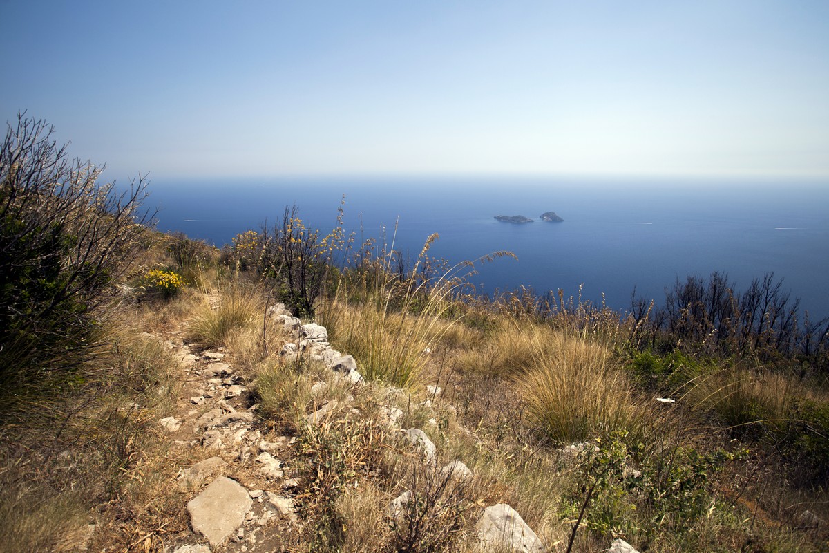
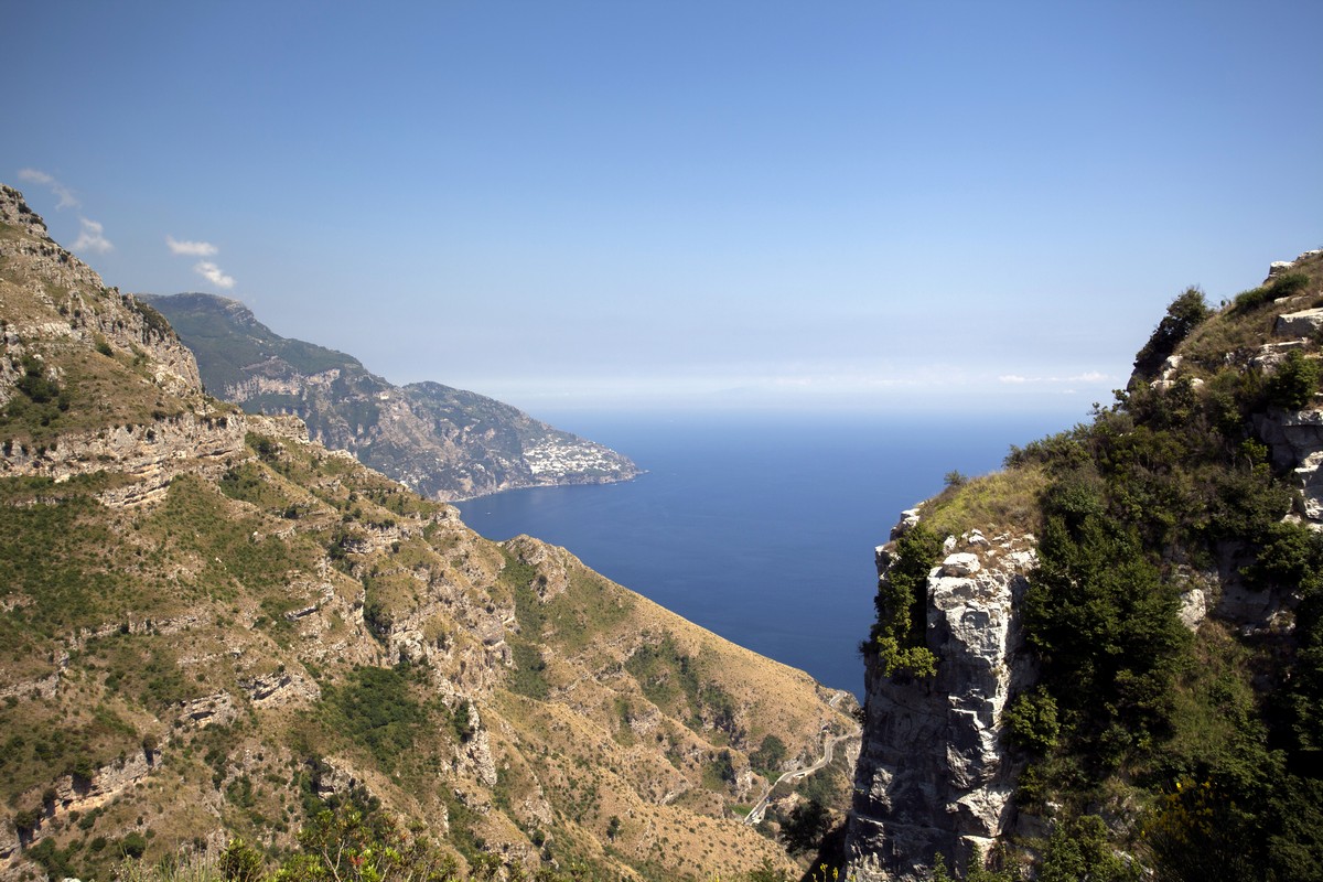
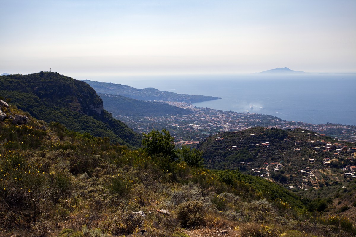
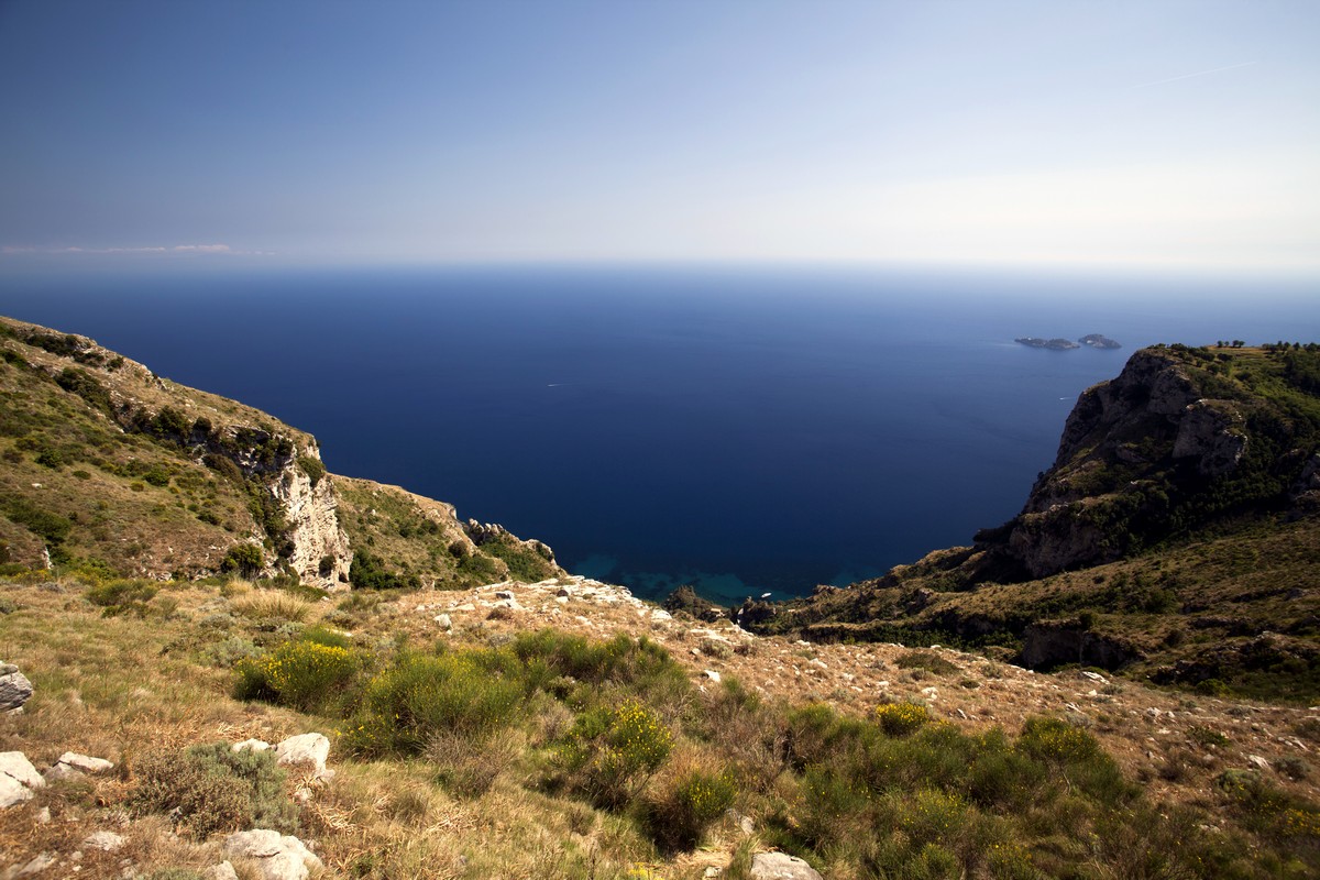
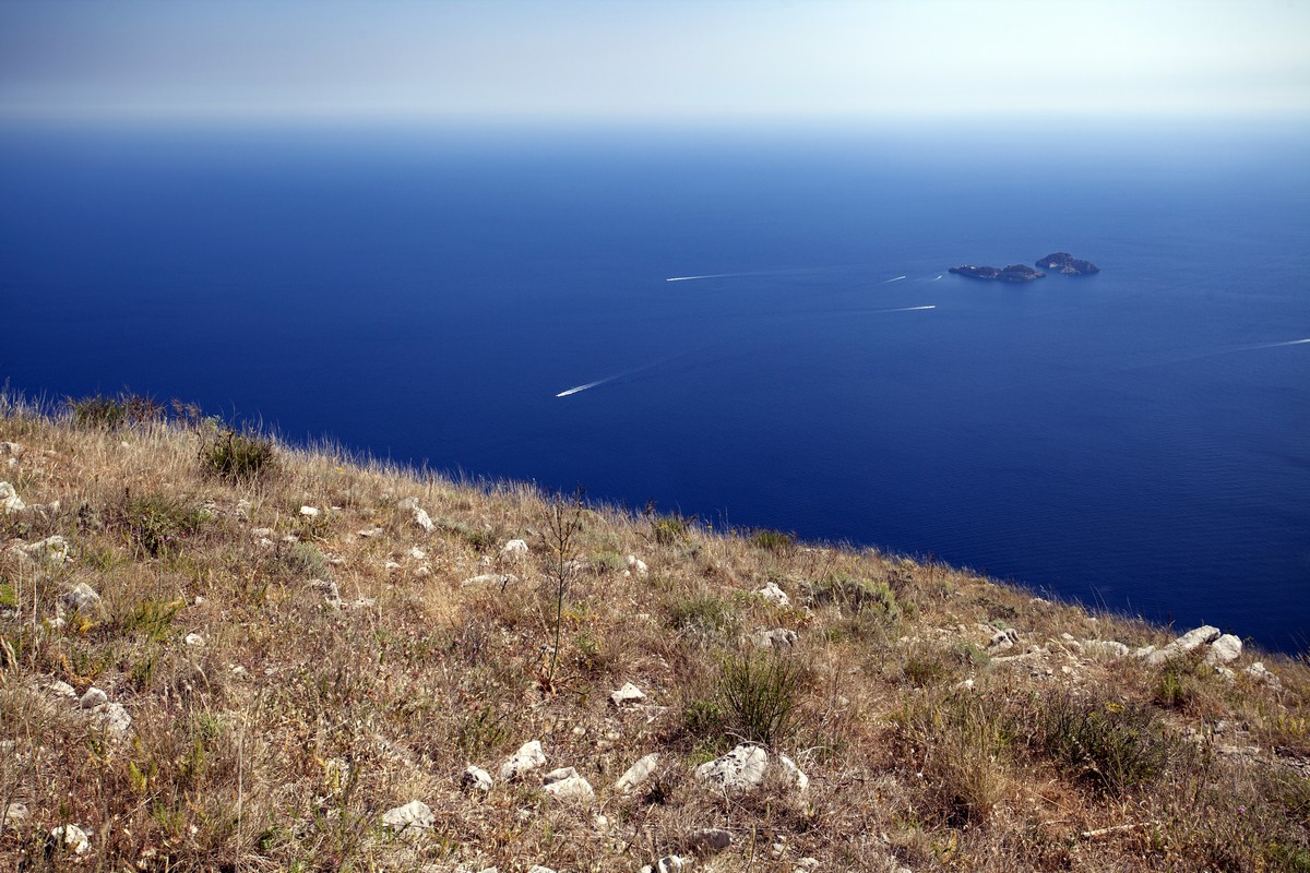
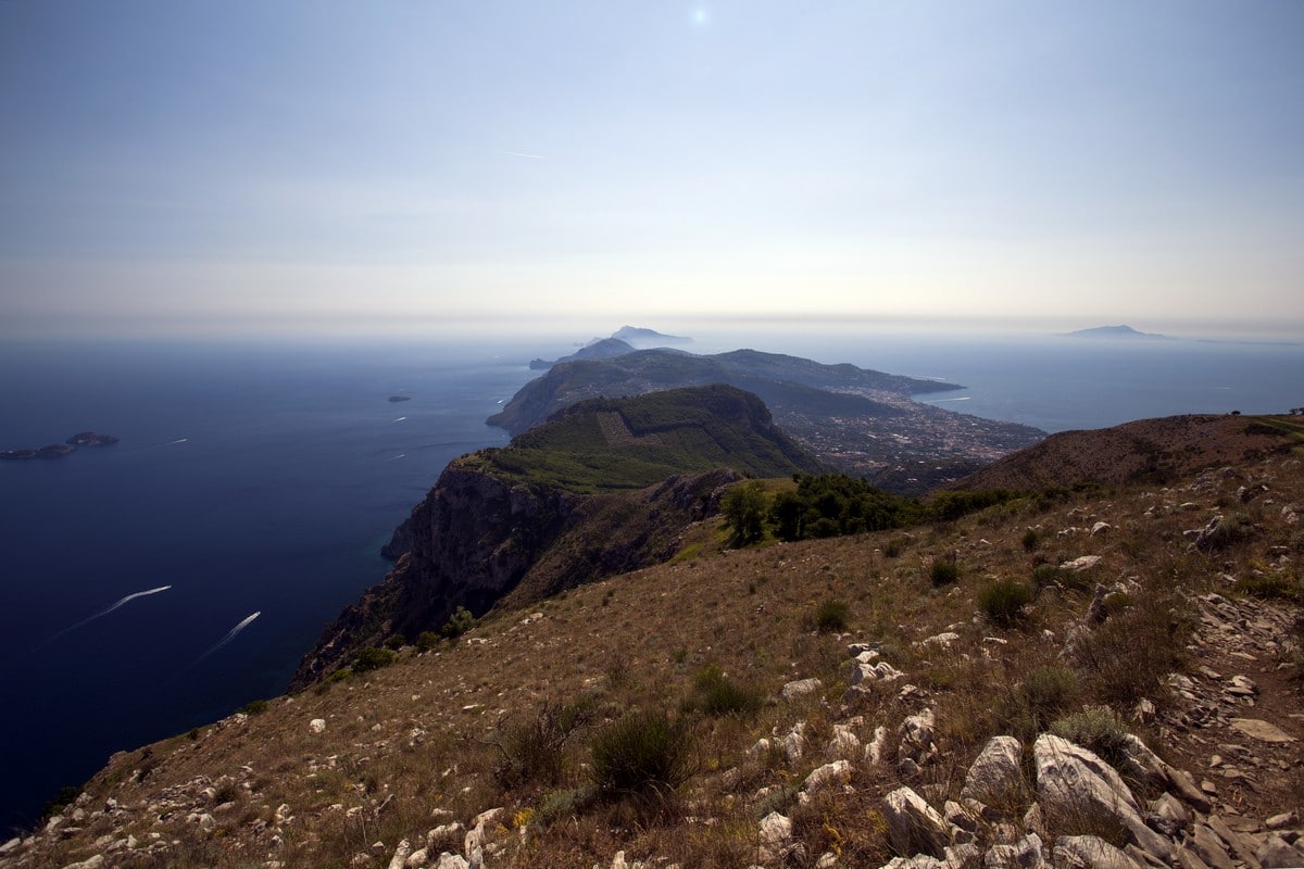
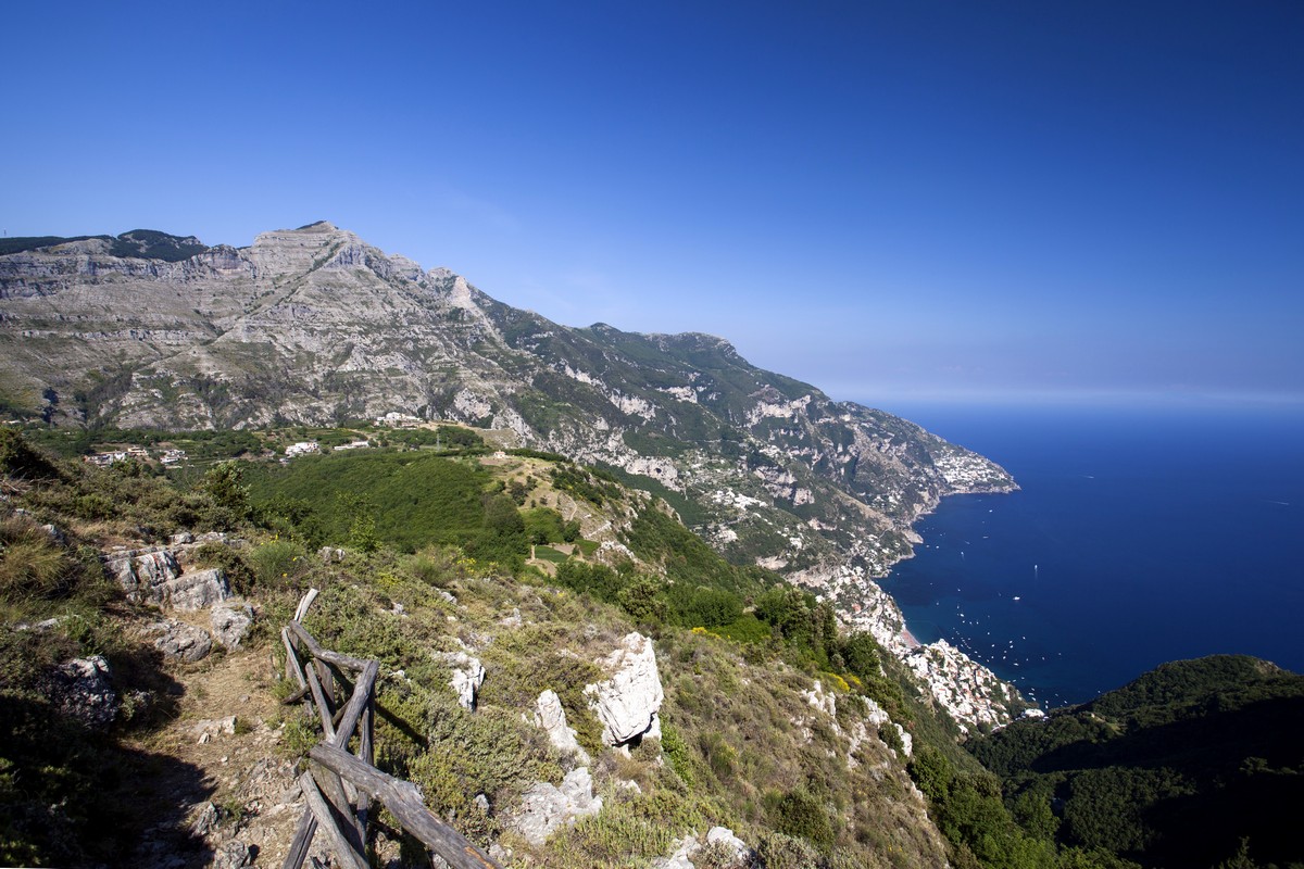
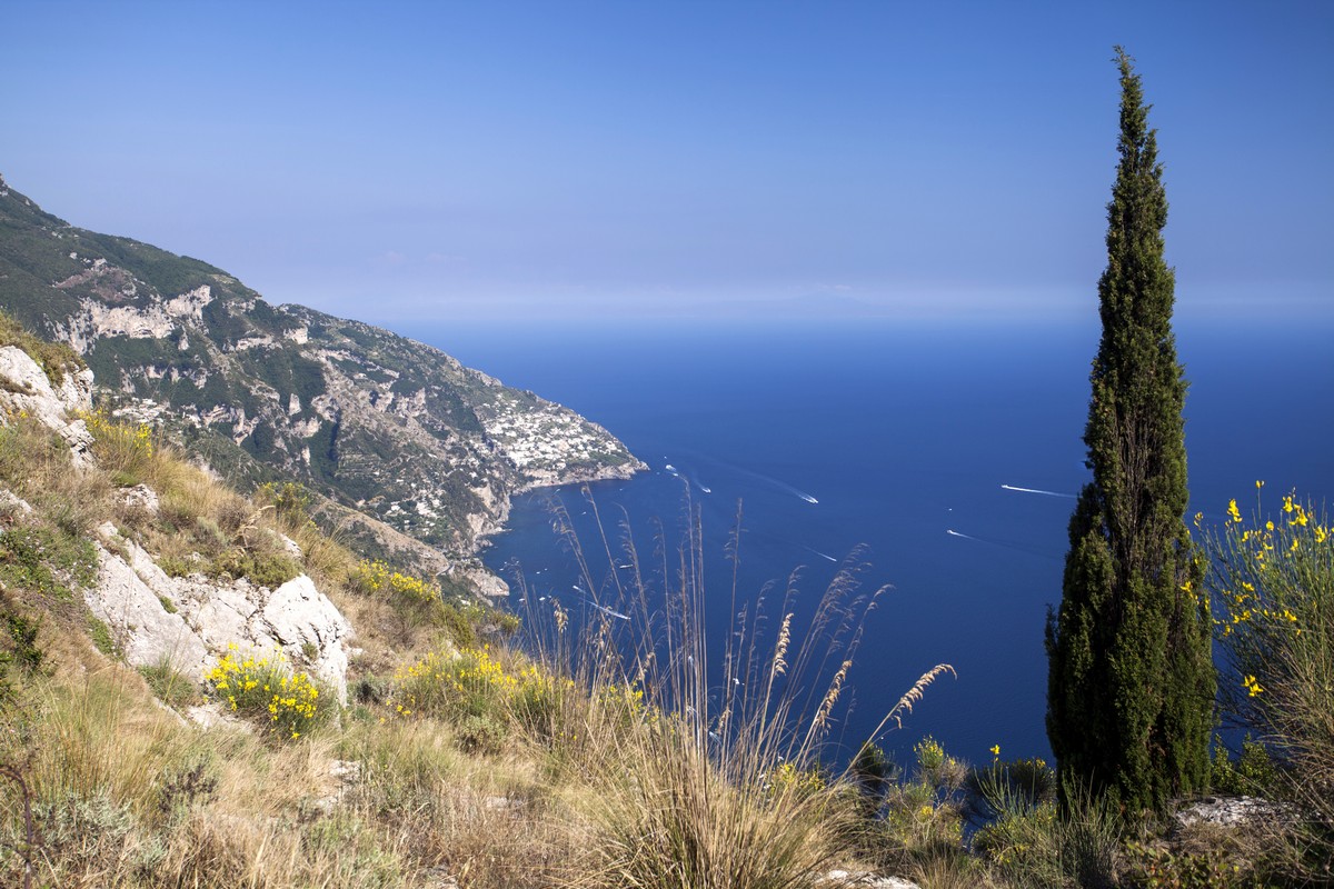
Continue along the switchbacking trail, ascending the mountain step after step. Here you can admire the bay of Naples with the Vesuvius Volcano dominating it from one side, and to the other the Li Galli archipelago. After 0.6mi you will arrive at a crossroad. Follow the right path along the mountainside, and after few meters you will find yourself in a clearing. Go right. Follow the path that leads into the vegetation. Here you will cross over to the other side of the mountain. You’ll start seeing the coast near Positano, with its clear water underneath.
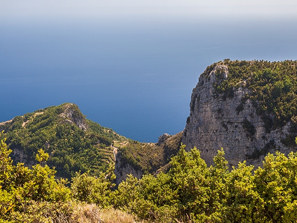
Following the trail, you will come to a path that begins to climb up the mountain. Follow it until you reach the top. Savour the views, then continue. Shortly after this you will come to a fence. Pass through the fence and stay close to it as it goes straight – here high vegetation and plants could hide the trail. At this point you’ll have reached Mount Comune at 2877ft.
After you pass through the edge of the fencing, begin your descent (to the left, staying on the same path) and follow the path down. After 919ft,you will arrive to another open fence and will come to another intersection, don’t get fooled by the intersection here: go right and follow along the broken down fence (on your right). At the next intersection after 2625ft, turn right and continue your descent. There will be an intersecting path, but veer left to continue down toward Positano
After 0.4mi from the intersecting path, take the path to the right (there should be a CAI signboard), on your left you will see some Positano buildings through the trees. Go down the rock stairs, they’ll lead you to Positano. To go back to Piano di Sorrento, walk down the paved road on the right until you reach a crossroad. Stop there and wait for the Bus to Sorrento.
If you’re looking for more amazing hikes in Amalfi Coast, check out the classic – Path of The Gods.
Insider Hints
Be aware of snakes! On a recent trip our contributors found an adult viper (Vipera Aspis) on the trail. The best thing you can do is to stop and be still. Vipers are not aggressive, so - if you’re still - after a while they will leave you alone. Don't try to pass by the snake and don't try to attack it, obviously.
Get a ticket for the bus before starting the trail because SITA bus drivers won’t issue them on-board.
Extra water is advised as the trail is long and—from May to September - is quite exposed to the sun.
To get to the trailhead from Sorrento take the SITA bus to Positano and ask to stop at Hotel Royal Hills. Via San Pietro will be on your left.
To get to the trailhead from Amalfi take the SITA bus to Sorrento and ask to stop at Hotel Royal Hills. Via San Pietro will be on your right.

Similar hikes to the Monte Comune hike
High Path of the Gods
The High Path of the Gods is a less known variation of the famous “Path of the Gods“ route. If…
Ring of Faito
If you like long walks in the forest mixed with stunning mountain views and seascapes then congratulations! We’ve found the…
Monte Canino
This trail is a difficult - yet short - hike and we recommended it for people looking get their heart…
Alexis Schweitzer 4 years ago
I did this walk with my friend, We enjoyed it with breathtaking views
claritam 4 years ago
It wasn't easy to get around but you'll be rewarded with awe-inspiring views when you make it!
Johnny C. 4 years ago
It was a thrilling hike! It's not that though and it's definitely worth it!
Danny V. 4 years ago
What a wonderful hike! It was a nice place to explore for adrenaline junkies!
Tyler D. 5 years ago
Amazing day tour. So glad to complete this hike without any trouble. The views were terrific.
George M. 5 years ago
This hike has very distinguished views. Marvelous in every way.
Laura K. 5 years ago
The hike is unspoiled, so expect some thick foliage and rugged trails. It requires some patient, but worth it.
Marina Lunn 5 years ago
P.s a few tips. 1. Follow the red and white stripe symbols on various rocks 2. After the first ascent. Do not follow route to the left and through the forest. This takes you to a dead end with a large cross. Instead turn right down an overgrown path. 3. Between the first ascent and the ‘fence’ mentioned above it is approx 4km through rocky terrain 4. When through the first ‘fence’ the field is VERY over grown. Stick to the left, don’t go down the hill. 5. When out of the field and through the second gate, turn left and follow dirt track. This is when the decent will start to Positano. From here it is another 4km to the centre and will take approx 1.5hours. Good luck!
Marina Lunn 5 years ago
I completed this with my boyfriend today (26 June 2019) and would not recommend this unless you don’t mind trekking through thick foliage. . It was just over 11k to Positano and through thick foliage nearly 80% of the way. If you are looking for a clear hike don’t choose this one, but the views are amazing!