Charles River Walk Walking Tour
View Photos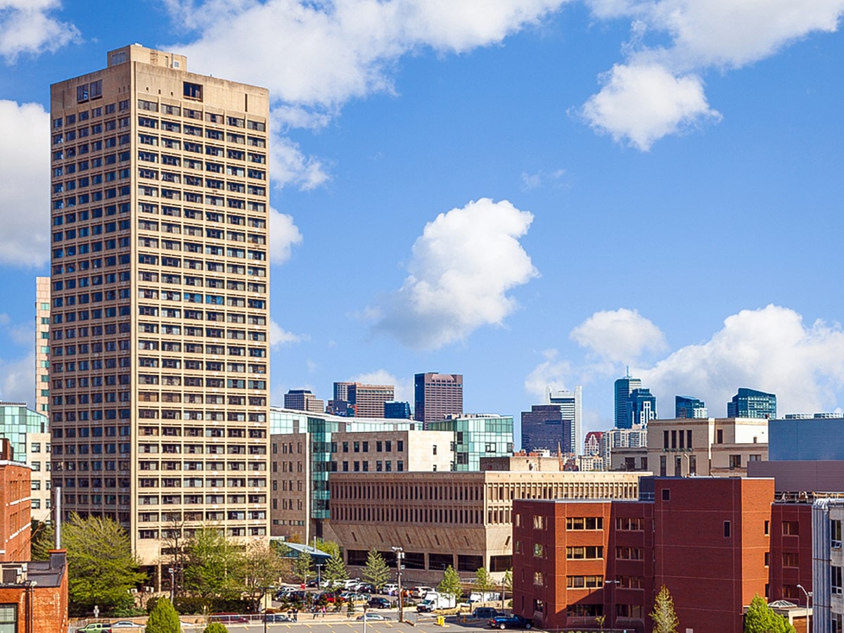
Charles River Walk Walking Tour
Difficulty Rating:
This Boston walking tour takes in one of the most scenic features in Boston - the Charles River. Walking alongside the Charles is the best way to see incredible views of both Cambridge and Boston depending what side you’re on. This walk will take you by some of those perfect spots, as well as highlighting key sites on the campuses that sit beside the river - Massachusetts Institute of Technology and Boston University.
Getting there
To begin, take the T to Kendall Square or the 64, 68, 85 or CT2 buses to the Kendall/MIT stop.

About
| Start | Kendall / MIT Station on Red Line |
| End | Harvard Bridge |
| Great views | Views of Cambridge and Boston from the Charles, great vantages from the BU Bridge. |
| Shopping | Kendall Square |
| Water | Our focus is the Charles River |
| Food and Drink | Pavement Coffee House |
| Architectural Gems | The Great Dome, BU Castle |
| Parks and Greenspaces | Killian Court |
| When to do | Best April to November |
| Pets allowed | Yes - On Leash |
| Family friendly | Yes |
| Crowd Levels | Moderate |
| Route Type | Circuit |
Charles River Walk
Elevation Graph
Weather
Route Description for Charles River Walk
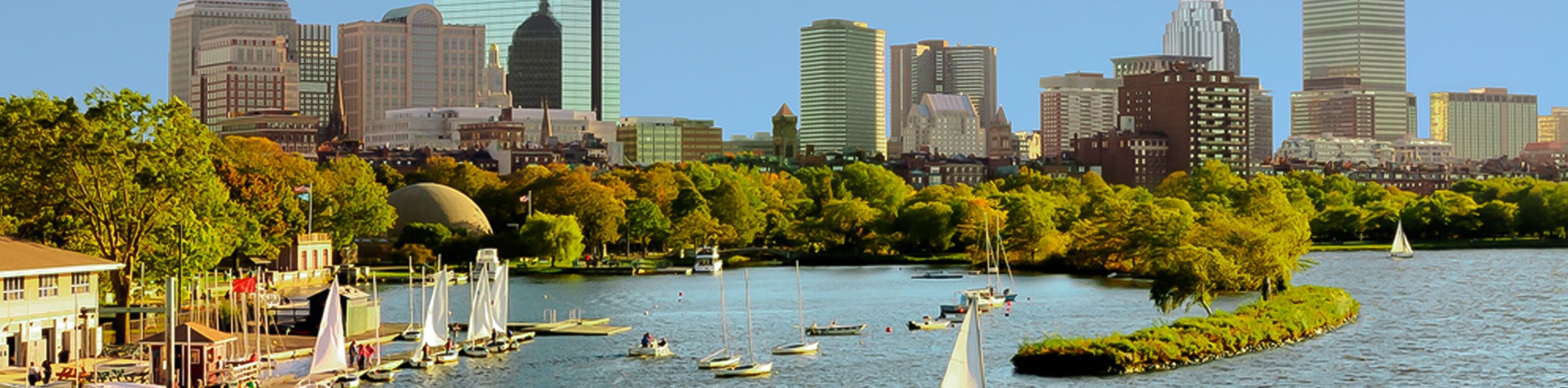
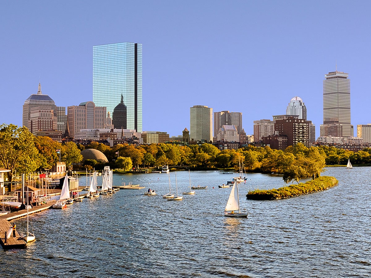
Walking along the Charles River is a spectacular way to enjoy a day out in Boston. This Boston walk combines fresh air, great views and a lot of Boston history to make a great day out.
Start this walk in Kendall Square, a hub of restaurants, shopping, and entertainment near MIT. Before setting off on this walk, stop into Champions for a drink or Legal Sea Foods if you haven’t yet filled your need for lobster while in Boston. Kendall Square is also a hub of innovation and home to a plethora of start-ups. Because of this, it has been referred to as “the most innovative square mile on the planet.”
After basking in the forward-thinking environment of Kendall Square, walk on Main Street toward Legal Sea Foods and then turn left onto Ames Street. Follow Ames Street as it takes you through the bulk of MIT’s campus and to Memorial Drive. From here, you’ll have an excellent view of the Charles River and if you turn right you should be able to spot the next stop – the MIT Sailing Pavilion on the river.
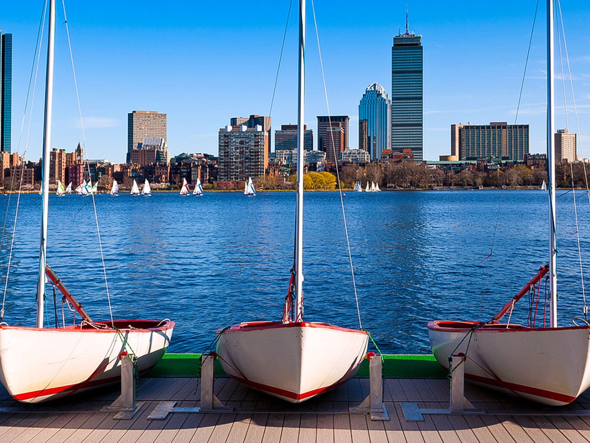
The MIT Sailing Pavilion, also known as the Walter C. Wood Sailing Pavilion, is an historic site in the world of college sailing. It is the oldest sailing pavilion in the world and is located at the university where intercollegiate sailing began. Today, the pavilion houses 110 sailboats.
From the sidewalk around the MIT Sailing Pavilion and all along Memorial Drive, you will have opportunities to snap great photos of downtown Boston, so be sure to take advantage of that as you stroll along the river to the next stop. To the right down Memorial Drive a bit, you’ll find stop number 3 – Killian Court.
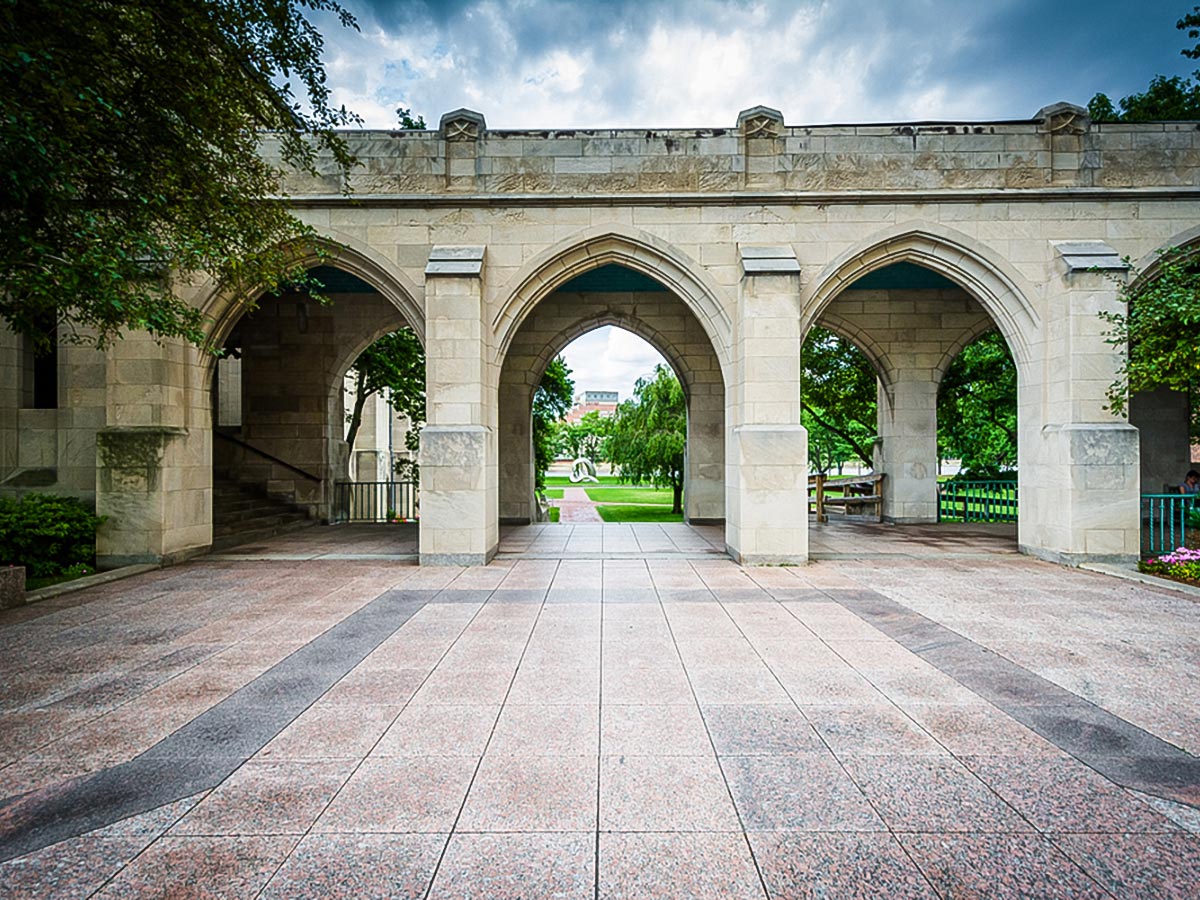
From commencement to frisbee games to hacks, Killian Court and the buildings surrounding it are a buzzing home to MIT activities. The green space is definitely relaxing, but if the weather is nice, you’ll likely find the area populated with students. However, it’s still worth taking a minute to sit and take in the gorgeous architecture of the Great Dome, which was modeled after the Pantheon in Rome, or the view of Boston across the Charles River.
The next stretch of walking is the longest on this hike, but it won’t feel like it when you’re strolling next to the beautiful river. Walk along Memorial Drive, taking in the scenery, until you reach the Boston University DeWolfe Boathouse. The newest boathouse to make its home on the Charles, BU’s boathouse opened in 1999. The boathouse boasts spectacular views, particularly for the Head of the Charles Regatta. From this site, you’ll be able to watch any boats that might be out on the water or take some pictures of BU’s main campus.
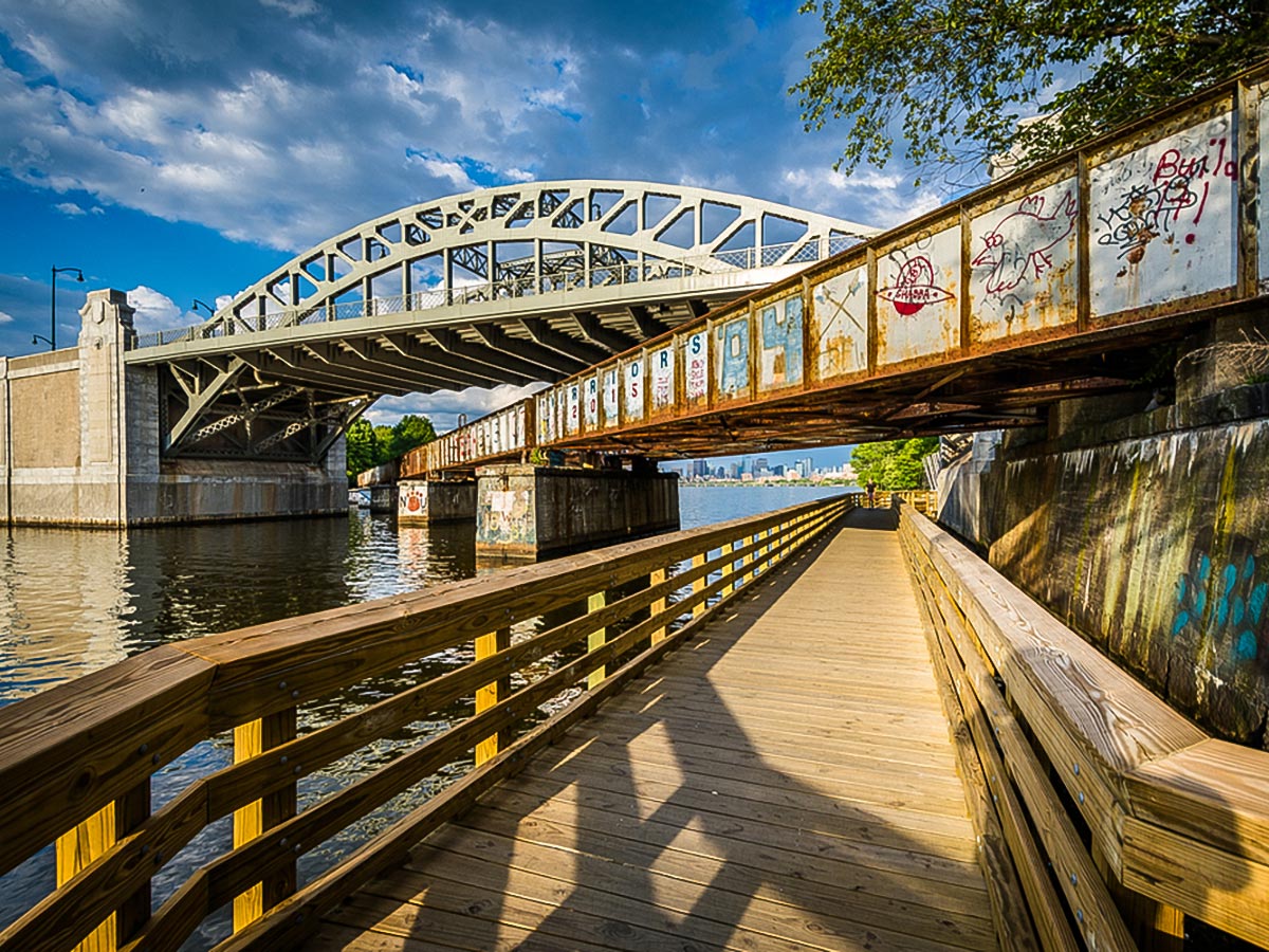
From the DeWolfe Boathouse, continue on Memorial Drive until you are able to turn left to cross the river. Originally named the Cottage Farm Bridge, the bridge taking you across the Charles is now called the Boston University Bridge. The BU Bridge holds the distinction of being one of the few places in the world where a boat can sail under a train, under a car, and under a plane. The bridge was originally constructed in 1928, but went through a massive rehab in 2008. It could definitely be argued that the BU Bridge offers some of the best views in Boston. Rivaled only by Top of the Hub, the Boston skyline seen from the BU Bridge is incredible.
After taking in the view, cross the BU Bridge and Commonwealth Avenue, then take a left on Comm Ave. Just past Boston University’s Engineering Product Innovation Center will be Pavement Coffee House, which is an excellent place to stop for a coffee or a snack if you find yourself needing a pick-me-up. The pastries at Pavement are delicious and the vibe makes it an excellent place to hang out.
Exit Pavement and continue on Comm Ave until it intersects with St. Marys Street. Turn left to cross Comm Ave and you will be standing in Marsh Plaza looking at Marsh Chapel. Marsh Plaza marks the center of BU’s campus and is home to the sculpture titled Free At Last by Sergio Castillo which commemorates BU alum Dr. Martin Luther King, Jr. Next to the sculpture in Marsh Plaza is the BU seal. Legend says that if you step on the seal, you won’t graduate from BU in 4 years.
At the far end of the plaza from Comm Ave is Marsh Chapel. The chapel was completed in 1950 and was built in the Gothic style. Though the university is historically Methodist, Marsh Chapel is nondenominational. In 1962, the Marsh Chapel Experiment, also known as the Good Friday Experiment, took place here. The experiment tested whether psilocybin, a psychedelic compound, would act as a reliable entheogen, or induce a spiritual experience, in religiously predisposed subjects. The result was essentially that yes, psychedelic compounds produce intense religious experiences.
Go down the steps between Marsh Plaza and the College of Arts and Sciences classroom building and you will find yourself on BU Beach, which is not a beach at all but is the largest green space on BU’s campus. Cross the beach toward the right to end up walking along Bay State Road. Follow Bay State Road to the right and where Bay State intersects with Granby Street, you’ll be standing across from stop number 8 – the BU Castle.
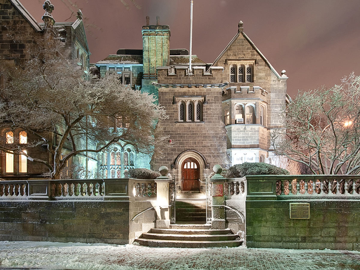
The castle was originally built as a private residence in 1915 and was donated to BU in 1939. From 1939 to 1967, it was used as the home of Boston University presidents. Today, the BU Castle can be rented for private events and has been used as a filming location for movies and TV shows such as 21 and the 2016 Ghostbusters. Hidden in the basement of the castle is the BU Pub. If you happen to be a BU student, faculty, staff member, alum, or invited guest, you should definitely stop in for a drink.
To continue on the walk, follow Bay State Road across Granby Street and keep walking until you reach Silber Way. Turn left on Silber way followed by left on Back Street and here you’ll see a footbridge to take you across Storrow Drive and onto the Esplanade. Watch out for bikes and runners as you stroll alongside the Charles River, taking in the greenery of the Esplanade. Originally dedicated in 1910 as the Boston Embankment, today the Esplanade is a popular place for recreation or exercise. Located throughout the Esplanade are playgrounds, walkways, exercise equipment, ball fields, docks, Community Boating, and the Hatch Memorial Shell performance stage. In 2009, the Esplanade was designated as a Boston Landmark.
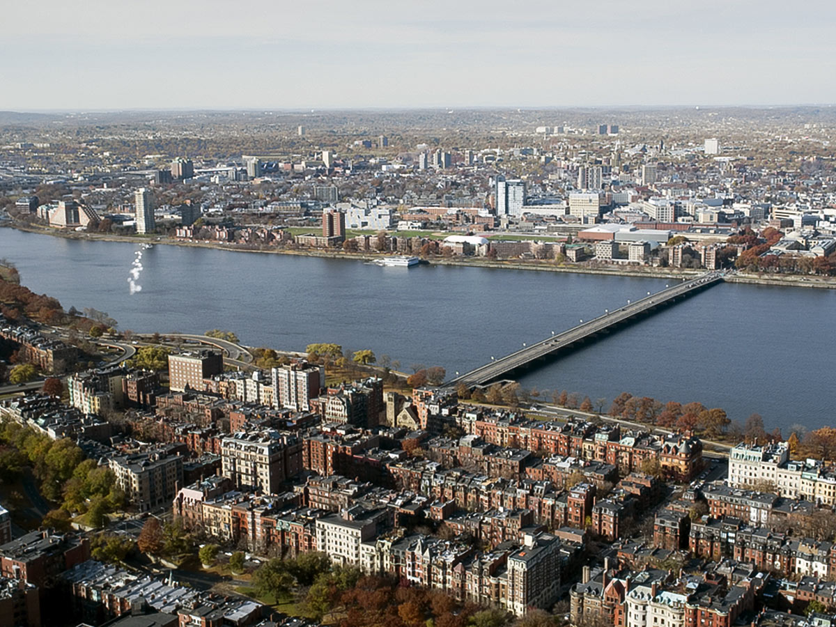
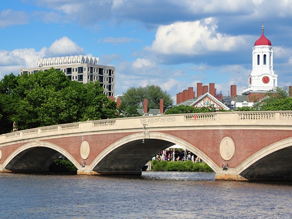
Take a minute or two to sunbathe on a dock if the weather allows, but eventually your stroll along the Esplanade will lead you to the Mass Ave Bridge. The Mass Ave Bridge, also known as the Harvard Bridge, opened in 1891. The bridge connects Boston and Cambridge and was named for John Harvard, who the university is also named after. The bridge is another excellent spot to capture skyline pictures of both Cambridge and Boston.
After crossing the Mass Ave Bridge, you will be back on MIT’s campus. Take a right onto Memorial Drive after exiting the bridge and you will find yourself back at Killian Court and you could continue to explore MIT and Cambridge by foot. Or, after exiting the bridge, continue up Mass Ave and catch the 1 bus at the Mass Ave at Memorial Drive stop to take you to a different part of Boston.
Insider Hints
If you make this walk during summer, you could also add kayaking on the Charles. Paddle Boston offers rental locations in Kendall Square and Allston.
Another ideal time for this walk would be in October during Head of the Charles. This weekend would give you incredible views of boats on the water and you would have many opportunities to watch the races.
Walking along the Esplanade alone at night isn’t the safest idea, so if you plan to do this walk after dark, be sure to take someone with you!
We often walk back across Harvard Bridge and into Back Bay (if a game is on to Fenway) at the end of this walk.

Similar Walking Tours to the Charles River Walk Walking Tour
MIT to Beacon Hill
This is another great Boston walking tour for lovers of American History. Boston is well-known for being a historic city…
Harvard to MIT
This Boston walking tour takes you to adjacent Cambridge, famous for Harvard Business School, Harvard University and MIT. This is…
Financial District to Theatre District
This Boston walking tour will allow you to explore the waterfront and Boston’s Financial District. Don’t let the name confuse…
Kellyy Ferguson 4 years ago
Stunning views. Great walkways. Beautiful sky views at night.
Antonia G. 4 years ago
Nice tour. We had so much fun. Lots of cool shops alomg the way.
Alann Worth 5 years ago
Beautiful walkways, bridges, and greens next to the River Charles. Amazing and highly recommended.
Pepper S. 5 years ago
Very tranquil and lots of activity on the river at all times. Riverside walks were very spectacular. I would definitely recommend a stroll here if the weather is good.
Eva Lorenz 5 years ago
A very scenic walk along the river. It does have lots of older trees so you do have to watch out for roots. There were spots to stop and sit and enjoy the views.
breezylove 5 years ago
Such a great site! Everything looks amazing.