Willow Springs Basin Tank via Bulldog Canyon
View Photos
Willow Springs Basin Tank via Bulldog Canyon
Difficulty Rating:
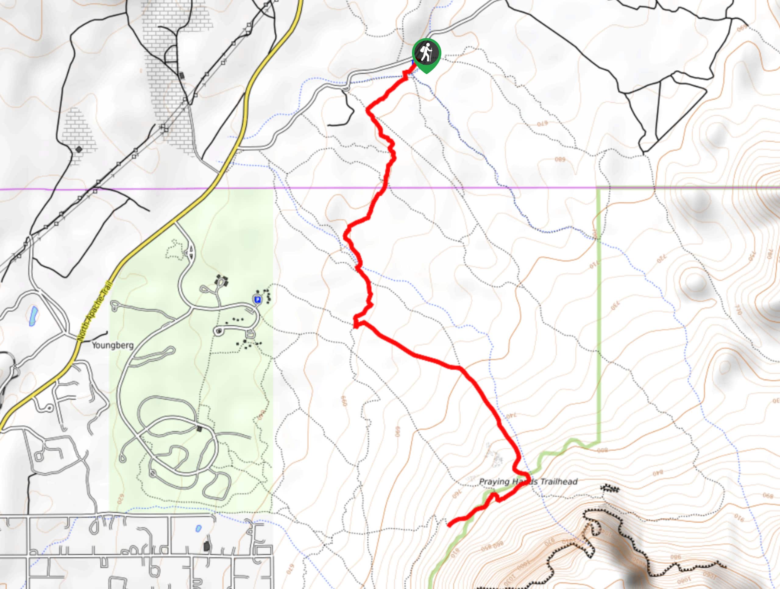
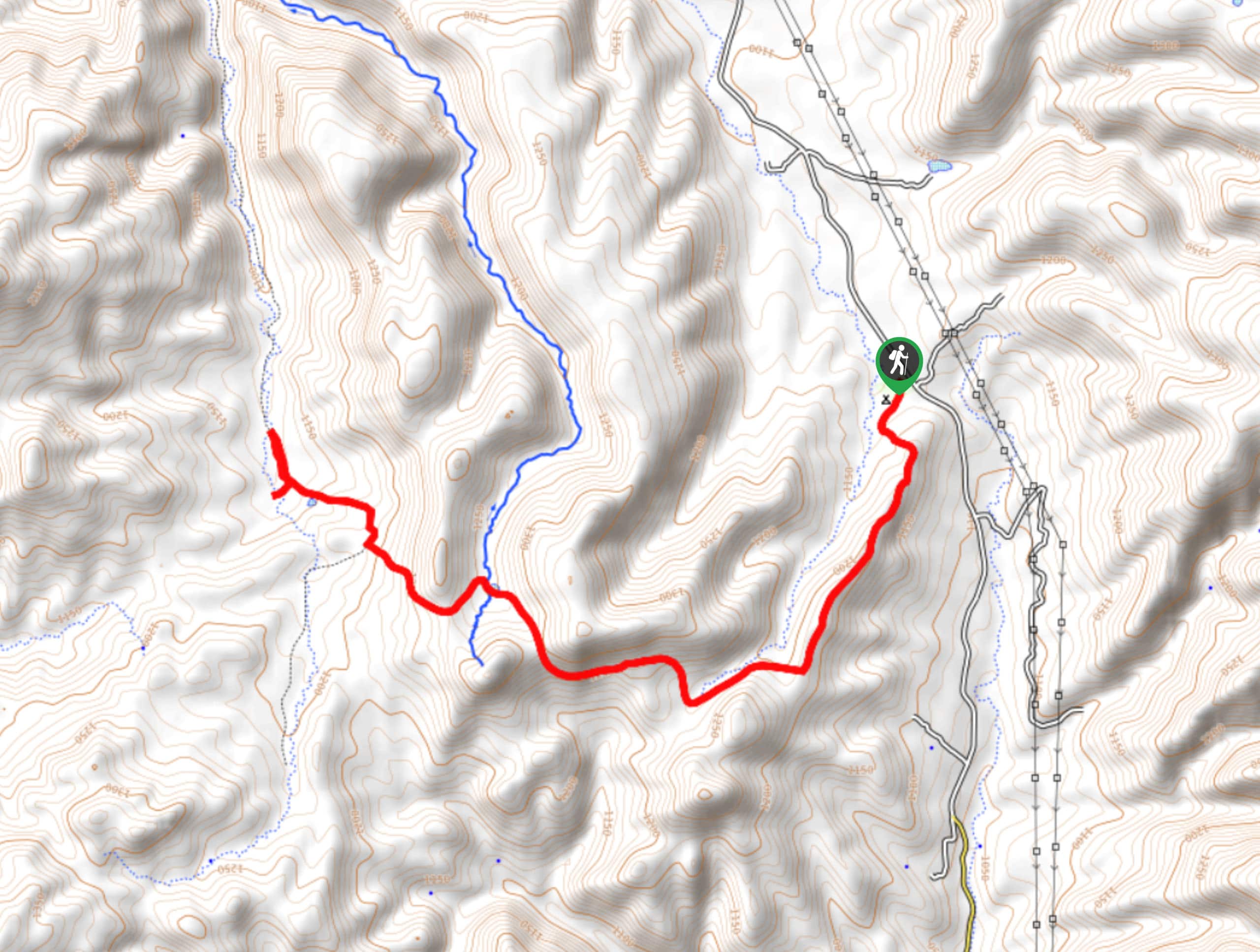
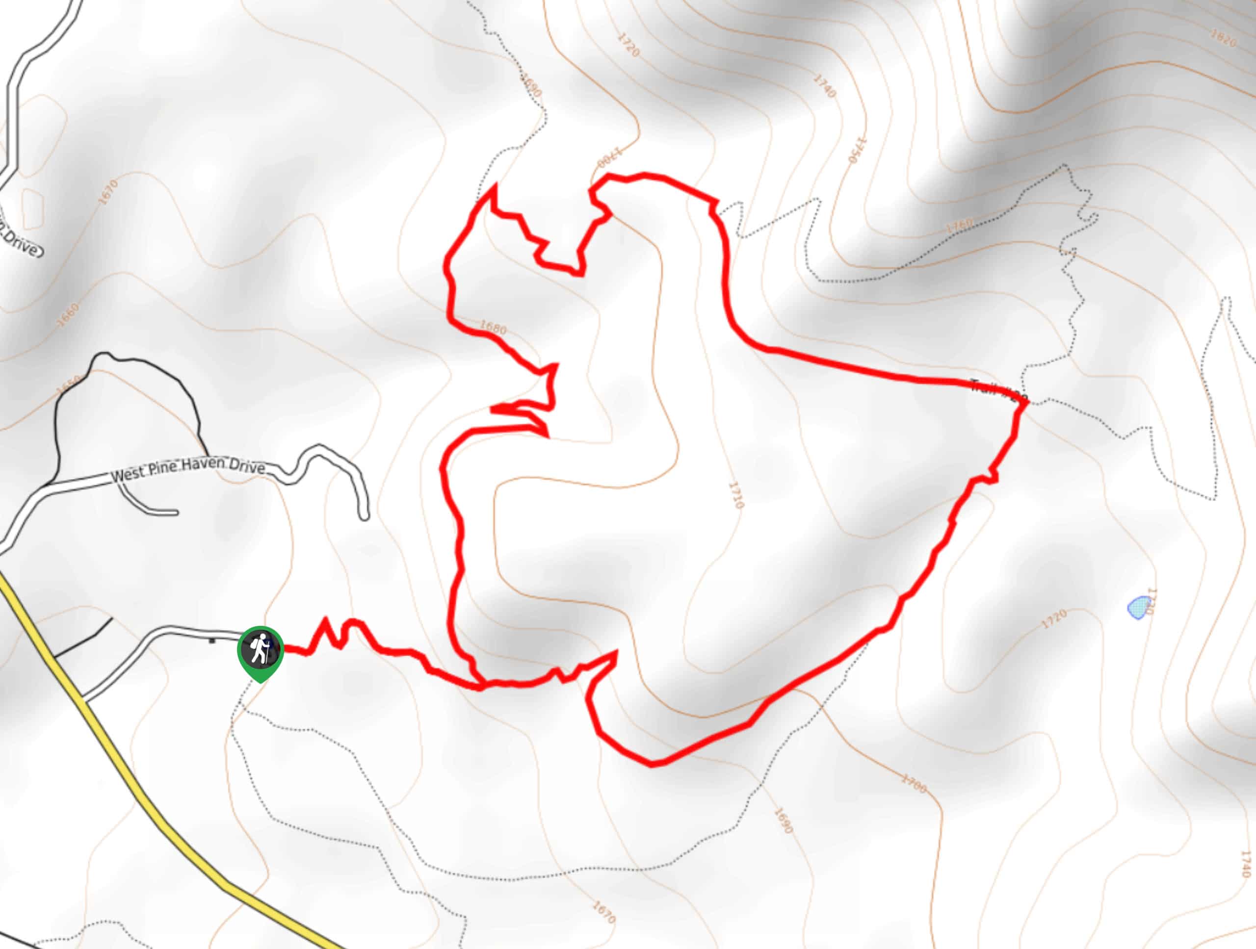
The Willow Springs Basin Tank via Bulldog Canyon is a 6.0mi loop hike in the Tonto National Forest that can be reached quickly from the upper northeast reaches of the Mesa area. This hike offers stellar scenes of towering saguaros and red rock canyon views. It does require some routefinding and a GPS track is helpful, but it’s worth the small bit of preparation required. Bring lots of water on this route.
Getting there
The trailhead for the Willow Springs Basin Tank via Bulldog Canyon is off SR 88.

About
| Backcountry Campground | No |
| When to do | October-May |
| Pets allowed | Yes - On Leash |
| Family friendly | Yes |
| Route Signage | Poor |
| Crowd Levels | Low |
| Route Type | Lollipop |
Willow Springs Basin Tank via Bulldog Canyon
Elevation Graph
Weather
Willow Springs Basin Tank via Bulldog Canyon Description
The Willow Springs Basin Tank via Bulldog Canyon is a 6.0mi hike that leads you through a scenic portion of the Tonto National Forest with tall cacti lining your trail and the mountains in the distance. This loop is beautiful and it won’t take long to get to if you live in the Mesa area. This route is also popular with off-road vehicles and horseback riders. Remember to share the trail.
This hike has some sections where the trail can become a bit difficult to follow. A downloaded GPS route is a must! Additionally, it gets very hot in this area. Avoid this hike in the summertime and bring plenty of water no matter what time of year you choose to visit.
From the trailhead, hike directly into the canyon ahead of you. Where the trail splits, you’ll start your loop. You can do the loop whichever way appeals to you– the views are similar clockwise and counterclockwise. When you reach the base of the loop again, retrace your steps to the trailhead.
Insider Hints
Hikers and horseback riders don’t need a permit for this hike, but OHVers do. Permits are free.
Similar hikes to the Willow Springs Basin Tank via Bulldog Canyon hike
Jacob’s Crosscut Trail
Jacob’s Crosscut Trail is an important route in the network of trails in Lost Dutchman State Park. This route is…
Bronco Trail
The Bronco Trail is a 7.9mi out and back route used for hiking and horseback riding. This trail…
Pine Canyon Trail Loop
The Pine Canyon Trail Loop in Pine, Arizona is a quick 2.7mi loop that is rated as easy.…
Comments