

Military Sinkhole Trail
View PhotosMilitary Sinkhole Trail
Difficulty Rating:
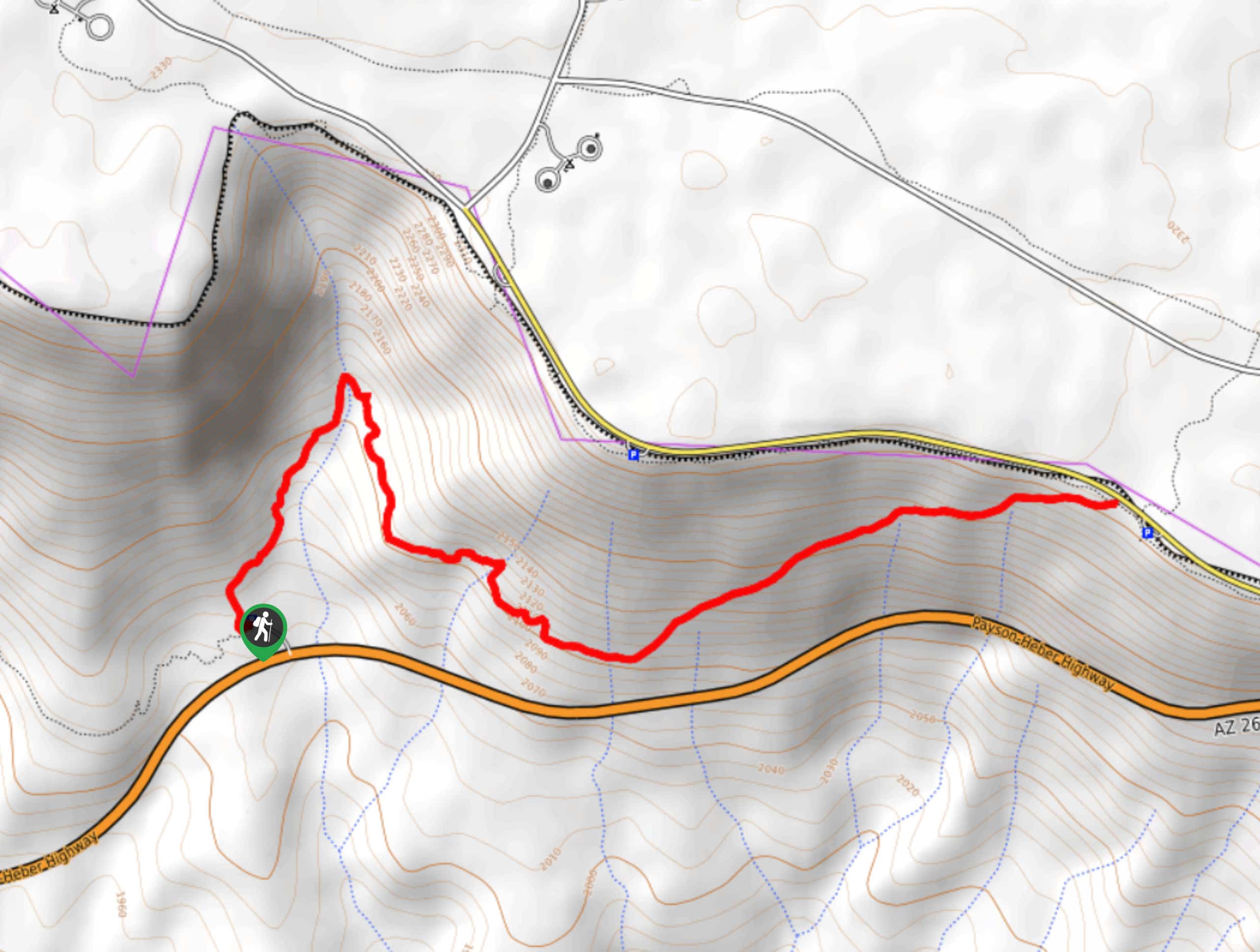
The Military Sinkhole Trail is a very scenic route in the Tonto National Forest that leads you through a forest on the edge of a mesa to a viewpoint. This hike is nice and shady and it’s at its absolute best during the fall when the trees come alive with color. There are lots of campgrounds just beyond the trail on the mesa if you want to make a weekend trip out of it. Expect moderate traffic on this route.
Getting there
The trailhead for the Military Sinkhole Trail is off SR 260.
About
| Backcountry Campground | No |
| When to do | Year-round |
| Pets allowed | Yes - On Leash |
| Family friendly | Yes |
| Route Signage | Good |
| Crowd Levels | Moderate |
| Route Type | Out and back |
Military Sinkhole Trail
Elevation Graph
Weather
Military Sinkhole Trail Description
We never get tired of a good viewpoint, and the Military Sinkhole Vista is one to add to your list. While you can drive to the viewpoint, we recommend taking the scenic route by foot and hiking the Military Sinkhole Trail. This route is well-signed, very pretty, and accessible for many skill levels. While this hike is always enjoyable, we definitely recommend visiting in the fall to appreciate the splendid colors of the forest if you can.
The route starts from the trailhead parking area. You’ll ascend up the wall of the mesa on a clear, well-marked trail. You’ll be hiking through the trees for much of this route, which is a relief on hot days. Climb steeply up to where the trail meets the creek, where you’ll cross over and begin a traverse east.
The traverse eventually begins to pick up a bit of elevation gain as it reaches the viewpoint, but the hard work is over after the first half of the hike. You’ll ascend gradually to the viewpoint, which is at the lip of the mesa. From here, you’ll retrace your steps.
Similar hikes to the Military Sinkhole Trail hike

Jacob’s Crosscut Trail
Jacob’s Crosscut Trail is an important route in the network of trails in Lost Dutchman State Park. This route is…

Bronco Trail
The Bronco Trail is a 7.9mi out and back route used for hiking and horseback riding. This trail…

Pine Canyon Trail Loop
The Pine Canyon Trail Loop in Pine, Arizona is a quick 2.7mi loop that is rated as easy.…


Comments