

See Canyon Trail
View PhotosSee Canyon Trail
Difficulty Rating:
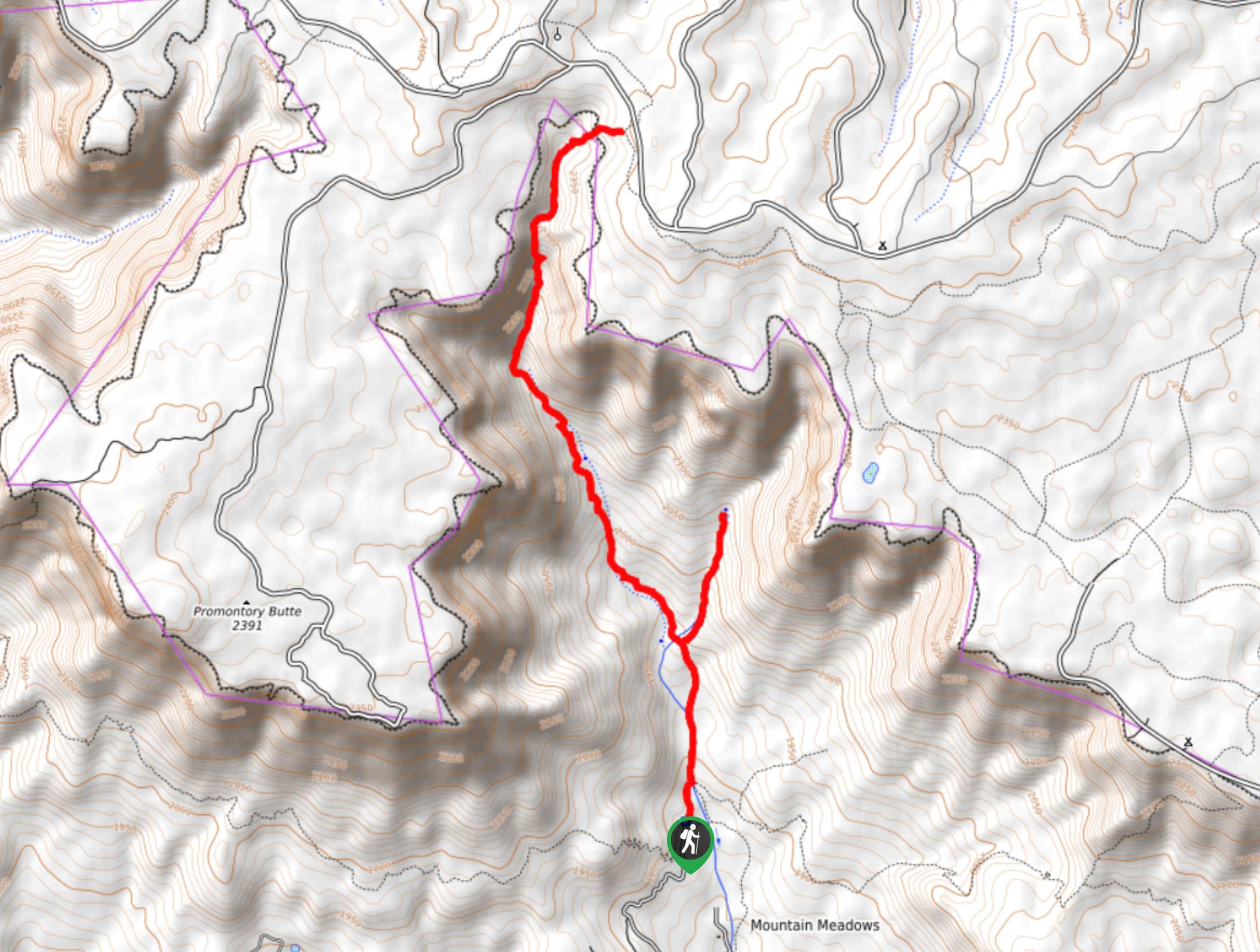
See Canyon Trail is a 7.6mi hard hike in the Tonto National Forest that takes you to the headwaters of the See Spring and through a gorgeous canyon. This hike is easier at first and gets harder as you go, so families or beginners can opt to hike as far as they comfortably can and turn back early if needed. Bring a GPS route on this hike as it’s not quite as easy to follow the further you get into the canyon.
Getting there
The trailhead for the See Canyon Trail is at the end of FR 284.
About
| Backcountry Campground | No |
| When to do | April-November |
| Pets allowed | Yes |
| Family friendly | No |
| Route Signage | Poor |
| Crowd Levels | High |
| Route Type | Out and back |
See Canyon Trail
Elevation Graph
Weather
See Canyon Trail Description
See Canyon Trail is a fun adventure with varied scenery, ranging from the green-framed headwaters of the See Spring to the tall canyon walls of See Canyon. Most of the elevation gain on this trail comes near the end of the trail, so families and beginners often hike as far as they like and then turn around. More adventurous hikers can make it to the end of the canyon for the best viewpoint.
The trail gets a bit hard to follow the further you get into the canyon. A downloaded map will be a lifesaver if you intend to go all the way. Additionally, poles and good boots will be helpful if you want to finish the climb at the end of the canyon.
From the trailhead, hike towards the canyon. The trail to the springs splits off to the right, and we recommend making the shorter trip up to the headwaters before backtracking to the main trail. Back on the main trail, you’ll hike deeper and deeper into the canyon. The walls rise above you and there’s some very pleasant shade. The trail ends after scaling the far wall of the canyon. Turn back and retrace your steps.
Similar hikes to the See Canyon Trail hike
Jacob’s Crosscut Trail
Jacob’s Crosscut Trail is an important route in the network of trails in Lost Dutchman State Park. This route is…
Bronco Trail
The Bronco Trail is a 7.9mi out and back route used for hiking and horseback riding. This trail…
Perlite Road to Arnett Creek Loop
The Perlite Road to Arnett Creek Loop takes you through a section of the Boyce Thompson Arboretum grounds and through…


Comments