

Altitude Trail
View PhotosAltitude Trail
Difficulty Rating:
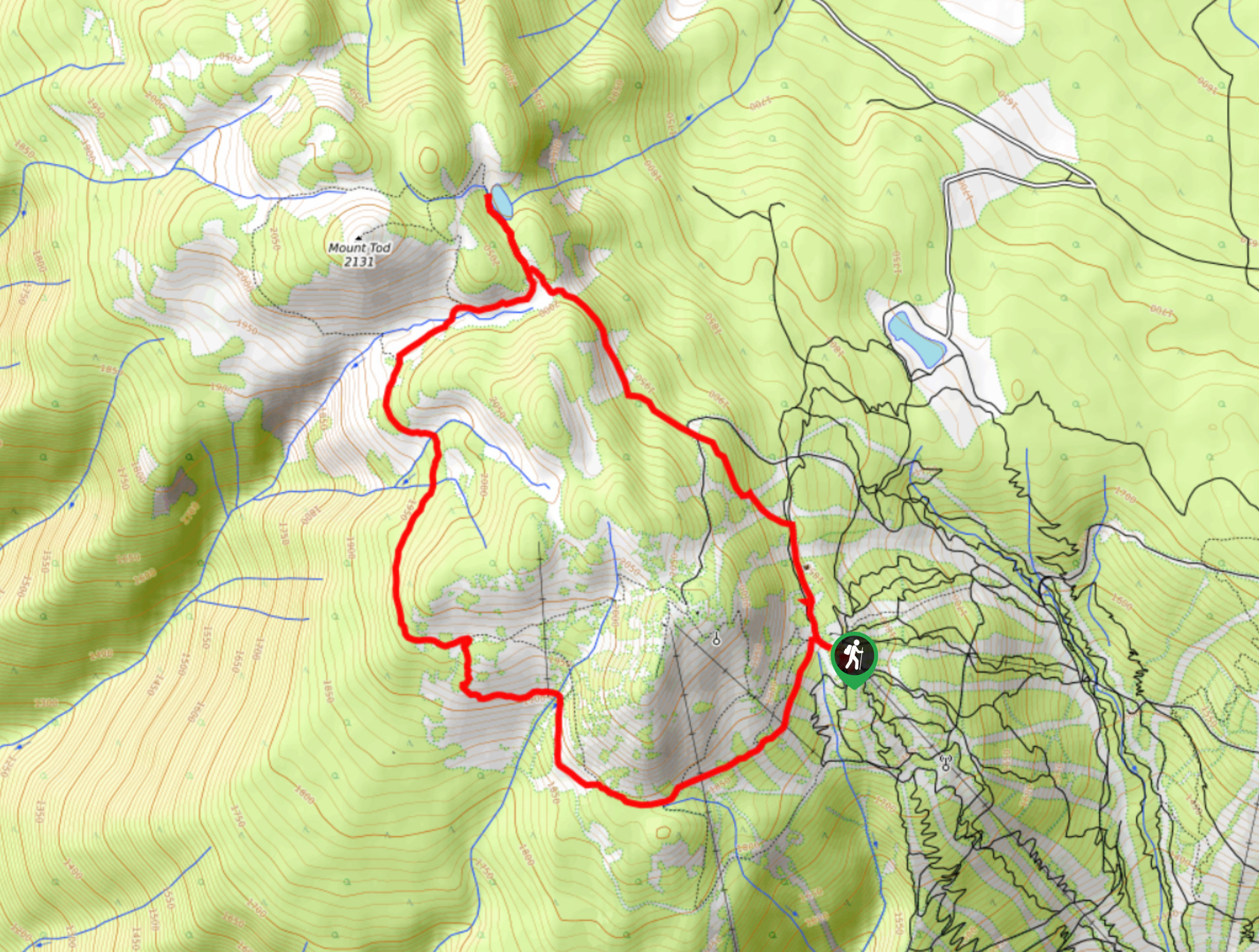
The Altitude Trail is a 5.6mi lollipop hiking route at the Sun Peaks Mountain Resort that will allow you to explore the heavily wooded slopes in the area and visit the calm waters of Tod Lake. Along the trail, you will experience some scenic views across the valley and the beautiful subalpine setting around the lake with Tod Mountain in the near distance. Hikers will need to utilize the Sun Burst Chairlift or extend their hike up the mountainside in order to reach the trailhead. You will be required to purchase a hiking pass to utilize the trails in this area.
Getting there
To reach the trailhead the Altitude Trail from Kamloops, drive to the north for 14.6mi on BC-5 and make a right on Old Highway 5. Turn left after 656ft on Tod Mountain Road, continuing on for 14.9mi. Turn right again on Sun Peaks Road and you will find the parking area on the left after 5.7mi. To access the trailhead you can either hike up the mountainside or take the Sun Burst Express Chairlift.
About
| When to do | June-October |
| Backcountry Campsites | No |
| Pets allowed | Yes |
| Family friendly | Older Children only |
| Route Signage | Average |
| Crowd Levels | Low |
| Route Type | Lollipop |
Altitude Trail
Elevation Graph
Weather
Altitude Trail Description
Although the area is popular during the winter season, hiking the Altitude Trail will enable you to explore the Sun Peaks Mountain Resort area during the summertime and appreciate the natural beauty of its heavily wooded slopes and green meadows. Setting out from the top of the chairlift, make your way to the southwest and through the forest for some intermittent views that stretch across the valley. Follow the trail as it turns north and heads toward the foot of Tod Mountain. After crossing over several mountain streams, you will arrive at the charming shores of Tod Lake with the rugged slopes of the mountain providing a beautiful woodland setting. After taking in the views, head back along the trail and follow the path to the left to take an alternate path to the chairlift that will lead you through stretches of beautiful forest and the green grass of the ski runs. Once you arrive at the trailhead, you can either make your way down the mountainside or continue to explore the picturesque subalpine landscape.
Similar hikes to the Altitude Trail hike

Community Trail
The Community Trail is a 8.3mi point-to-point hiking route just north of Kamloops, BC, that will allow you…

Lac du Bois Tower Loop
The Lac du Bois Tower Loop is a 4.0mi hiking circuit northwest of Kamloops that will allow you…

Gibraltar Rock
The trek to Gibraltar Rock follows a 2.0mi out-and-back trail that sets out from the Paul Lake Beach…


Comments