Mara Mountain Cliffs South Hike
View Photos
Mara Mountain Cliffs South Hike
Difficulty Rating:
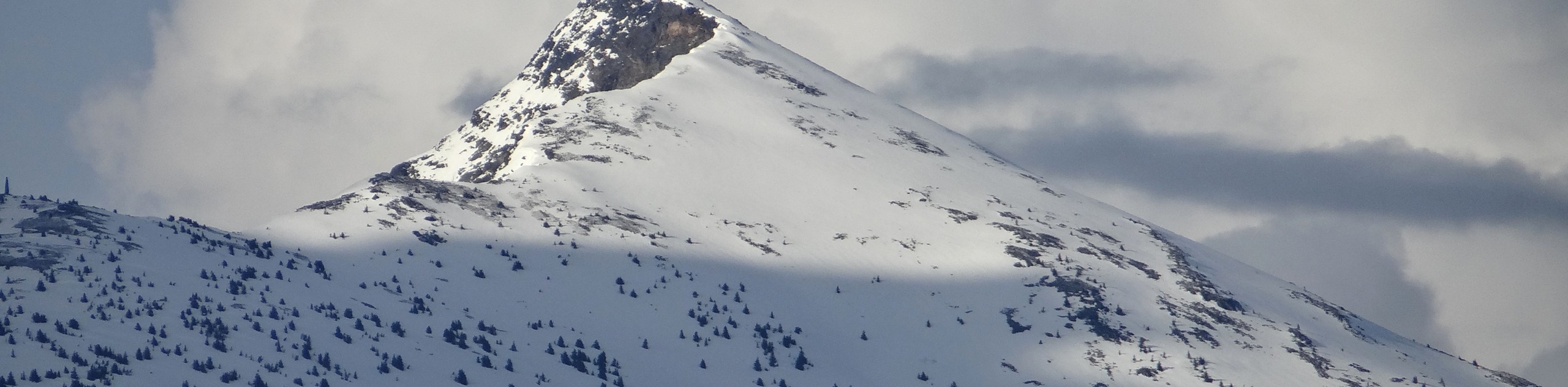
The Mara Mountain Cliffs South is a tough lollipop hiking route in Kamloops that climbs uphill through Lac du Bois Grasslands Provincial Park to reach the summit of Mara Mountain. From there, hikers will have a breathtaking view that sweeps across the Thompson River Valley from Kamloops Lake in the west to the city in the east. This hike is located within cougar country, so make sure to bring bear spray and make plenty of noise while out on the trail.
Getting there
To reach the Mara Mountain Cliffs South trailhead from Kamloops, drive west for 3.0mi on Ord Road and turn left to follow it for a further 591ft. Make a right on Tranquille Road and continue along it for 3.4mi. Turn right onto Red Lake Road and you will arrive at the parking area on your right in 1312ft.

About
| When to do | April-October |
| Backcountry Campsites | No |
| Pets allowed | Yes |
| Family friendly | No |
| Route Signage | Average |
| Crowd Levels | Moderate |
| Route Type | Lollipop |
Mara Mountain Cliffs South Hike
Elevation Graph
Weather
Mara Mountain Cliffs South Hike Description
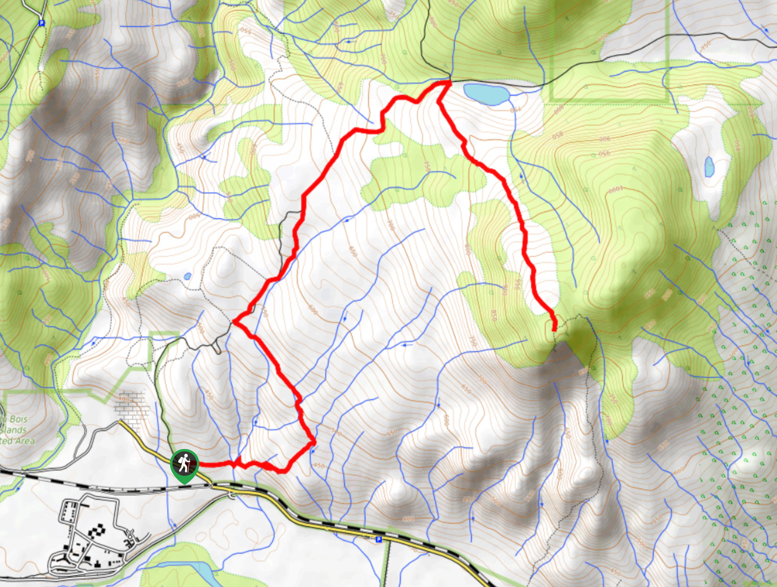
The Mara Mountain Cliffs South Hike is a great way to get some leg burning exercise and take in some breathtaking views of the Kamloops area in the process. Setting out from the parking area, follow the trail to the east as it utilizes the Mara Loop Trail to climb up through the rolling terrain. After crossing over several streams and meeting up with a junction at the northern tip of the loop, follow the trail to the right to set out on a course towards the summit of the mountain. Continue along the trail to the northeast until you reach Massey Lake, then turn to the south to begin the climb uphill to the summit. This final push will see you gain 656ft of elevation, but the amazing views from the lookout at the top of the peak will definitely be worth the effort. After taking in the commanding view of the scenic river valley. Head back along the trail and complete the Mara Loop portion of the hike to return to the parking area below.
Similar hikes to the Mara Mountain Cliffs South Hike hike
Community Trail
The Community Trail is a 8.3mi point-to-point hiking route just north of Kamloops, BC, that will allow you…
Lac du Bois Tower Loop
The Lac du Bois Tower Loop is a 4.0mi hiking circuit northwest of Kamloops that will allow you…
Raft Peak Trail
The Raft Peak Trail is a 4.0mi out-and-back hiking route northeast of Clearwater, BC, that will take you…
Comments