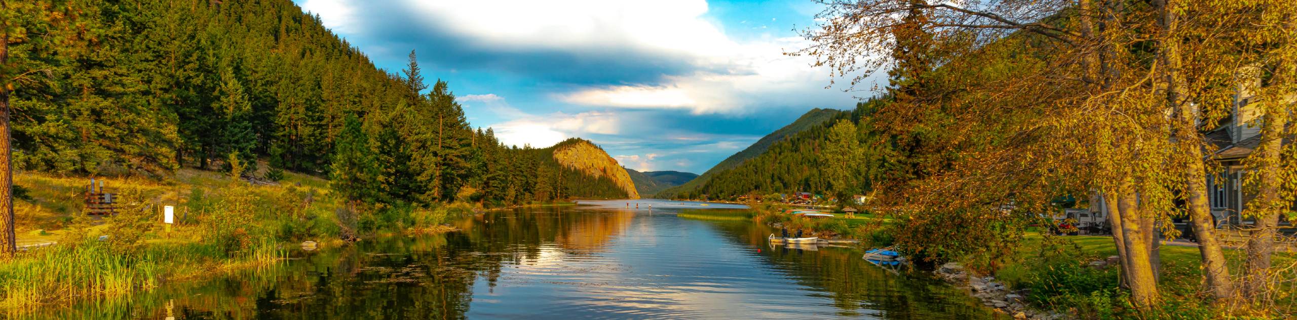
Margaret Falls Upper Loop Trail
View Photos
Margaret Falls Upper Loop Trail
Difficulty Rating:
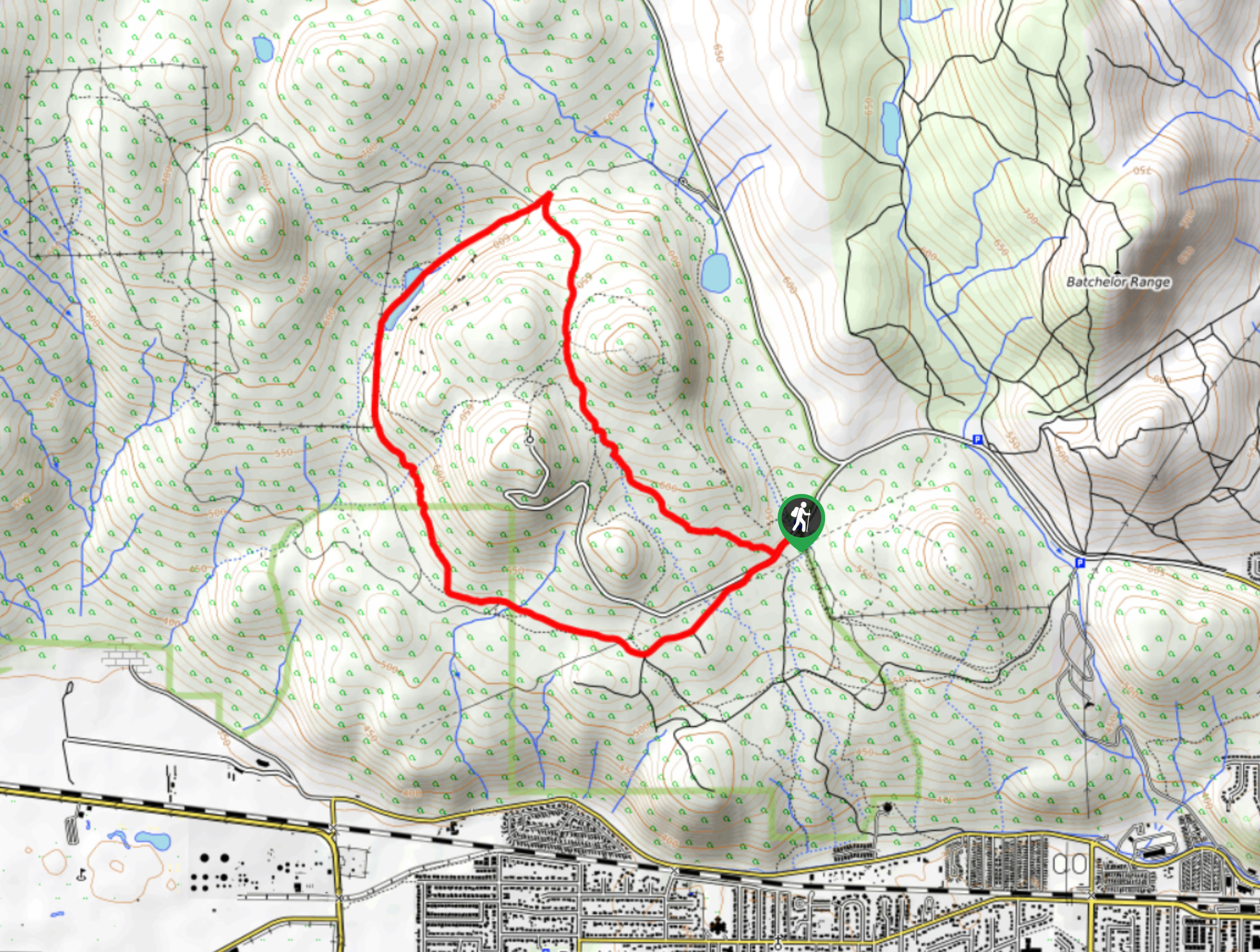
The Margaret Falls Upper Loop is a 3.4mi hiking circuit in Herald Provincial Park that climbs uphill through the forest along Reinecker Creek and offers some amazing views of the falls. Along the trail, you will experience a scenic forest setting filled with mature trees and other types of vegetation, as well as some amazing views of Margaret Falls and Shuswap Lake. This route is made up of wide paths that are well maintained, so while some stretches are a bit steep, they are easily manageable for hikers of most skill levels.
Getting there
To reach the trailhead for the Margaret Falls Upper Loop from Salmon Arm, head west on BC-1 for 9.4mi and turn right onto Sunnybrae-Canoe Point Road. After 7.1mi, you will find the parking area on the left.

About
| When to do | May-October |
| Backcountry Campsites | Bastion Mountain, Reinecker, Homestead |
| Pets allowed | No |
| Family friendly | Yes |
| Route Signage | Average |
| Crowd Levels | Moderate |
| Route Type | Circuit |
Margaret Falls Upper Loop Trail
Elevation Graph
Weather
Margaret Falls Upper Loop Trail Description
While the Margaret Falls Upper Loop is a great hiking route that will allow you to explore Herald Provincial Park, there are a few things to consider before planning a trip into the area. The park is sometimes subject to inclement weather such as flooding that will see the trail restricted until conditions are safe enough for hikers. Additionally, the steeper sections of the trail can become quite icy during the shoulder seasons and will likely require microspikes to safely traverse. Hikers should also remember to bring bear spray along for this hike, as black bears and cougars are often spotted in the area. Lastly, foot traffic can be high during peak times due to the three campsites located along the trail. Make sure to arrive early enough to secure parking and enjoy a bit of solitude on your hike.
All of these things considered, this is an amazing family-friendly hike that you will not want to miss. Along the trail, you will be able to relax in the breathtaking forest setting and experience the raw power and natural beauty of the falls themselves before hiking along the edge of Shuswap Lake and making your way through the heavily forested canyon. There is so much to do and see while in the area that you might as well combine this hike with a weekend of camping at one of the nearby sites.
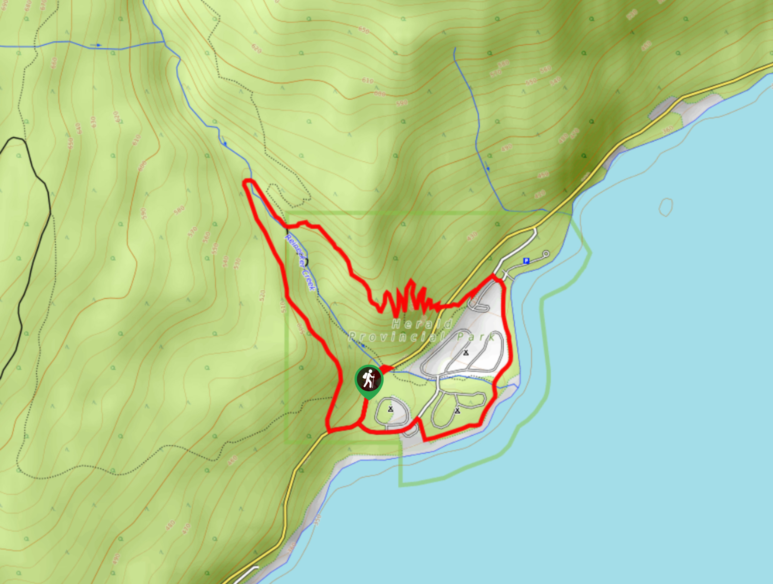
Setting out from the parking area, follow the trail to the northeast and cross over Reinecker Creek, before heading left at the junction to make your way up to Margaret Falls. You will need to hike along the creek for roughly 1181ft and cross over several bridges to arrive at the falls, where you will have an amazing view of the cascading water as it drops off the vertical rock wall towering above. After taking in the views, head down the same trail and turn right at the junction to pass the parking area and make your way to the Bastion Campground.
Follow the trail along the road and turn left to enter the campground on a route that will skirt along the edge of Shuswap Lake. Take in the amazing views across the water, continuing on for 1.1km until you arrive at a parking area. Cut through the parking area, where you will find the Upper Canyon Trail on its northern side
Take the Upper Canyon Trail to cross over the road and begin your uphill climb through a series of switchbacks. After roughly 1804ft, you will come to a scenic lookout with some nice elevated views across the lake. Continue uphill along the heavily-forested trail for 2789ft, while you enjoy the serene atmosphere under the thick canopy of the trees.
Arriving at a junction, pass straight through to arrive at the northernmost point of the trail at another crossing of Reinecker Creek. Make your way to the other side and follow the trail as it turns to the south on a 1km journey through the tranquil forest back to the side of the road. Once there, go left and you will arrive back at the parking area in 787ft, having completed the Margaret Falls Upper Loop.
Insider Hints
The trail can become icy in the shoulder seasons, so make sure to bring microspikes if you are looking to hike during these times.
Dogs are only allowed in a small area near the Reinecker Campground due to animal activity in the area.
Bring bear spray and make plenty of noise along the trail, as black bears and cougars are often spotted in the area.
Stop in at the park gate for a trail map and informational brochure (also downloadable on the BC Parks site).
Similar hikes to the Margaret Falls Upper Loop Trail hike
Community Trail
The Community Trail is a 8.3mi point-to-point hiking route just north of Kamloops, BC, that will allow you…
Lac du Bois Tower Loop
The Lac du Bois Tower Loop is a 4.0mi hiking circuit northwest of Kamloops that will allow you…
Gibraltar Rock
The trek to Gibraltar Rock follows a 2.0mi out-and-back trail that sets out from the Paul Lake Beach…
Comments