

Pilot Bay Lighthouse Trail
View PhotosPilot Bay Lighthouse Trail
Difficulty Rating:
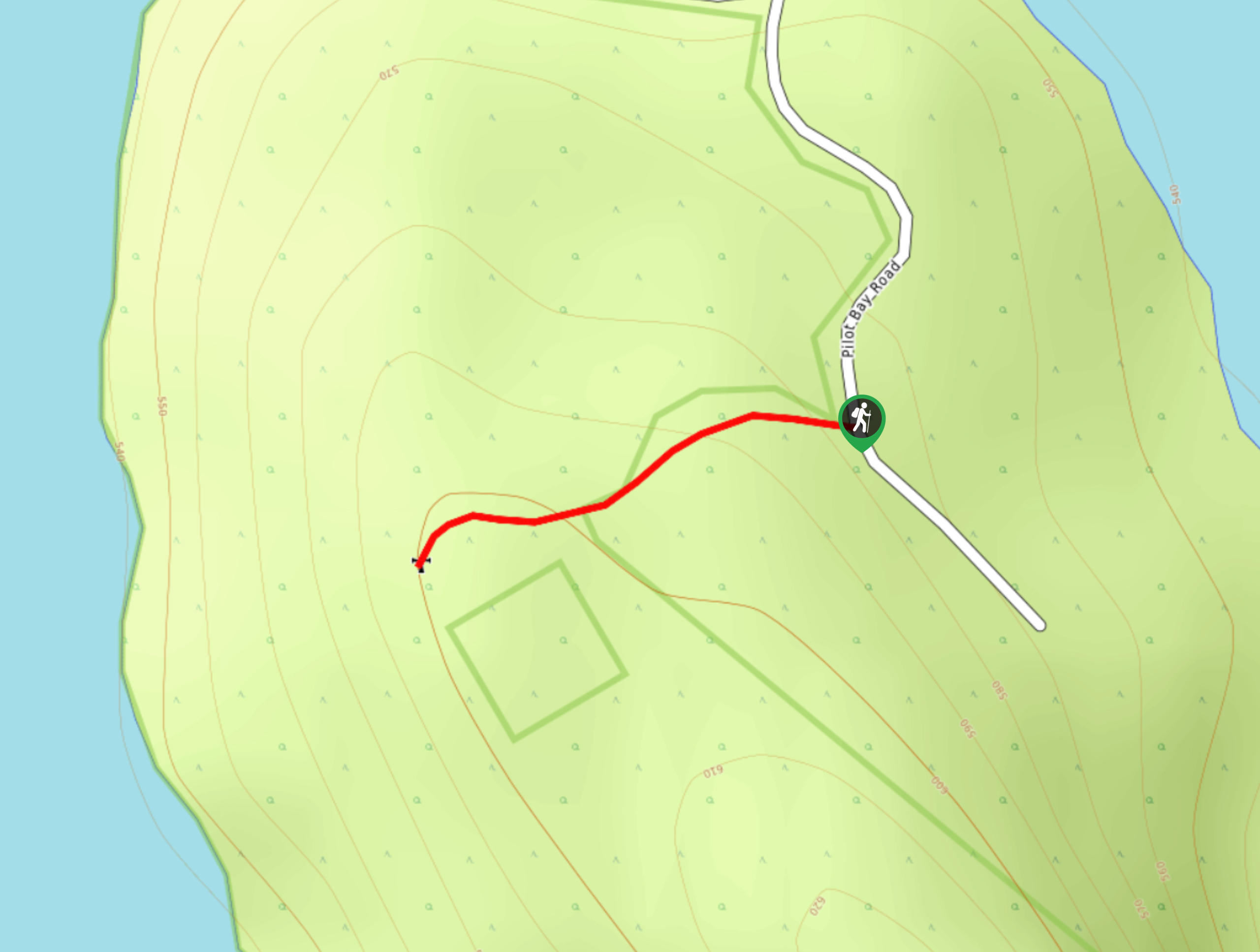
The Pilot Bay Lighthouse Trail is a 0.4mi out-and-back hiking route in Pilot Bay Provincial Park that will briefly take you uphill to visit an historic lighthouse that was built in 1904. Along the hike you will be surrounded by a beautiful forest setting and have views stretching out over Kootenay Lake. This is a short family-friendly hike that is also suitable for those with historical interests.
Getting there
To get to the trailhead for the Pilot Bay Lighthouse Trail from Crawford Bay, head west on BC-3A for 2.9mi and turn left onto Pilot Bay Road. After 2.6mi, make a slight left and you will find the trailhead in 984ft.
About
| When to do | Year-Round |
| Backcountry Campsites | No |
| Pets allowed | Yes - On Leash |
| Family friendly | Yes |
| Route Signage | Average |
| Crowd Levels | Low |
| Route Type | Out and back |
Pilot Bay Lighthouse Trail
Elevation Graph
Weather
Pilot Bay Lighthouse Trail Description
Hiking along the Pilot Bay Lighthouse Trail is a fun (albeit short) experience that allows you to experience the natural beauty of Pilot Bay Provincial Park, while learning a bit about the history of the area as well. Hikers will make their way up the forested hill to visit a lighthouse that was built and activated around the turn of the century, during the era when steamwheeler ships were a prevalent way of transporting goods and people between the various mining communities in the area. From the viewpoint around the lighthouse, hikers will have an amazing view that looks out over all three arms of Kootenay Lake and its forested shores. After taking in the views, carefully head back down the slope to return to your vehicle, having completed the Pilot Bay Lighthouse Trail.
Similar hikes to the Pilot Bay Lighthouse Trail hike

Wilson Creek Falls Trail
The Wilson Creek Falls Trail is a 1.8mi out-and-back route in Goat Range Provincial Park that travels along…

McPhee Waterfalls Hike
The McPhee Waterfalls Hike is a 3.5mi out-and-back hiking route near Castlegar, BC, that will take you along…

Merry Creek Trail
The Merry Creek Trail is a 2.8mi lollipop hiking route in Castlegar, BC that passes through a picturesque…


Comments