

Tex Lyon Trail
View PhotosTex Lyon Trail
Difficulty Rating:
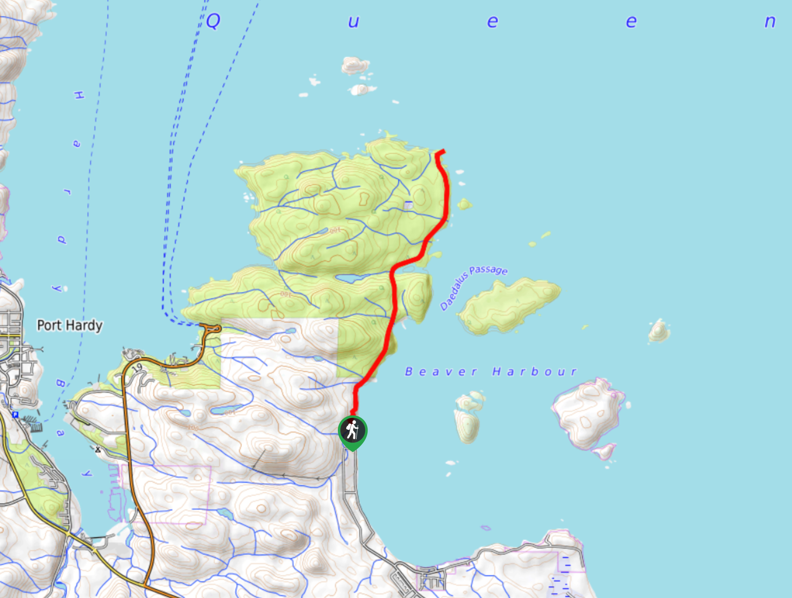
The Tex Lyon Trail is a 7.9mi out-and-back hiking route near Port Hardy, BC that will allow hikers to experience the natural beauty and rugged nature of the coastal landscapes of Vancouver Island. Along the route, you will have some amazing views looking out across the waters of Beaver Harbour, as well as the chance to spot local wildlife like eagles and amphibians. The trail itself is poorly maintained and overgrown, so make sure to bring a GPS to stay on the correct course.
Getting there
To get to the Tex Lyon trailhead from Port Hardy, make your way south for 3.2mi along BC-19 and turn left onto Byng Road. Make a left after 2.2mi onto Beaver Harbour Road follow it for 2.1mi before turning left onto Chatham Street. In 787ft, you will find the trail straight ahead.
About
| When to do | Year-round |
| Backcountry Campsites | No |
| Pets allowed | Yes |
| Family friendly | No |
| Route Signage | Poor |
| Crowd Levels | Low |
| Route Type | Out and back |
Tex Lyon Trail
Elevation Graph
Weather
Tex Lyon Trail Description
Due to the unmaintained nature of the route, the Tex Lyon Trail isn’t recommended for beginner hikers and should be completed with a good trail map or GPS so as not to get lost while out on your hike. Additionally, the trail follows very closely along the coast and the tide should be taken into account when planning your journey.
Setting out from the trailhead, make your way north along the edge of the coast and utilize the log bridges to cross over the streams. The route is fairly overgrown, so take your time as you carefully navigate through the thick brush. Muddy sections along the trail will have installed ropes in order to help you traverse the challenging terrain. Roughly halfway through the hike, the trail will take a detour through the forest around a small cove before continuing onto the point at the terminus of the trail. From here, hikers can enjoy scenic views across the blue water before retracing their steps back to the trailhead.
Similar hikes to the Tex Lyon Trail hike

Tod Mountain via Altitude Trail
Tod Mountain via Altitude Trail is a 6.0mi lollipop hiking route at the Sun Peaks Mountain Resort that…

Merry Widow Ridge
The Merry Widow Ridge Trail is a 4.3mi out-and-back hiking route on the northern end of Vancouver Island…

Dave Farrant Trail to Blinkhorn Point
The Dave Farrant Trail to Blinkhorn Point is a 47.8mi out-and-back hiking route that follows closely along the…


Comments