

Woss Lookout
View PhotosWoss Lookout
Difficulty Rating:
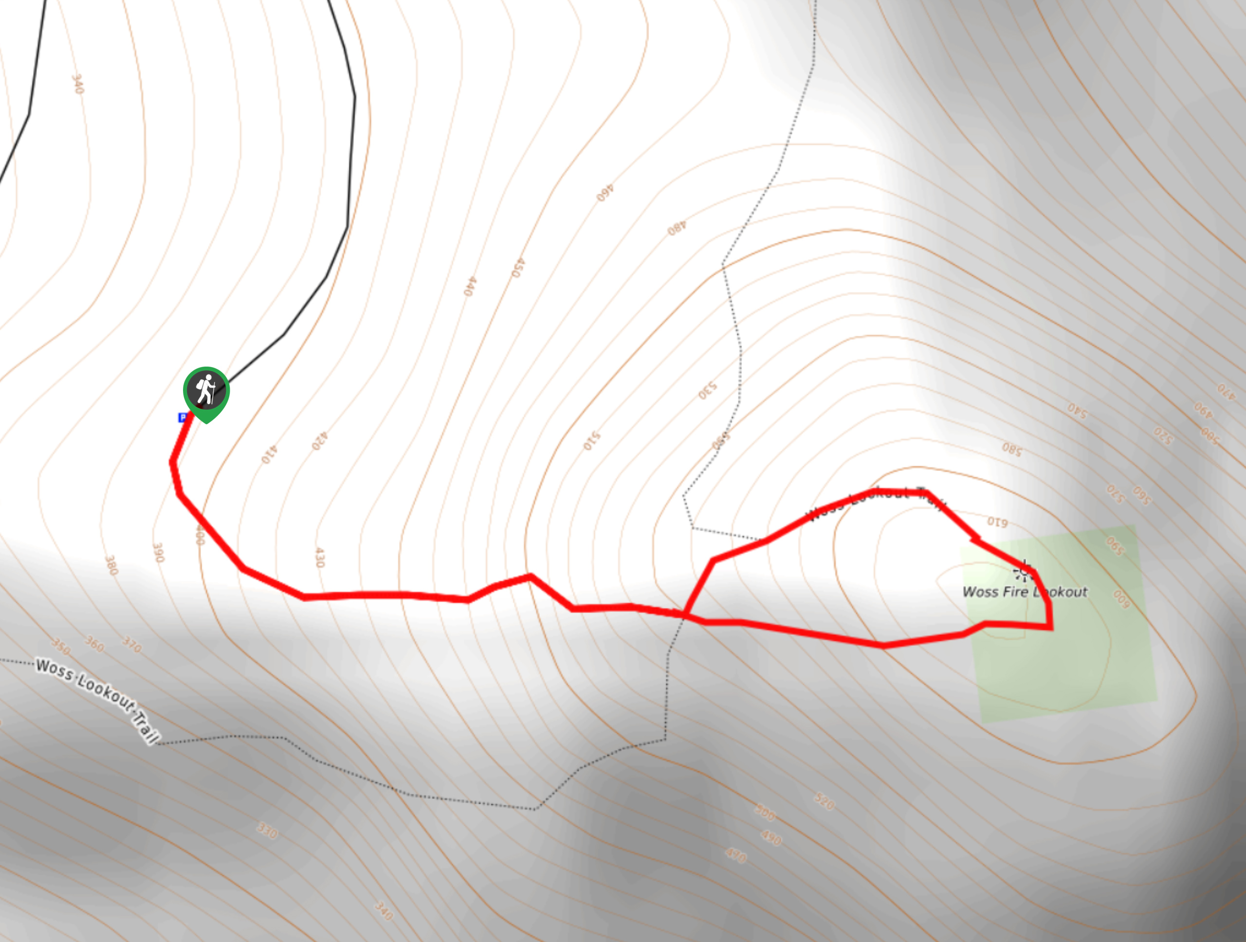
The hike up to Woss Lookout is one of the best value hikes that you can find in northern Vancouver Island. This 0.9mi out-and-back hiking route will take you up a steep hill to an absolutely breathtaking viewpoint that offers a sightline over the Nimpkish River Valley and the surrounding mountain peaks. Make sure to attempt the drive in with a 4x4 high clearance vehicle, as the road is very rough with steep drop offs.
Getting there
To reach the Woss Lookout trailhead from Woss, head northeast on Englewood Drive for 2133ft and turn left onto Markusen Main. Follow this for 2.4mi and turn right onto the gravel road. Continue on for 1.1mi to arrive at the trailhead.
About
| When to do | March-October |
| Backcountry Campsites | No |
| Pets allowed | Yes |
| Family friendly | Older Children only |
| Route Signage | Average |
| Crowd Levels | Low |
| Route Type | Out and back |
Woss Lookout
Elevation Graph
Weather
Woss Lookout Trail Description
For the minimal distance and amount of effort required, the hike up to Woss Lookout is arguably one of the most scenic hikes in northern Vancouver Island and is certainly a hidden gem in the area. The road up to the trailhead is fairly treacherous, so make sure you have an appropriate vehicle for the journey.
Setting out from the trailhead, make your way east along the trail as it enters into the cover of the forest on a steep climb up the hillside. With 732ft of elevation gain packed into the quick hike, it is definitely a bit of a leg burner, but the very short length of the trail means you will be at the summit in no time. Once there, you will be greeted by a breathtaking scene of the Nimpkish River Valley stretched out before you, flanked on either side by the rugged mountains of the island’s interior. After taking in the views, head back down the trail to return to the parking area where you began.
Similar hikes to the Woss Lookout hike

Tod Mountain via Altitude Trail
Tod Mountain via Altitude Trail is a 6.0mi lollipop hiking route at the Sun Peaks Mountain Resort that…

Merry Widow Ridge
The Merry Widow Ridge Trail is a 4.3mi out-and-back hiking route on the northern end of Vancouver Island…

Dakota 576 Crash Site Trail
The Dakota 576 Crash Site Trail is a slightly overgrown but fun hiking route that will take you from Bear…


Comments