

Trail of Hope
View PhotosTrail of Hope
Difficulty Rating:
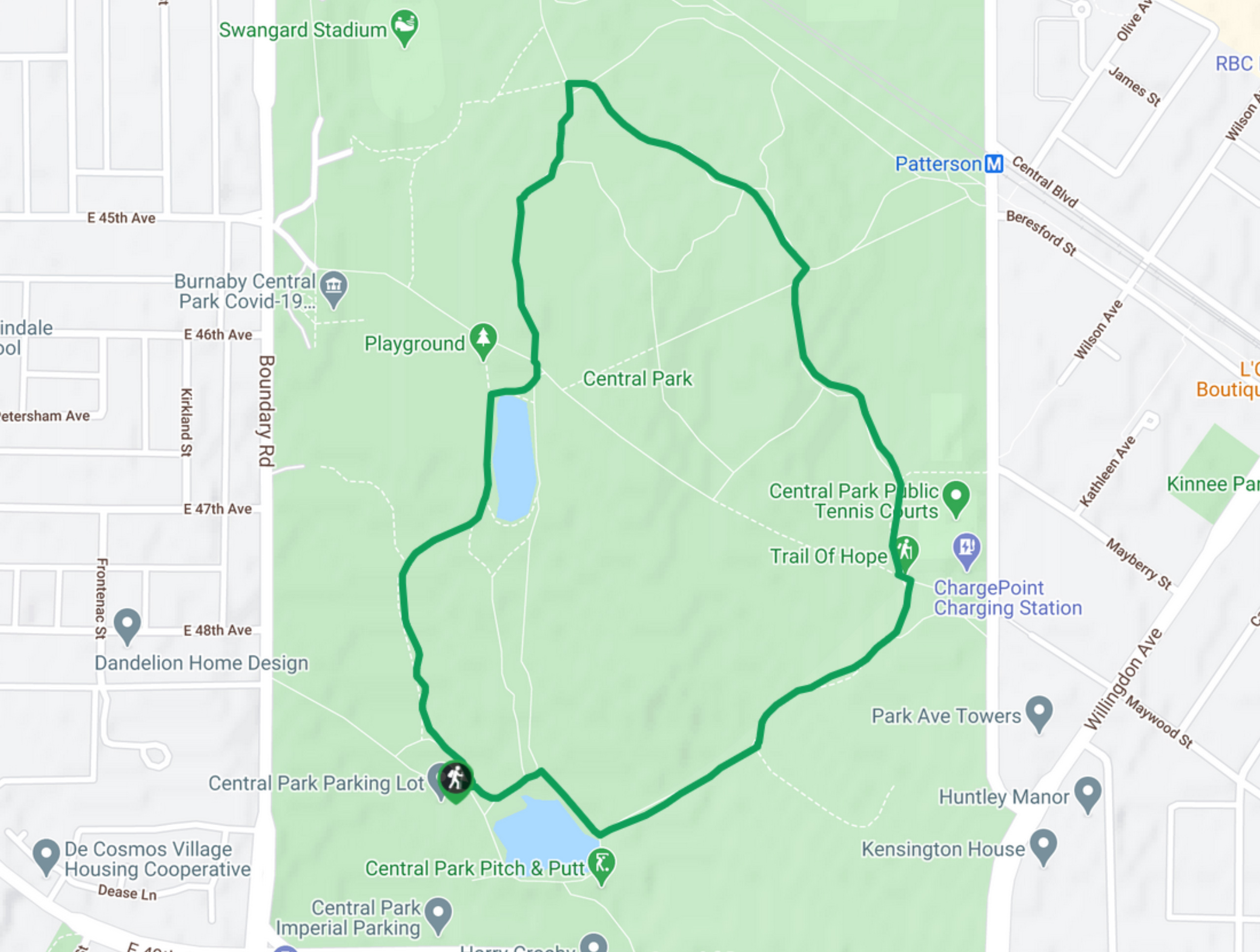
The Trail of Hope is a 1.4mi loop route through the network of trails within Central Park in Burnaby, BC. The trail has minimal elevation changes and a wide gravel path, making it ideal for families and hikers of all skill levels and capabilities to get out and enjoy the outdoors. Highlights along the trail include two ponds, various picnic areas and the Swangard Stadium.
Getting there
To get to the parking area for the Trail of Hope from Vancouver, drive south along Main Street, using the left lanes to turn slightly left onto Kingsway/BC-1A/BC-99A S. After 7km, make a right turn onto Boundary Road and a left onto Imperial Street. After 656ft, turn left to enter Central Park and you will arrive at the parking area.
About
| When to do | Year-Round |
| Backcountry Campsites | No |
| Pets allowed | Yes - On Leash |
| Family friendly | Yes |
| Route Signage | Average |
| Crowd Levels | High |
| Route Type | Circuit |
Trail of Hope
Elevation Graph
Weather
Trail of Hope Description
The Trail of Hope is a forested route through Burnaby’s Central Park that is popular with hikers, dog walkers, and families. Due to this popularity, foot traffic can be extremely high along the trail, especially on weekends or during peak hours. It is best to arrive early to the park in order to secure a parking spot and take full advantage of the trails before the crowds arrive.
This trail is a short loop through the park that passes by two ponds and several recreational areas. The park is heavily forested, making it a great escape within the city limits for when you just need a little bit of peace and quiet without actually leaving the city. In addition to this scenic woodland setting, the park is also home to a number of wildlife species such as ducks, geese, and squirrels. This, plus the fact that the trail is stroller and wheelchair friendly, makes the park an ideal option for getting out and exploring nature with the entire family.
Setting out from the parking area, follow the trail to the right as it skirts around the Lower Pond. Continue east along the trail as it passes through the dense tree cover of the park and turns north past the tennis courts. From here, keep following the trail as it veers northwest, ending up near the Swangard Stadium. Keep on the Trail of Hope as it turns south, passing by the Upper Pond on its way back to the parking lot off of Imperial Street.
Similar hikes to the Trail of Hope hike

Trans Canada and Pandora Trail Loop
The Trans Canada and Pandora Trail Loop is a combination of several trails within the Burnaby Mountain Conservation Area that…

DeBoville Slough to Addington Lookout
The hike along DeBoville Slough to Addington Marsh is an easy 6.0mi out-and-back trail along a paved path…

Port Moody Shoreline Trail
The Port Moody Shoreline Trail is a 3.6mi out-and-back route that follows along the beautiful waters of the…


Comments