

Eagle Mountain Powerline Trail
View PhotosEagle Mountain Powerline Trail
Difficulty Rating:
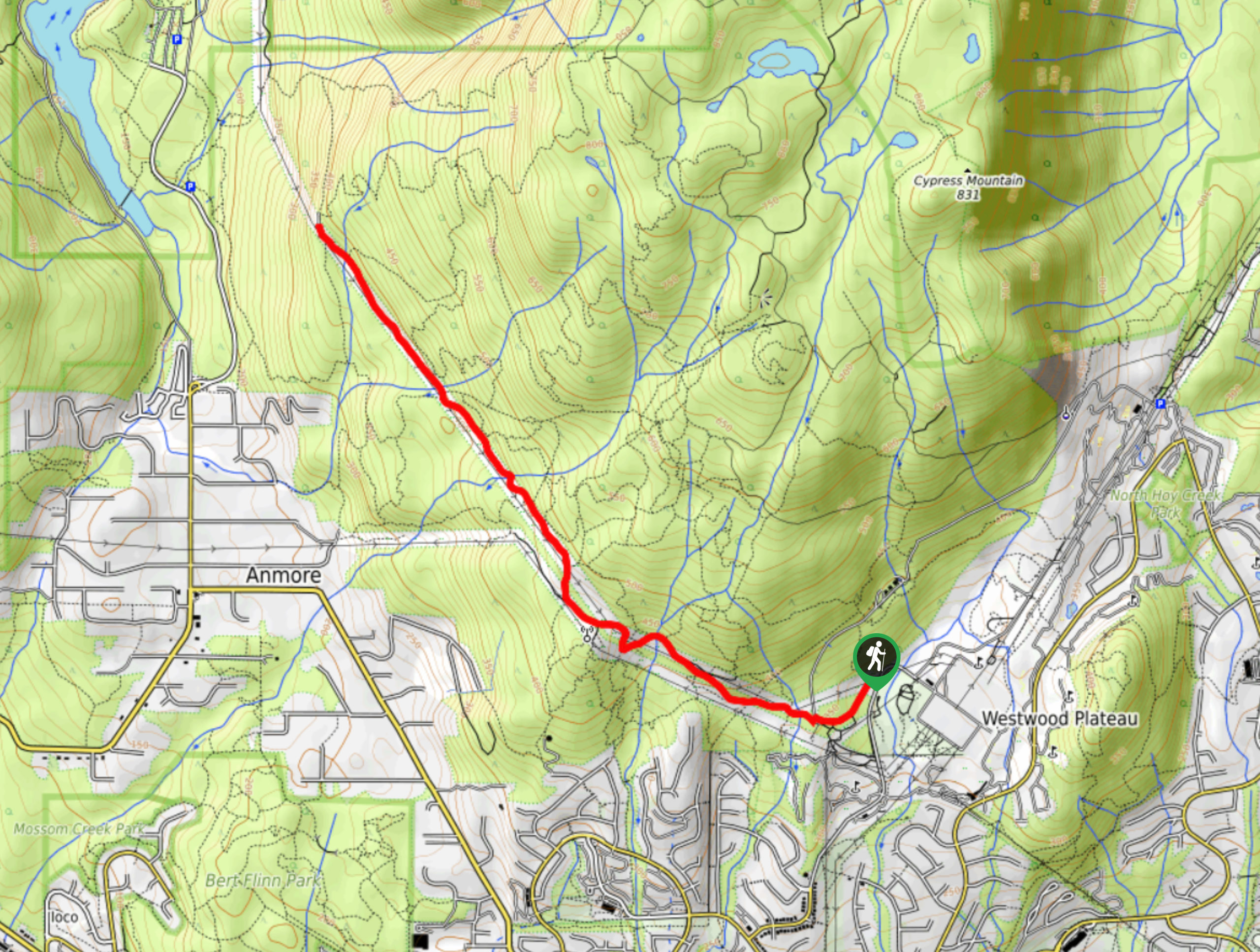
The Eagle Mountain Powerline Road is a fairly easy-going 5.1mi out-and-back route that travels along a clearing in the forest up to a viewpoint over Buntzen Lake. The trail itself doesn’t contain many views, but the wide gravel path offers a gentle uphill climb that is accessible for most skill levels, and the view over the lake is spectacular. This is a straightforward route that makes for an easy afternoon outing.
Getting there
To reach the trailhead for Eagle Mountain Powerline Road from Coquitlam, drive north on Johnson Street and make a left turn onto Parkway Boulevard. After 2297ft, make a left onto Panorama Drive and continue on for 900m. From here, make a right onto Eagle Mountain Drive and follow it for 1.0mi to reach the trailhead on the left.
About
| When to do | April-November |
| Backcountry Campsites | No |
| Pets allowed | Yes - On Leash |
| Family friendly | Older Children only |
| Route Signage | Average |
| Crowd Levels | Low |
| Route Type | Out and back |
Eagle Mountain Powerline Trail
Elevation Graph
Weather
Eagle Mountain Powerline Road Description
The Eagle Mountain Powerline Road covers a stretch of trail that cuts through the forest along a set of power lines north of Coquitlam. Because the route makes use of an access road, the trail is wide and easily navigated for the entirety of its length. Although it is very well maintained, hikers utilizing this route should still wear proper hiking footwear, as stretches of the trail are fairly rocky, and certain parts may become muddy in wet weather. Additionally, hikers should make sure to bring bear spray along with them, as bears are known to frequent the cleared areas along the forest’s edge.
Due to the nature of the trail and the fact that it is surrounded by dense forest on both sides, there are not any real views along the hike. That is not to say that there are none, but hikers will have to wait until the end of the trail to be rewarded with a scenic view that overlooks Buntzen Lake. While this route may not be the most visually stunning, it does offer a nice hike through the woodlands along a very well maintained trail that most people will enjoy.
Setting out from the trailhead, make your way along the paved road for about 1312ft, keeping an eye out for a trail on the left that branches off past a gate. Make your way through the gate and cross over Noons Creek to begin your journey along the gravel expanse of the Eagle Mountain Powerline Road.
In terms of navigation, this route is about as easy as they come, requiring hikers to simply keep along the wide gravel path as it slowly climbs uphill. Although named after nearby Eagle Mountain, this access road does not lead directly up to the peak. Instead, the end of the road links up with a network of trails that can be followed northeast towards the summit.
Continuing along the trail, approximately 2625ft after crossing Noons Creek, you will approach a separate branch known as West Noons Creek. Cross over it and follow the trail as it winds back and forth along the powerline clearing and past the radio towers on the left. 200m after the radio towers, there will be a fork in the trail. Keep right to continue uphill toward the viewpoint over Buntzen Lake.
Keep hiking along the gentle incline of the route for another 1.4mi, crossing over Mossom and Annore creeks, before arriving at the beautiful lookout over Buntzen Lake. Take in the scenic views of the woodland landscape and the majestic mountains positioned ruggedly in the backdrop before making your way back down Eagle Mountain Powerline Road to return to your vehicle.
Hiking Route Highlights
Buntzen Lake
Buntzen Lake has been a producer of hydroelectric energy for the surrounding area since 1904. Previously known as Trout Lake and Lake Beautiful, Buntzen Lake is now better known as an extensive recreational area. While it is still used to generate power, the 3.0mi lake has seen its contribution to the grid drop to 0.4% of BC Hydro’s supply.
Insider Hints
As with most BC hiking trails, bring bear spray.
Although this is an access road, wear proper hiking footwear as sections of the trail are fairly rocky.
This route is frequently used by mountain bikers, so be mindful of your surroundings when on the trail.
Similar hikes to the Eagle Mountain Powerline Trail hike

Trans Canada and Pandora Trail Loop
The Trans Canada and Pandora Trail Loop is a combination of several trails within the Burnaby Mountain Conservation Area that…

Quarry Trail
The Quarry Trail is a scenic hike through the beautiful wetlands of Minnekhada Regional Park that takes hikers to several…

DeBoville Slough to Addington Lookout
The hike along DeBoville Slough to Addington Marsh is an easy 6.0mi out-and-back trail along a paved path…


Comments