Mosquito Creek Hike
View Photos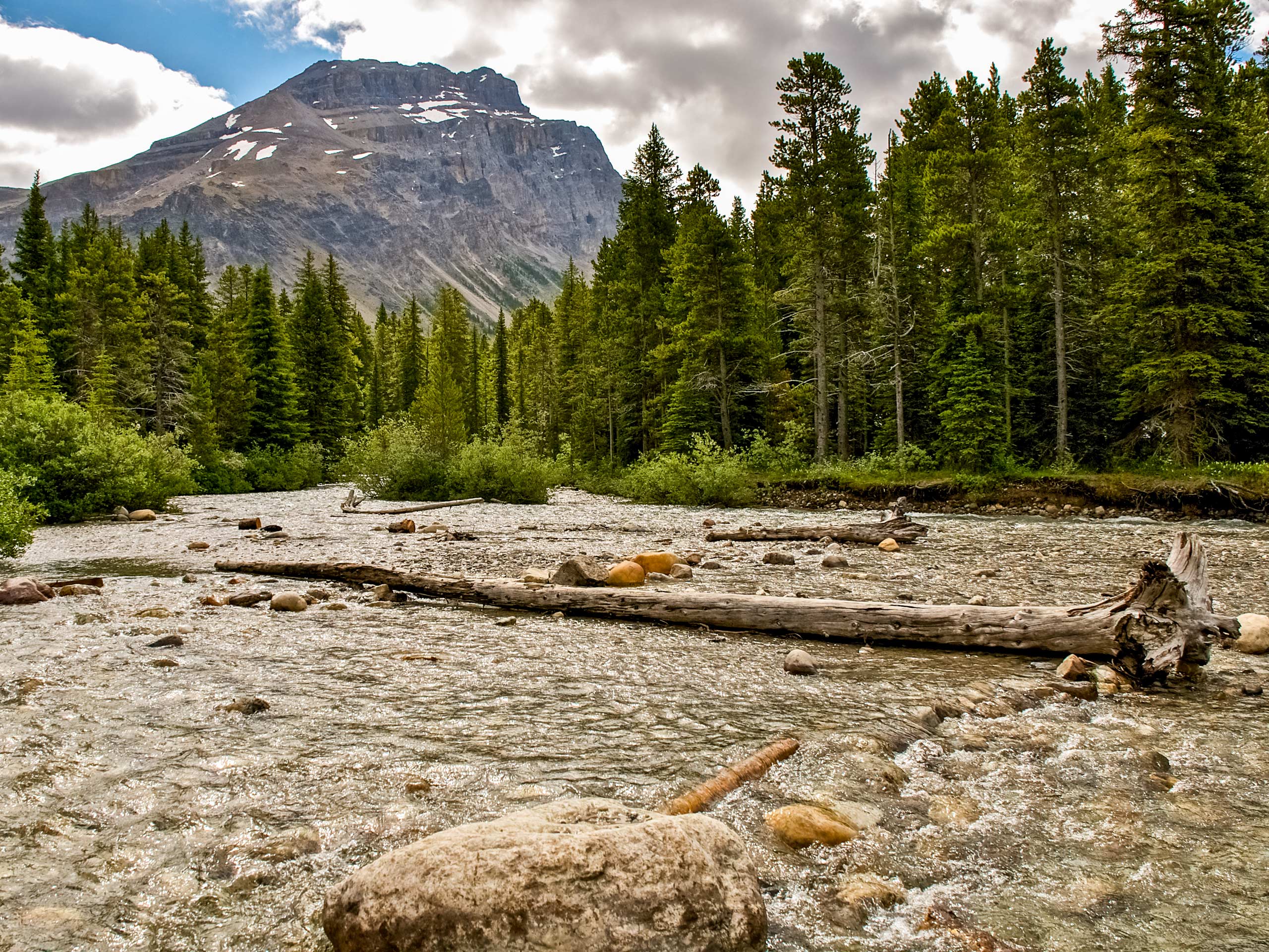
Mosquito Creek Hike
Difficulty Rating:
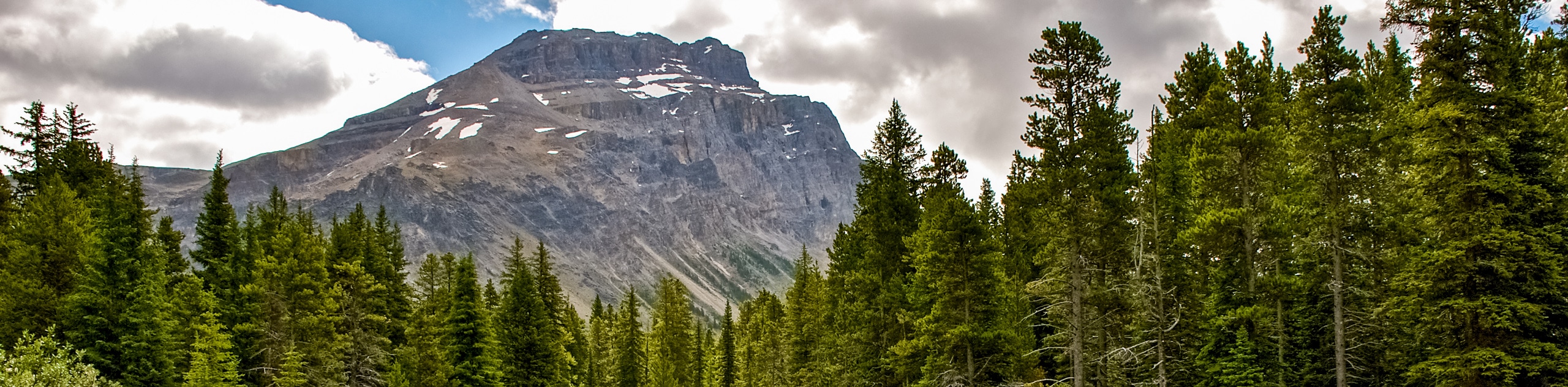
Starting from Mosquito Creek Wilderness Hostel, this hike winds up the Mosquito Valley, providing occasional views of the grand Noseeum Mountain. It will lead hikers to the flowing Mosquito Creek, where a quaint backcountry campground is situated. This is a great rest stop for lunch as there are picnic tables and pit toilets.
Getting there
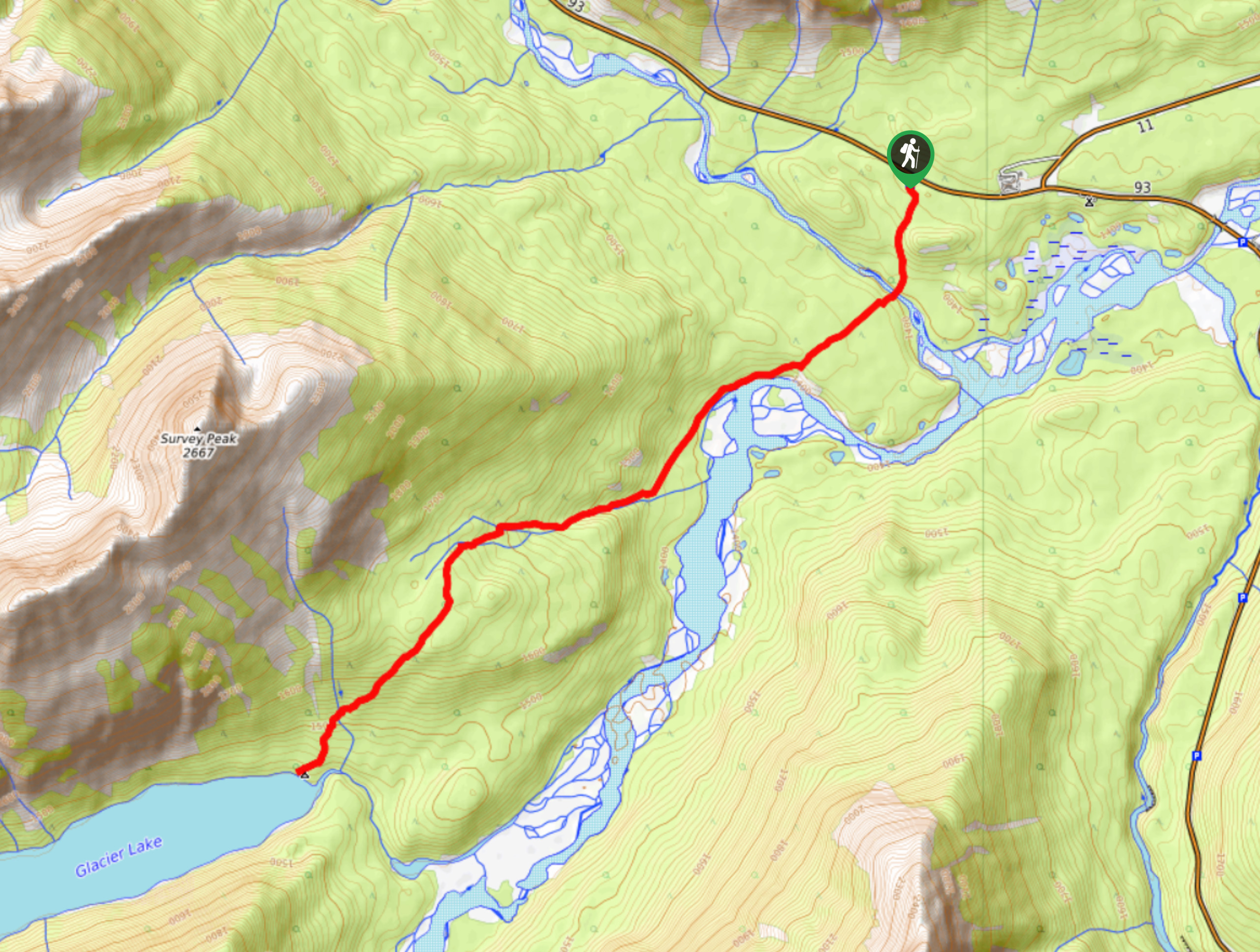
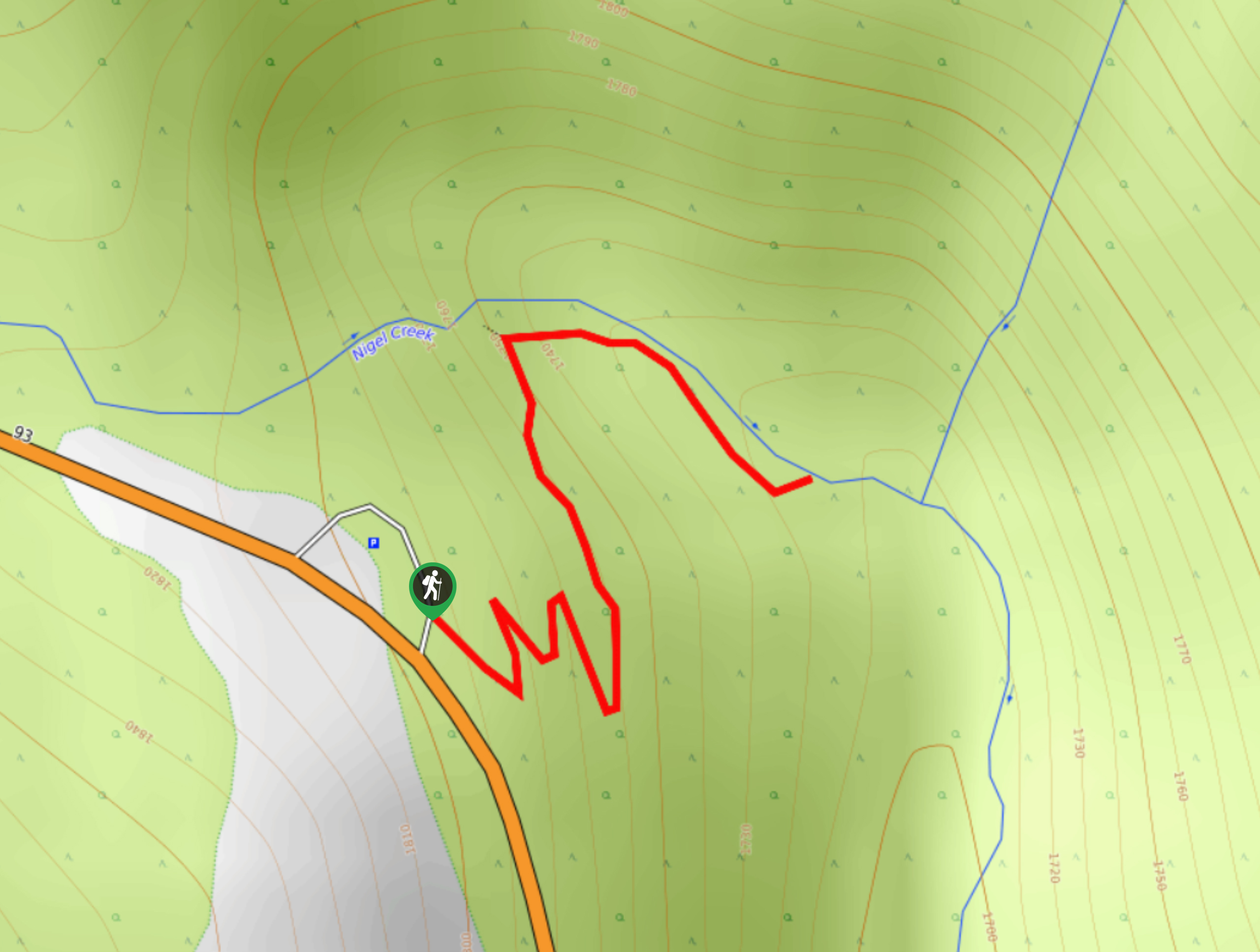
To get to Mosquito Creek hike, travel along the Trans-Canada Highway from Banff, continuing on to the Icefields Parkway (93N) Highway. Make sure you have a valid park pass here. From the beginning of the Icefields Parkway, travel 18.6mi north until you reach the Mosquito Creek Wilderness Hostel. Turn left to the hostel and park in the parking lot. Cross the highway to the east side, where you will begin your hike up Mosquito Creek.

About
| When to do | June-September |
| Backcountry Campsites | Mosquito Creek (Mo5) Parks Canada |
| Pets allowed | Yes - On Leash |
| Family friendly | Yes |
| Route Signage | Average |
| Crowd Levels | Low |
| Route Type | Out and back |
Mosquito Creek Hike
Elevation Graph
Weather
Mosquito Creek Trail Description:
Mosquito Creek trail starts on the east side of the Icefields Parkway across from Mosquito Creek Wilderness Hostel. The trail follows the Mosquito Valley to the Mo5 campground, where your turnaround point will be. As you wind through Mosquito Valley, you will come to various clearings that give excellent views of Nooseum Mountain. After 1.6mi, you will find a faint trail to the OXO Peak scramble route off to the left. Stay on the main trail, and another faint trail for the same scramble will appear in another 1640ft. Continue along the trail through the forest for about 2625ft before passing another faint trail to the left that leads to Quartzite Peak.
The trail is reliable and straightforward, leading to the creek crossing and footbridge at the Mosquito Creek Campground. The trail continues on to some more difficult trails and campgrounds at Molar Creek and Fish Lakes, respectively. Beware that the campground serves as a junction for further backpacking routes as well as the scramble routes for Mosquito Mountain and Ramp Peak. These are all excellent additions for those looking for a longer, more technical day.
The hike to Mosquito Creek is a great option for families or those who aren’t ready for more distance and elevation. This hike may be a 6.2mi roundtrip, but Mosquito Creek is still a great distance for a day hike. You will be mostly in the valley, so don’t expect any grand alpine views. You will catch some of the surrounding peaks and be able to enjoy the calm sounds of the creek at the campground where your hike will end.
Insider Hints
Plan a stay at the Wilderness Hostel for a fun excursion
Book a site at Mo5 campground for an overnight hike
Take the whole family on this easy-to-accomplish trail
Similar hikes to the Mosquito Creek Hike hike
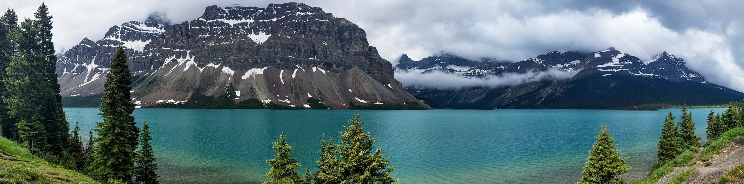
Glacier Lake
The relatively flat Glacier Lake trail is commonly used by backpackers; however, it makes for an excellent day hike. Whether…
Waterfowl Lake Trail
This quick and easy route takes families to Upper Waterfowl Lake from the Waterfowl Lakes Campground. Lower Waterfowl Lake is…
Panther Falls
The Panther Falls Hike is often missed by those travelling the Icefields Parkway. Tucked away between more popular landmarks, Panther…
Comments