Bow Summit hike
View Photos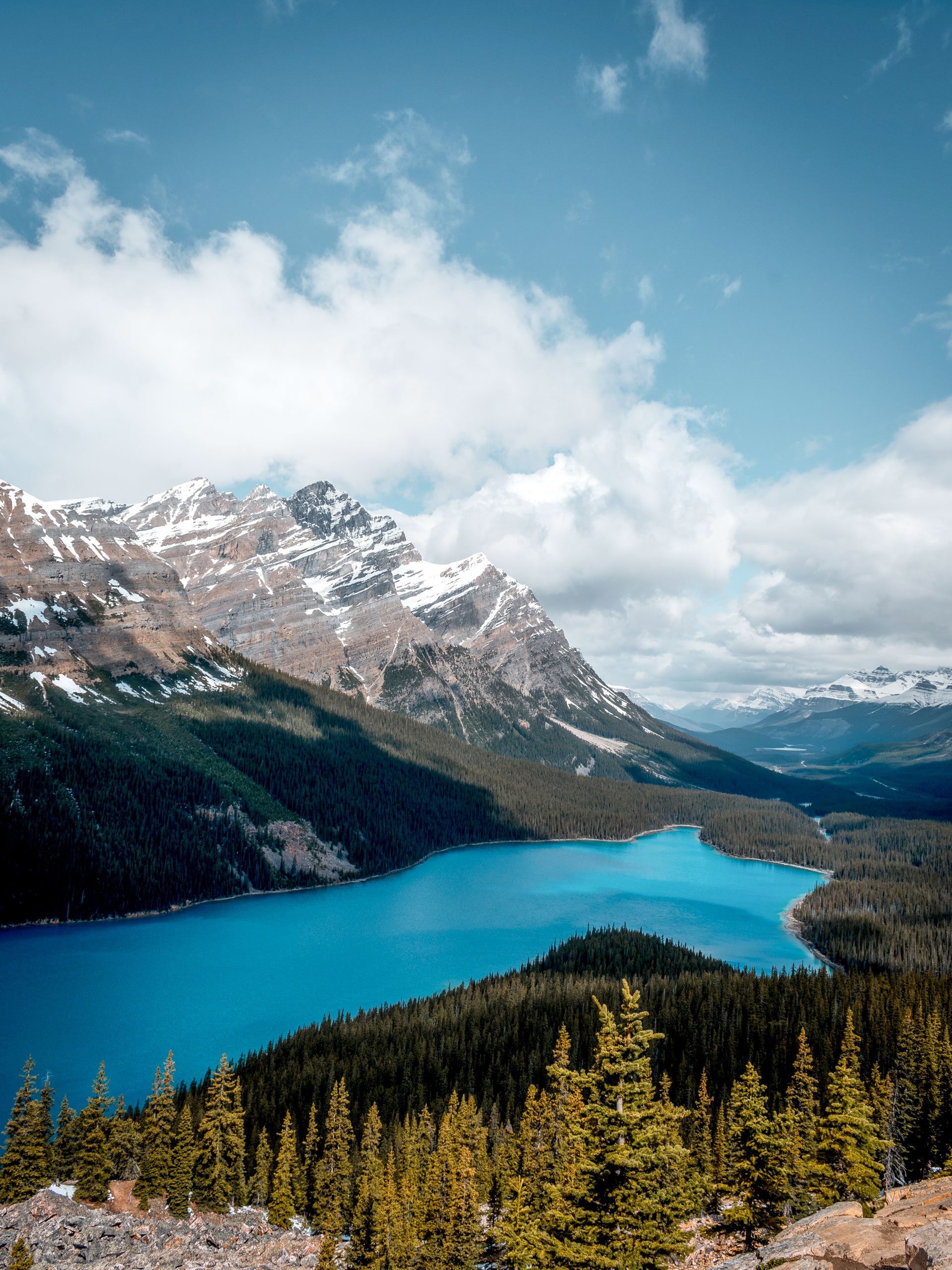
Bow Summit hike
Difficulty Rating:
Bow Summit is a popular hike, but not as popular as its precursor, Peyto Lake viewpoint. You may feel discouraged when you see the crowds, but as you continue you will leave them behind. This is an excellent way to see glaciers, lakes, rivers and peaks from a height without a full-day excursion. This close-to-the-car trail is a great way for the entire family to stretch their legs along the Icefields Parkway.
Getting there
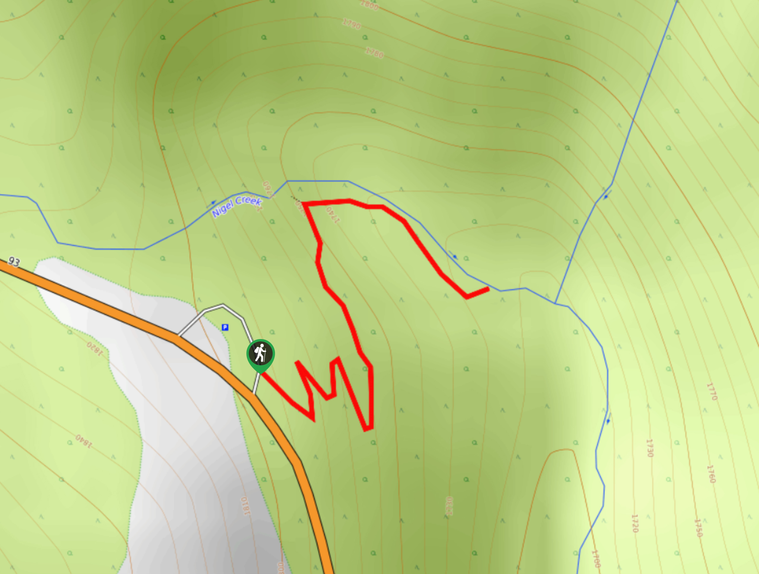
To get to Bow Summit, you will travel north on the Icefields Parkway from Banff or Lake Louise. After passing the entrance to the 93N from the Trans-Canada junction, you will continue for 26.1mi to the Bow Summit parking lot. If you lose track of distance, it is 3.0mi north of Num-Ti-Jah lodge at Bow Lake. Pull into the Bow Summit parking lot, and your trail begins here.

About
| When to do | June-September |
| Backcountry Campsites | No |
| Pets allowed | Yes - On Leash |
| Family friendly | Yes |
| Route Signage | Average |
| Crowd Levels | High |
| Route Type | Out and back |
Bow Summit
Elevation Graph
Weather
Bow Summit Trail Description:
The Peyto Lake viewpoint is extremely populated with tourists during the summer. Keep in mind that this is one of the most recommended stops along the scenic Icefields Parkway. But don’t let the crowds chase you away—there is a reason this trail is so popular! However, choosing to take the route to Bow Summit beyond the main viewpoint will take you further away from the crowds, so don’t worry.
This hike is an excellent way to catch some incredible views of a diverse landscape without setting aside too much time. Bow Summit is an excellent choice if you are looking for a quick and impressive hike along the Icefields Parkway.
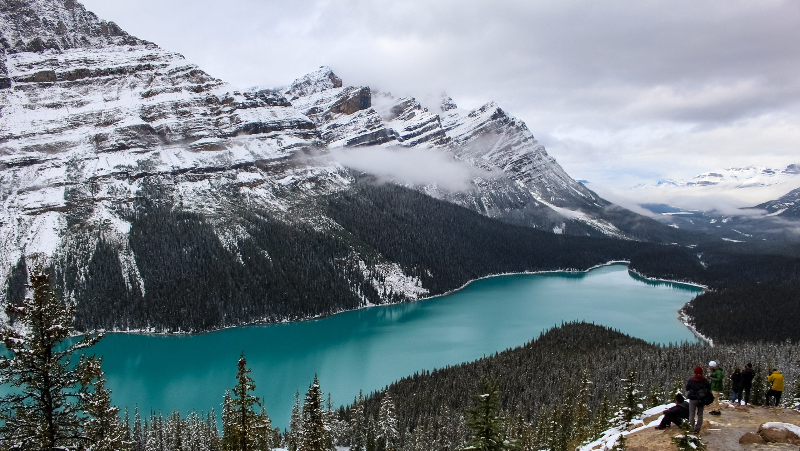
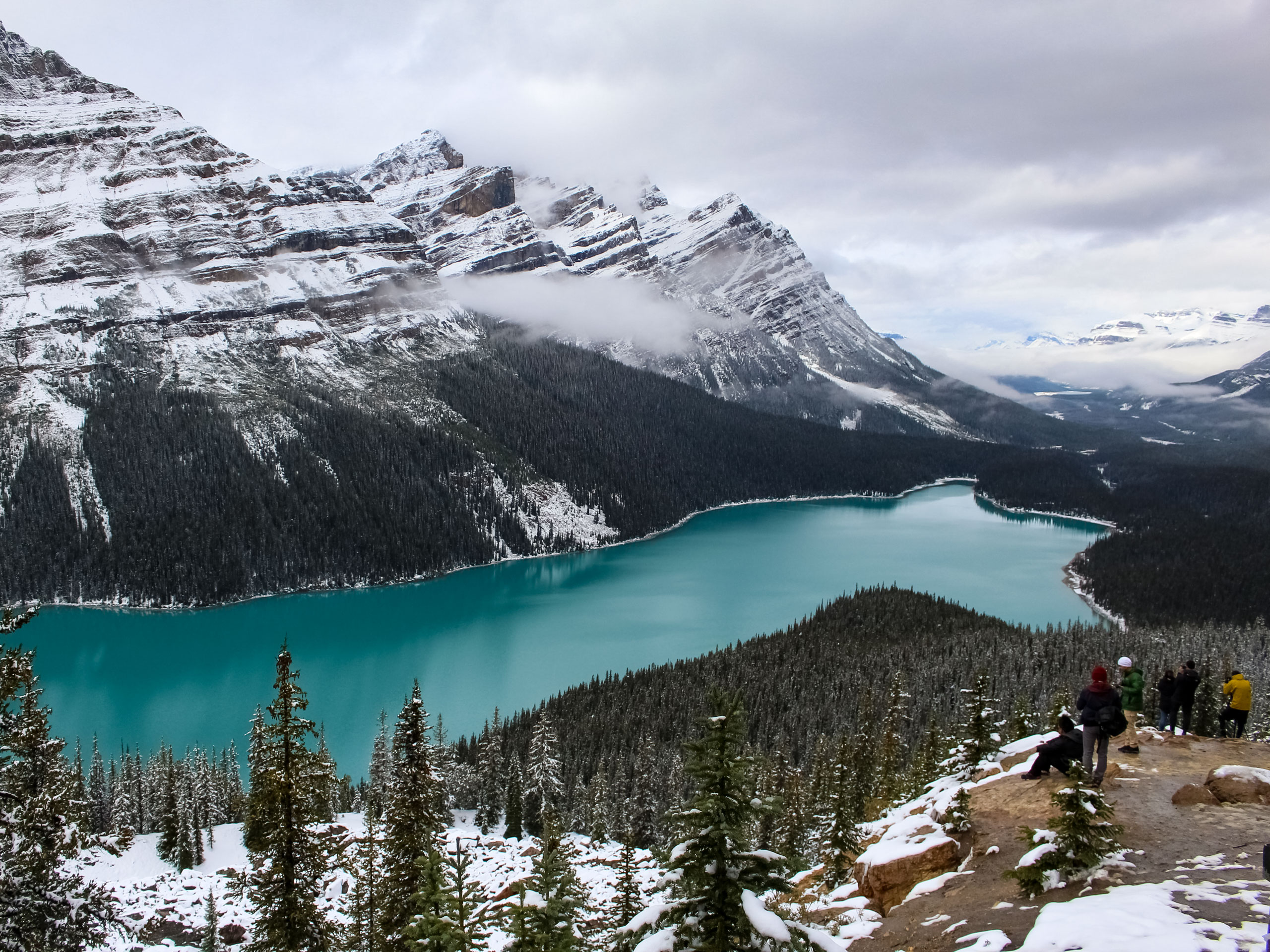
From the main parking lot, take the wide path at the back of the lot to the viewpoint to get a good look at Peyto Lake. The map will show a road that leads to the viewpoint for bus parking, but you will want to take the hiking trail.
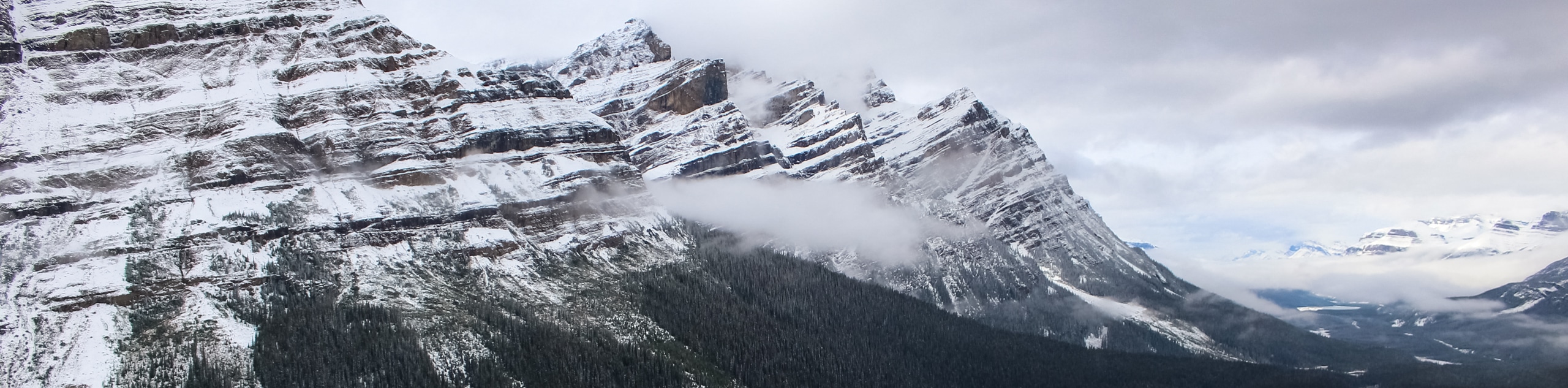
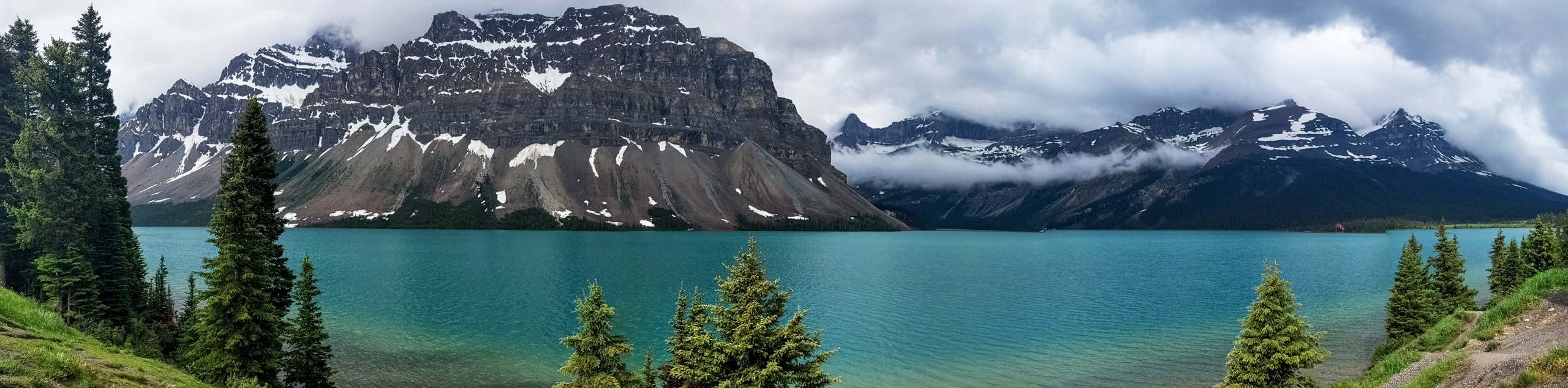
At the wooden platforms, you will find some benches and interpretive signs with information about Peyto Lake. Take in the views and look for the fox silhouette shaped by the contours of the lakeshore. Continue from here on the well-marked trail, where you will likely leave behind most of the tourists. When reaching Bow Summit, you’ll be able to see the Peyto Glacier and surrounding peaks.
Hiking Route Highlights
Peyto Lake and Glacier
Seeing Peyto Lake and Glacier from the heights of Bow Summit gives hikers new perspectives of these world-renowned landmarks. A quick hike from the car on your road trip will provide you with unforgettable views and photo opportunities.
Since opening to the public in 1941, the Icefields Parkway has been hosting visitors as they stop to admire the collection of famous viewpoints. Bow Summit is a must-do hike along the route for the whole family.
Insider Hints
Avoid the crowds by taking the hiking trail instead of the bus road
Gain local knowledge from interpretive signs
Be sure to stop at the wooden platforms to view Peyto Lake
Similar hikes to the Bow Summit hike
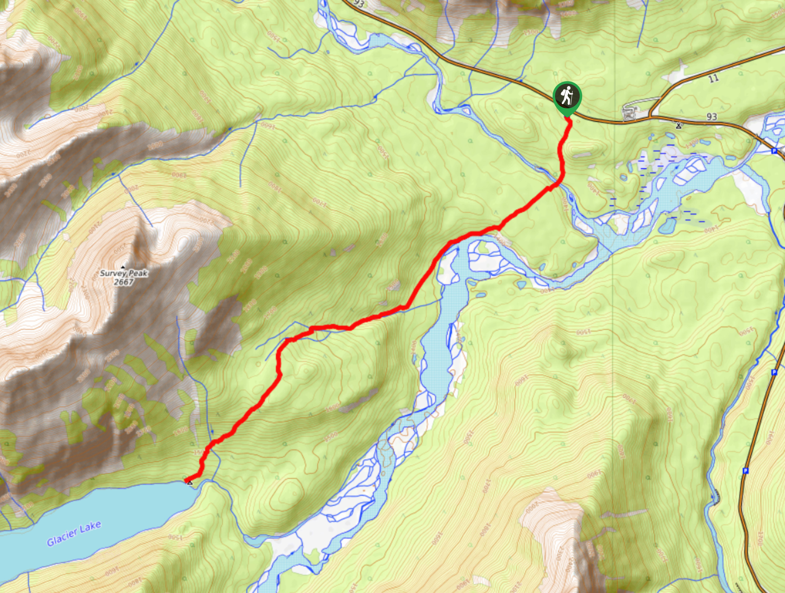
Glacier Lake
The relatively flat Glacier Lake trail is commonly used by backpackers; however, it makes for an excellent day hike. Whether…
Waterfowl Lake Trail
This quick and easy route takes families to Upper Waterfowl Lake from the Waterfowl Lakes Campground. Lower Waterfowl Lake is…
Panther Falls
The Panther Falls Hike is often missed by those travelling the Icefields Parkway. Tucked away between more popular landmarks, Panther…
Comments