Sawblade Falls hike
View Photos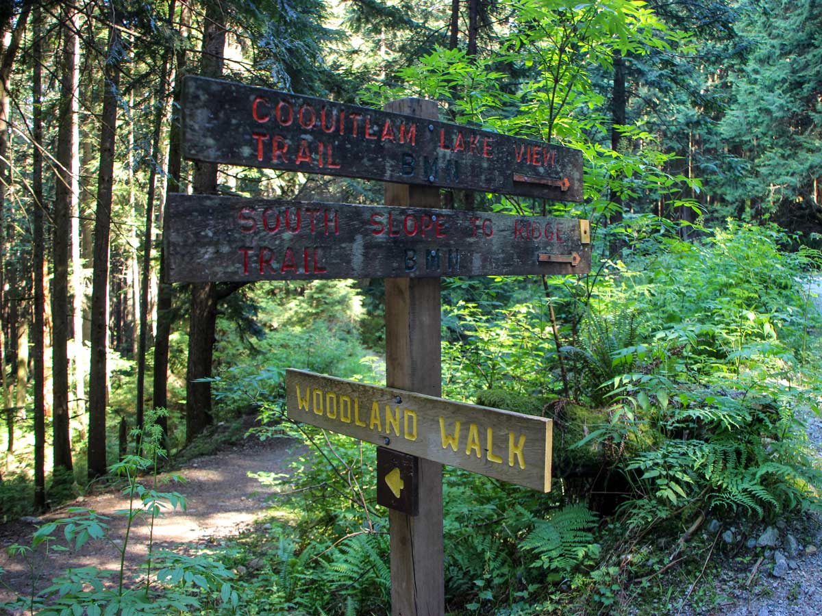
Sawblade Falls hike
Difficulty Rating:
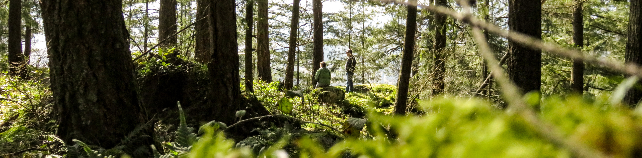
Explore woodland trails on the Sawblade Falls hike, which leads to a scenic waterfall located on Burke Mountain in Pinecone Burke Provincial Park, Coquitlam. Pass by smaller falls and beautiful alpine forests to enjoy fresh mountain air on the way to the main attraction.
Getting there
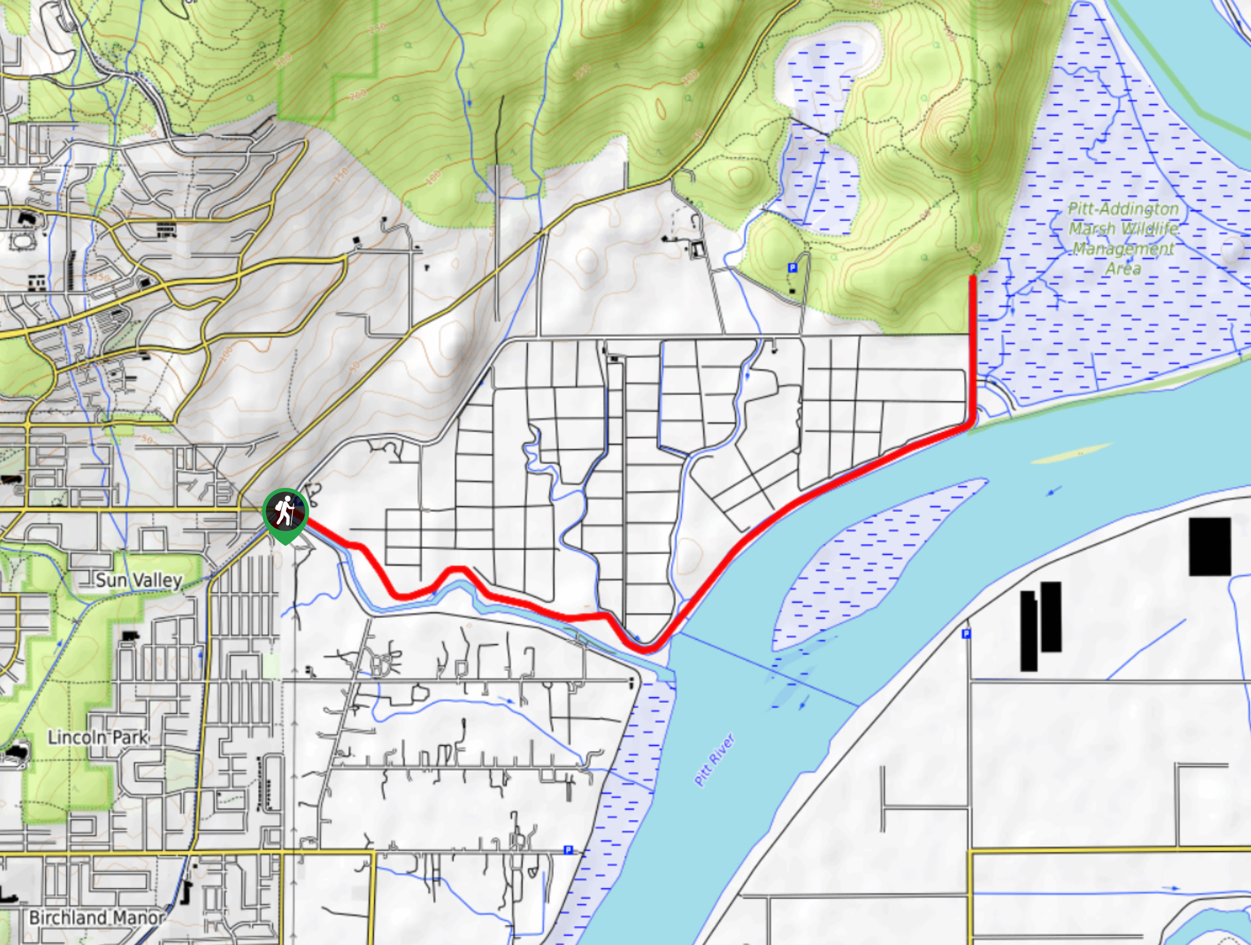
From the Lougheed Highway, go north on Falcon Drive. Turn right onto Guildford Way, and then left on Pipeline Road. Go right on David Ave, and soon after go left on Coast Meridian Road. Go right on Harper Road and follow it to roadside parking just before the road ends at the Port Coquitlam Hunting and Fishing Club.

About
| When to do | Any season |
| Backcountry Campsites | No |
| Family friendly | Older Children only |
| Route Signage | Average |
| Crowd Levels | Moderate |
| Route Type | Lollipop |
Sawblade Falls
Elevation Graph
Weather
Route Description for Sawblade Falls
To start the Sawblade Falls hike, park by the yellow gate on the side of the road, then proceed up the nearby gravel road.
Within five minutes following the path, you’ll arrive at your first junction. Go left, making a hairpin turn.
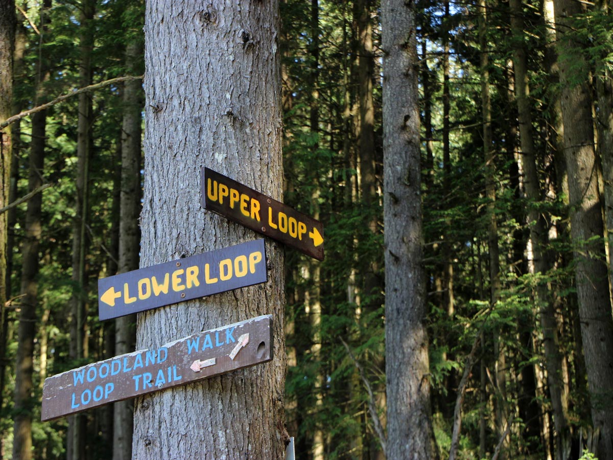
When the trail splits once more, follow the sign marked for the Woodland Walk.
In about 1.1mi into the hike, you arrive at a dirt path, directly under two sets of power lines. Go left onto the road. Walk about 100 yards and you will cross a bridge over Pritchett Creek.
Continue until you spot a sign for the Upper Loop, which is our planned return route. Instead, press onwards towards the Lower Loop, following the dirt trail. As you crest the corner, you’ll see Mount Beautiful, Dilly Peak, and Eagle Ridge ahead of you, across the valley. This is a great spot for a quick photo op and water break. Look up at the trees and you’ll spot a sign for the Lower Loop to the right, follow it.
Once on the trail, it becomes more bumpy and rough, though with minimal grade. Follow the blue markers over a few creeks, until the path continues on a sharp uphill path, following alongside a creek.
About 2.1mi into the hike, there are signs in the trees marked for ‘Falls’ in yellow text on a wooden board. Go left. Don’t go right, which would be easy to do. To the right is one of two connecting trails to the Upper Loop Trail. Be careful to look for this junction and stay left on the Lower Loop.
From here, cross over a creek and look down to spot tricky roots sticking up in some sections.
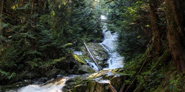
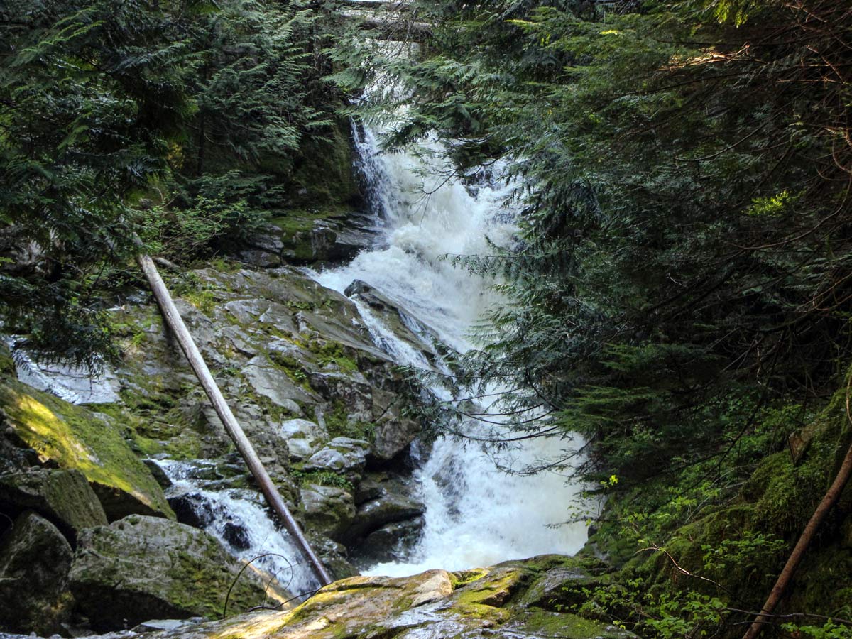
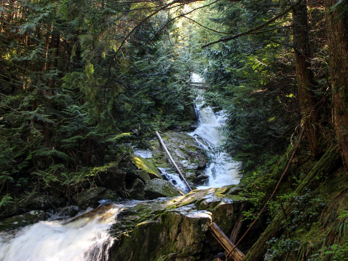
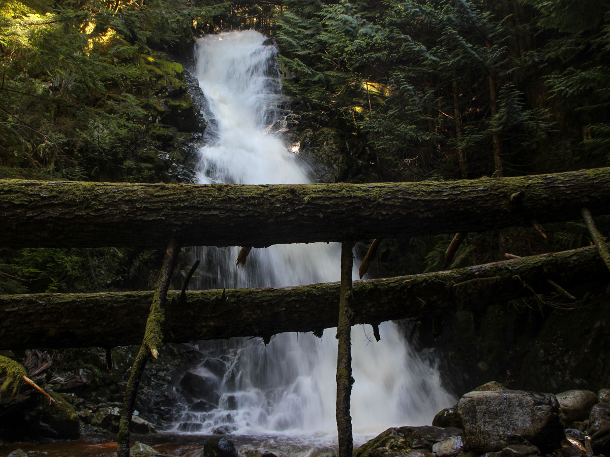
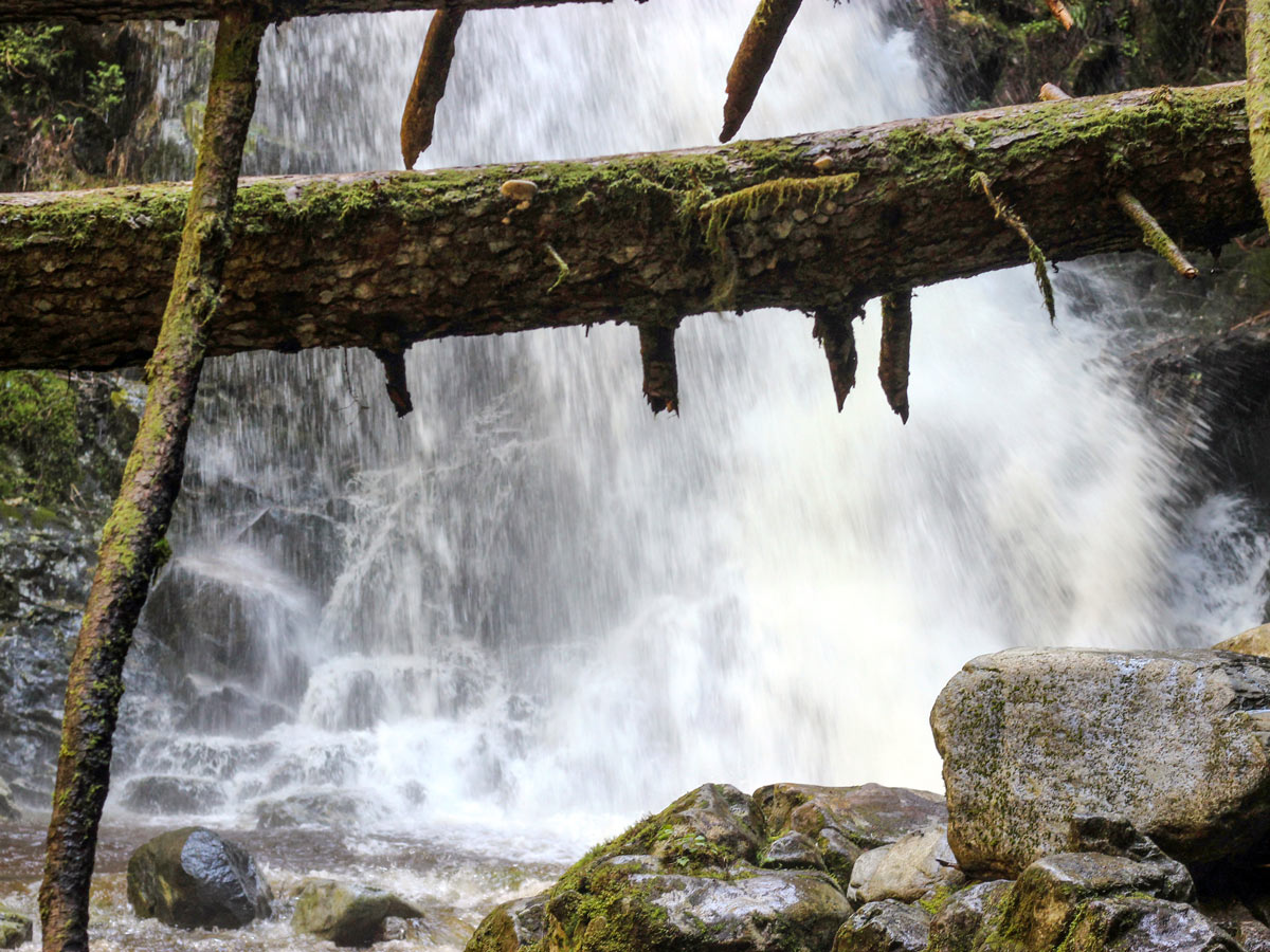
Eventually, you will spot a large stump, left behind from years of logging in the area. Here, the terrain begins to level out and you’ll continue to notice those blue flags until you arrive at Woodland Falls. Pop off the trail here for a quick scramble down the creek to get a better view.
Once back on the trail, follow the signs for Sawblade Falls on your left and prepare for the hardest part of the hike—a sharp incline that zig-zags all the way up, as it connects to the Upper Loop Trail. Keep following the signs for Sawblade Falls.
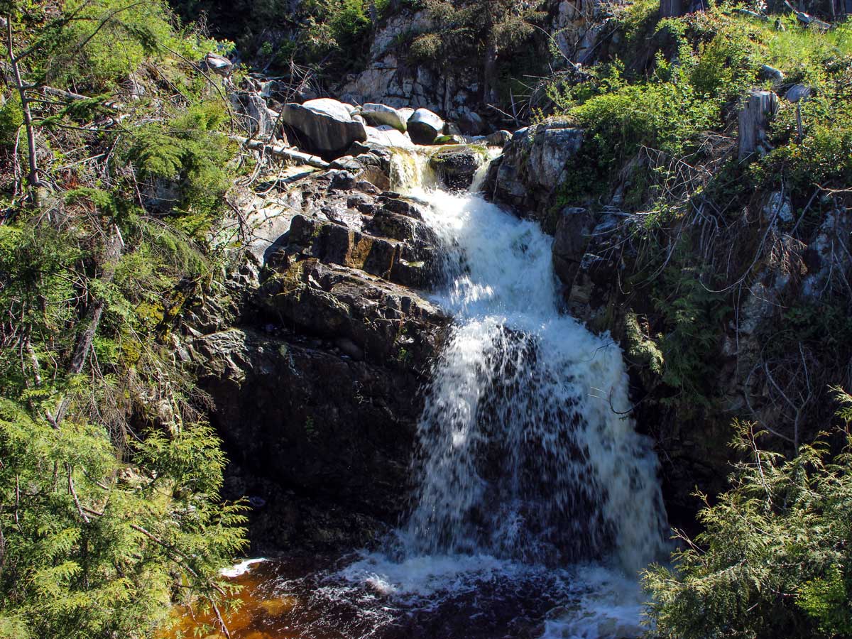
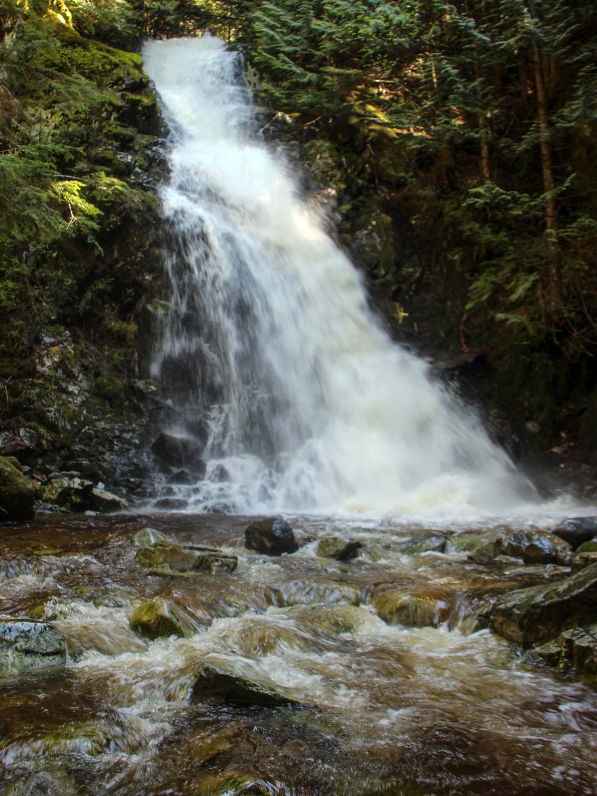
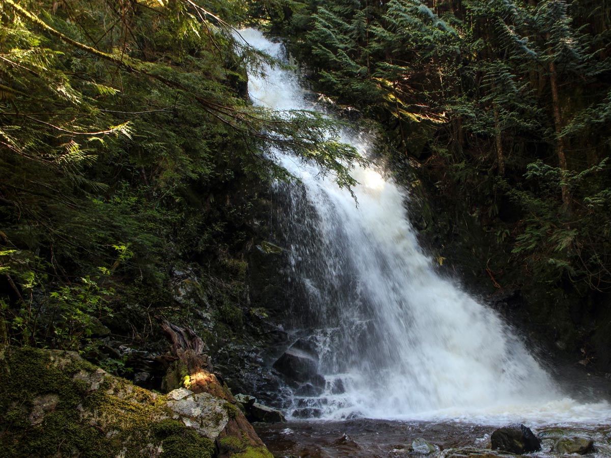
There’s a trail that goes all the way down to the bottom of Sawblade Falls. There isn’t a lot of space down there to stretch out and enjoy lunch, but you’ll get a great view of the water of Coho Creek pouring over the forty-foot falls.
After you’ve rested at Sawblade Falls, retrace your steps back to where to trail split at the Upper Falls, You’ll want to follow the Upper Loop/ Harper Road path all the way back until you reach the Woodland Walk. You will reach the dirt road you were on earlier, and you can go left. You’ve now completed the loop and can retrace your steps the rest of the way back to your car.
Insider Hints
Parking can be busy on the weekend with the many mountain bikers riding here.

Similar hikes to the Sawblade Falls hike
Trans Canada and Pandora Trail Loop
The Trans Canada and Pandora Trail Loop is a combination of several trails within the Burnaby Mountain Conservation Area that…
Quarry Trail
The Quarry Trail is a scenic hike through the beautiful wetlands of Minnekhada Regional Park that takes hikers to several…
DeBoville Slough to Addington Lookout
The hike along DeBoville Slough to Addington Marsh is an easy 6.0mi out-and-back trail along a paved path…
Isaac Tomlins 6 years ago
Great trail and amazing hike. Bring water and food. Enjoy the day.
Macky O. 6 years ago
It was a fairly easy hike that offers lots of beautiful views. Nice view of surrounding mountains at the top. Amazing stumps from the old-growth forest will leave you breathless.
Jude L. 6 years ago
Amazing and challenging hike. It's also rewarding when you get to the falls. This trail was very well marked, so it was easy to find the paths. Will definitely go back again.