Enjoy the stunning countryside of Wales as you walk on a famous Offa’s Dyke Path
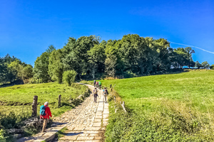
Walking the Offa’s Dyke Path is one of the highlights of UK walking. Straddling the English-Welsh border, this walking path allows you to explore the rolling hills, majestic castles, country churches, Iron Age hillforts and charming villages and pubs of one of the prettiest parts of the UK.
Offa’s Dyke is an earthwork that straddles the border of England and Wales. Believed to be named after Offa, an Anglo-Saxon King of Mercia from AD757 until 796 who ordered its’ construction. While massive, it’s precise original purpose is still debated. The best guess is that the 177 mile (285 Km) long earthwork was constructed in the 8th century, probably to divide King Offa’s Kingdom of Mercia from rival kingdoms in what is now Wales. The Trail links Sedbury Cliffs near Chepstow on the banks of the Severn Estuary with the coastal town of Prestatyn.
Enjoy this stunning walk from Northern to Southern Wales, enjoying the beautiful countryside, great walking, and wonderful villages.
Highlights of the Offa's Dyke Complete Walk
Prices
- No Booking or Credit Card Fees
- Save Money
- Happiness Guaranteed
Offa’s Dyke Complete Walk Itinerary
Day 1 Arrive at Chepstow
Arrive Chepstow and stay overnight. Please note that there is a short section of the trail, approximately 1.5 miles in length, to the south of Chepstow. We recommend a there-andback walk on the evening of your arrival if you wish to tackle this section; transfers are not provided to the top of Sedbury Cliffs as standard.
Overnight Location: Bed and Breakfast at Chepstow
Distance: None
Meals: None
Day 2 Chepstow to Monmouth
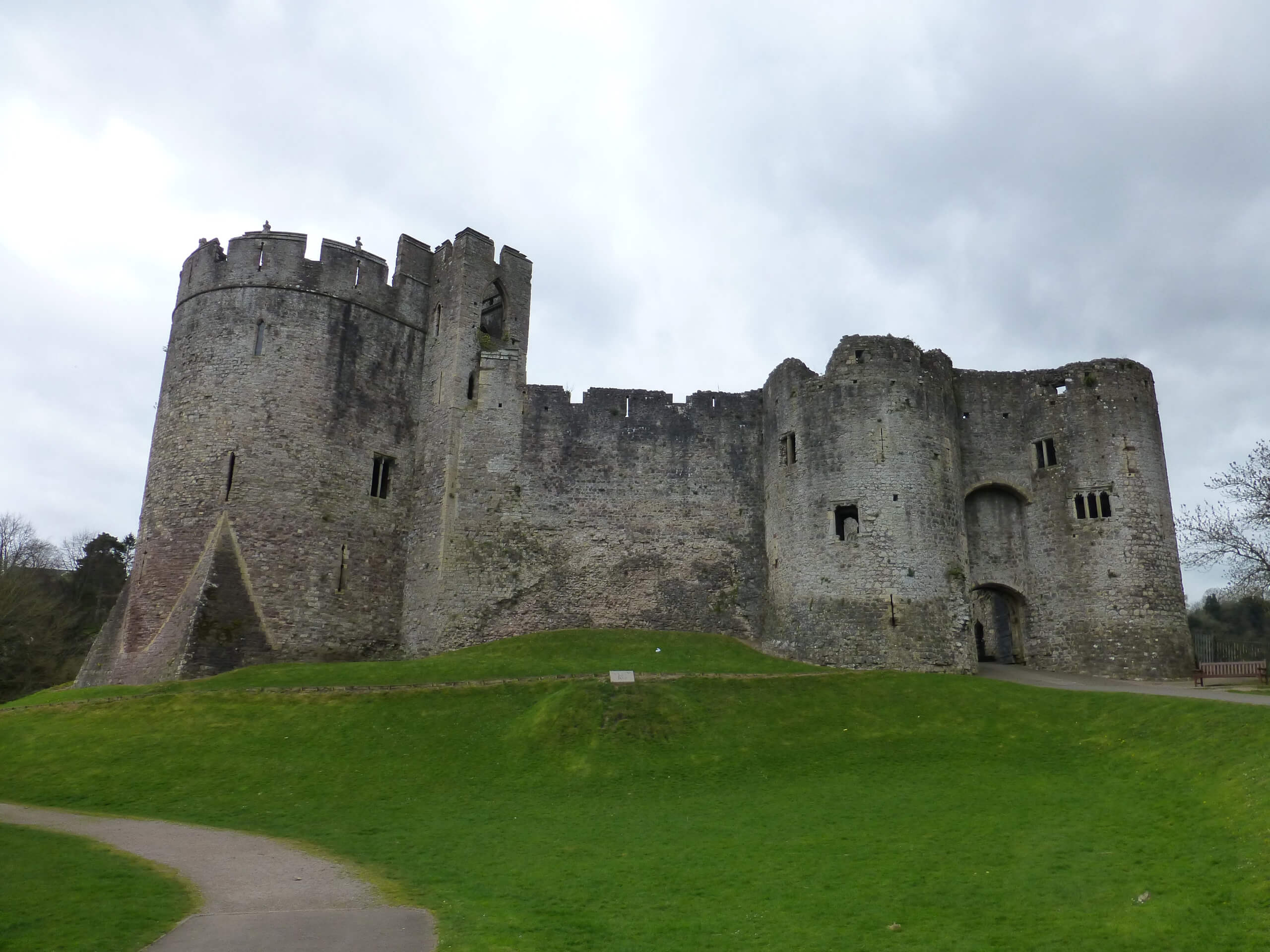
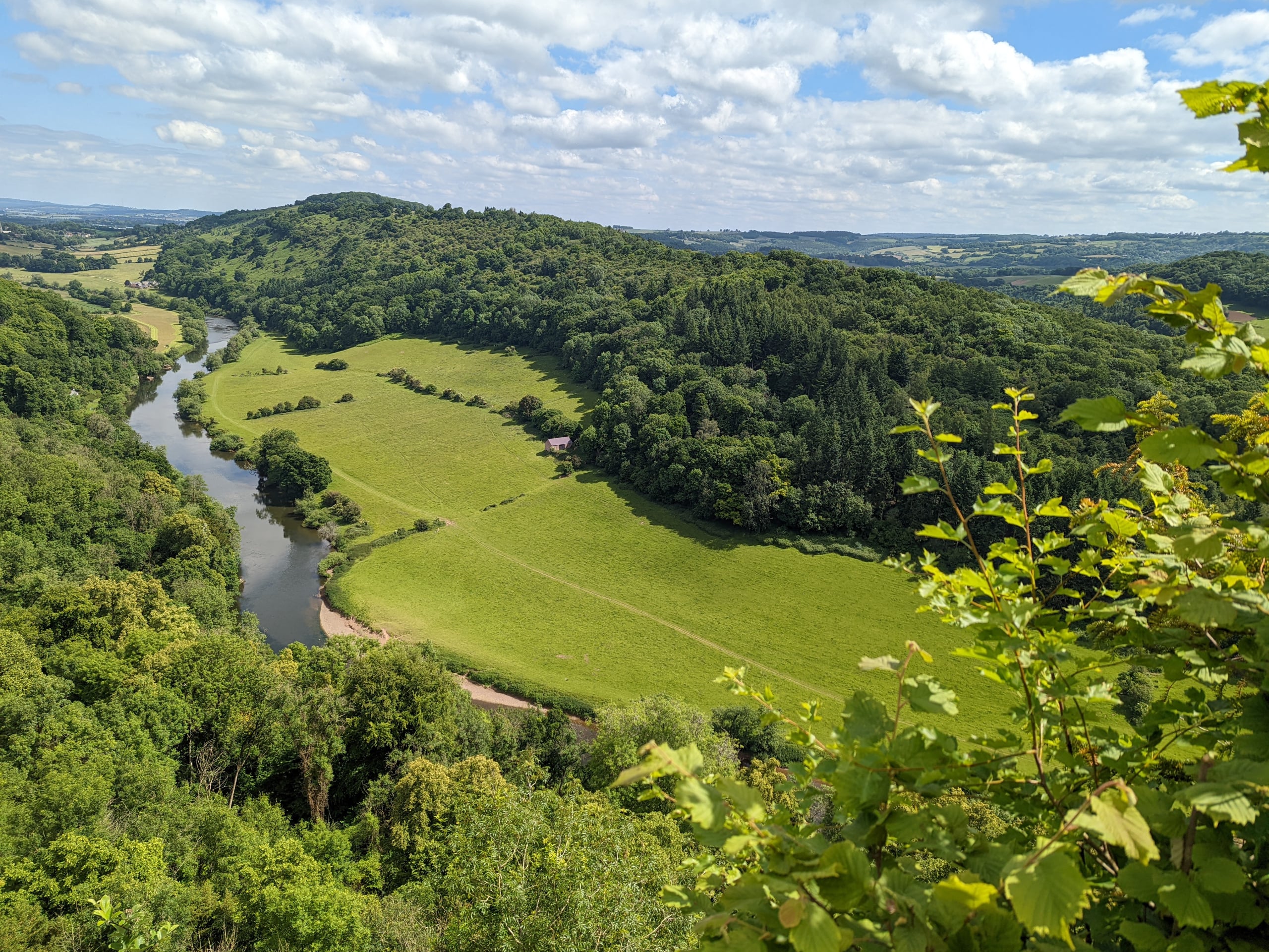
Offa’s Dyke Path starts in England overlooking the Severn estuary which is designated as a Maritime Natural Area. The estuary has the second highest tidal range in the world caused by the 5 rivers that feed the estuary and its funnel shape. The Dyke itself is first met at the very start of the Trail, close to Sedbury Cliff. The Trail passes to the east of Chepstow with views of Chepstow Castle, the oldest surviving post Roman fortification in Britain. From here the Trail continues its journey north on the eastern side of the River Wye high on the tree lined escarpment with a number of classic viewpoints, one of the most iconic being the view of Tintern Abbey from Devil’s Pulpit.
The Trail makes its first of many journeys across the border into Wales at Redbrook and continues on to the viewpoint at The Kymin, with its 17thcentury banqueting hall and naval temple. This section of the Trail finishes in Monmouth, a Welsh border town situated at the confluence of the Rivers Wye, Monnow and Trothy and perhaps best known as the birthplace of Henry V. One of the town’s best known landmarks is the 13th century Monnow Bridge, the only remaining Medieval fortified bridge in Great Britain, which the Trail passes under.
Overnight Location: Bed and Breakfast at Monmouth
Distance: 17.5 miles / 28 km
Meals: Breakfast, lunch, dinner
Day 3 Monmouth to Pandy
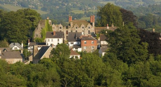
This section of Offa’s Dyke Path crosses the gently undulating and very peaceful farmland of Monmouthshire. Leaving behind the River Wye you are now joined by its tributaries, the rivers Monnow and Trothy. This area is mainly sheep country but on route you will also pass through orchards, now mainly supplying apples to the cider industry. The Dyke itself is nowhere to found along this section of the Trail but the area has a rich medieval history with ruined castles and abbey sites.
The Trail passes right alongside White Castle, well worth a visit if you have an hour to spare, a Norman castle originally probably built by William Fitz Osbern and then greatly improved in the 13th century by Hubert de Burgh.
The Trail also passes through the site of Abbey Grace Dieu. Founded in 1248 it was the last Cistercian house in Wales, nothing remains now except for a few grassy undulations. The route passes through the small villages of Llanfihangel Ystum Llywern, Llantilio Crosseny, White Castle and Llangattock Lingoed, all with churches that are well worth a brief visit. On the approach to Pandy there are great views of the Black Mountains including Hatterrall Ridge over which the next part of the Trail passes and Skirrid, sometimes known as Holy Mountain.
Overnight Location: Bed and Breakfast at Pandy
Distance: 16.75 miles / 27 km
Meals: Breakfast, lunch, dinner
Day 4 Pandy to Hay-on-Wye
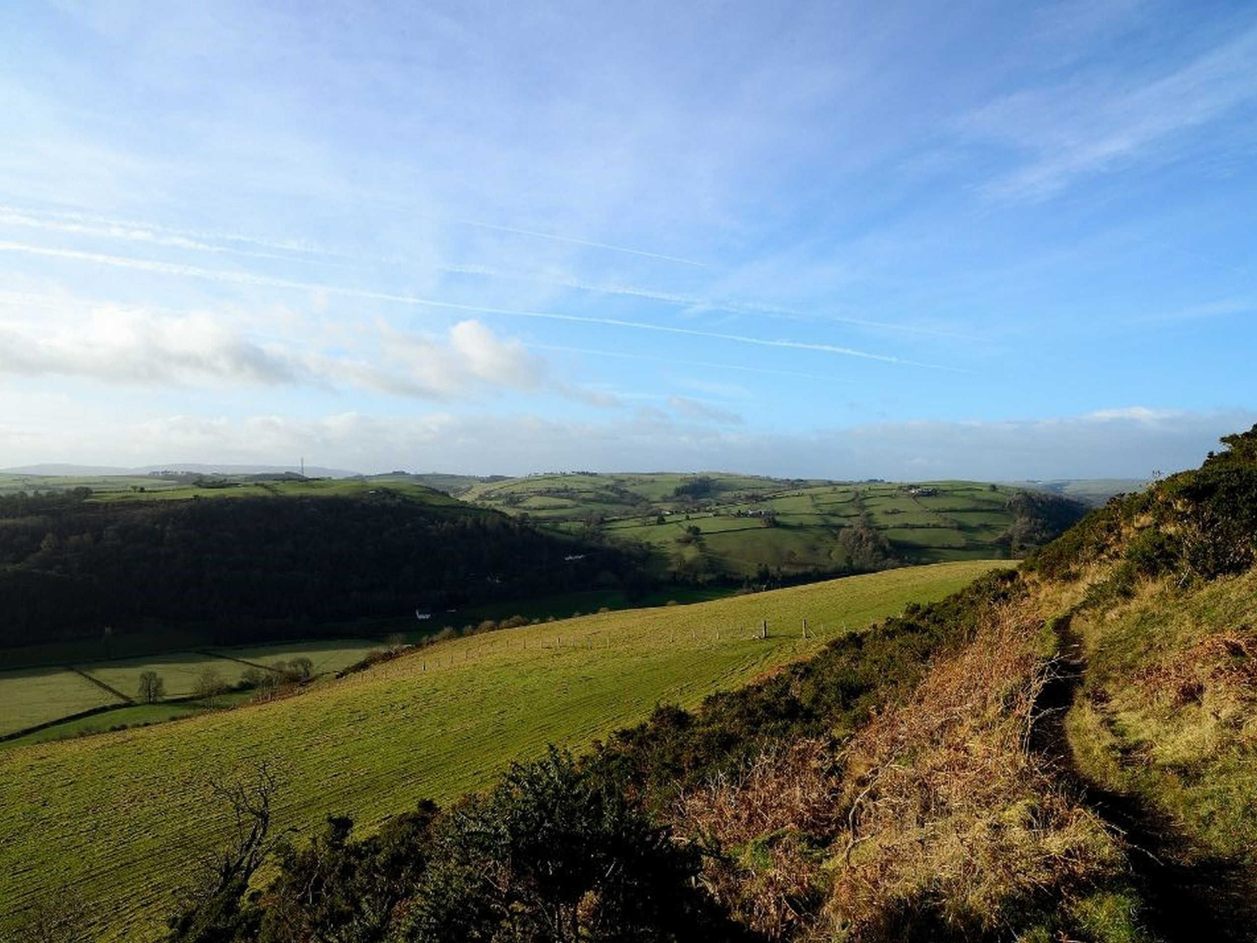
A steady climb from Pandy brings you to the first dramatic upland section of the Trail in the Black Mountains and the highest point of the route at 2300 ft (700m). This section straddling the national border on the Hatterall Ridge lies within the Brecon Beacons National Park. Once the summit has been reached the Trail follows a well-defined and improved ridge walk for about 11 miles to Hay Bluff, with stunning views to either side.
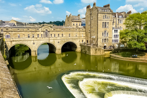
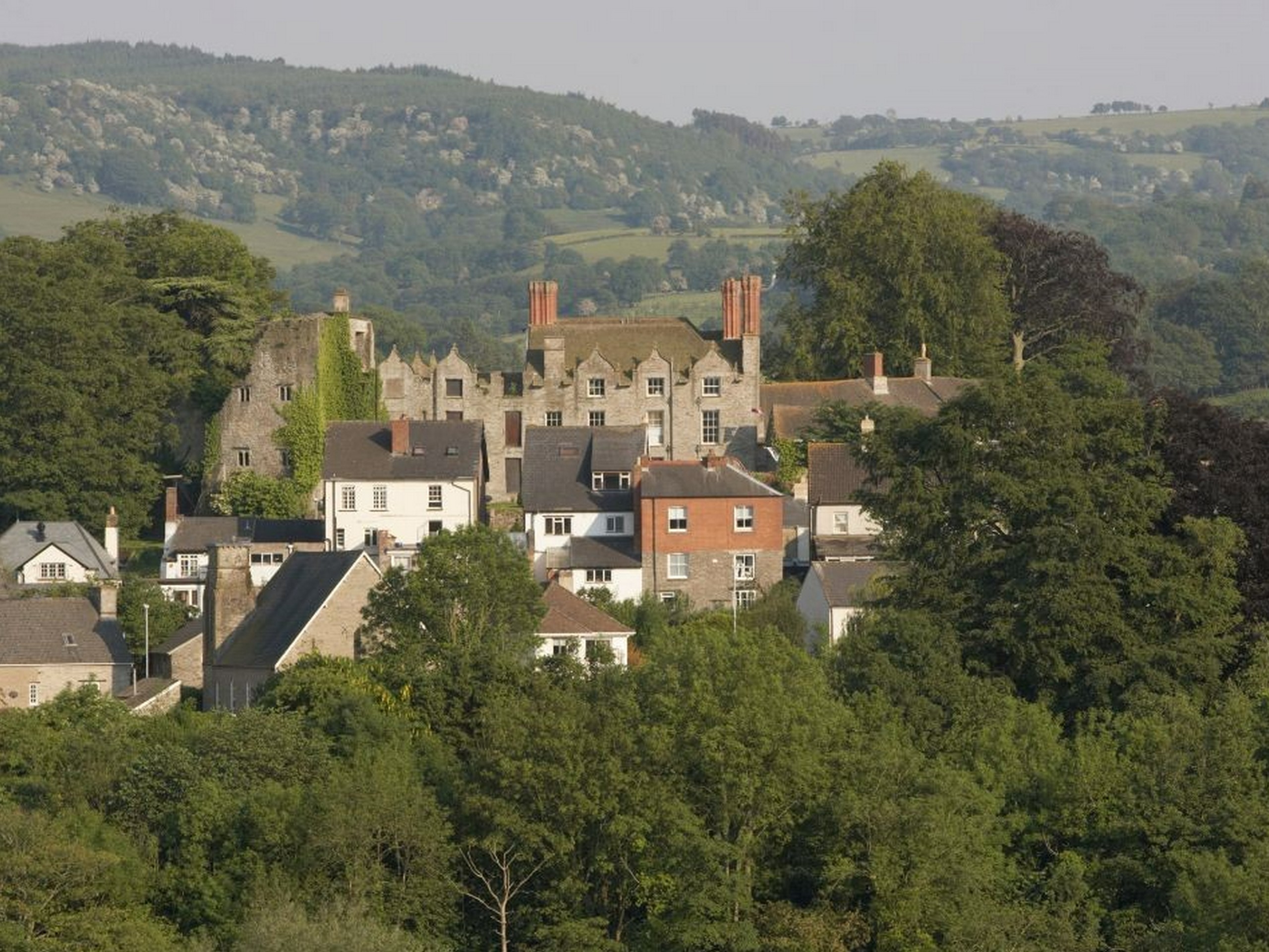
You have the Vale of Ewyas to one side and the Olchon Valley to the other with distant views of the Skirrid, Sugar Loaf and much more from different points along the ridge. Many walkers break the journey across the ridge with an overnight stay at either Llanthony Priory with its 11th century Augustinian Priory or, on the other side of the ridge, Longtown with its 12th century Norman motte-and-bailey fortification. The whole of this upland section is designated as a Site of Special Scientific Interest with various management regimes in place to improve its condition. The final decent brings you into Hay on Wye, famed for its numerous bookshops, the town also has the ruins of two Norman castles.
Overnight Location: Bed and Breakfast in Hay-on-Wye
Distance: 17.5 miles / 28.2 km
Meals: Breakfast, lunch, dinner
Day 5 Hay-on-Wye to Kington
This section starts off alongside the Wye, last seen at Monmouth, before passing through the rolling territory of the Powys – Herefordshire border. This area is well known for the diaries written by the Victorian country curate Francis Kilvert who wrote about life in the rural parishes with his observations on country life. The Trail passes through the small village of Newchurch – the church here is always open and welcomes walkers and you can help yourself to a cup of tea for a small donation. The Royal Oak in Gladestry also welcomes walkers and is well worth a stop before the final walk into Kington.
As a finale to the stage the Trail rises to over 400 metres on Hergest Ridge with dramatic 360 degree views. On a clear day Pen y Fan can be seen to the south, the Malverns to the east and the hills of Shropshire to the north. The summit of Hergest Ridge has an old racecourse which is exactly a mile around. This area was also the inspiration for Arthur Conan Doyle’s Hound of the Baskervilles and Mike Oldfield’s second album Hergest Ridge. The day finishes in the border market town of Kington, a very important livestock town being on the drovers route.
Overnight Location: Bed and Breakfast in Kington
Distance: 14.75 miles / 23.3 km
Meals: Breakfast
Day 6 Kington to Knighton
As well as superb views from the remote hills this stage is notable for long stretches of well preserved Dyke before the Trail enters its ‘spiritual home’ – Knighton (Tref-y-Clawdd, meaning the town on the dyke in Welsh). On leaving Kington the Trail passes over Brandor Hill and its golf course, the highest in England. Soon after, on Rushock Hill, the Trail meets up with Offa’s Dyke again, which it parted company with 56 miles ago after leaving Lower Redbrook in the Wye Valley. From this point to Chirk Castle the Trail and Offa’s Dyke keep each other company for most of the journey.
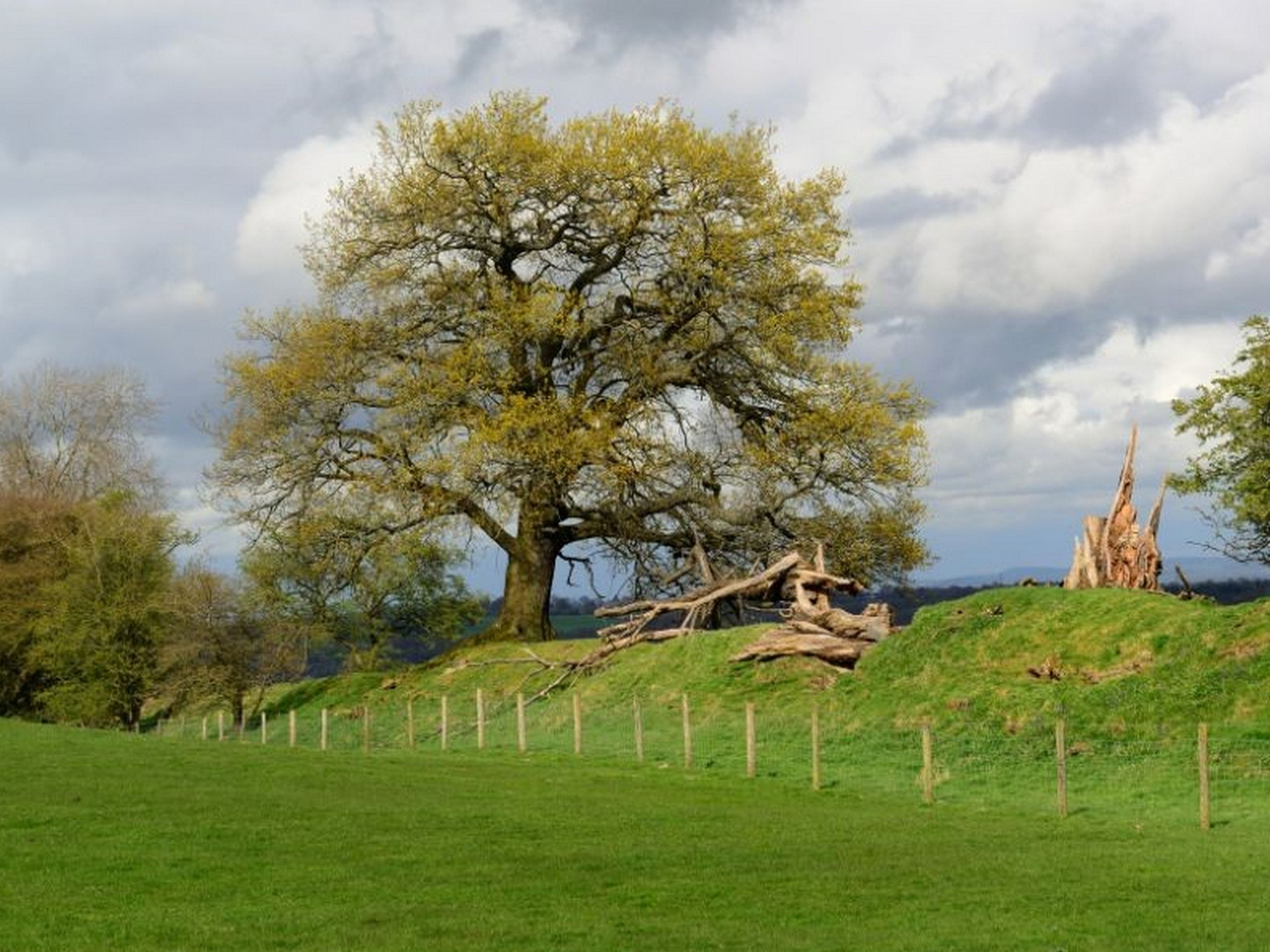
The Trail soon passes over the border again from Herefordshire into Powys, the county with the longest section of the route. On route to Knighton the Trail passes through the Woodland Trust owned site of Granner Wood, which through careful management is being restored to broadleaf woodland. The Trail soon drops down to the River Lugg at Dolley Old Bridge with its many meanders. It is well worth stopping on the bridge to watch dippers and a glimpse of kingfishers if you are lucky. The next climb brings you up to Furrow and Hawthorn Hill. From here there are stunning views westwards into Radnorshire. One of Owain Glyndwr’s famous battle sites can also be seen from here where he fought the English at the Battle of Pilleth, with the square clump of trees that mark the burial site of the soldiers. The final decent brings you down into Knighton and almost the half way point on your journey and the home of the Offa’s Dyke Centre.
Overnight Location: Bed and Breakfast in Knighton
Distance: 13.5 miles / 21.7 km
Meals: Breakfast
Day 7 Knighton to Brompton Crossroads (Montgomery)
This ‘switchback’ section is generally reckoned to be the toughest on the Trail as it rises and falls through the Shropshire Hills Area of Outstanding Natural Beauty. However the views and sense of tranquillity make the effort well worthwhile.
This section also has some of the best preserved sections of Offa’s Dyke that can be found on Llanfair Hill at the point where the Jack Mytton Way crosses the Trail. Just above Newcastle on Clun you are at the true midpoint of the Trail, with its midway marker, a good photo opportunity for all walkers. At Hergan where there is what seems a natural break in the Dyke, the Shropshire Way joins the Trail. This route will be meet on a number of occasions over the coming days as you head north. Another trail to cross paths with Offa’s Dyke Path on this section is Wild Edric’s Way, named after a Saxon nobleman who led a number of guerrilla wars against the Normans in the middle marches. There are very few villages on this section but a number of hidden gems await the walker, one of these is Churchtown – at the foot of a narrow valley you find the church but there’s definitely no sign of a town. The Kerry Ridgeway is the next trail to cross paths with the route and from this point on it’s level or downhill all the way to Montgomery, very welcome after all the ups and downs of this section of the Trail.
Overnight Location: Bed and Breakfast in Brompton Crossroads
Distance: 15 miles / 24 km
Meals: Breakfast
Day 8 Brompton Crossroads to Buttington Bridge
There is ample opportunity to see the Dyke itself as it is followed across fairly flat but very pleasant terrain for most of this section. The Dyke and Trail here are also still on the true national boundary – as you cross to and fro over the border there are a number of occasions where you can have one foot in England and one in Wales.
Towards the end of the section the route climbs up to the earthworks of Beacon Hill fort, the site now owned by Clywd Powys Archaeological Trust. A picnic table has been installed by the Trust on the southern boundary which gives fabulous views to the east, south and west. The section finishes on a descent to Buttington Bridge where you meet the River Severn, from where it is a short walk into Welshpool.
Overnight Location: Bed and Breakfast in Buttington Bridge
Distance: 12.3 miles / 20 km
Meals: Breakfast
Day 9 Buttington Bridge to Llanymynech
This is a transitional stage between the hills and almost flat throughout. The Trail follows stretches of the Montgomeryshire Canal and the River Severn before reaching the town of Llanymynech where the Wales – England border is the main street! The main landmark viewed over the River Severn from the Trail is that of the Breidden Hills, with Rodney’s Pillar on its summit.
The monument was built by the gentlemen of Montgomeryshire who supplied the oak wood from the area and shipped them down the River Severn to Bristol where Admiral Rodney’s naval fleet was built. Parts of this section are prone to flooding during very wet periods so checking for Environment Agency flood warnings is advisable. The Trail joins the Montgomery Canal for a number of stretches. The canal was originally used to transport lime to improve the farmland of the Severn Valley. While in Llanymynech, a visit to the heritage area with its Hoffman Kiln, the best preserved of its kind, is well worth it.
Overnight Location: Bed and Breakfast in Llanymynech
Distance: 10.5 miles / 17 km
Meals: Breakfast, lunch, dinner
Day 10 Llanymynech to Chirk Hill
After the flattest section the Trail, it returns to rising and falling via Llanymynech Hill, Moelydd, Candy Woods and Oswestry Old Racecourse. There are some good stretches of the Dyke itself and industrial archaeologists will be interested by the mining areas around Nantmawr.
The first ascent of the day brings you to the Llanymynech Quarry, now disused but previously a busy limestone quarry supplying the Hoffman Kiln. Sections of the quarry are now under the management of the Shropshire Wildlife Trust and the Montgomeryshire Wildlife Trust as local nature reserves. Both Trusts are now using sheep to graze the quarry’s grasslands which is increasing the botanical diversity and helping to provide better habitats for various butterflies. The summit of Moelydd is one of the surprises of the day – the 360-degree views are stunning and a topascope helps you identify the many hills you see.
Overnight Location: Bed and Breakfast in Chirk Hill
Distance: 14 miles / 22.5 km
Meals: Breakfast
Day 11 Chirk Hill to Llandegla
This varied section includes the last stretch of the Dyke followed before it and the Trail part ways for good on the edge of the Llangollen Canal. This area is now part of the Clywdian Range and Dee Valley AONB which the Trail will be in for the rest of its journey to Prestatyn Hillside.
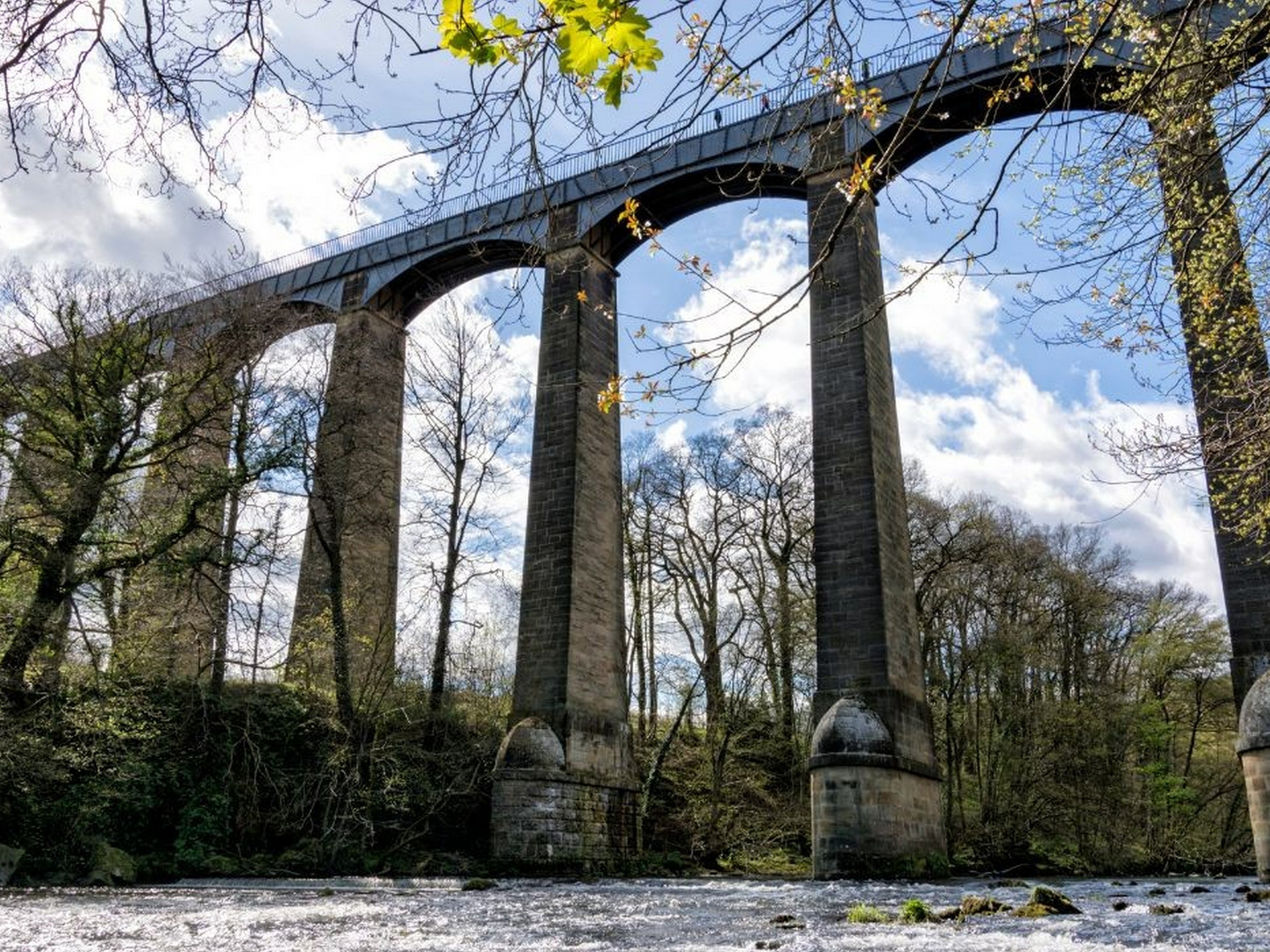
After Chirk Castle (which can be reached via a permissive route in the summer only) the Trail crosses the historic Pontcysyllte Aqueduct via an alternative / permissive route. The 127 feet aqueduct built by Thomas Telford in 1805 is now listed as a World Heritage Site and is the largest aqueduct in Britain. After leaving the village of Trevor, the Trail traverses the spectacular Eglwyseg Crags near Llangollen as it passes by Dinas Bran on its way to the well named ‘World’s End’. The route then passes over the moorland before descending through Llandegla Forest. This area of moorland and forest holds the largest population of Black Grouse in Wales and the rectangular mown areas are cut annually for the males to show off to the females, known as ‘lekking’.
Overnight Location: Bed and Breakfast in Llandegla
Distance: 15.5 miles / 25.7 km
Meals: Breakfast
Day 12 Llandegla to Bodfari
From Llandegla the Trail continues its journey through the Clywdian Range and for much of the time you are following the heather clad ridge that is so prominent in this area.
The Trail passes over or beside a string of iron / bronze age hillforts on its journey including Foel Fenlli, Moel Arthur and Penycloddiau. The key landmark on this section of the Trail is Jubilee Tower on the top of Moel Famau. The tower was built to celebrate the 50th year of the reign of George 3rd in 1810. This section affords magnificent views westwards across the Vale of Clwyd to Snowdonia and eastwards to the English border and beyond.
Overnight Location: Bed and Breakfast in Bodfari
Distance: 17.5 miles / 28 km
Meals: Breakfast
Day 13 Bodfari to Prestatyn
The most northerly section of the Trail is still in the Clwydian Range. Although the hills are smaller now the views and tranquillity are undiminished until finally the Trail descends into Prestatyn and after a stroll up the high street, journey’s end by the sea.
One of the distinguishing features of this part of the Trail is the series of stone stiles to the north of Marian Cwm which are not found on any other parts of the trail. As you proceed northwards the glimpses of the sea open up into full view with the ever growing off shore wind farm of Prestatyn and Rhyll filling the horizon. Fabulous views of Snowdonia and the North Wales coast are seen from Prestatyn Hillside before you descend into the town and onwards to the end of the Trail at Prestatyn beach. Traditionally at this point boots and socks are removed and a walk into the sea marks the end of your journey and gives some relief to those tired feet.
Overnight Location: Bed and Breakfast in Prestatyn
Distance: 12 miles / 19 km
Meals: Breakfast
Day 14 Departure day
Your trip ends after breakfast.
Overnight Location: None
Distance: None
Meals: Breakfast
Offa’s Dyke Complete Walk Price and Dates
This self-guided walking tour in Wales is always run as a private tour for your group only and the price per person depends on the type of the room that you choose.
The price below is per person:
- Price per person staying in a single room: $3,495 USD per person
- Price per person sharing a double room: $1,925 USD per person
Accommodation on Offa’s Dyke Complete Walk
This tour includes the accommodation in cozy bed and breakfasts, hotels or guesthouses. The rooms will have necessary modern conveniences to make your trip more comfortable.
In some cases, the accommodation listed below may need to be substituted for other comparable accommodations.
Single Rooms and Solo Travellers
Rooms are double occupancy. You can pay a supplement to have a private room in a hotel where possible. Solo travellers may be required to pay a supplement.
Hotels on Standard Tour
Bed and Breakfasts along the Offa’s Dyke Trail
Enjoy a comfortable stay in a simple bed and breakfast accommodations, conveniently located in towns along your walking path.
What’s Included in the Offa’s Dyke Complete Walk?
Meals
13 breakfasts are included.
Accommodations
Accommodations for 13 nights are included.
Transportation during the Tour
This itinerary includes luggage transfers, however, you are in charge of any other transportation you might require, including getting to and from the trailhead.
Also Included
- Accommodation
- Daily breakfasts
- Full Tour Information Pack
- Daily luggage transfers
- Smartphone App with GPS routes
- 24-hr emergency helpline
Not included
- Lunch, Dinner & Drinks
- Entrance to attractions
- Buses and/or Ferries unless otherwise stated
- Tourist Taxes where applicable
Optional Extras
- Additional nights before and after the tour
- Single supplement charges
Frequently Asked Questions about Offa's Dyke Complete Walk
Compass Holidays has been helping walkers explore the best walks in the UK since 1990. Their expert team organize great walking holidays so you can sit back, relax and enjoy your time away.
Learn More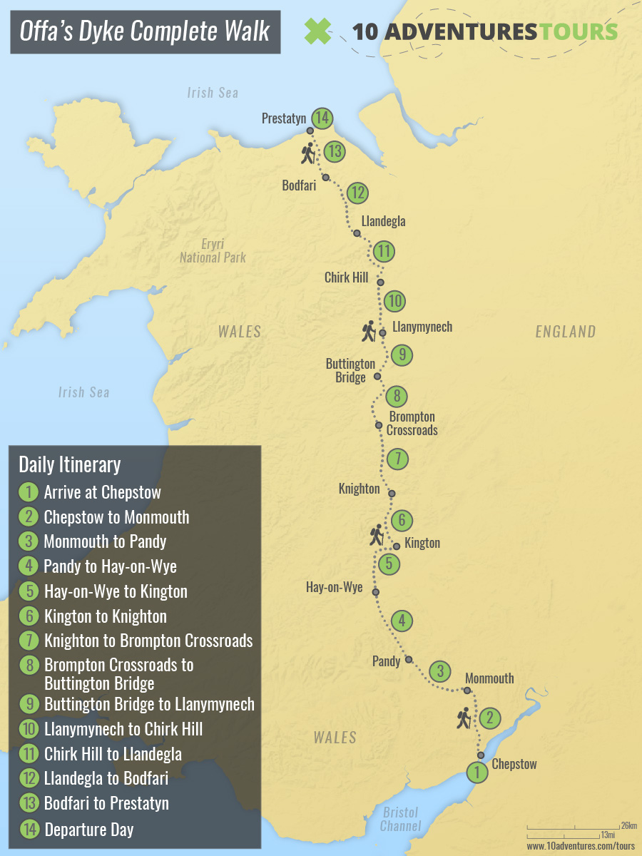
Is this tour for me?
Ask a Question