

Sauer’s Mountain Trail
View PhotosSauer’s Mountain Trail
Difficulty Rating:
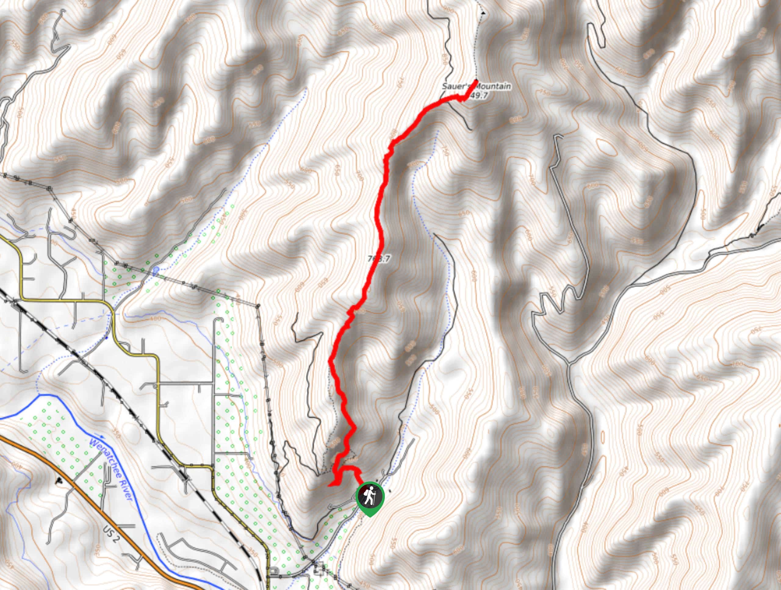
Sauer’s Mountain Trail is a beautiful hike that is within the ability level of most hikers. This trail is 5.2mi long with 1870ft of elevation gain. It’s moderately difficult, but the difficulty is definitely front-loaded with 1600ft of that gain happening in the first mile. If you can get past the first 1.0mi, it’s smooth sailing after that!
This hike begins on private property and then passes into the national forest, but it’s not maintained by the forest service. The trail condition is subject to change. Additionally, there is no public parking besides what’s at the trailhead, so we recommend arriving early. The parking does fill up.
Getting there
The trailhead for Sauer’s Mountain Trail is off Anderson Canyon Road. There is a small lot here.
About
| Backcountry Campground | No |
| When to do | May-October |
| Pets allowed | Yes - On Leash |
| Family friendly | Older Children only |
| Route Signage | Average |
| Crowd Levels | High |
| Route Type | Out and back |
Sauer’s Mountain Trail
Elevation Graph
Weather
Sauer’s Mountain Trail Description
Sauer’s Mountain is a wonderful hike. Most hikers consider the distance and elevation gain moderate but the views are stellar. The trail isn’t maintained by the forest service, so the conditions on the trail are variable. Heavy traffic keeps this trail mostly clear.
This route begins on private property. Note that there is no parking available beyond what’s in the trailhead parking lot. If the parking lot is full, you’ll need to come back another time. You won’t be able to park on the road to the trailhead as there is no public parking. We recommend arriving early to get a spot in the parking lot.
Because this is private property, remember to keep dogs on a leash and take all waste with you (good things to do regardless of the public or private nature of your trails!).
Beginning from the parking lot, you’ll set out on a trail heading uphill. The first mile of this hike is by far the toughest, but it gets easier later. You’ll hike through a wide switchback turn and then roughly northeast, keeping left, right, and then left. There are a few trails here that lead up the mountain, so refer to your GPS to make sure you’re going the right way.
There is a false summit just over half of the way up the trail. Traverse the ridge in between this and the true summit, which can be quite dry and dusty. There’s also little shade here.
Approaching the summit, stay straight as two trails branch off left and right. From the top, soak up the views and remember to sign the register! When you’re ready, it’s back down to the trailhead the same way you came up.
Insider Hints
Try hiking this trail midweek if possible for a less busy experience.
This trail can get hot on a sunny day, Bring sunscreen and lots of water.
Similar hikes to the Sauer’s Mountain Trail hike

Earl Peak via Bean Creek Trail
Earl Peak via Bean Creek Trail is a hard hike with varied scenery. The trail is 6.5mi long…

Little Giant Pass Hike
Little Giant Pass is a 8.5mi hike in Okanogan-Wenatchee National Forest. This hike is tough, but it’s kept…

Silver Falls Trail
Silver Falls Trail is a delightful hike suitable for the whole family. It takes you into a fascinating canyon with…


Comments