

Saddlerock Trail
View PhotosSaddlerock Trail
Difficulty Rating:
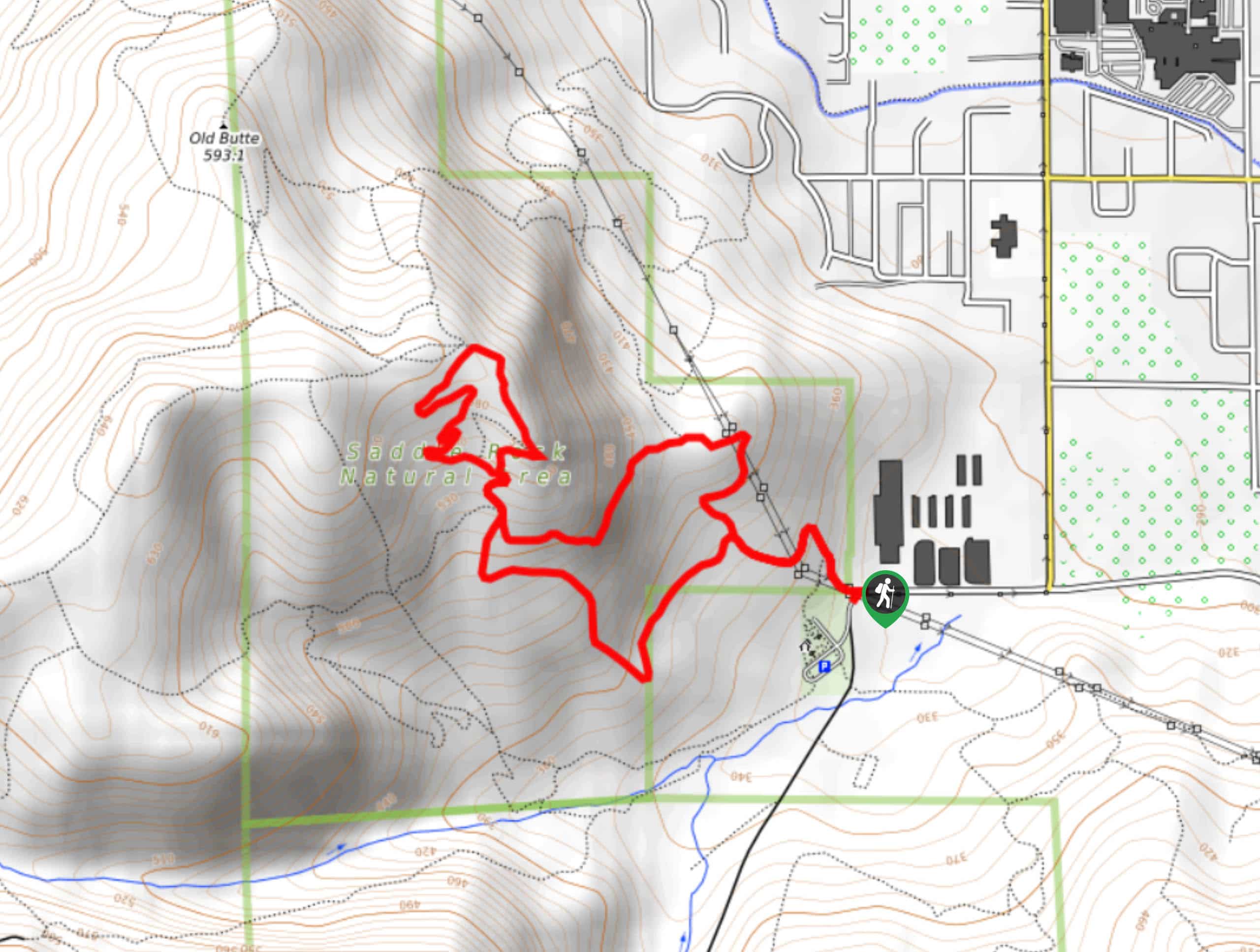
Saddlerock Trail is a loop trail in Okanogan-Wenatchee National Forest. This hike is 2.5mi long and can either be moderate or a bit tougher depending on the route you take on the mountaintop. You can either stick to the back of the peak for an easier go or venture to the front for a more adventurous experience. This trail sees heavy traffic.
Getting there
The trailhead for the Saddlerock Trail is near the end of Circle Street. There is parking here.
About
| Backcountry Campground | No |
| When to do | May-October |
| Pets allowed | Yes - On Leash |
| Family friendly | Older Children only |
| Route Signage | Average |
| Crowd Levels | High |
| Route Type | Loop |
Saddlerock Trail
Elevation Graph
Weather
Saddlerock Trail Description
Saddlerock Trail is a fun hike with good views, and you can tailor your experience a bit depending on what you do atop the mountain. Some kids may not like this trail because of the experience at the summit, but it’s suitable for most strong beginners.
Begin from the trailhead, taking Saddlerock Trail to where it splits into a loop. The way you go for the first loop doesn’t matter much, but we find the left-hand trail to be a bit more gradual. The trail briefly meets again, then splits near the summit. Here, go to the left and stay to the left onto the backside of the mountain. The footing is much better here and it’s not as daunting. Going right takes you to the frontside of the peak, and it’s all very loose rock here. It’s a bit sketchy for some, so don’t bother venturing over if you’d prefer firmer footing. Head back down to the first loop and choose your path, then hop back on the main trail to the trailhead.
Similar hikes to the Saddlerock Trail hike

Earl Peak via Bean Creek Trail
Earl Peak via Bean Creek Trail is a hard hike with varied scenery. The trail is 6.5mi long…

Little Giant Pass Hike
Little Giant Pass is a 8.5mi hike in Okanogan-Wenatchee National Forest. This hike is tough, but it’s kept…

Silver Falls Trail
Silver Falls Trail is a delightful hike suitable for the whole family. It takes you into a fascinating canyon with…


Comments