

Alta Mountain Trail
View PhotosAlta Mountain Trail
Difficulty Rating:
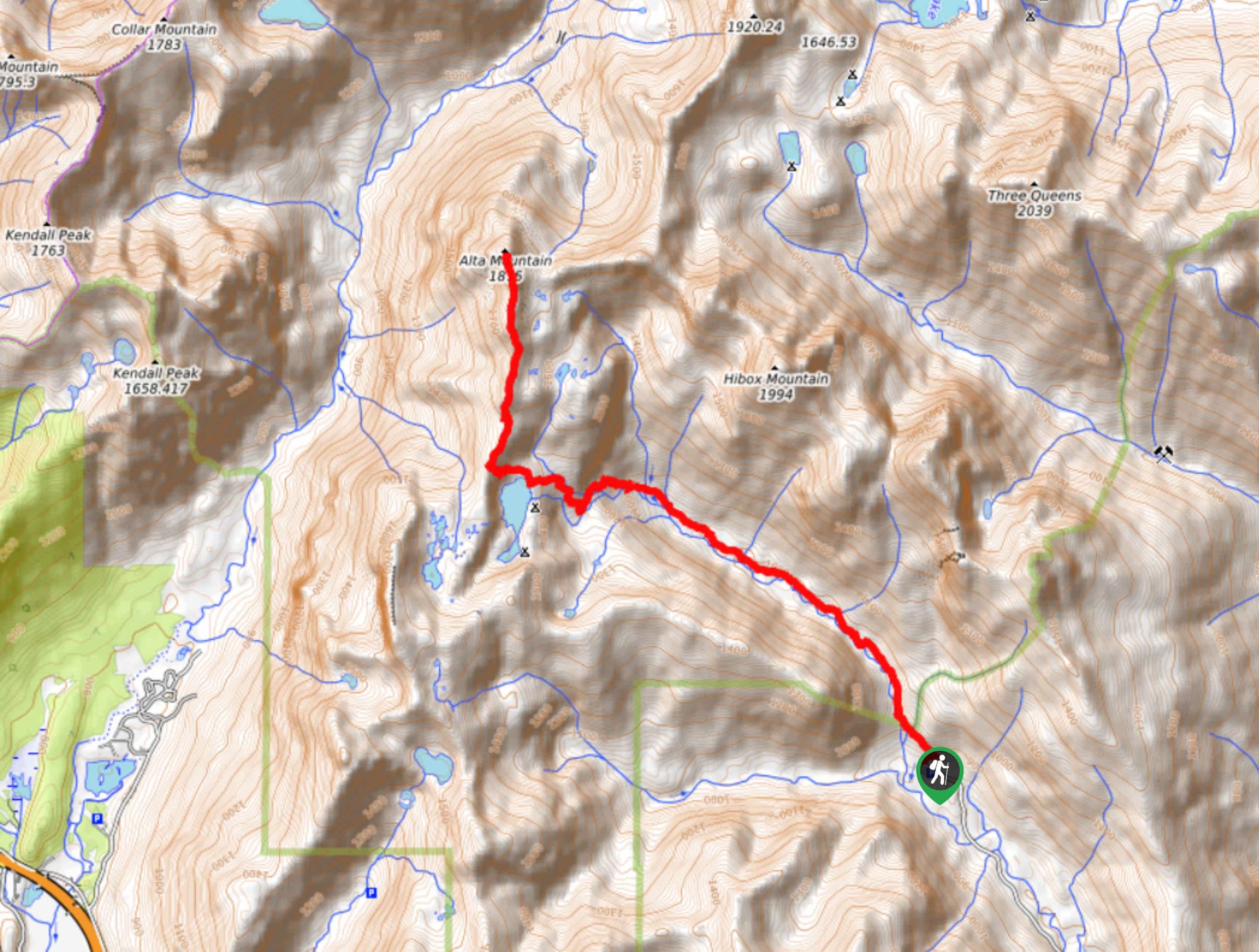
The trail that takes hikers to the popular Rachel Lake also provides access to Alta Mountain, a great summit with perfect views over the surrounding lakes. This hike can be done on its own or as a side trip for those destined for Rachel or Lila Lakes. Expect a hard hike with a touch of light scrambling and heavy-moderate traffic depending on which part of the trail you’re on.
Most of this trail is in the woods, but the views open up past Rachel Lake and get more impressive as you approach Alta’s summit.
Getting there
The trailhead for the Alta Mountain Trail is at the end of National Forest Development Road 4930. There is parking here.
About
| Backcountry Campground | Rachel Lake |
| When to do | May-October |
| Pets allowed | Yes - On Leash |
| Family friendly | No |
| Route Signage | Average |
| Crowd Levels | Moderate |
| Route Type | Out and back |
Alta Mountain Trail
Elevation Graph
Weather
Alta Mountain Trail Description
The trail that leads you up Alta Mountain is a delight, not just for the summit views but for the ease of access to Rachel Lake, Rampart Lakes, and Lila Lakes. If you’re here for just a day, the mountain should be plenty. If you can spare some time, a backpacking trip on this trail is a great adventure. While this 9.9mi hike is mostly forested on the way up, the views on the summit and at Rachel Lake make it well worth the trip. Expect some steep terrain and Class I scrambling.
From the trailhead at the end of the road, take the obvious trail into the forest. It’s wooded for the majority of the way, but trust that the views will come. The route starts out fairly mild and progressively gets steeper and rockier as you get closer to Rachel Lake.
Watch for small waterfalls as you go. It’s 3.5mi to Rachel Lake. At the lake, look for the signage that points to the “Trail.”. Follow this around the lake, taking a peek at your GPS if you’re having trouble finding the way.
Atop the ridge, look for a trail to your right. 0.3mi later, reach another junction. Go left here to begin to ascend Alta. It’s pretty much a straight shot with no switchback to help you out. There is some easy scrambling required, but it’s Class I for the most part and not highly exposed whatsoever.
Atop the peak, look out over the panoramic view of the lakes and mountains that surround you. From here, you’ll retrace your steps back down the mountain, past the lake, and to the trailhead.
Insider Hints
Remember your Northwest Forest Pass for this hike.
Take care on the drive to the trailhead, which is quite potholed.
The parking area is small, so try to arrive early on the weekends.
Similar hikes to the Alta Mountain Trail hike

Earl Peak via Bean Creek Trail
Earl Peak via Bean Creek Trail is a hard hike with varied scenery. The trail is 6.5mi long…

Seven Fingered Jack Hike
Seven Fingered Jack is a hike suitable for experienced hikers who are comfortable with loose rocky scrambles that lack a…

Little Giant Pass Hike
Little Giant Pass is a 8.5mi hike in Okanogan-Wenatchee National Forest. This hike is tough, but it’s kept…


Comments