Radar Hill
View PhotosRadar Hill
Difficulty Rating:
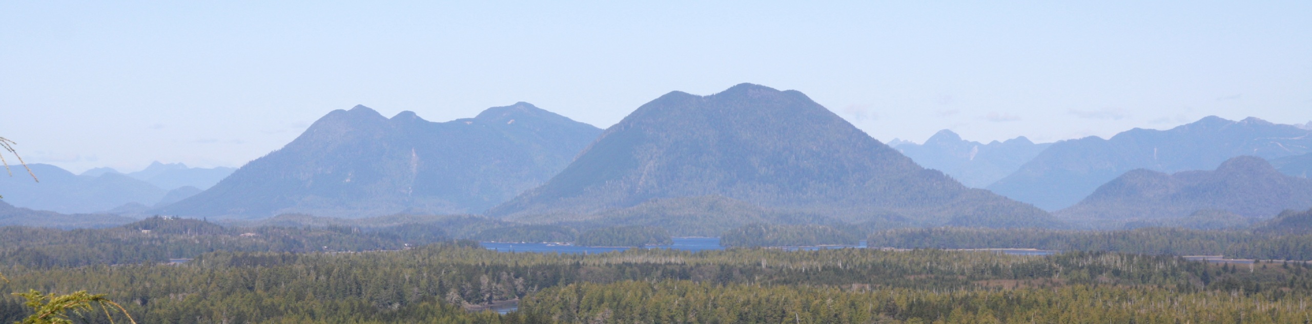
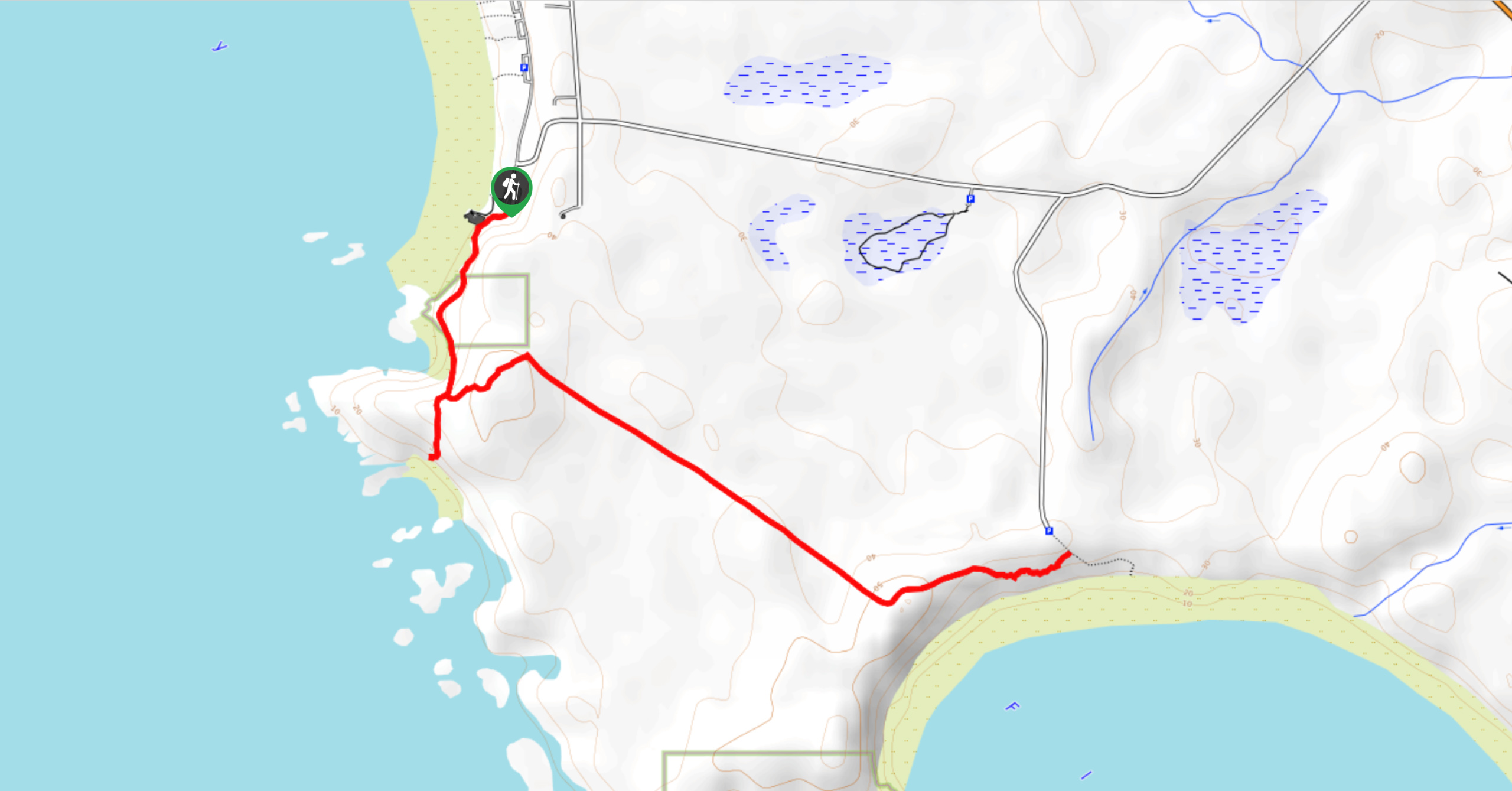
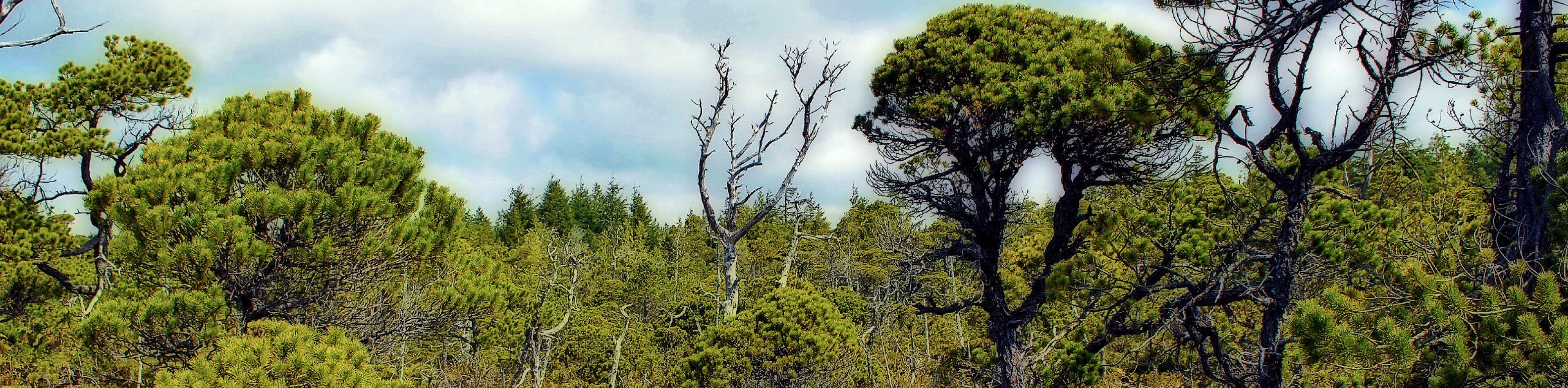
The hike at Radar Hill is a 0.3mi loop trail that will take you on a short journey from the parking lot and through the forest to a beautiful lookout over the rugged woodland landscape around Tofino. Along the trail, you will be able to check out a few historical sites from the Cold War Era and explore the area atop the hill. This is a brisk hike great for those who love charming scenery and historical sites.
Getting there
To find the parking area at Radar Hill from Tofino, drive east on BC-4 for 5.1mi and make a right. You will find the parking area at 0.9mi.

About
| When to do | May–October |
| Backcountry Campsites | Np |
| Pets allowed | Yes - On Leash |
| Family friendly | Yes |
| Route Signage | Average |
| Crowd Levels | Low |
| Route Type | Circuit |
Radar Hill
Elevation Graph
Weather
Radar Hill Trail Description
The hike up Radar Hill isn’t really a hike but more of a short stroll to a beautifully scenic viewpoint and a few historical sites. The trail is a brief 1640ft walk from the parking lot that will take you to an excellent vantage point with a sightline over the surrounding mountains and beautiful forest.
The hill itself takes its name from its history as the home of a radar station during the Cold War, and while there isn’t much in the way of historical remains, there is a war monument at the top of the hill. The Kap’yong Memorial serves as a commemoration of the Canadian Forces and their involvement during the Korean War. Whether you are looking to visit the historical sites, take in the beautiful woodland scenery, or both, this quick route is sure to have something of interest for everyone.
Similar hikes to the Radar Hill hike

Green Point Trail to Combers Beach
The Green Point Trail to Combers Beach is a quick hike that will take you from the Green Point Campground…
Nuu Chah Nulth Trail
The Nuu Chah Nulth Trail is a 3.8mi out-and-back hiking route that sets out from the Kwisitis Visitor…
Shorepine Bog Trail
The Shorepine Bog Trail is a 0.5mi hiking loop that traverses a wooden boardwalk and provides an insight…
Comments