

Mallard Lake Trail
View PhotosMallard Lake Trail
Difficulty Rating:
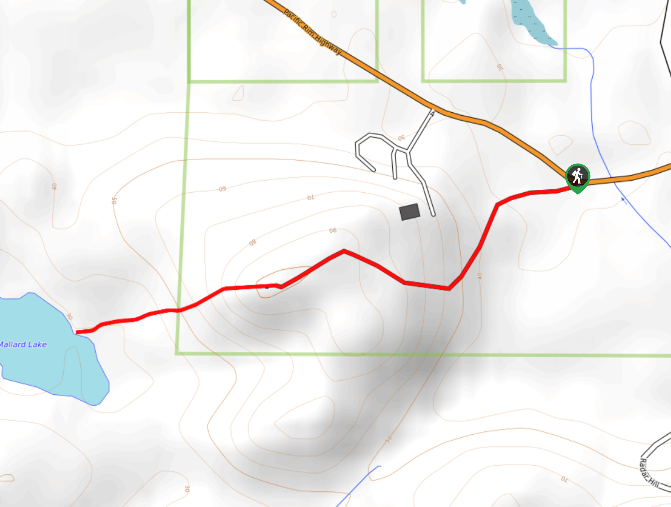
The Mallard Lake Trail is a 1.7mi out-and-back hiking route south of Tofino that passes through some rough and overgrown terrain to reach the shores of Mallard Lake. Although the trail itself isn’t overly difficult, the thick brush along the route tends to slow your progress on this short hike to the lake. That being said, the landscape is fairly scenic once you reach the shores of Mallard Lake, and several partial views extend to the surrounding area.
Getting there
To reach the Mallard Lake Trail from Tofino, drive east on Campbell Street for 1.3mi and continue onto BC-4. After 4.5mi, you will find the trailhead on the right.
About
| When to do | April–October |
| Backcountry Campsites | No |
| Pets allowed | Yes - On Leash |
| Family friendly | Older Children only |
| Route Signage | Poor |
| Crowd Levels | Low |
| Route Type | Out and back |
Mallard Lake Trail
Elevation Graph
Weather
Mallard Lake Trail Description
Hiking along the Mallard Lake Trail is a rough and rugged experience that will require you to push your way through overgrown stretches of terrain. The route is fairly short, and there is only a minimal elevation gain of 591ft, which certainly helps in reducing the amount of time required to reach the lake.
Setting out on the trail, you will initially climb uphill along a logging road before reaching a tower on top of the hill. From here, continue along the trail as the forest cover begins to thicken into a narrow tunnel of overgrown brush. Reaching the shores of the lake, you will be able to take in the natural beauty of the serene woodland atmosphere. Once you have finished at the lake, make your way back down the same route to return to your vehicle.
Similar hikes to the Mallard Lake Trail hike

Green Point Trail to Combers Beach
The Green Point Trail to Combers Beach is a quick hike that will take you from the Green Point Campground…

Nuu Chah Nulth Trail
The Nuu Chah Nulth Trail is a 3.8mi out-and-back hiking route that sets out from the Kwisitis Visitor…

Shorepine Bog Trail
The Shorepine Bog Trail is a 0.5mi hiking loop that traverses a wooden boardwalk and provides an insight…


Comments