Lac Bleu
View Photos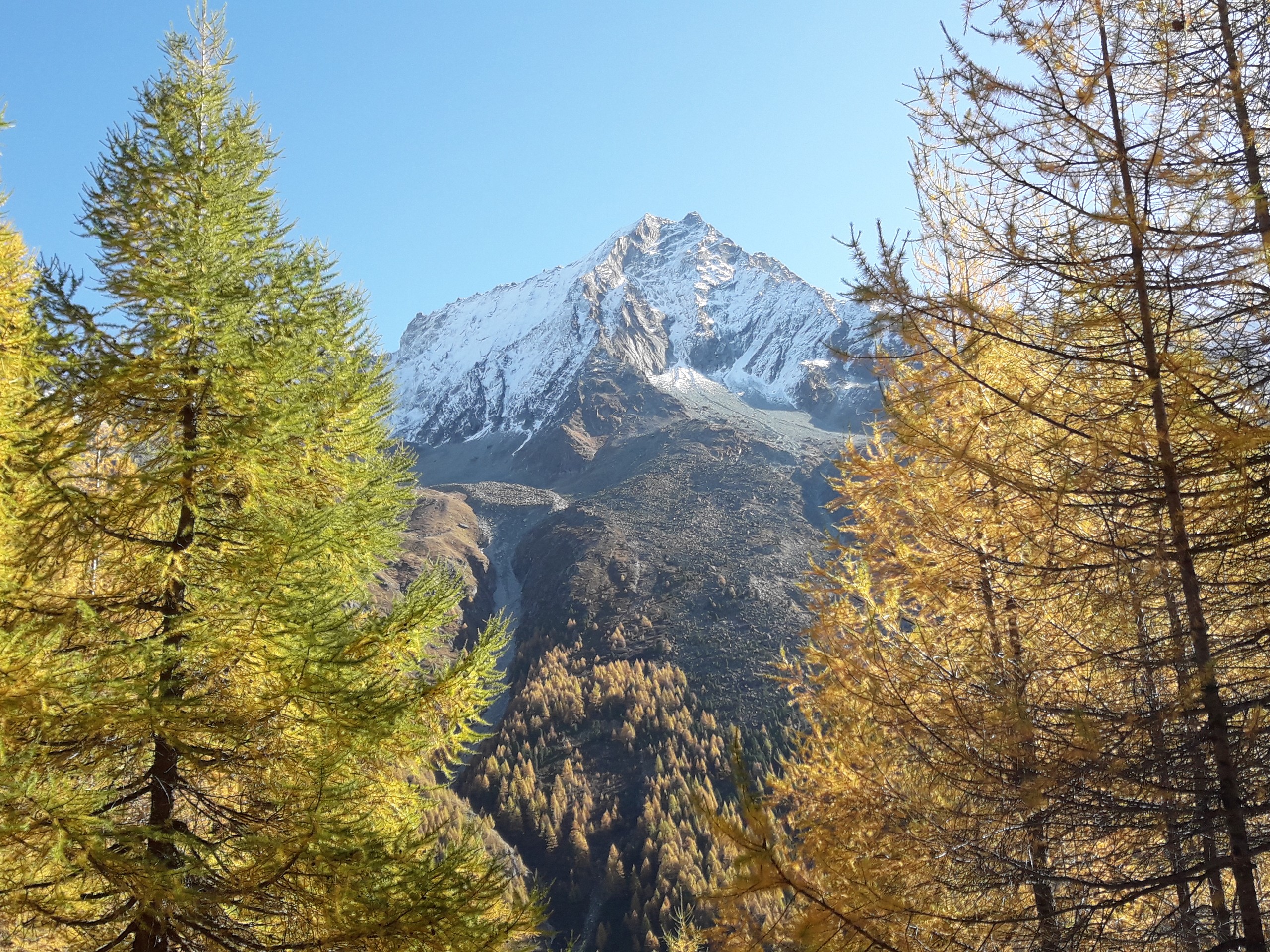
Lac Bleu
Difficulty Rating:
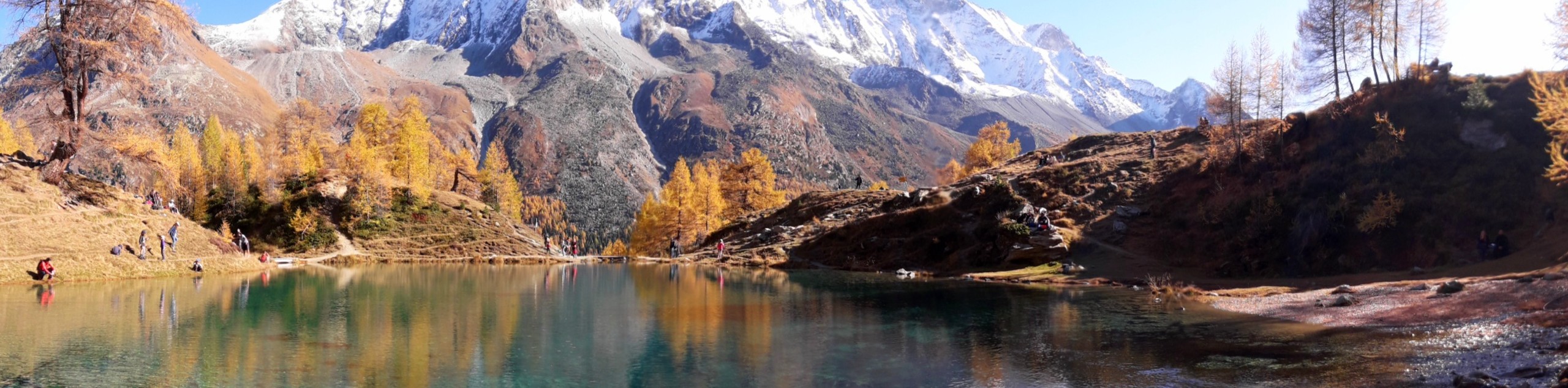
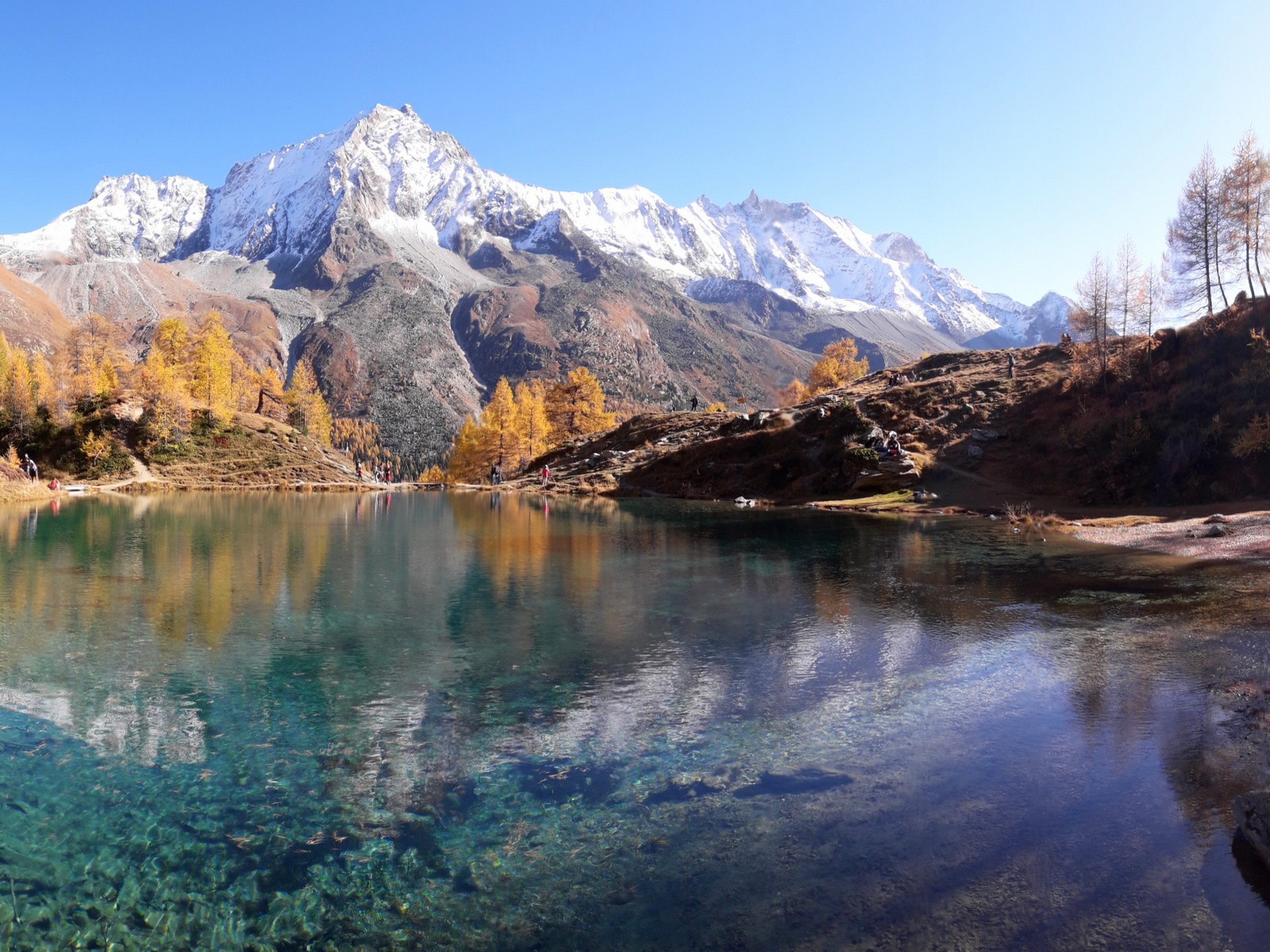
Lac Bleu is claimed to be the clearest lake in the Swiss Alps. The hike to this gem is short but steep, perfect for a picnic while relaxing on the banks of the lake. The view from around the lake rewards you with stunning snapshots of snow-capped summits.
Getting there
Lac Bleu is in the municipality of Evolene in the canton of Valais (Wallis). The starting point of the hike is the village of La Gouille. From the city of Sion, take a bus to Les Hauderes centre, then transfer to a bus headed to Arolla. Get off at La Gouille. The bus trip takes 1 hour 10 minutes. Driving from Sion to La Gouille will take about 45 minutes.

About
| When to do | June to October |
| Backcountry Campsites | Camp Arolla (3 km away) |
| Pets allowed | Yes - On Leash |
| Family friendly | Yes |
| Route Signage | Poor |
| Crowd Levels | Moderate |
| Route Type | Out and back |
Lac Bleu
Elevation Graph
Weather
Route Description for Lac Bleu
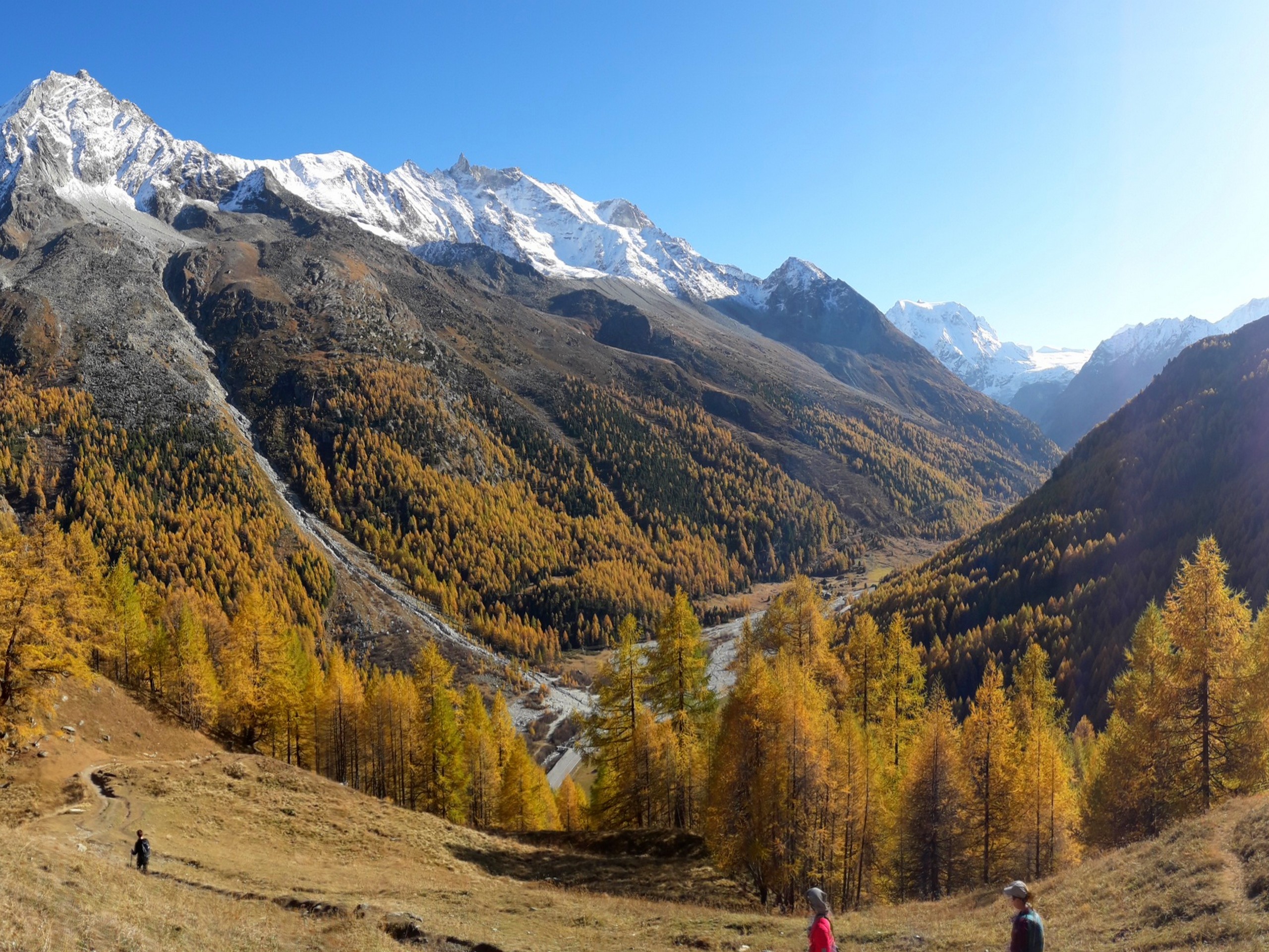
The hike to Lac Bleu is on a steep trail not suitable for strollers. The hike is short and safe, so adventurous young children can often manage the hike.
There are several trails leading to Lac Bleu, the shortest starts from La Gouille, a small village near Evolene. Parking your car can be an issue as there are only a few spots available in La Gouille, but it is possible to find some parking spots along the main road Le Pô.
Start the hike by entering La Gouille and finding the trail signs that point you to Lac Bleu. You will then weave your way through some buildings and houses until you see the start of the trail. The trail rises steeply and has several forks along the way.
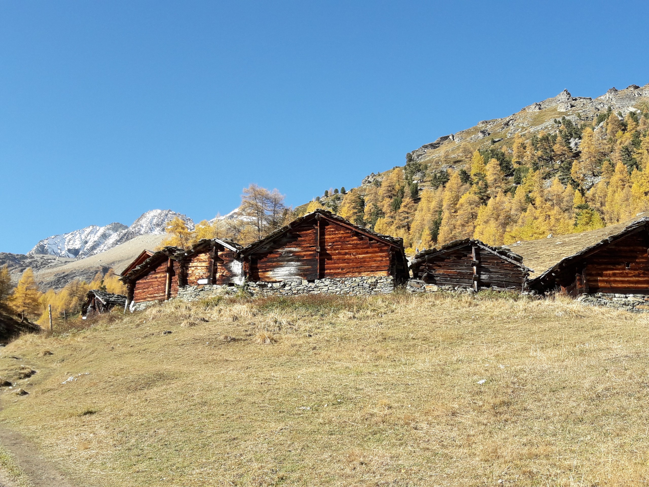
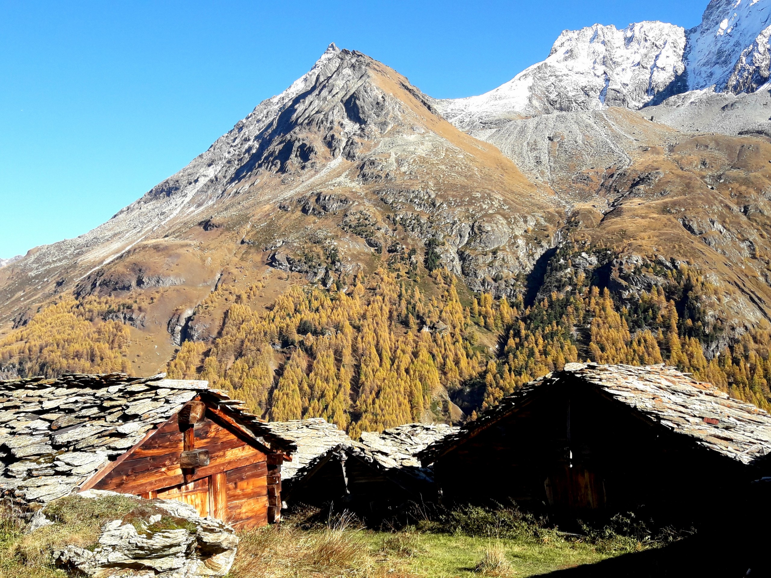
Trail signs will point you in the right direction. Along the way, you will pass by several small unoccupied huts, which seem to be storage used by farmers. The trail continues to rise until it crosses a small bridge on one end of Lac Bleu.
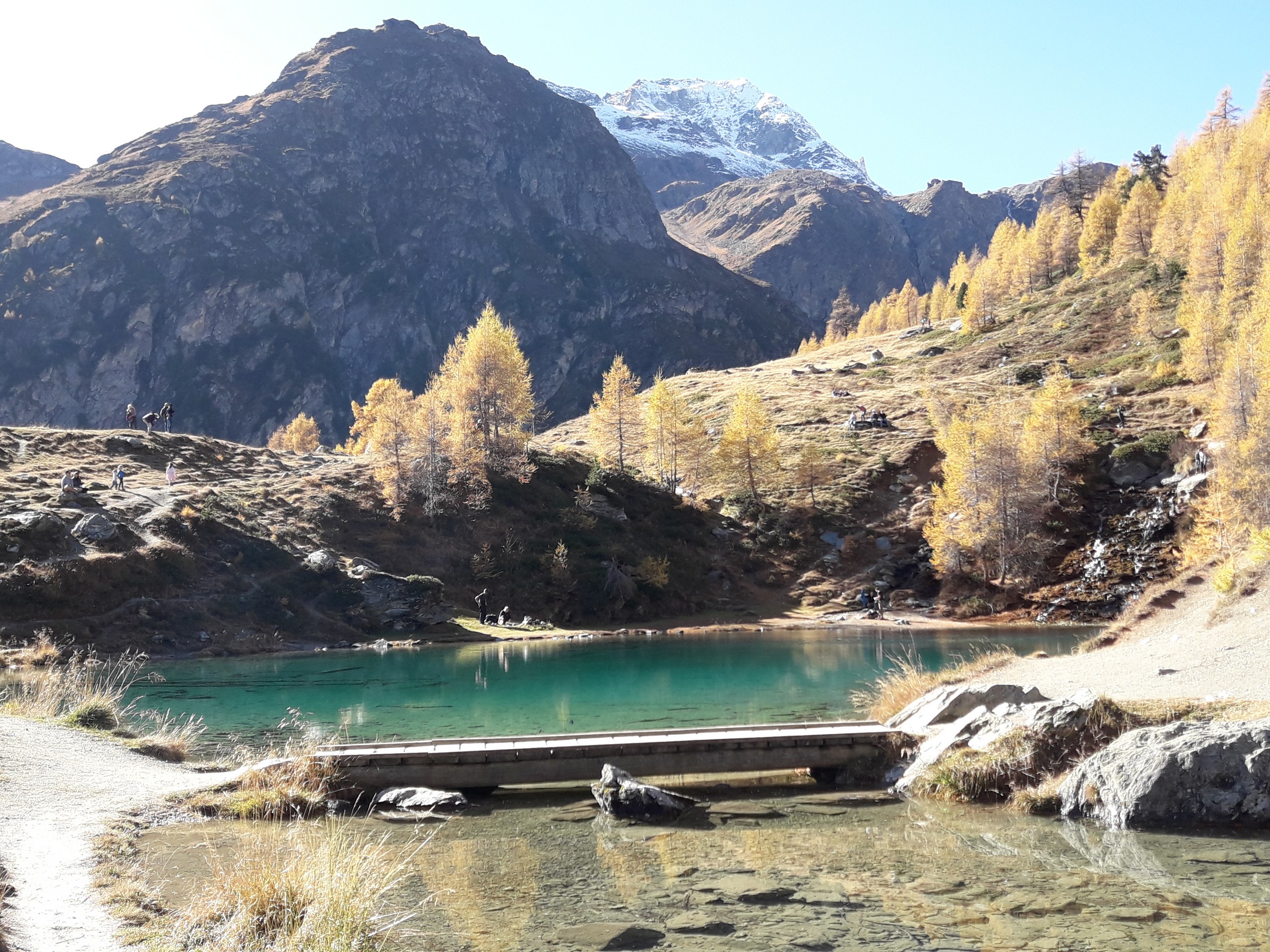
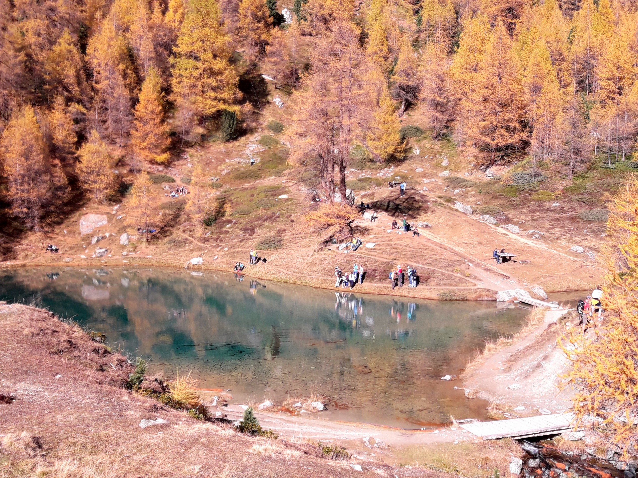
Walk around the area to find an ideal picnic spot- there are a few benches and picnic tables around the lake. Some hikers take the plunge and swim in the cool water. Enjoy your time here as you please!
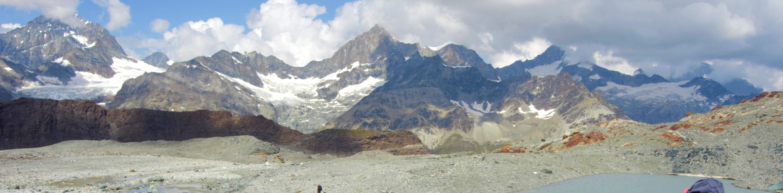
Take the same route you took to return to La Gouille. From around the lake, you have a good view of Dent de Perroc (12060ft) across the valley. From a distance, you may also see Glacier d’ Arolla and L’Eveque (12192ft). Enjoy the fabulous views before retracing your steps.
Insider Hints
Camping is available at Camp Arolla 1.9mi down the road from La Gouille.
If coming from Arolla or Camp Arolla, you can take alternate trails that avoid walking on the road.
Pension du Lac Bleu at La Gouille has a restaurant and serves meals on its terrace, and it’s a perfect stop after hiking to Lac Bleu.
Similar hikes to the Lac Bleu hike
Matterhorn Glacier Trail
The Matterhorn Glacier Trail (Nr. 26) takes you close to the Furgg Glacier and right beside the east flank of…
Eiger Trail
The Eiger Trail skirts the north face of one of the most iconic mountains in Europe. The hike is relatively…
Edelweiss Refuge Loop
Zermatt is an area strewn with hiking trails that intersect on well signposted routes. This hike can be altered depending…
Comments