Fründen Hut
View Photos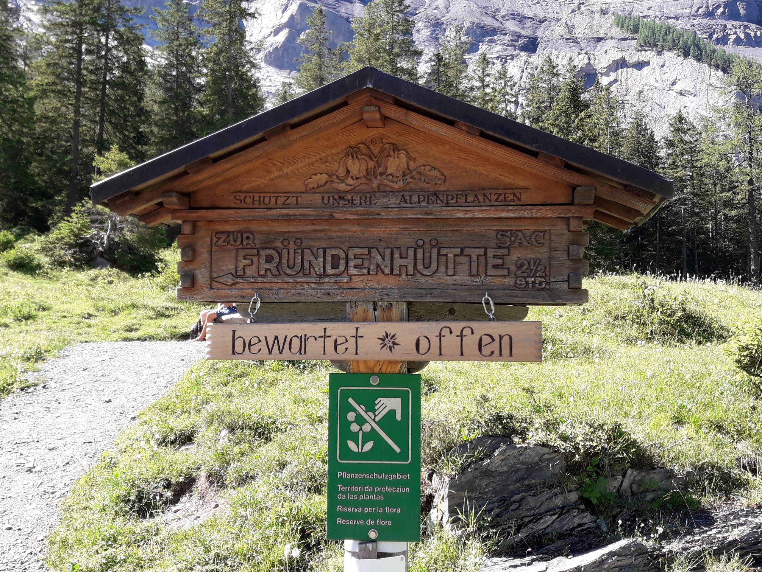
Getting there
From the Kandersteg Bahnhof train station, walk south a short distance and then turn left onto Bahnhofstrasse. Continue about 700ft, then turn left on Dorfstrasse. After about 650ft, you’ll have passed two streets. Turn right on a paved walkway beyond the second street. You’ll walk about a third of a mile, then turn left on Oschistrasse and walk about 360ft to the gondola. Check in at the reception centre for the gondola. You will ride the gondola up.

About
| When to do | June to September |
| Pets allowed | Yes - On Leash |
| Family friendly | No |
| Route Signage | Good |
| Crowd Levels | High |
| Route Type | Lollipop |
Fründen Hut
Elevation Graph
Weather
Route Description for Fründen Hut
The Fründen Hut trail is usually open from June to September, but check with the tourist office for up to date conditions. Plan your hike with enough time to arrive back at the lift station before its closing schedule and before sundown. Take note of the lift operating hours (09:00 – 18:00), which may change. We don’t recommend doing this hike if there is rain, fog or thunderstorms.
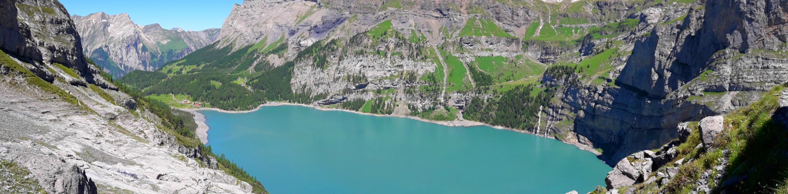
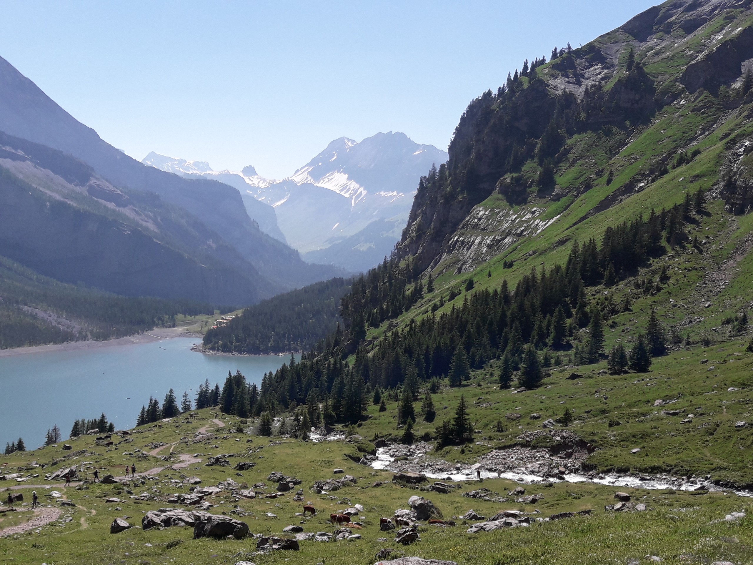
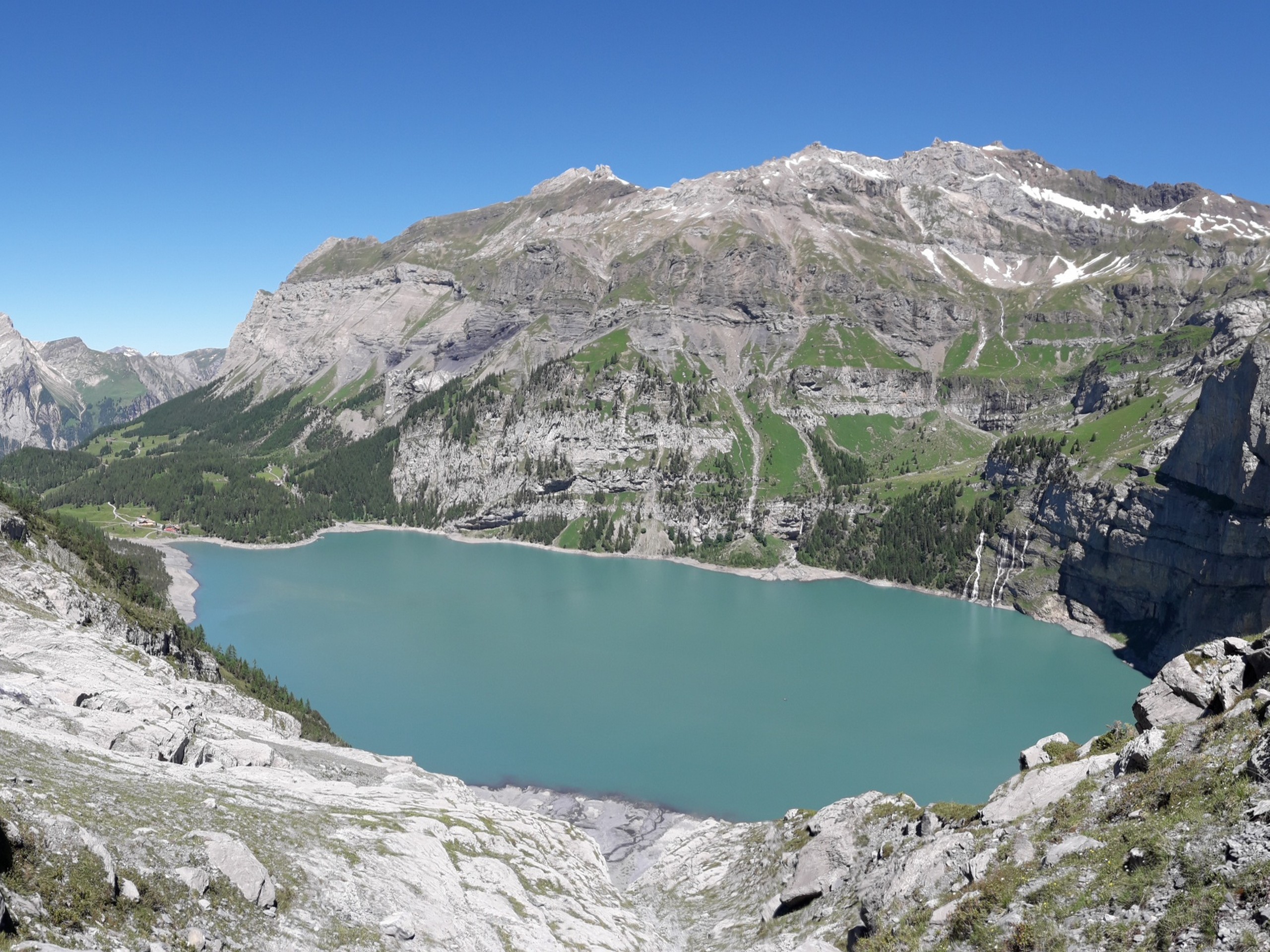
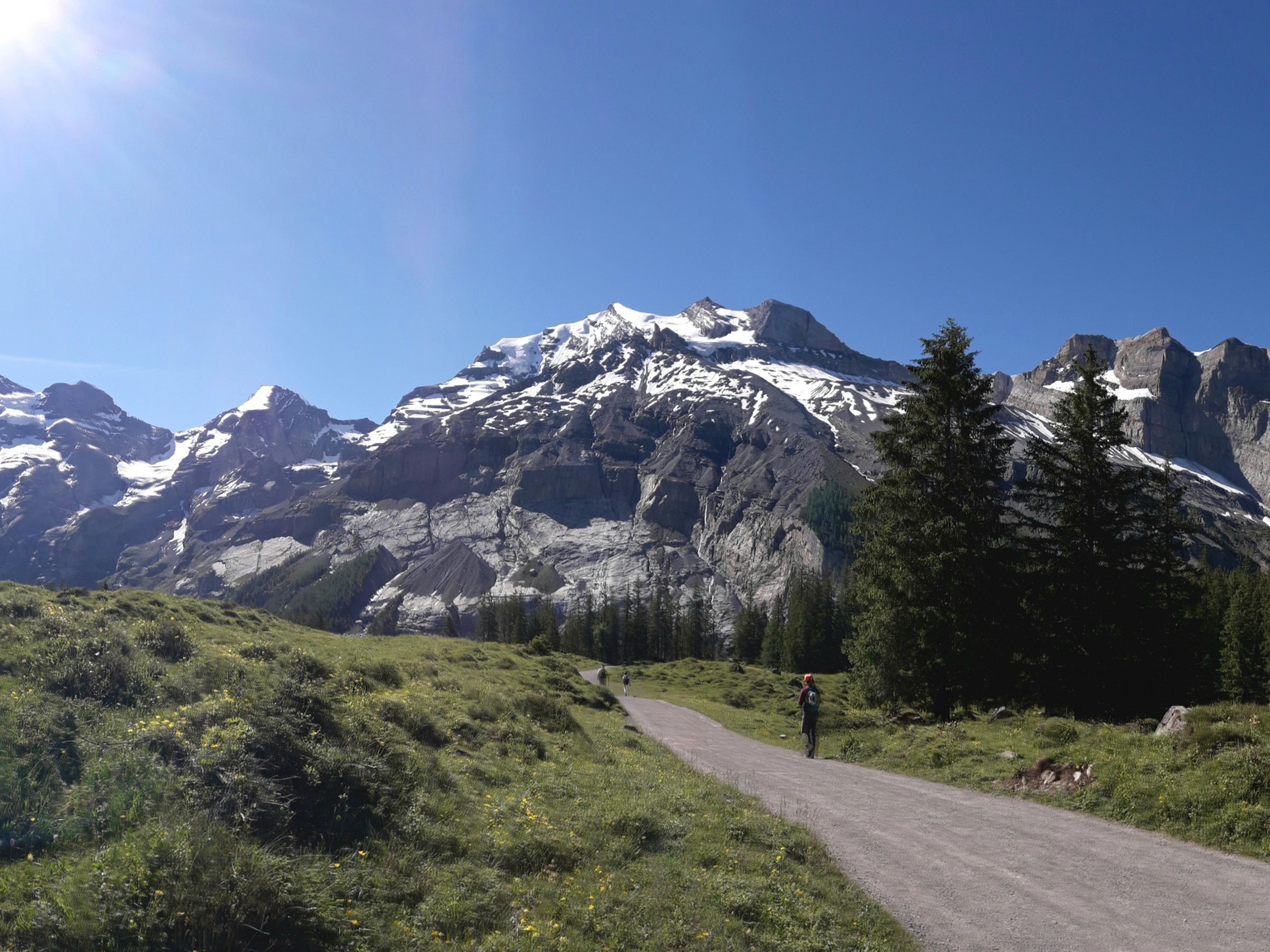
The hike can take between 5 and 7 hours, so plan on starting early and take enough food and water for the day. Take the lift from Kandersteg to Oeschinensee. From the upper lift station, a 0.6mi walk takes you to the west end of the lake. The start of the trail has a sign that says Frundenhutte, this refers to a hut high above the south side of the lake. The trail is marked with a white-red-white symbol on tree trunks or rocks.
Follow the trail eastward along the southern bank of the lake. The trail starts to ascend gently but soon rises well above the lake. About midway between west and east end of the lake, there is a fork to the south that ascends to Frundenhutte, and if you have the time you can add this detour.
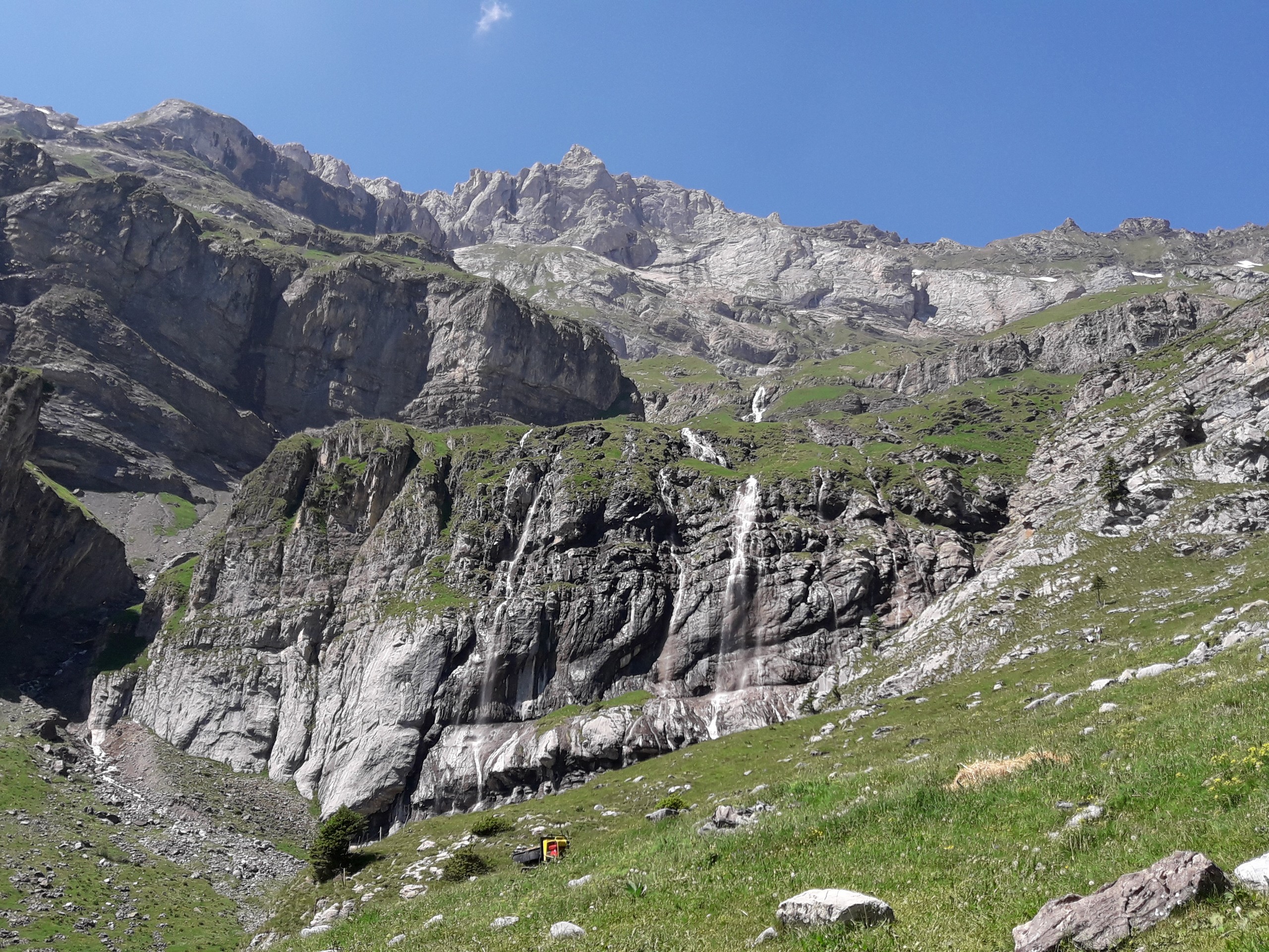
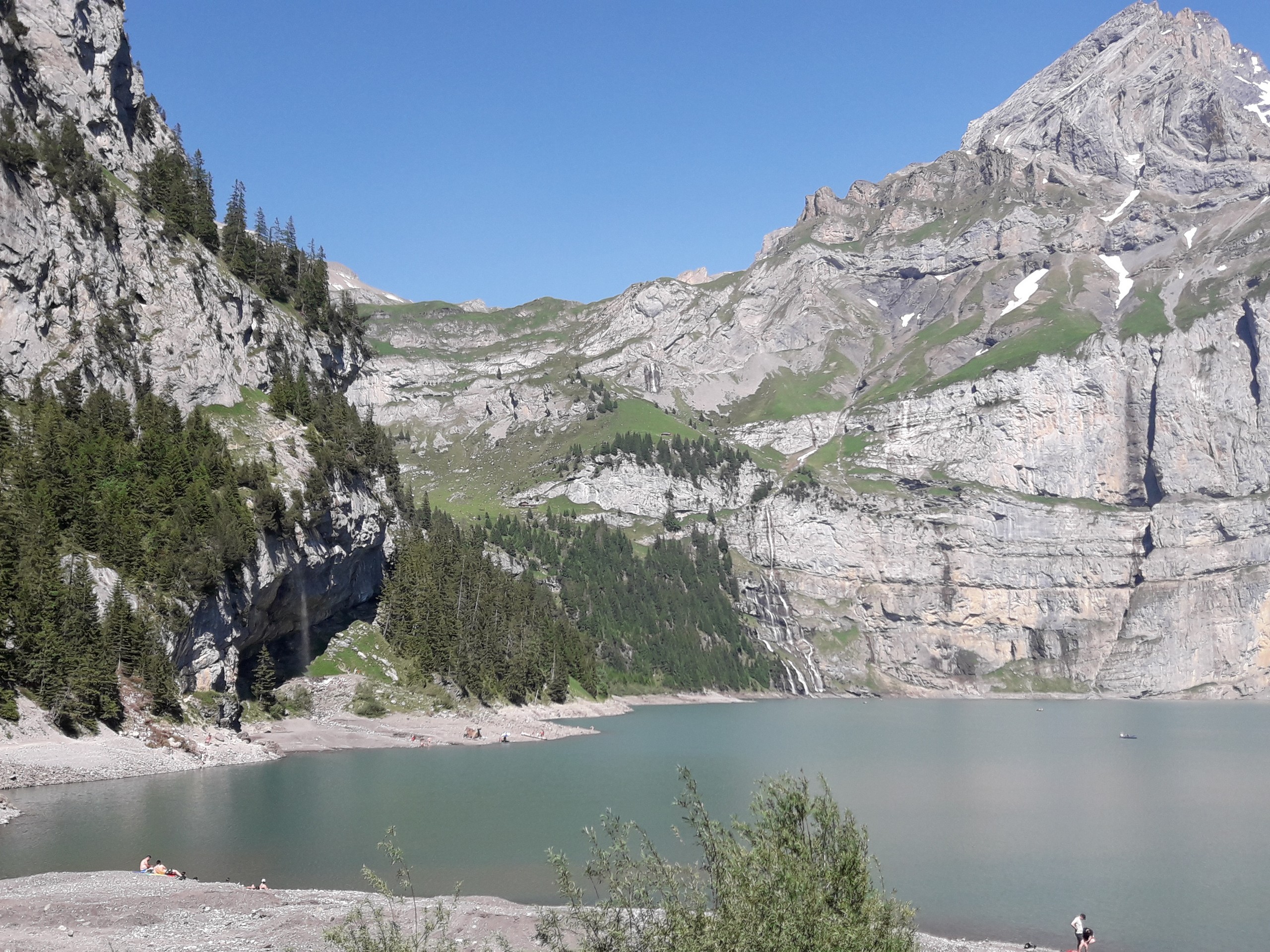
Continuing towards the east end of the lake, the trail turns northward, then crosses an ice-covered river about 10 meters wide. Before you descend into the gully and cross the ice, try to locate the continuation of the trail on the other side. Take maximum care crossing the ice.
After crossing the icy section, locate the trail above the gully a few meters lower than where the ice ends. Do not blindly go downhill along the gully, the trail is above eye level and takes a few steep steps up from the river bank
Past the icy section, the trail is quite narrow and exposed with a sheer drop on one side. If you brought your via ferrata set, consider wearing your harness before you cross the ice as you may have a harder time putting on your harness on the narrow trail past this section.
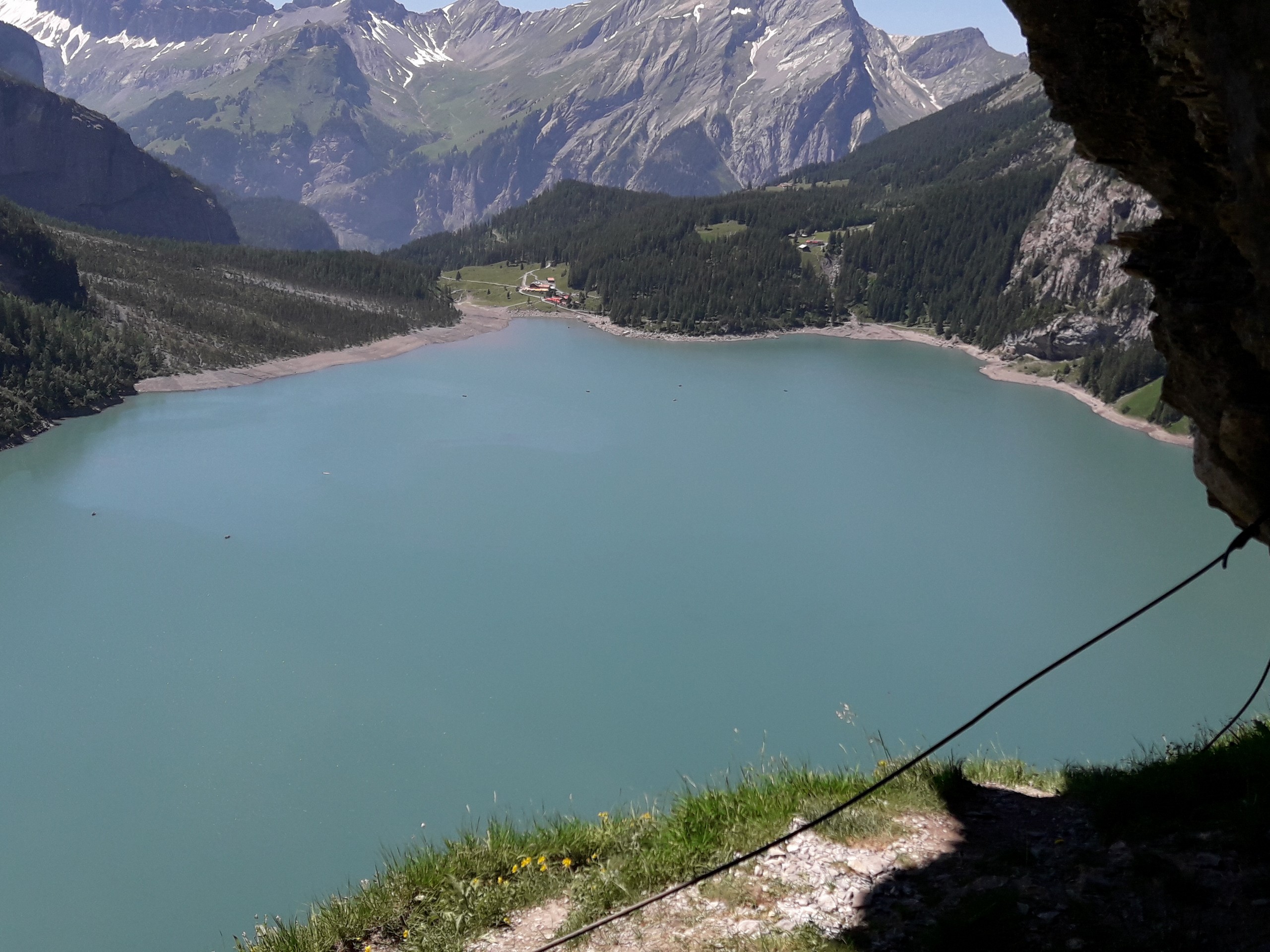
A few dozen meters past the ice crossing, you will come across the start of the steel cables, where you can clip in to be safe. The steel cable section is a few hundred meters long over steep and exposed terrain. Continue along the trail until the steel cable ends and the terrain becomes easier.
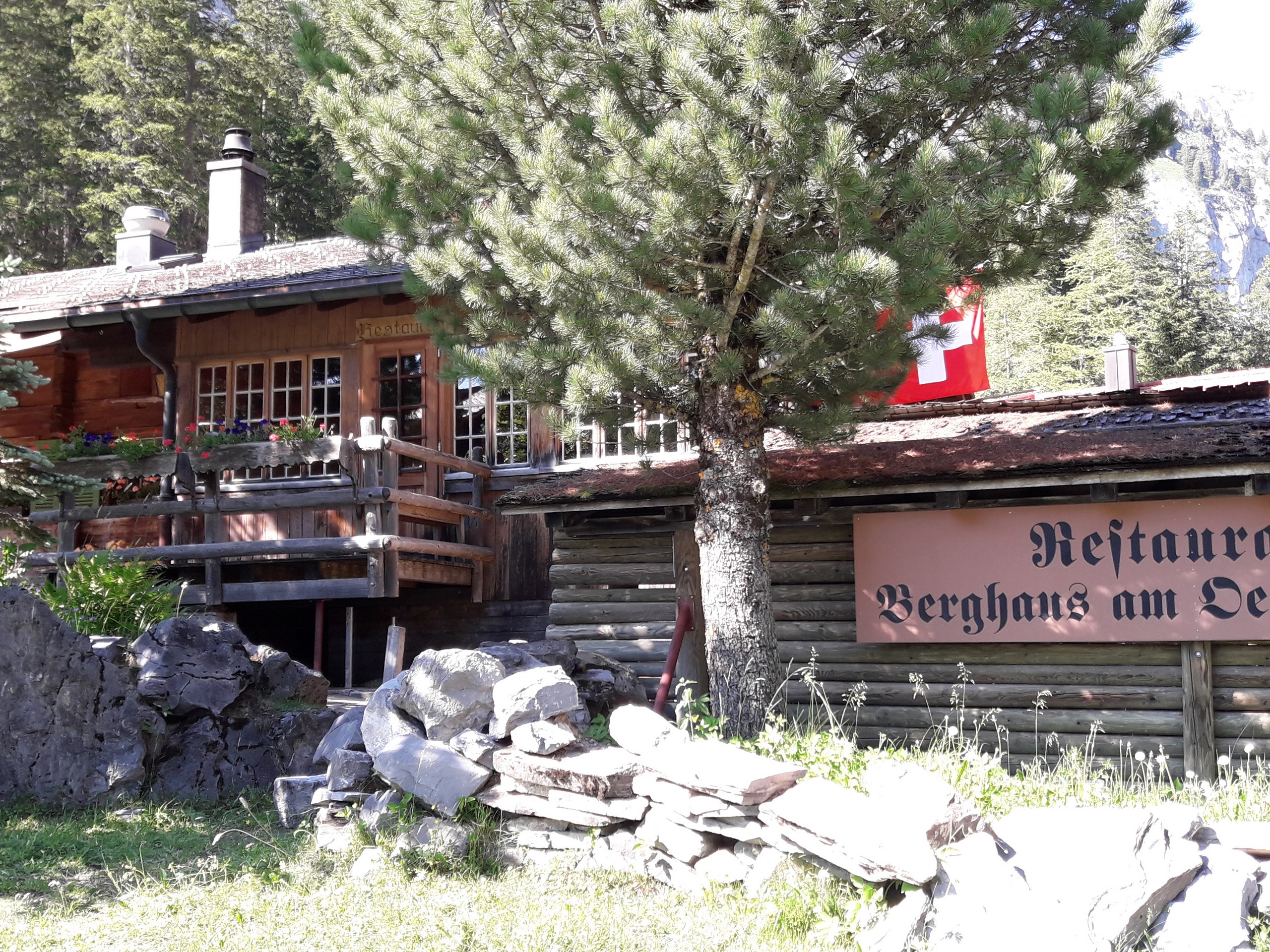
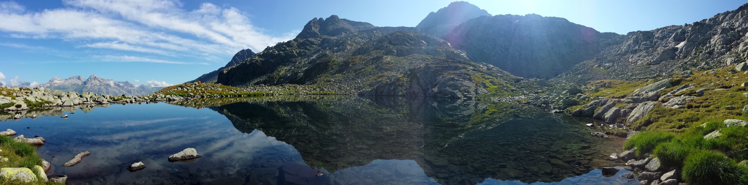
Eventually you will arrive at Underbargli, a small hut that sells drinks and snacks. From Underbargli, take the trail that descends to the lake and heads west along the north bank of the lake. This leg of the trail is on easy terrain and goes back to the west end of the lake.
If you have the time, enjoy a meal at the restaurant or take a swim in the lake to celebrate your trek.
Return to the lift station before closing time
Insider Hints
There are rowboats available at the lake for tourists
You can walk back down to Kandersteg instead of taking the gondola. It adds 2.4mi to the day.
Similar hikes to the Fründen Hut hike
Pizzo della Casa
This is a challenging hike that starts out in Switzerland, crosses the border to Italy, passes two alpine lakes, descends…
Matterhorn Glacier Trail
The Matterhorn Glacier Trail (Nr. 26) takes you close to the Furgg Glacier and right beside the east flank of…
Eiger Trail
The Eiger Trail skirts the north face of one of the most iconic mountains in Europe. The hike is relatively…
Comments